
Peoples
- TARAHUMARA
Citation
Comisión Nacional para el Desarrollo de los Pueblos Indígenas. Regiones indígenas de México. Publication no. 330.972. 2006. https://www.gob.mx/cms/uploads/attachment/file/35735/cdi-regiones-indigenas-mexico.pdf.
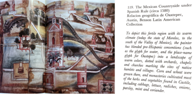
The Mexican Countryside under Spanish Rule (Circa 1580), Relacion Geográfica de Oaxtepec
Map 1580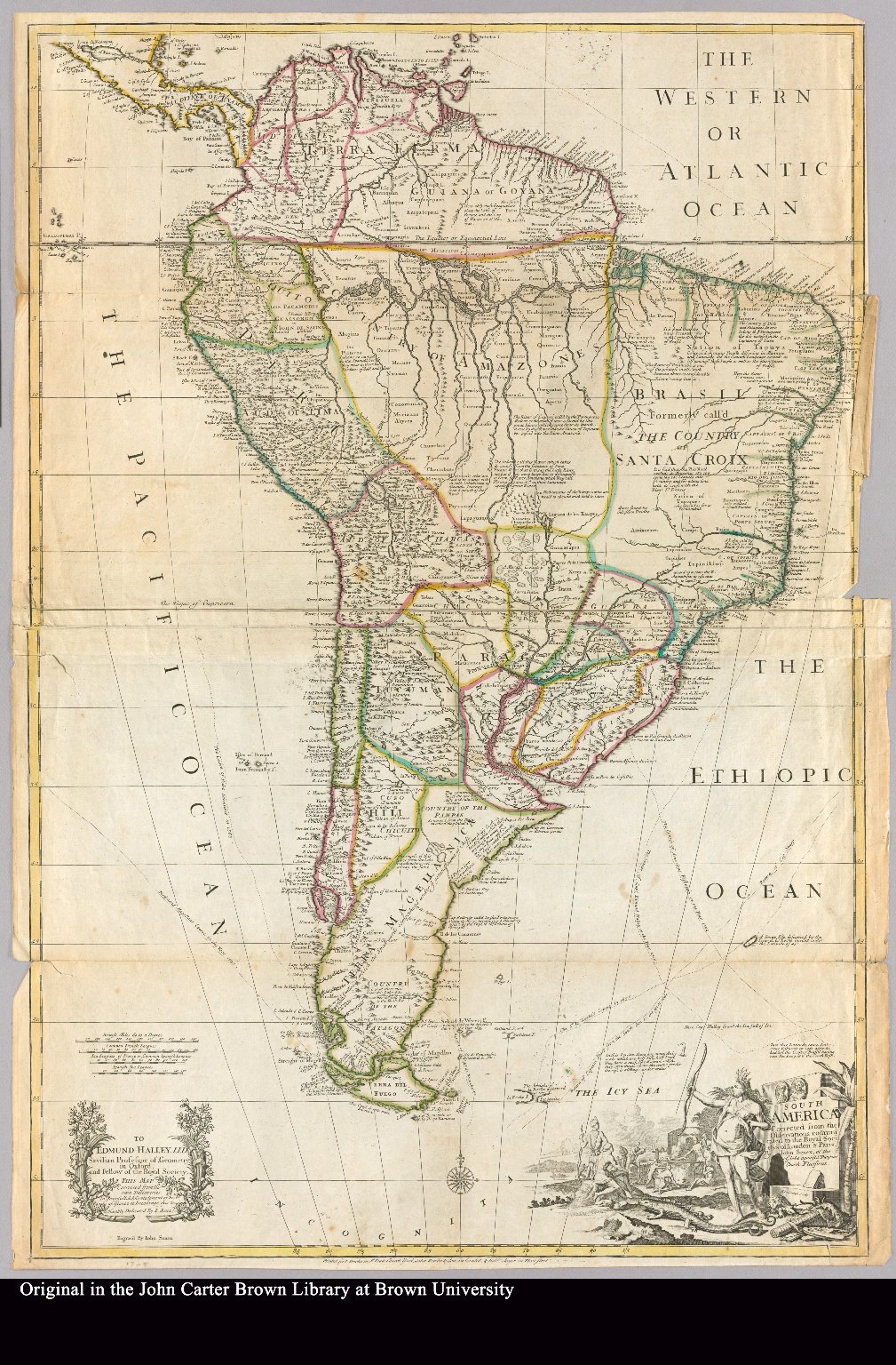
South America corrected from the observation communicated to the Royal Society"s of London & Paris by John Senex, at the Globe against St. Dunstans Church Fleetstreet.
Map 1755
Plano de la Yntendencia de Arequipa. Hecho de orden del Exmo. Sor. Virrey Fr. Dn. Francisco Gil y Lemos, año de 1792
Map 1792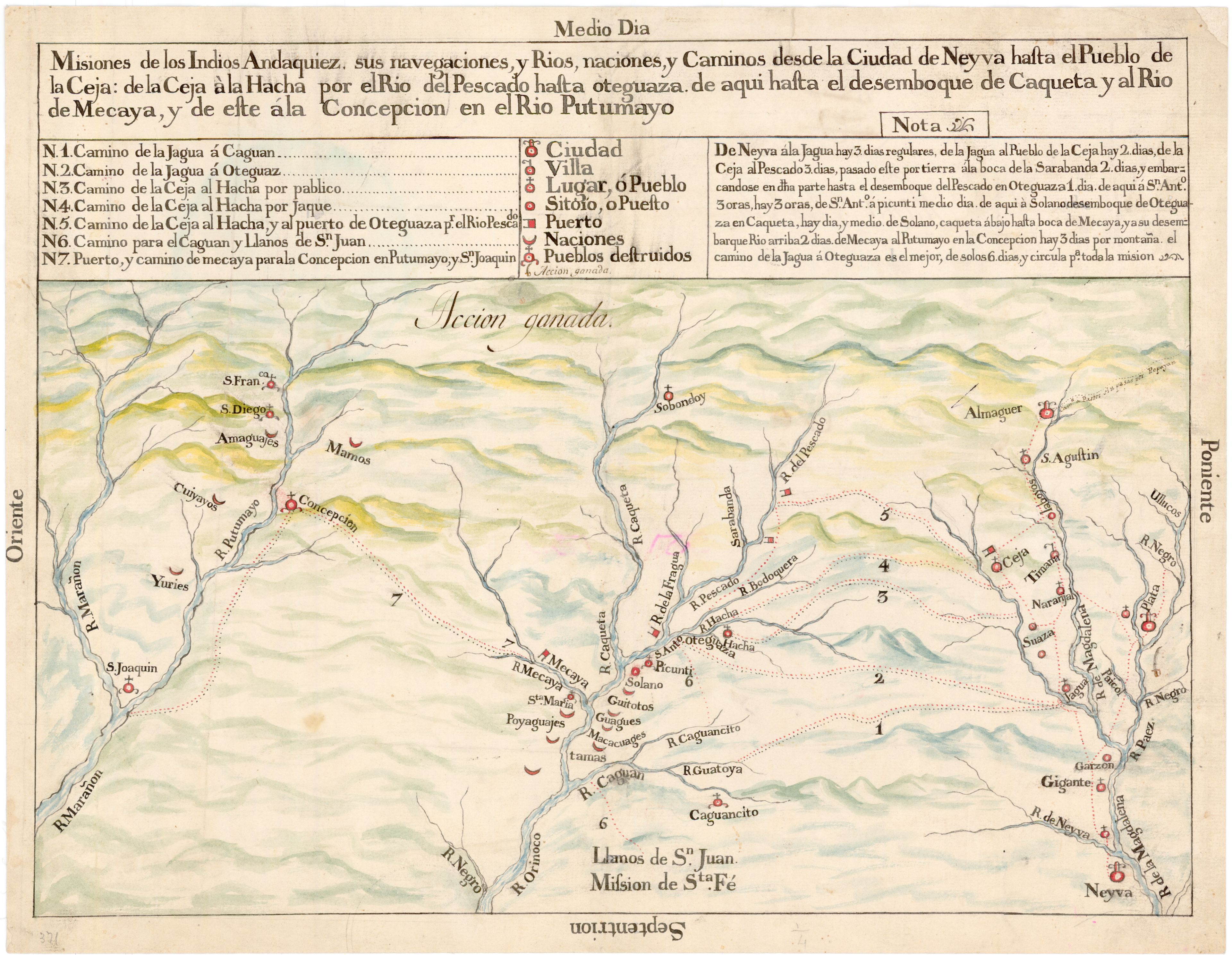
Misiones de los Indios Andaquiez : sus navegaciones, y Ríos, naciones, y Caminos desde la Ciudad de Neyva hasta el Pueblo de la Ceja, y de este ála Concepción en el Río Putumayo
Map 1792
The Spanish and Musketor shore and the bay of Honduras and the islands adjacent
Map 1735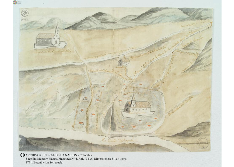
Bogotá y la Serrezuela
Map 1771![Tawahka homeland, 1916: Showing Río Wampú (Wanpo), Río Patuca (Butuk), Cerro Quigungun (Wangkibila Volc [anol]), and the first cartographical rendering of Krautara (Moravian Archives, Bethlehem, Pennsylvania, Heath 1916)](https://dnet8ble6lm7w.cloudfront.net/maps_sm/HON/HON0014.png)
Tawahka homeland, 1916: Showing Río Wampú (Wanpo), Río Patuca (Butuk), Cerro Quigungun (Wangkibila Volc [anol]), and the first cartographical rendering of Krautara (Moravian Archives, Bethlehem, Pennsylvania, Heath 1916)
Map 1916![A Cobra Grande manda para sua filha a noz de Tucunã [The Great Snake sends the Tucunã nut to her daughter]](https://dnet8ble6lm7w.cloudfront.net/art_sm/ABRA048.png)
A Cobra Grande manda para sua filha a noz de Tucunã [The Great Snake sends the Tucunã nut to her daughter]
Artwork