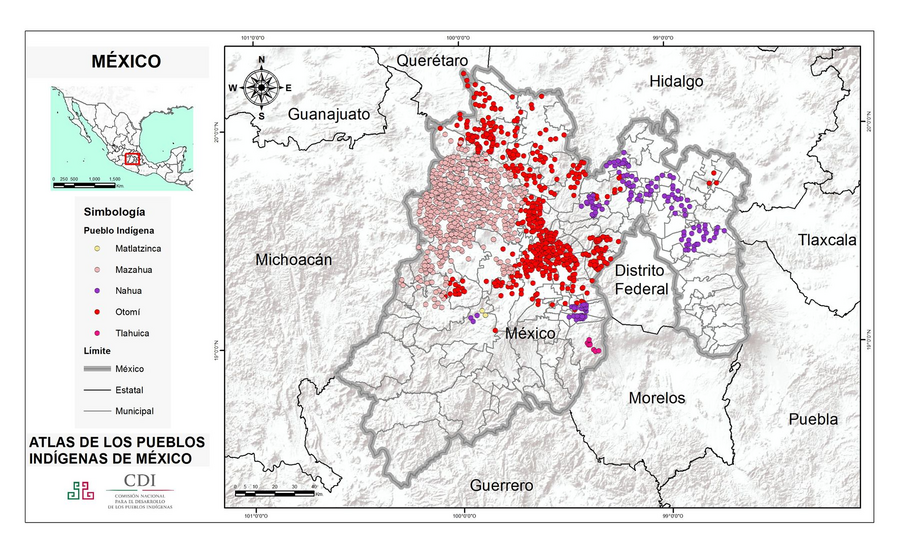
Peoples
- MATLATZINCA
- MAZAHUA
- NAHUA
- OTOMI
- TLAHUICA
Citation
Instituto Nacional de los Pueblos Indígenas. "Distribución por Entidad Federativa." Atlas de los pueblos indígenas de México. http://atlas.inpi.gob.mx/distribucion-por-entidad-federativa/.
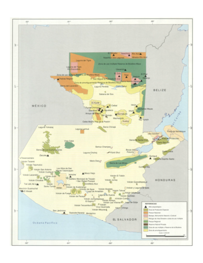
Sistema guatemalteco de áreas protegidas (SIGAP) y sitios arqueológicos en 2000.
Map 2000
The modern departments of Ahuachapán, La Libertad, Santa Ana, and Sonsonate (highlighted in red) now contain the highest concentration of Indigenous communities in El Salvador.
Map 2010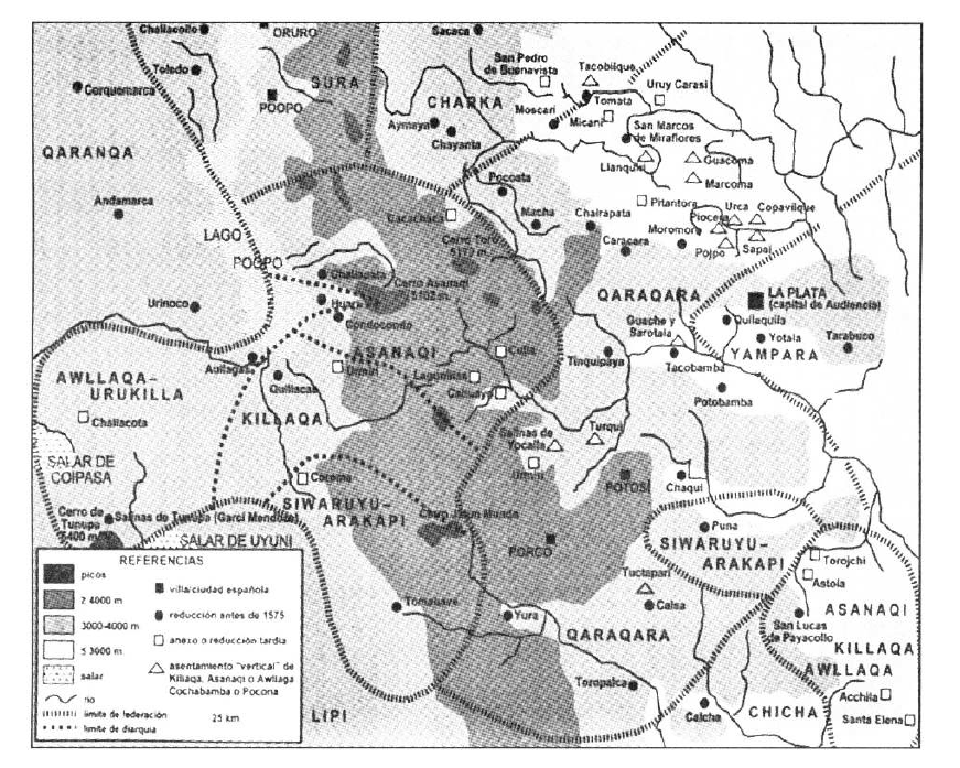
TERRITORIO DEL SEÑORÍO AYMARA DE LOS KILLAKAS A PRINCIPIOS DEL SIGLO XVI
Map 1500 - 1530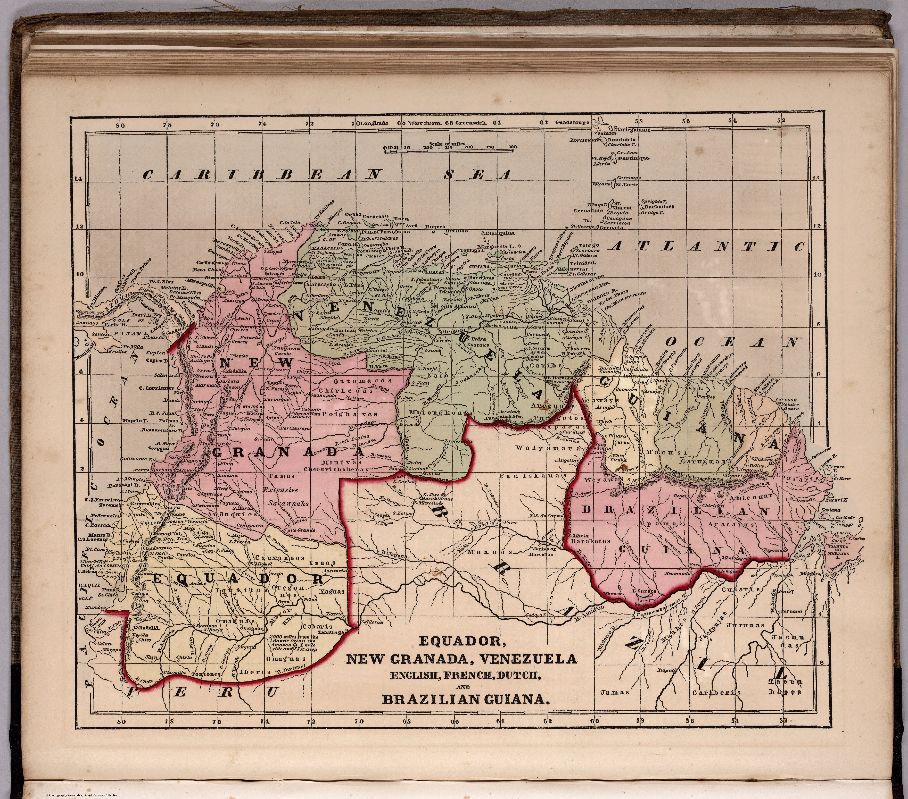
ECUADOR;NEW GRANADA;VENEZUELA;AND GUIANA.
Map 1800 - 1899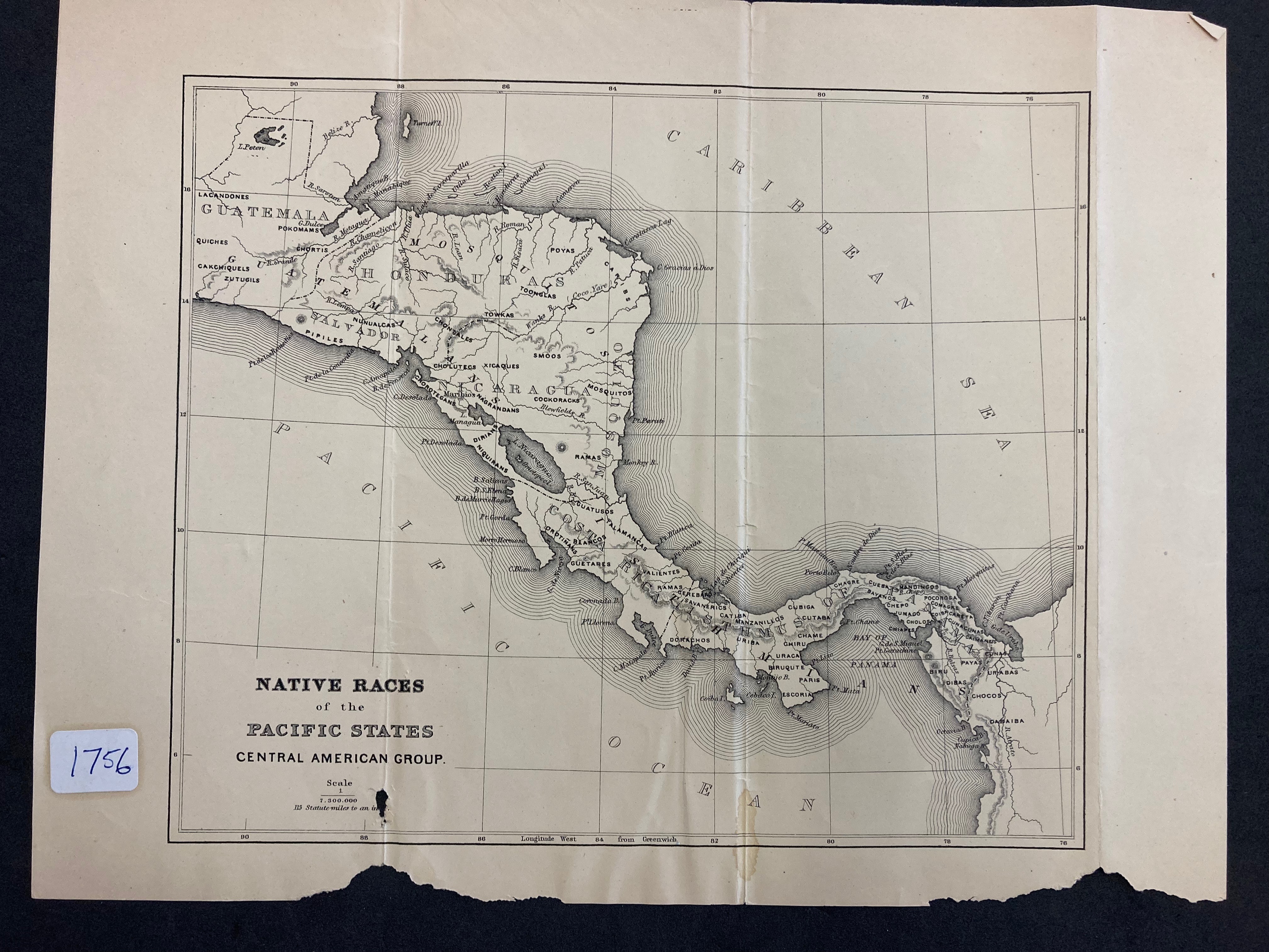
NATIVE RACES of the PACIFIC STATES
Map 1800![[Panama]](https://dnet8ble6lm7w.cloudfront.net/maps/PAN/PAN0004.jpeg)
[Panama]
Map 1730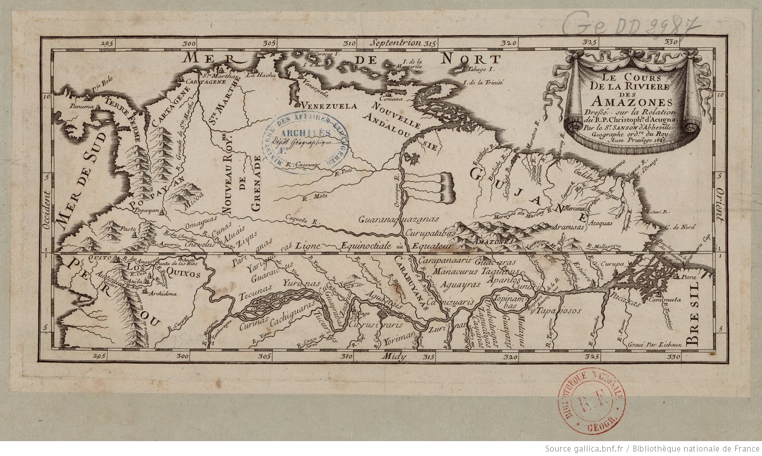
Le Cours de la Riviere des Amazones
Map 1680![El territorio de los abuelos [The Territory of the Grandparents]](https://dnet8ble6lm7w.cloudfront.net/art_sm/APER078.png)
El territorio de los abuelos [The Territory of the Grandparents]
Artwork