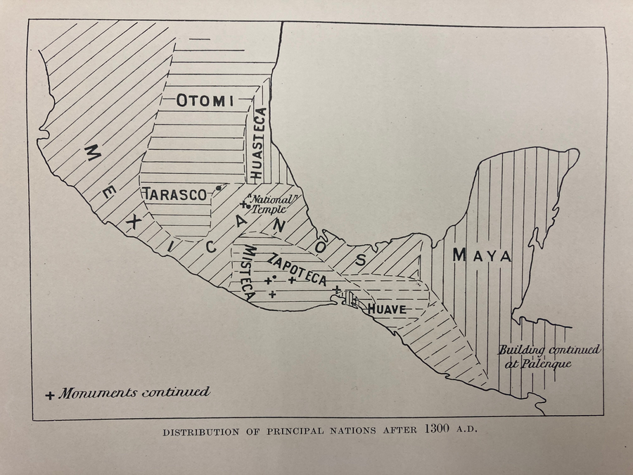
Peoples
- MEXICANO
- OTOMI
- TARASCO
- HUASTECA
- MISTECA
- ZAPOTECA
- HUAVE
- MAYA
Citation
Gadow. "Distribution of Principal Nations After 1300 A.D." Map. 1908. H280. Latin American Library Map Collection. Tulane University, New Orleans.
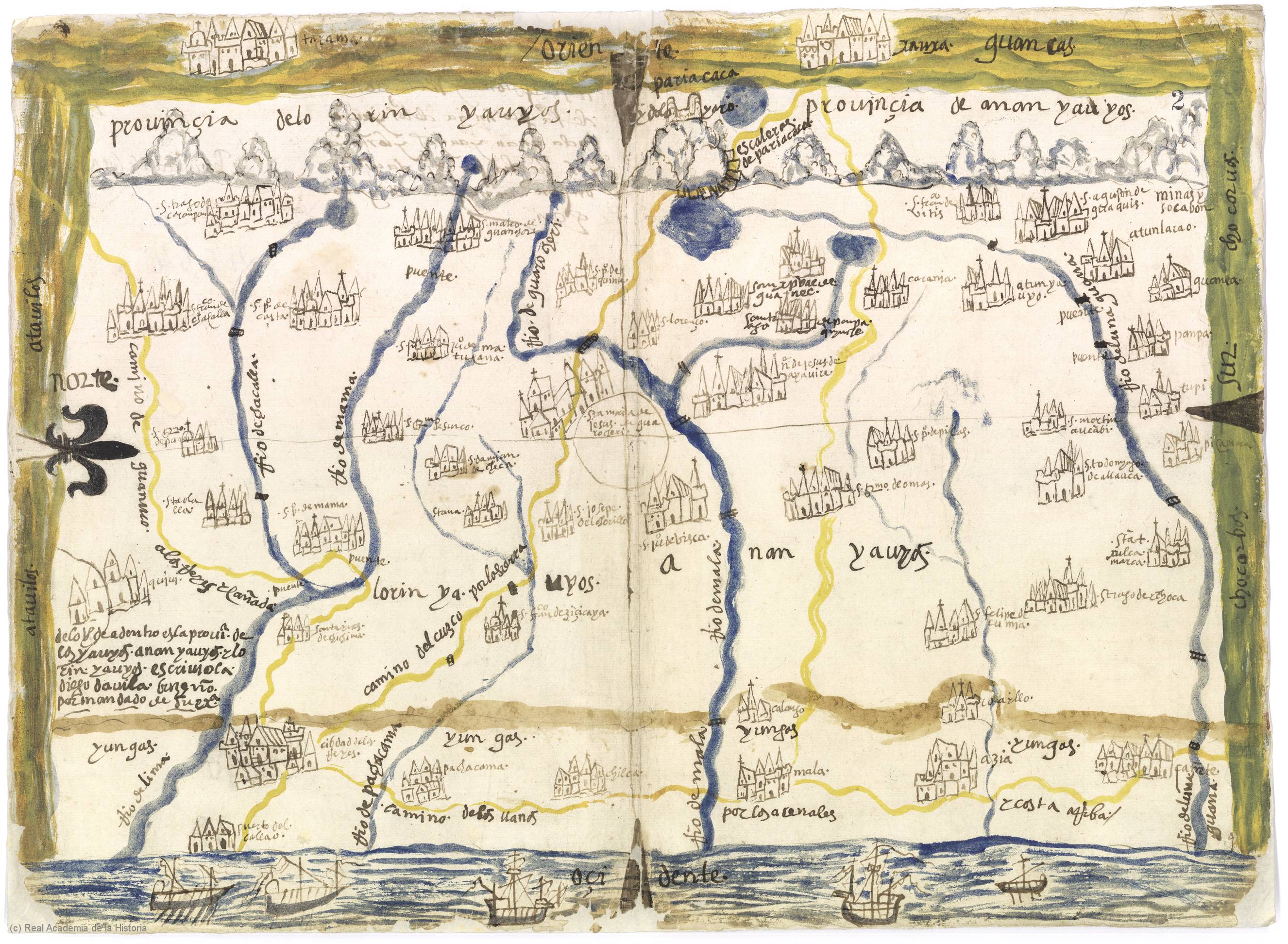
Provincia de Yauyos
Map 1586
THE KARANQAS AYMARA POLITY - Instant shot of trans-border connections around 1900 (Google Earth adaptation)
Map 1860 - 1930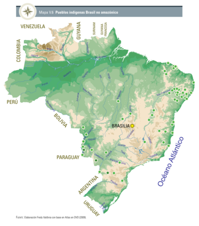
Pueblos indígenas Brasil no amazónico
Map 2009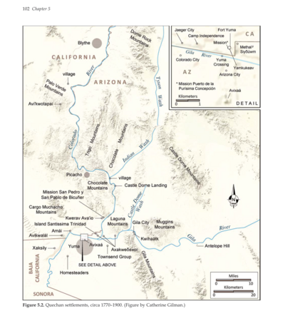
Quechan settlements, circa 1770-1900
Map 1770 - 1900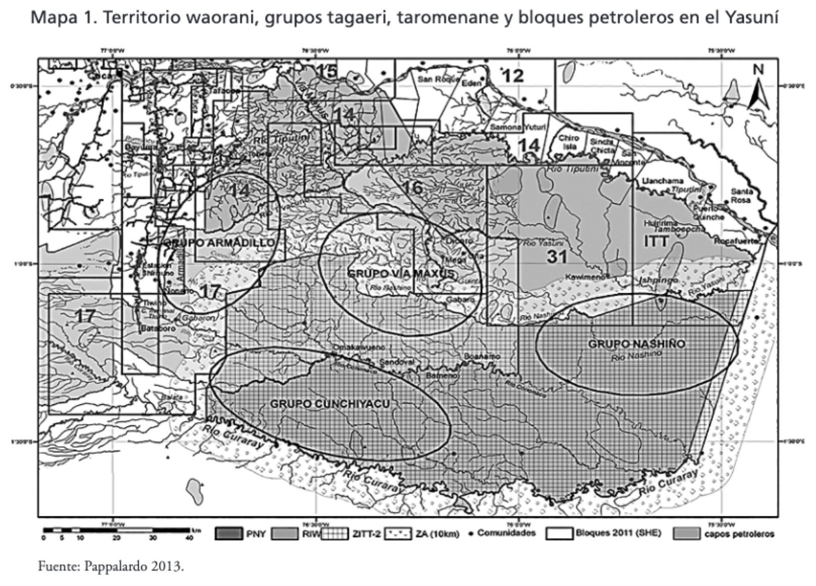
MAPA 1. TERRITORIO WAORANI;GRUPOS TAGAERI;TAROMENANE Y BLOQUES PETROLEROS EN EL YASUNÍ
Map 2013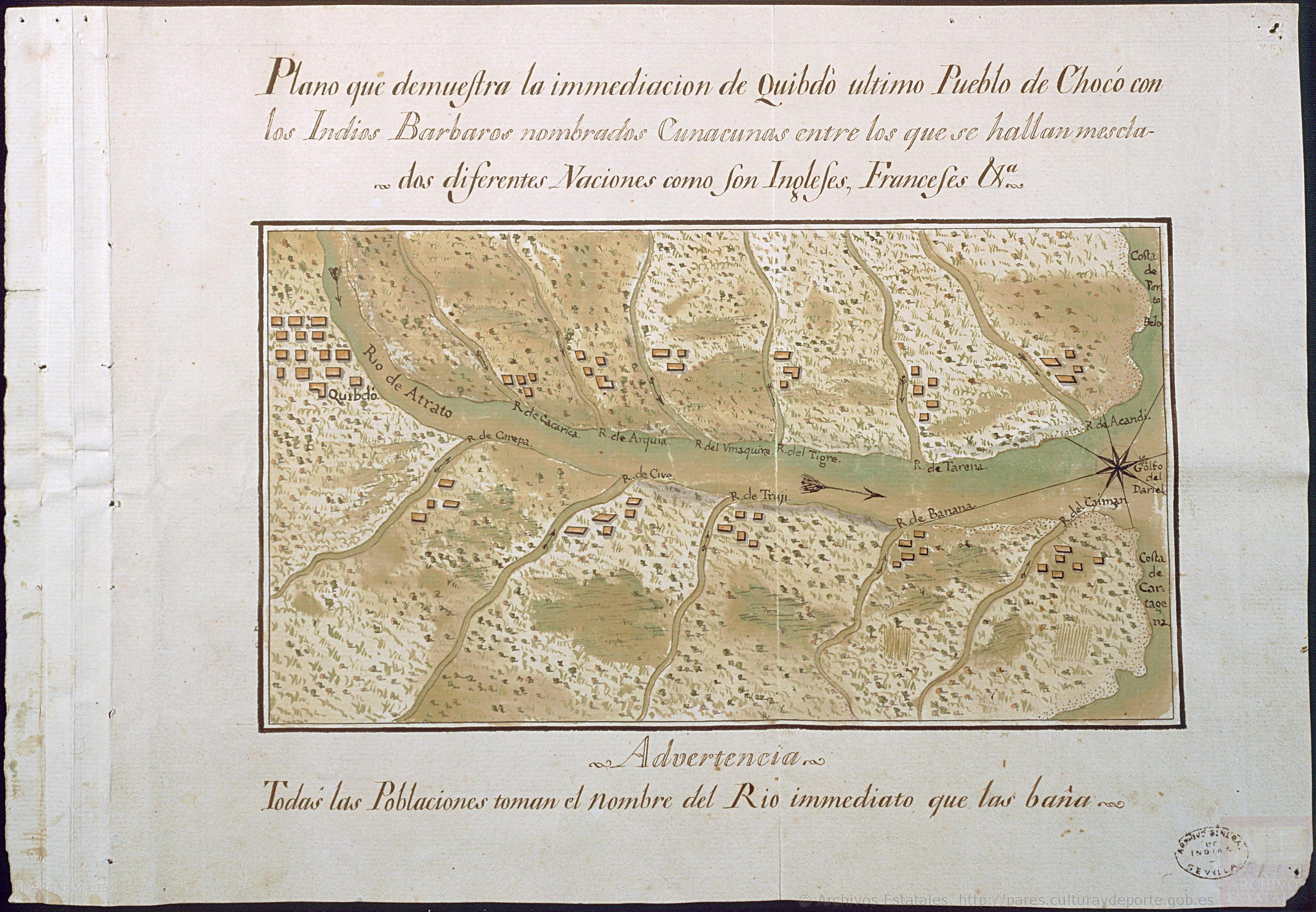
"Plano que demuestra la inmediación de Quibdó, último pueblo de Chocó, con los Indios Bárbaros nombrados Cunacunas, entre los que se hallan mezclados diferentes Naciones, como son ingleses, franceses, &."
Map 1753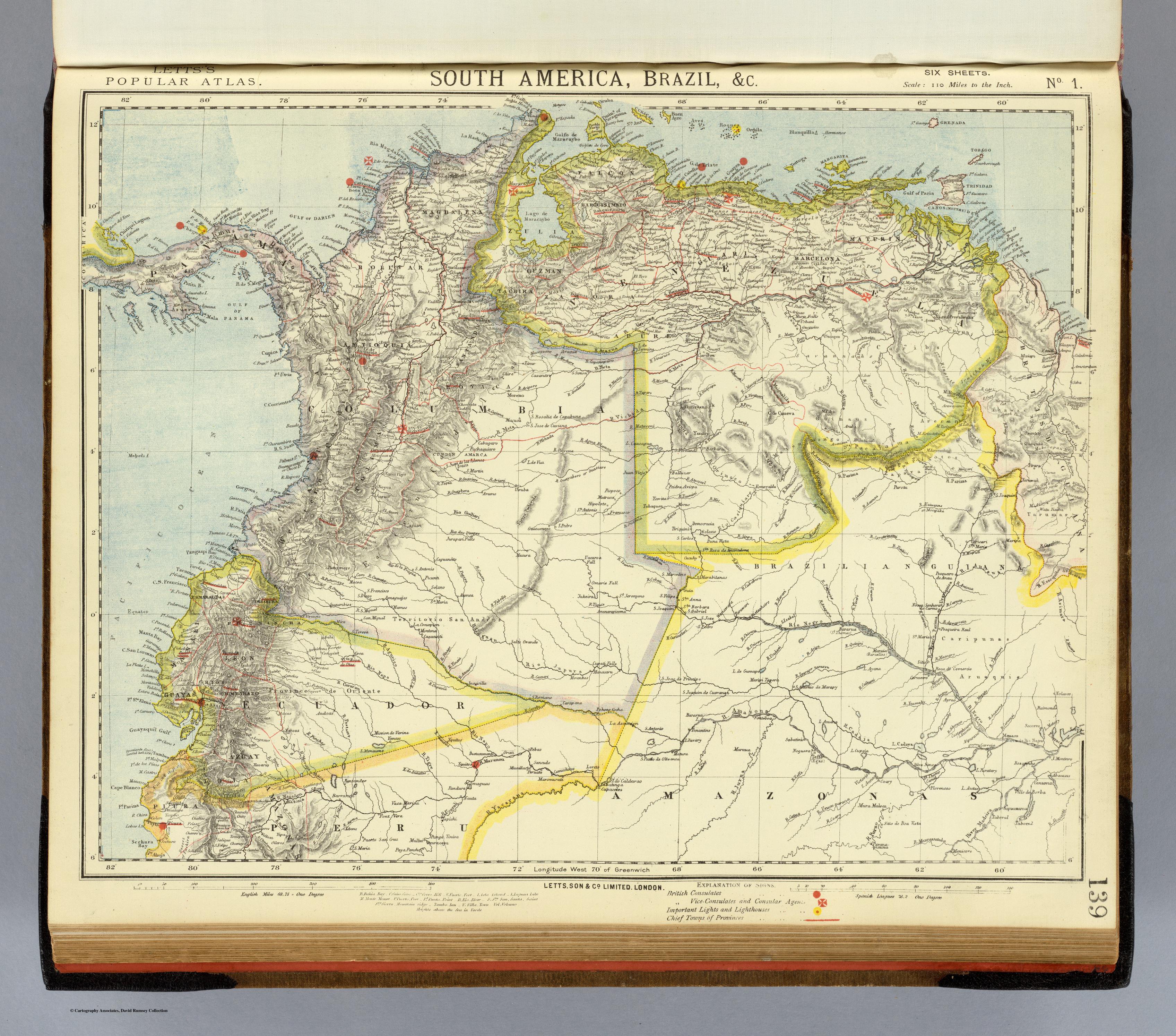
SOUTH AMERICA;BRAZIL;&C.
Map 1883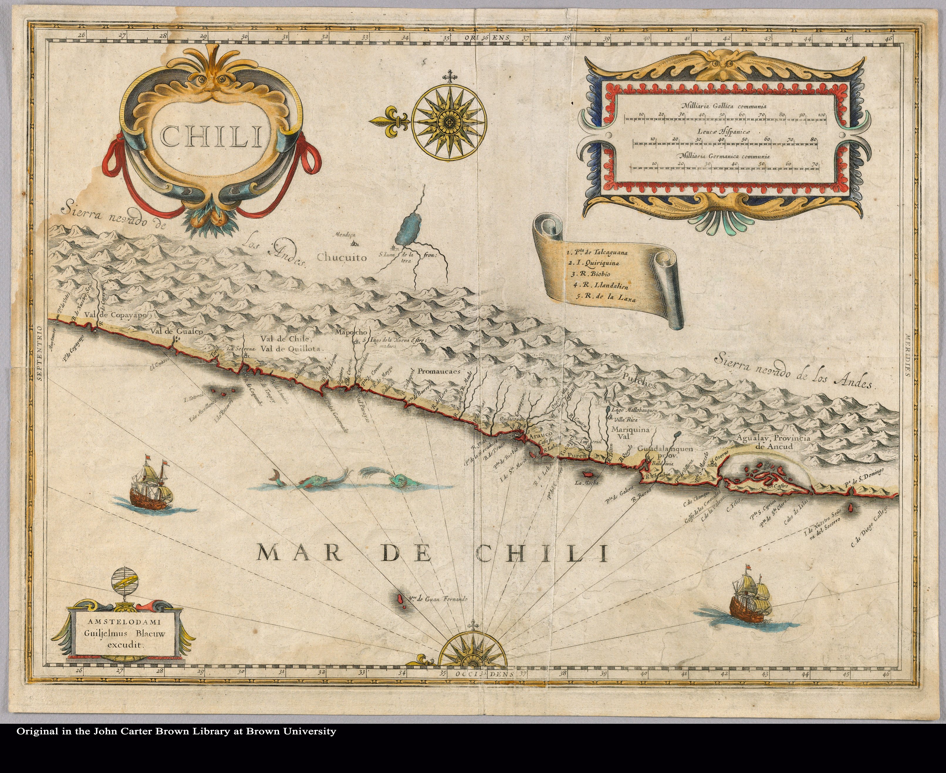
Chili
Map 1663