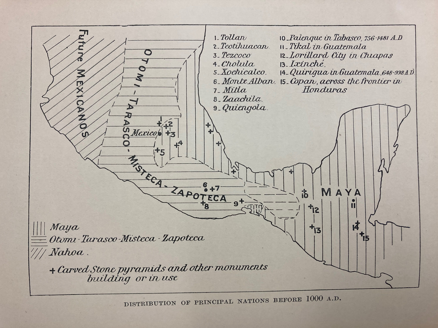
Peoples
- MEXICANO
- OTOMI
- TARASCO
- MIXTECO
- ZAPOTECA
- MAYA
Citation
Gadow. "Distribution of Principal Nations Before 1000 A.D." Map. 1908. H281. Latin American Library Map Collection. Tulane University, New Orleans.
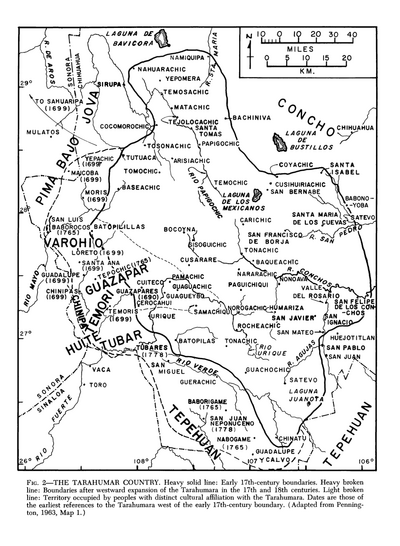
The Tarahumar Country
Map 1600 - 1699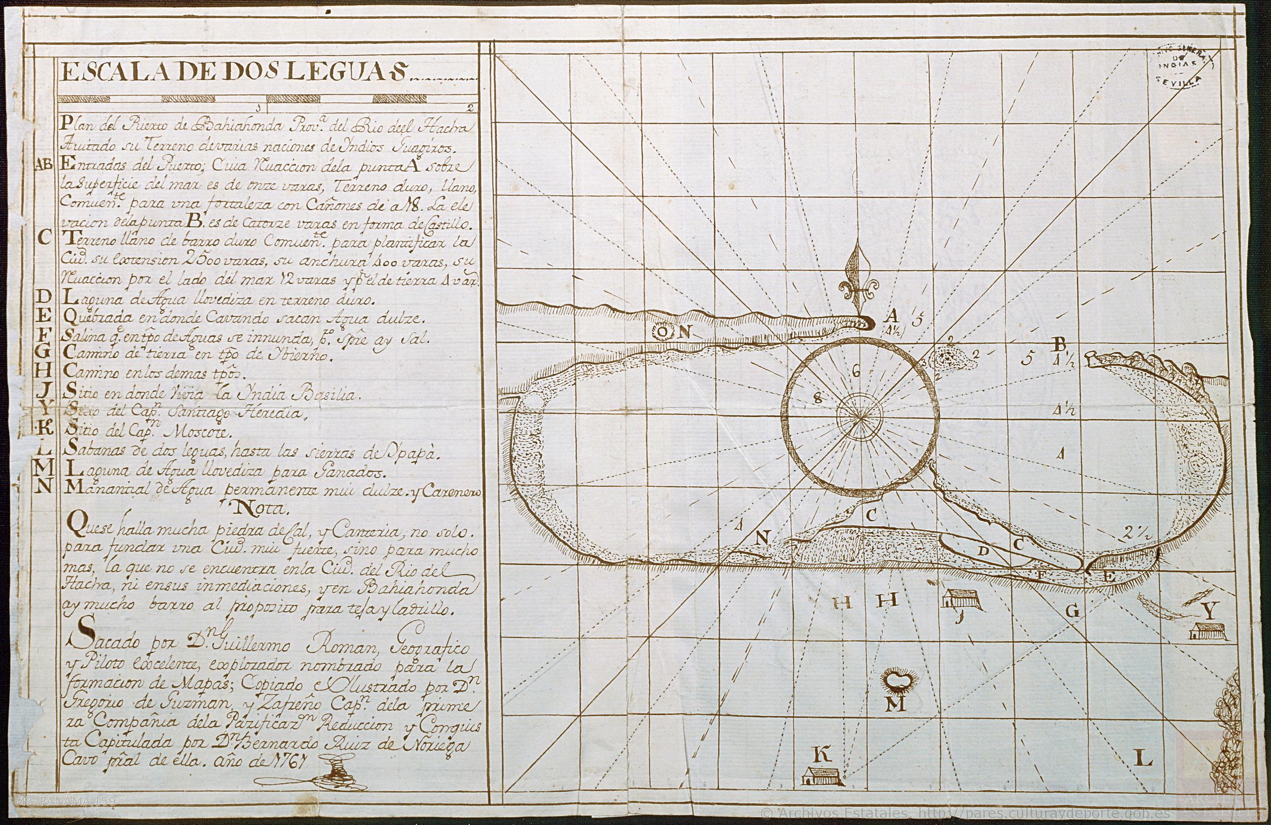
Plan del Puerto de Bahiahonda, Provincia del Rio del Hacha, Auitado su terreno de varias naciones de Yndios Guagiros
Map 1761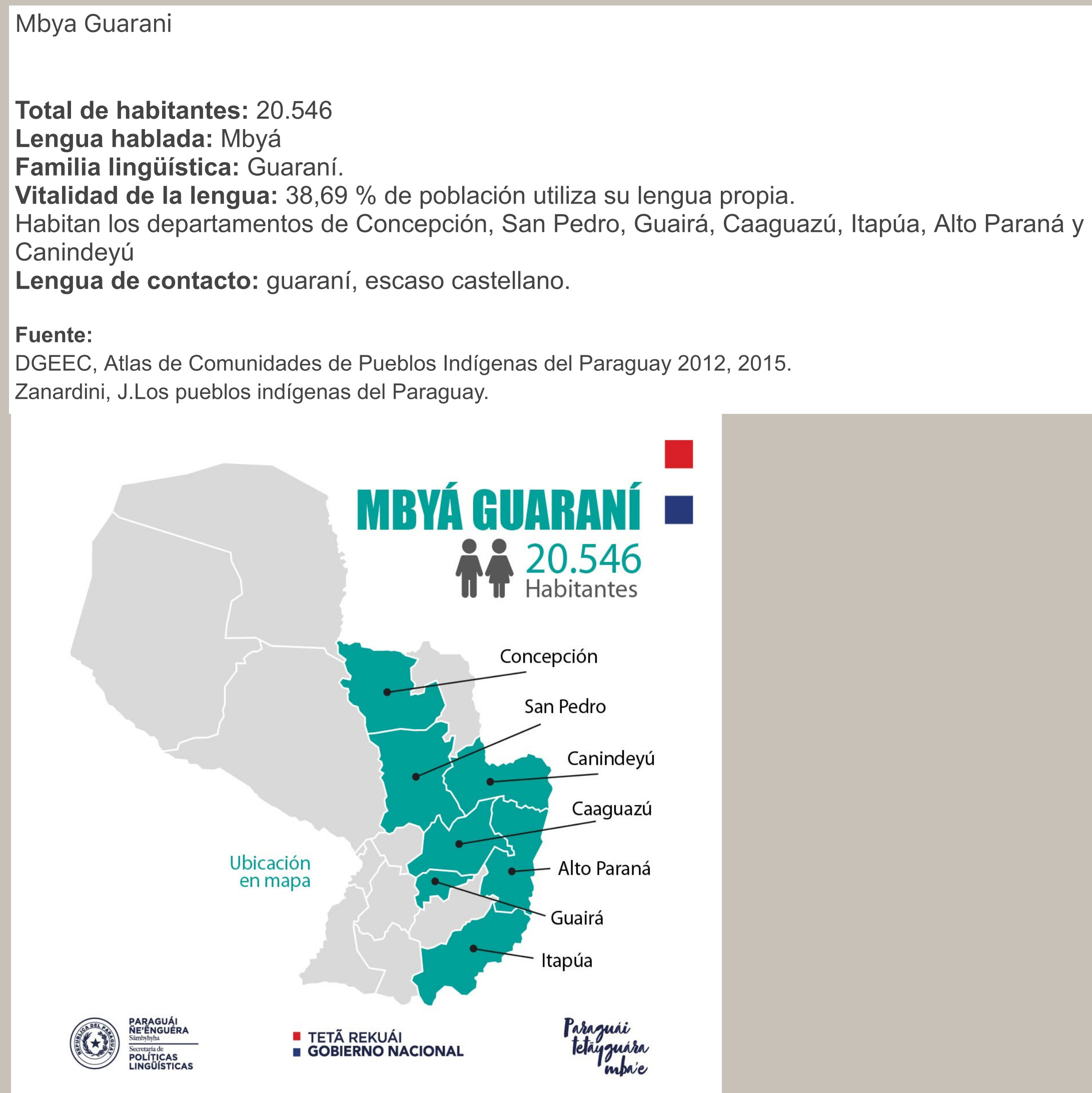
MBYÁ GUARANÍ
Map 2015
Guyanes. Amér. Mérid. no. 7. (Dresse par Ph. Vandermaelen, lithographie par H. Ode. Cinquième partie. - Amer. merid. Bruxelles. 1827)
Map 1800 - 1899
Fronteras aproximadas de los idiomas de Guatemala, alrededor de 1524
Map 1524
PUEBLO MAYA
Map 2020
A MAP of the CARACAS
Map 1818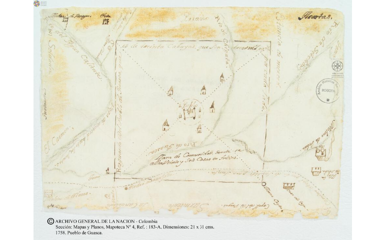
Pueblo de Guasca
Map 1758