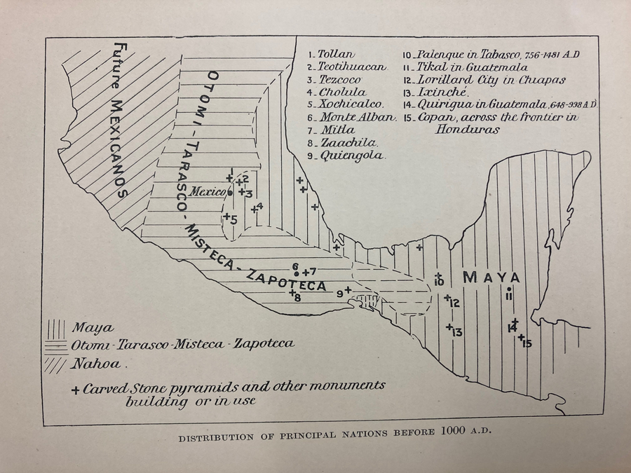
Peoples
- MEXICANO
- OTOMI
- TARASCO
- MIXTECO
- ZAPOTECA
- MAYA
Citation
Gadow. "Distribution of Principal Nations Before 1000 A.D." Map. 1908. H281. Latin American Library Map Collection. Tulane University, New Orleans.
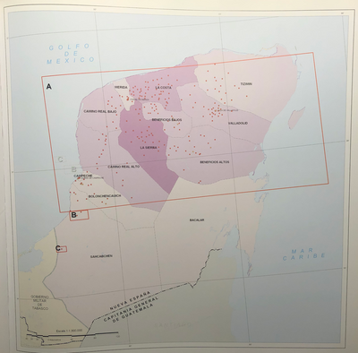
INTENDENCIA DE YUCATÁN
Map 1800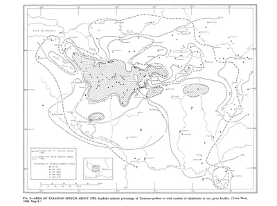
Area of Tarascan Speech around 1750
Map 1750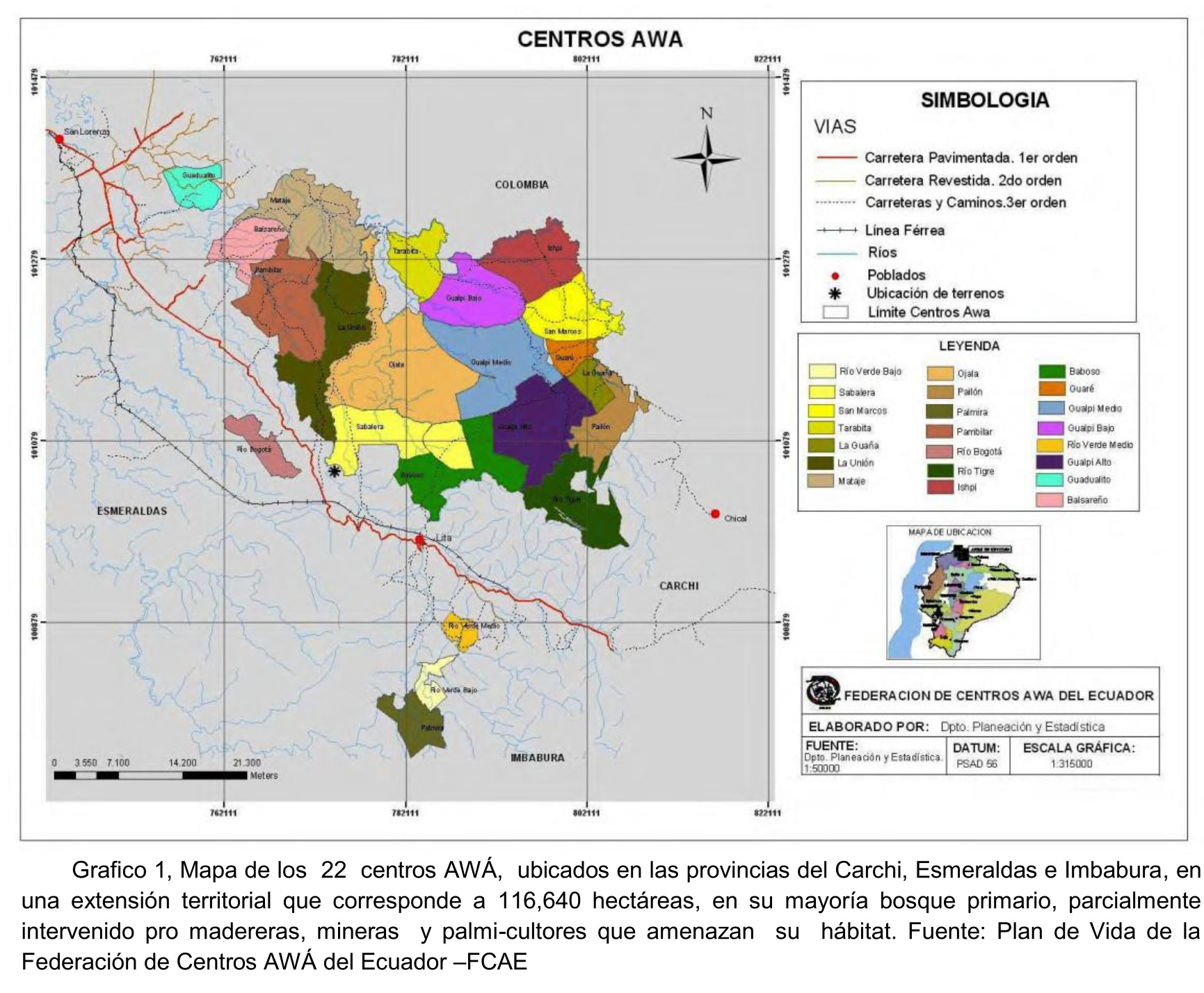
Grafico 1;Mapa de los 22 centros AWÁ;ubicados en las provincias del Carchi;Esmeraldas e Imbabura;en una extensión territorial que corresponde a 116;640 hectáreas;en su mayoría bosque primario;parcialmente intervenido pro madereras;mineras y palmi-cultores que amenazan su hábitat. Fuente: Plan de Vida de la Federación de Centros AWÁ del Ecuador –FCAE
Map 2013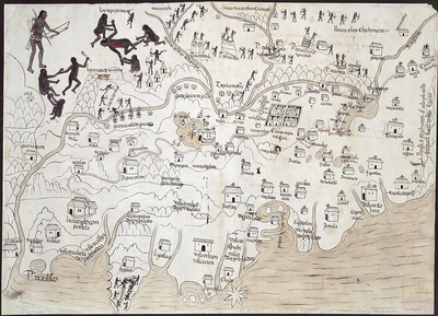
MAPA DE LA NUEVA GALICIA
Map 1550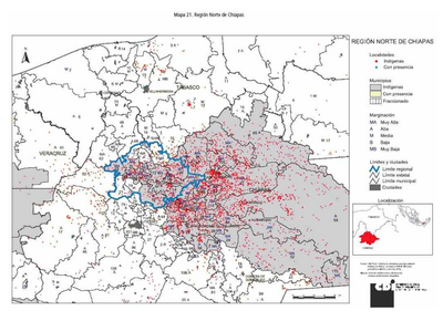
REGIÓN NORTE DE CHIAPAS
Map 2000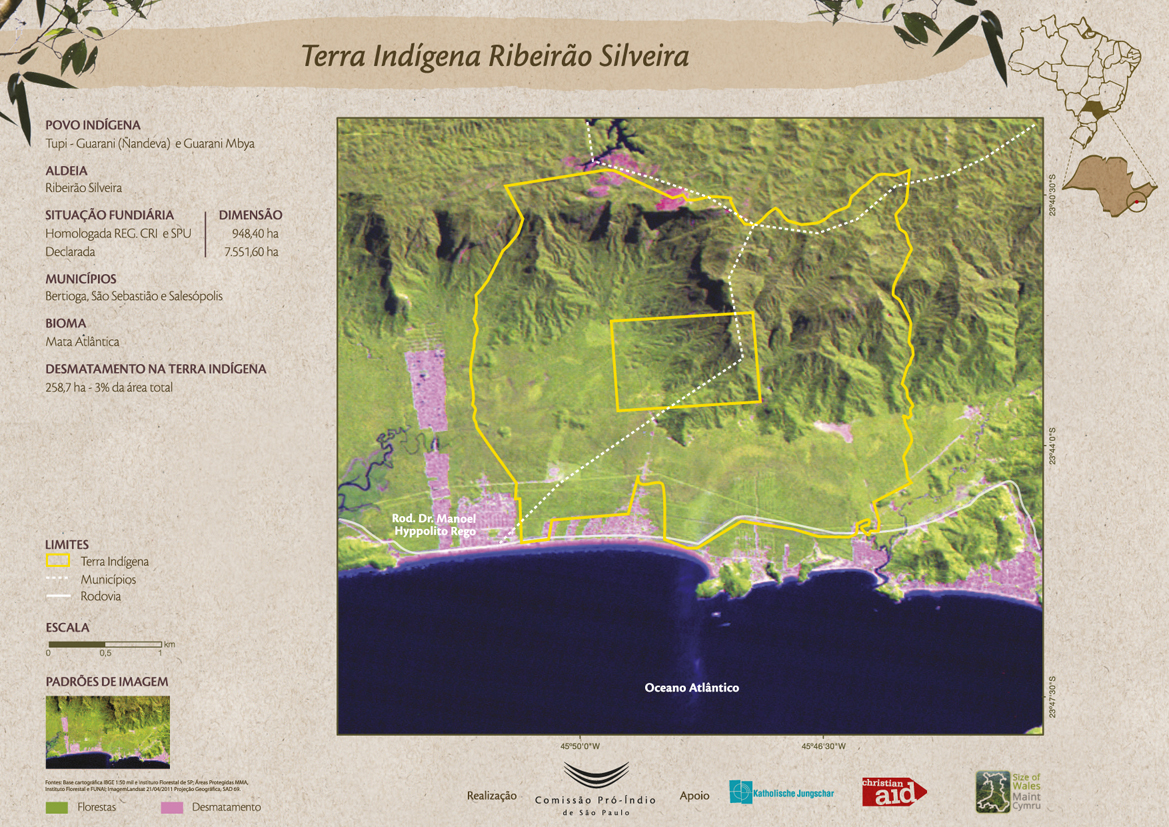
Terra Indígena Ribeirão Silveira
Map 2011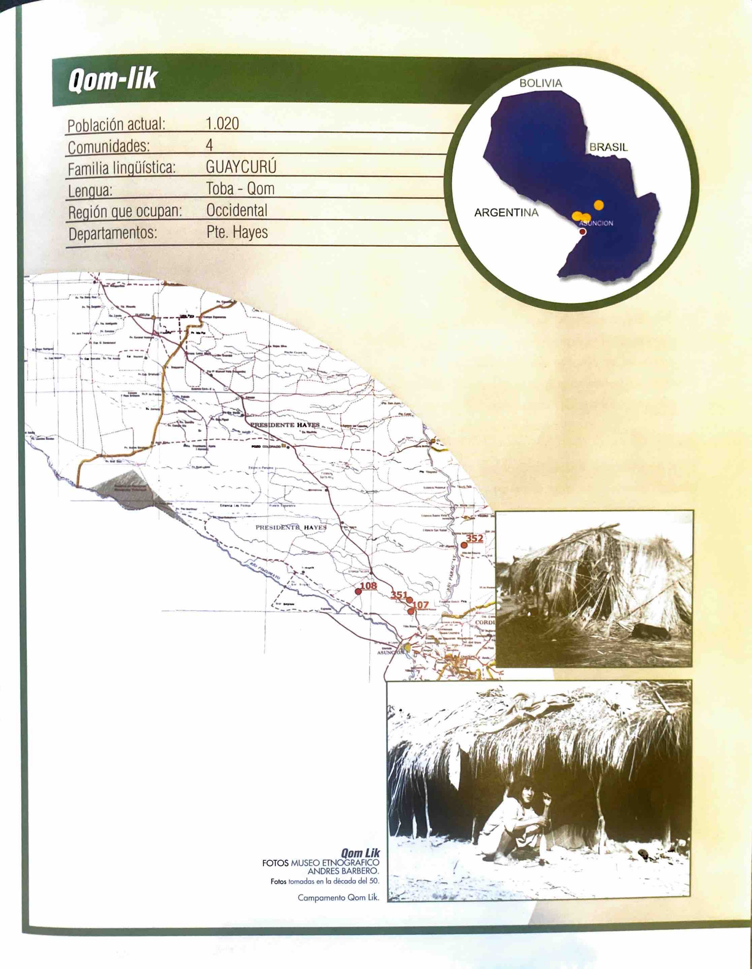
Qom-lik
Map 2001
Carte de la Guyane Française et l'Isle de Cayenne
Map 1798