
Citation
National Geographic Society. "Arquelogical Map of Middle America." The National Geographic Magazine, 1968. https://maps.lib.utexas.edu/maps/atlas_mexico/noted_archeological_sites.jpg.
!["Plan geografico del Vireynato de Santafe de Bogota;Nuevo Reyno de Granada;que manifiesta su demarcación territorial;islas;rios principales;provincias;y plazas de armas;lo que ocupan indios barbaros;y naciones extrangeras;demostrando los cõfines de los dos Reynos de Lima;México;y establecimientos de Portugal sus lindantes: con notas;historiales del ingreso anual de sus rentas reales;y noticias relativas a su actual estado civil;político;y militar [material cartográfico] / formando en servicio del Rey nro. sor. por el D. D. Francisco Moreno y Escandón;fiscal protector de la Real Audiencia de Santa Fe;y juez conservador de rentas;lo delineo D. Joseph Aparicio Morata;año de 1772;gobernando el reyno el excmo. sor. Bailio Frey D. Pedro Messia de la Cerda"](https://dnet8ble6lm7w.cloudfront.net/maps/CNT/CNT0007.jpg)
"Plan geografico del Vireynato de Santafe de Bogota;Nuevo Reyno de Granada;que manifiesta su demarcación territorial;islas;rios principales;provincias;y plazas de armas;lo que ocupan indios barbaros;y naciones extrangeras;demostrando los cõfines de los dos Reynos de Lima;México;y establecimientos de Portugal sus lindantes: con notas;historiales del ingreso anual de sus rentas reales;y noticias relativas a su actual estado civil;político;y militar [material cartográfico] / formando en servicio del Rey nro. sor. por el D. D. Francisco Moreno y Escandón;fiscal protector de la Real Audiencia de Santa Fe;y juez conservador de rentas;lo delineo D. Joseph Aparicio Morata;año de 1772;gobernando el reyno el excmo. sor. Bailio Frey D. Pedro Messia de la Cerda"
Map 1772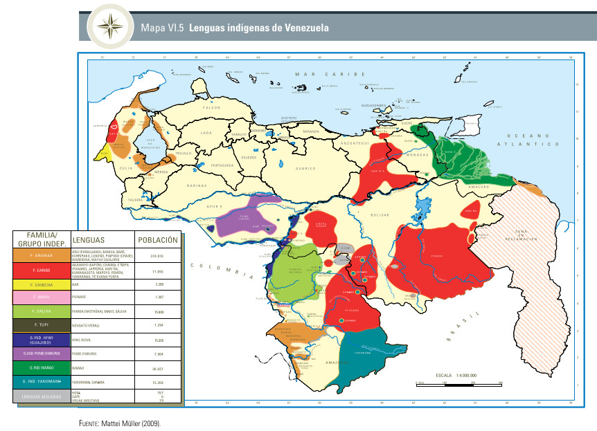
Mapa VI.5 Lenguas indígenas de Venezuela
Map 2009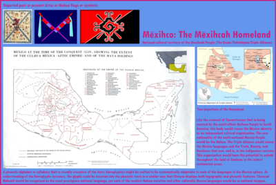
Mexico at the time of the conquest (1519), showing the extent of the Culhua Mexica (Aztec Empire) and of the Maya holdings
Map 1519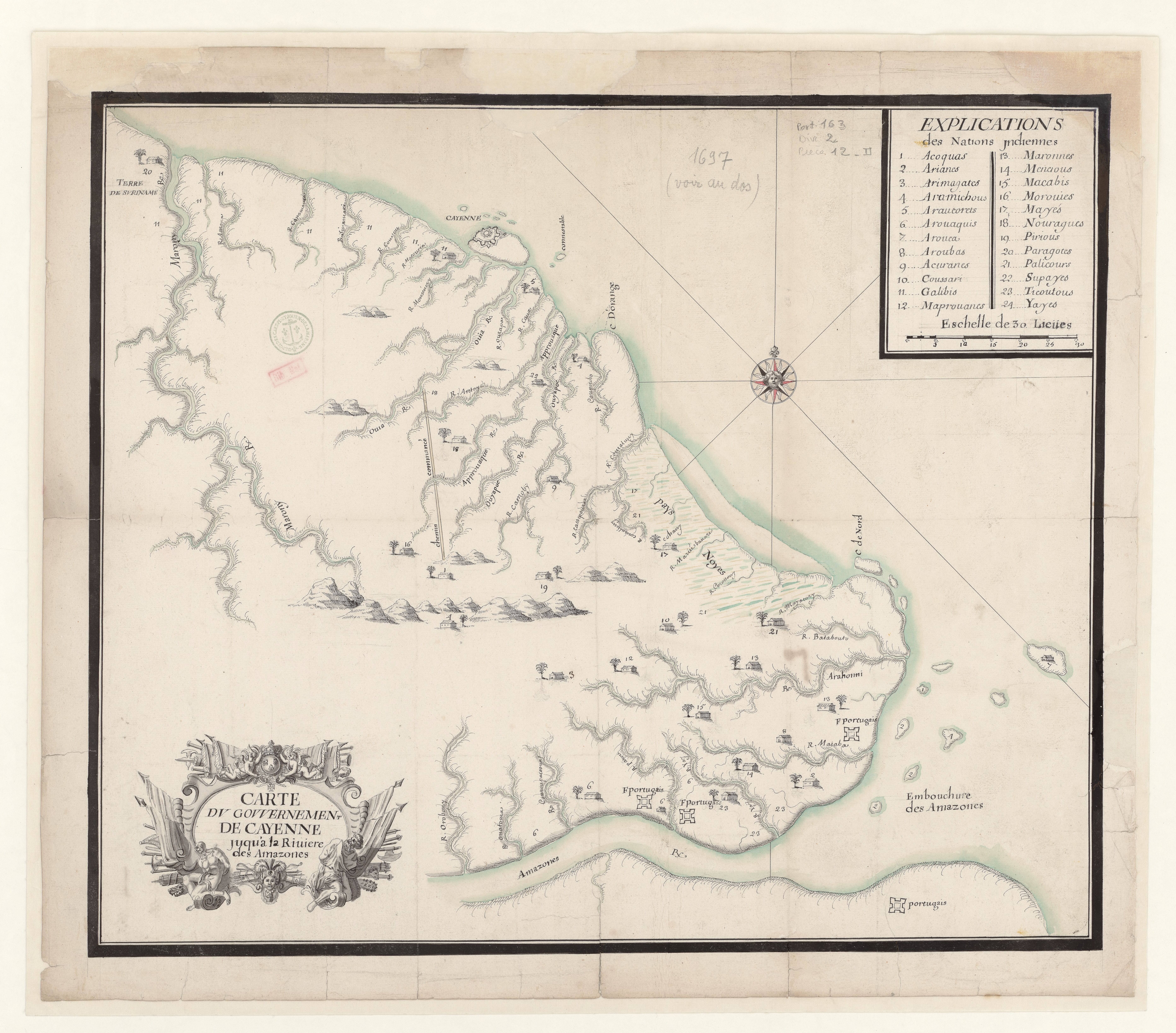
Carte du gouvernement de Cayenne jusqu'à la rivière des Amazones.
Map 1697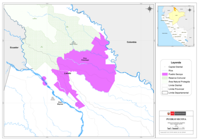
PUEBLO SECOYA
Map 2021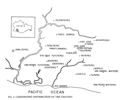
Geographic Distribution of the Chatino
Map 1969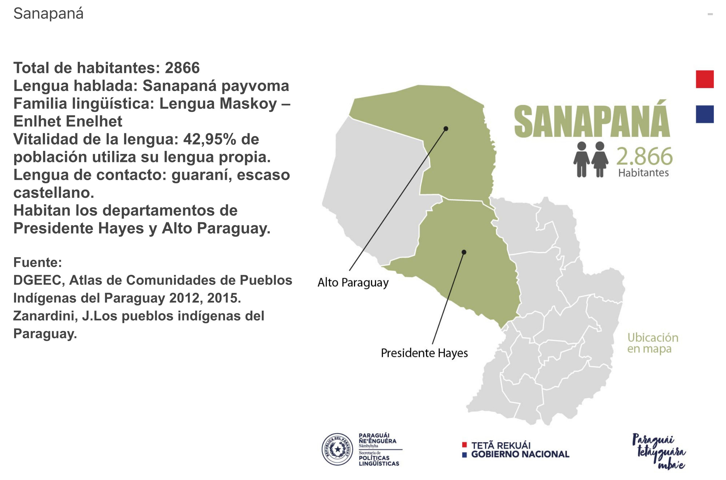
SANAPANÁ
Map 2015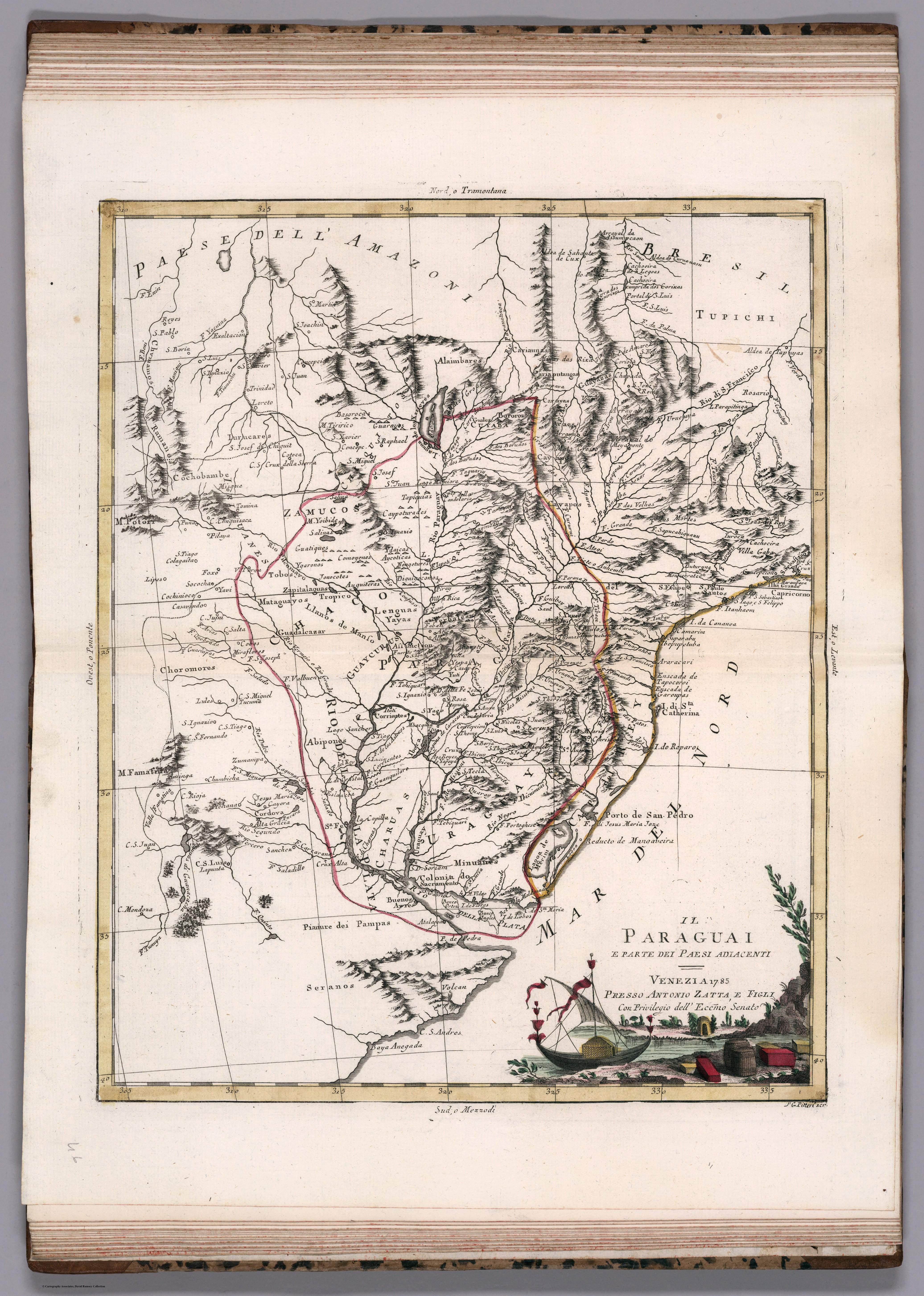
IL PARAGUAI E PARTE DEI PAESI ADIACENT
Map 1785