Citation
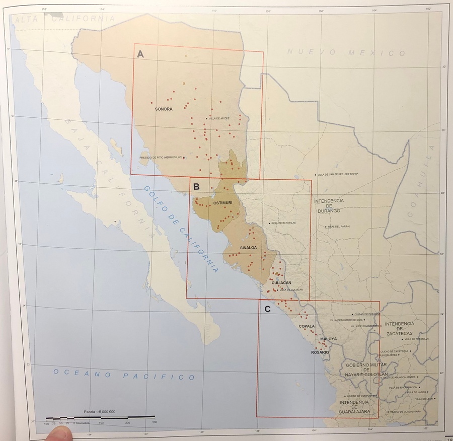
Tanck de Estrada, Dorothy. Atlas Ilustrado de los Pueblos de Indios: Nueva España, 1800. México: El Colegio de México, 2005. N/A - NO DIGITAL ACCESS
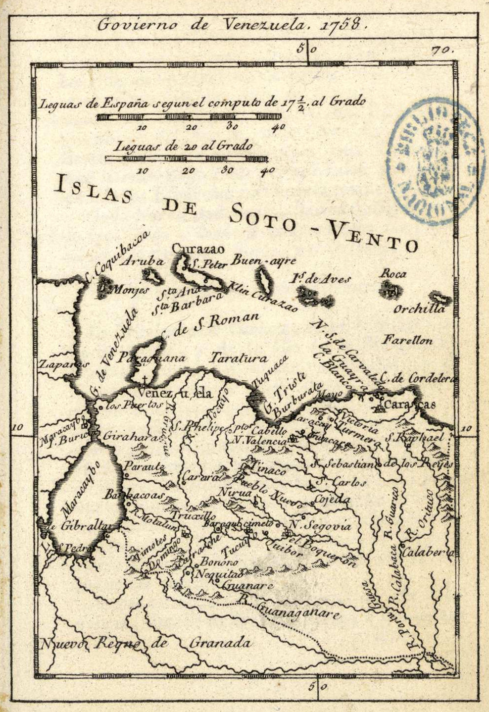
Govierno de Venezuela;1758.
Map 1758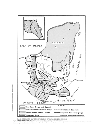
SCHEMATIC MAP OF DISTRIBUTION OF MAYA-SPEAKING INDIANS (From Morley, 1956, pl.7)
Map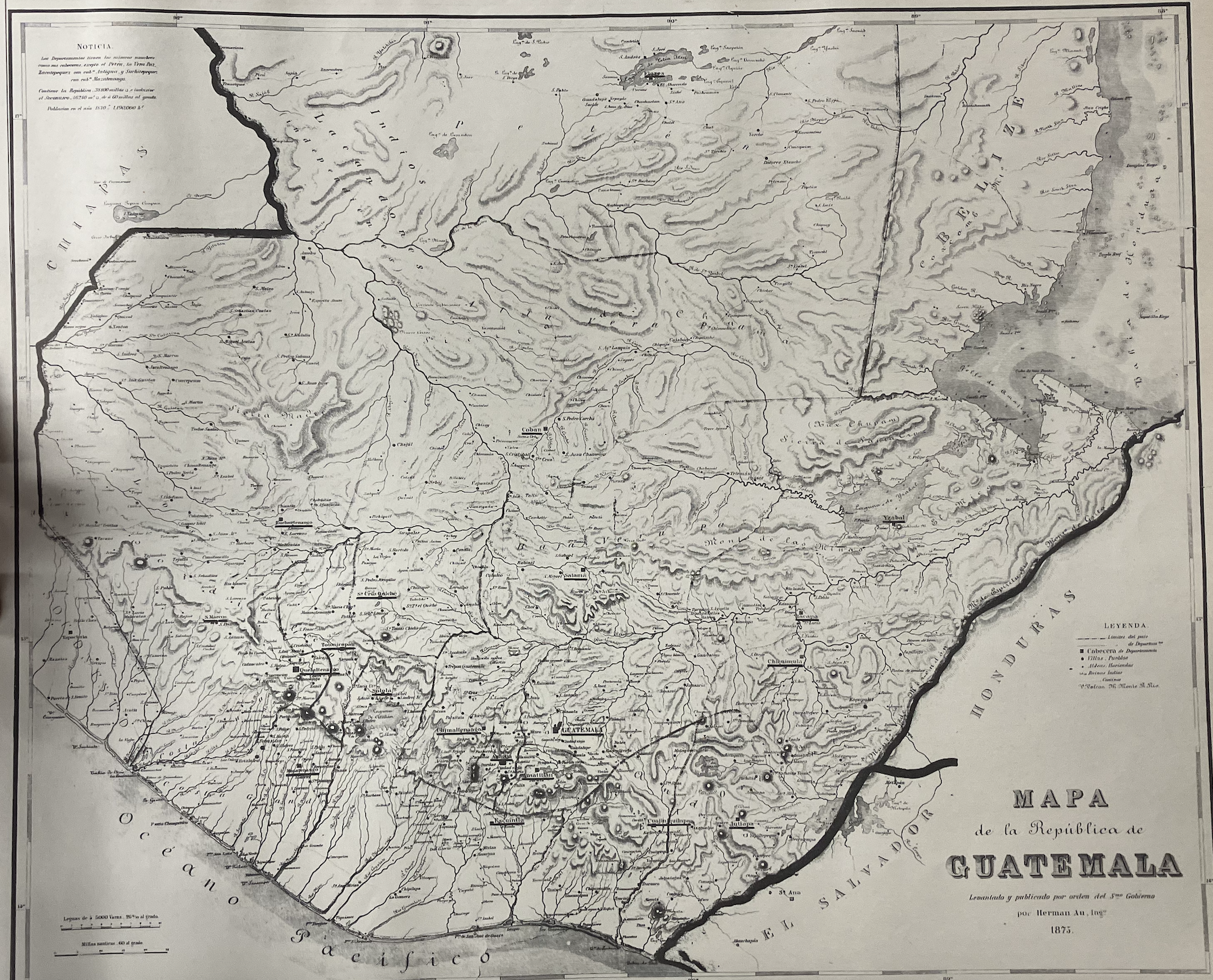
Mapa de la República de Guatemala
Map 1800 - 1900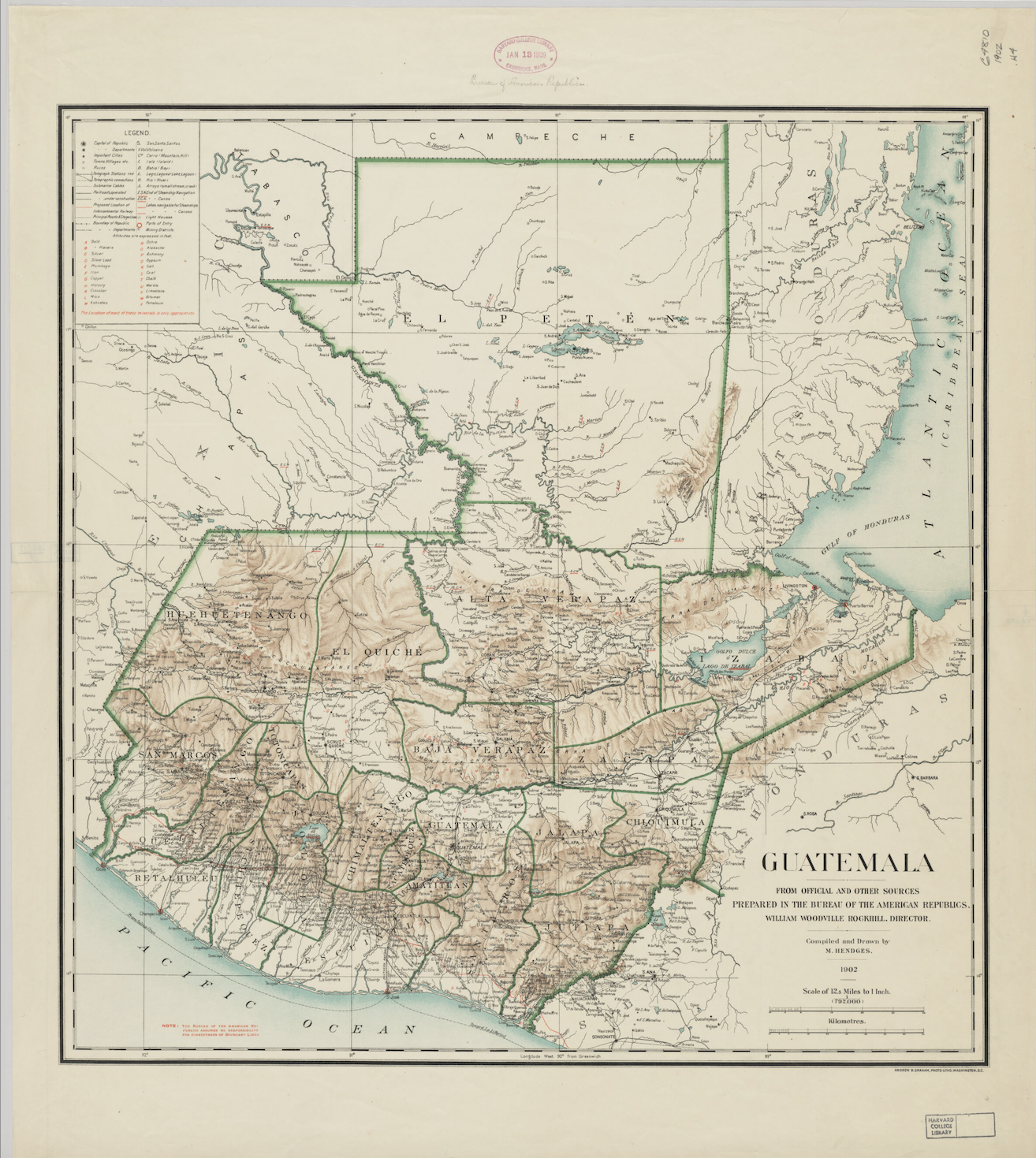
Guatemala: From Official and Other Sources
Map 1900 - 1902![Ani Xeati de los animales [Ani Xeati of the Animals]](https://dnet8ble6lm7w.cloudfront.net/art_sm/APER062.png)
Ani Xeati de los animales [Ani Xeati of the Animals]
Artwork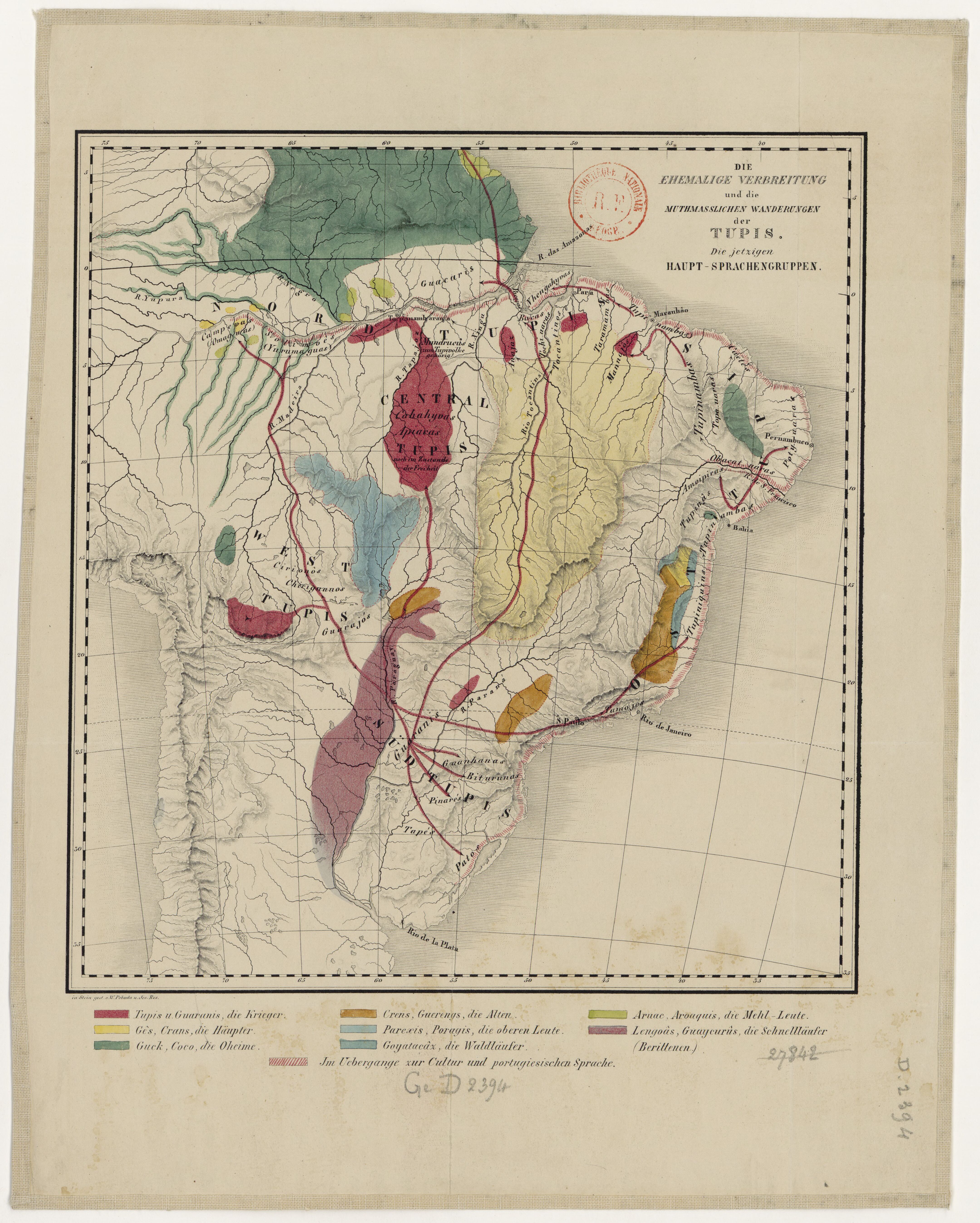
DIE EHEMALIGE VERBREITUNG und die MUTHMASSLICHEN WANDERUNGEN der TUPIS. Die jetzigen HAUPT-SPRACHENGRUPPEN.
Map 1875![Mapa de la costa de la provincia de [Santa Marta con las bahías], Rios y Sitios](https://dnet8ble6lm7w.cloudfront.net/maps/COL/COL0086.jpg)
Mapa de la costa de la provincia de [Santa Marta con las bahías], Rios y Sitios
Map 1770
The Spanish and Musketor shore and the bay of Honduras and the islands adjacent
Map 1735