
Citation
Tanck de Estrada, Dorothy. Atlas Ilustrado de los Pueblos de Indios: Nueva España, 1800. México: El Colegio de México, 2005. N/A - NO DIGITAL ACCESS
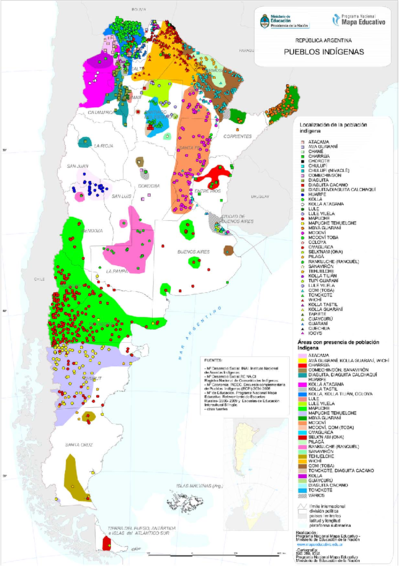
PUEBLOS INDIGENAS
Map 2021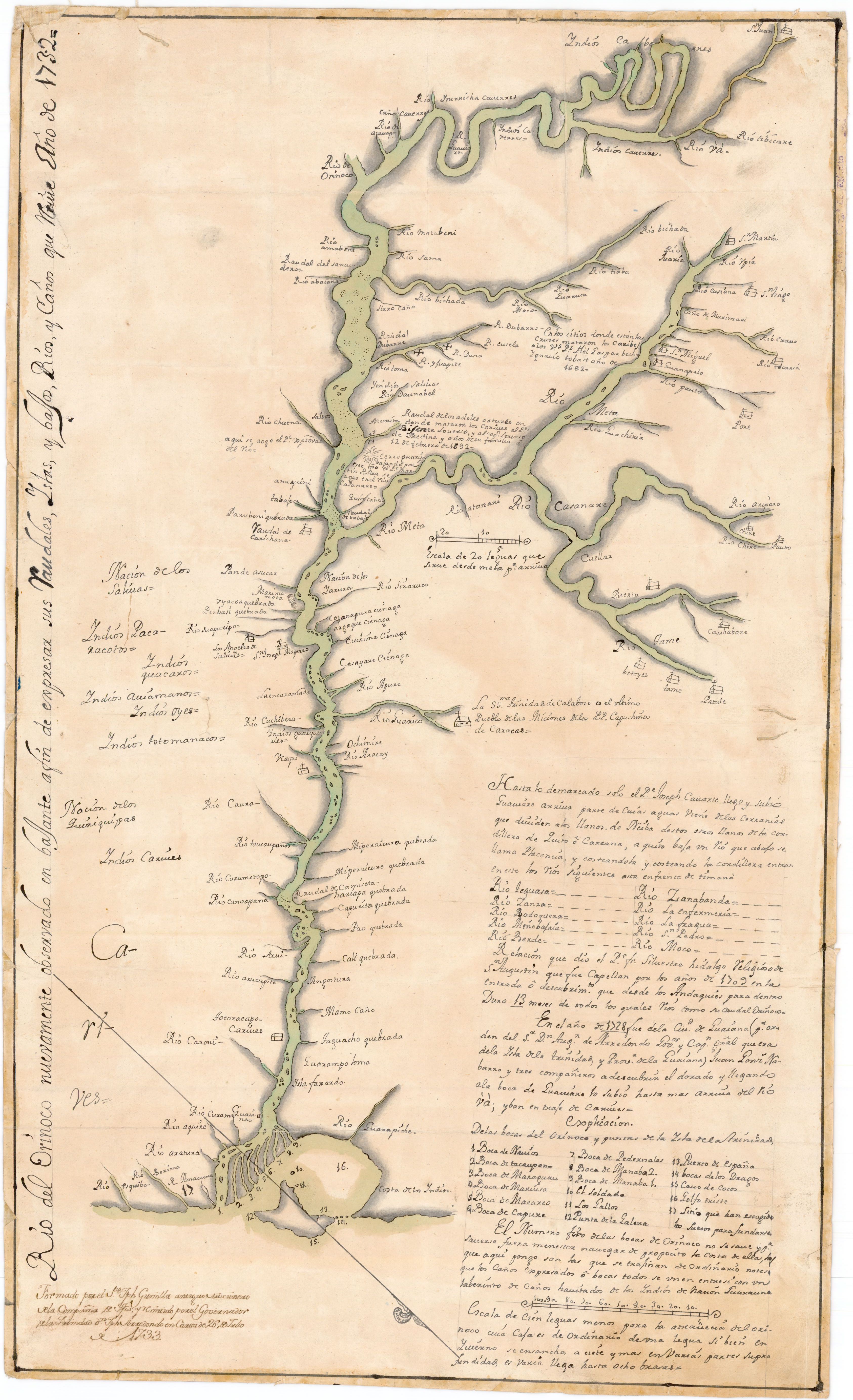
Río del Orinoco nuevamente observado en bajante a fin de expresar sus Caudales;Yslas y bajos;Rios y Caños que tiene
Map 1732
Serie Fatherland / Padre Patria
Artwork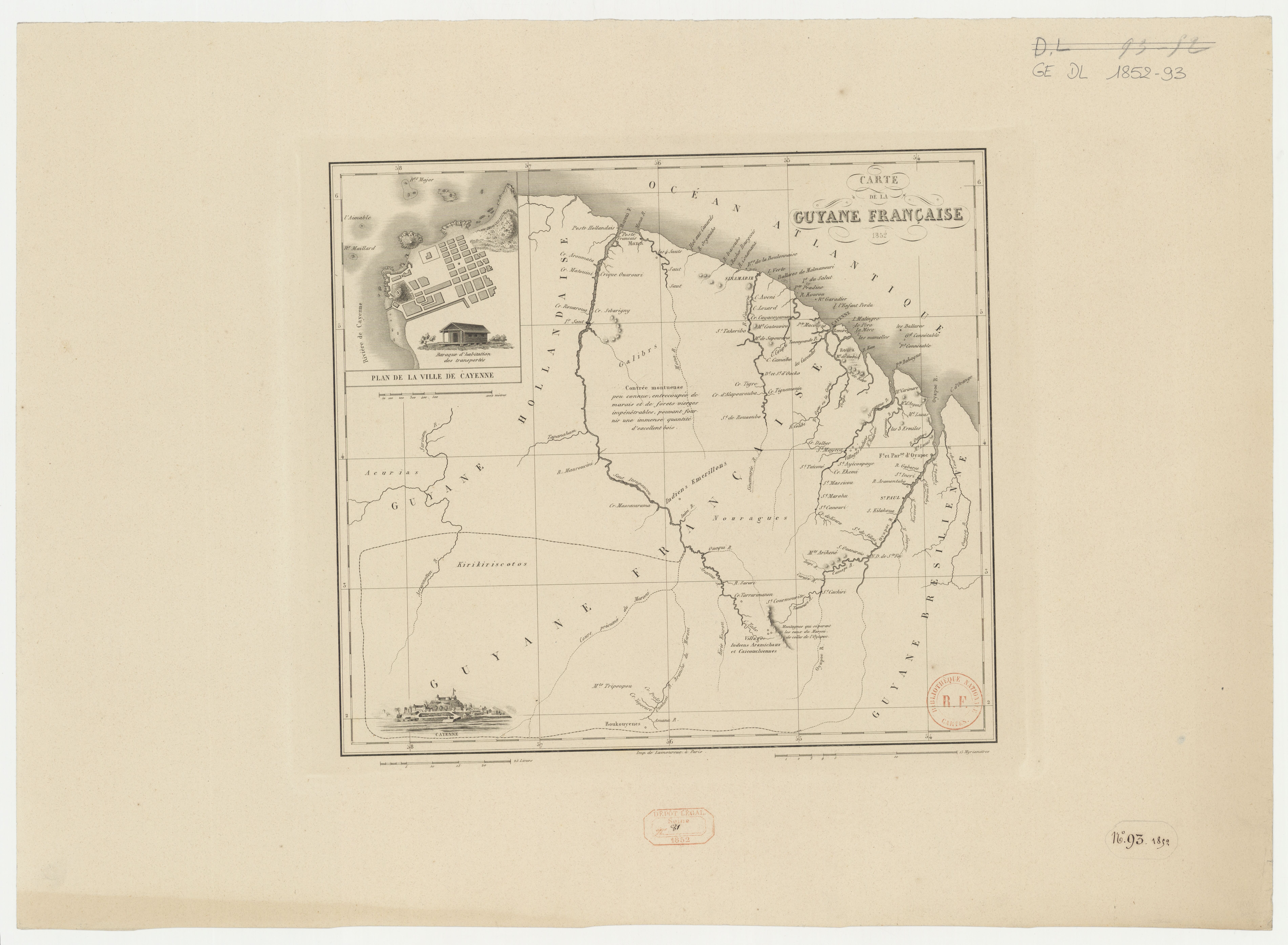
Carte de la Guyane française
Map 1852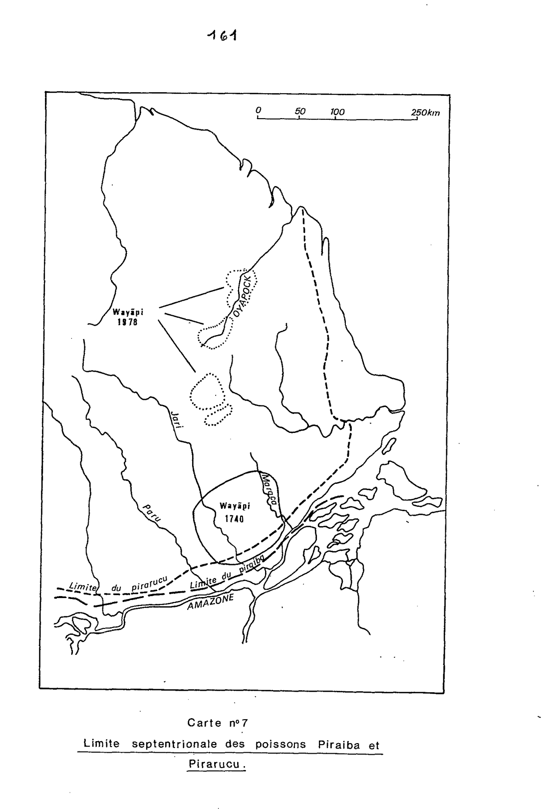
Carte n°7: Limite septentrionale des poissons Paraiba et Pirarucu
Map 1740 - 1978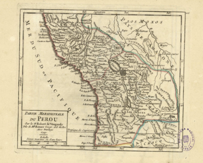
PARTIE MERIDIONALE DU PEROU
Map 1749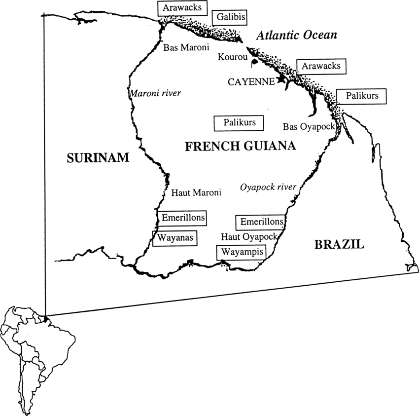
Fig. 1. Map of French Guiana with locations of the various Amerindian groups
Map 1999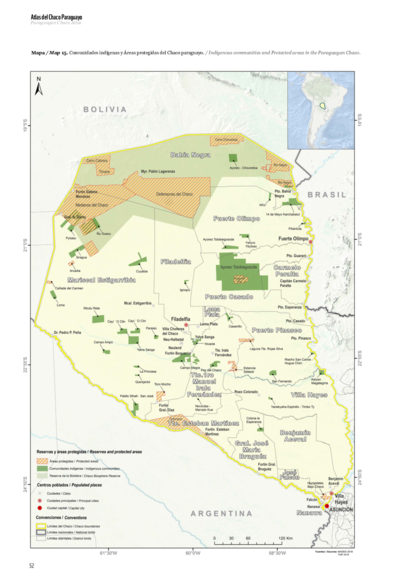
Comunidades indígenas y Áreas protegidas del Chaco paraguayo
Map 2020