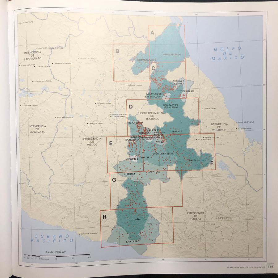
Citation
Tanck de Estrada, Dorothy. Atlas Ilustrado de los Pueblos de Indios: Nueva España, 1800. México: El Colegio de México, 2005. N/A - NO DIGITAL ACCESS
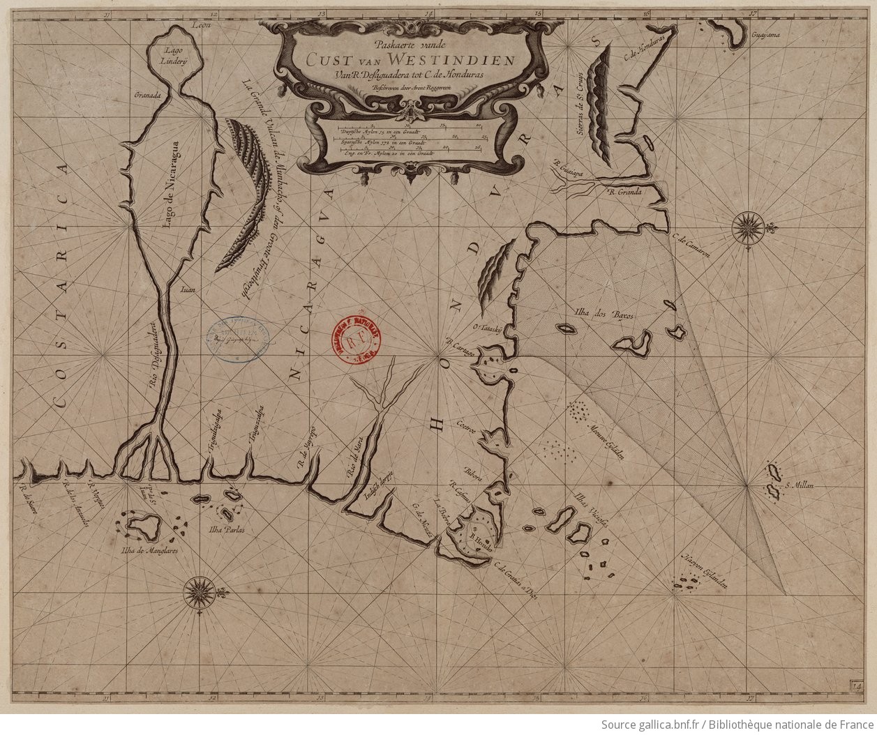
Paskaerte vande cust van Westindien van R. Desaguadera tot C. de Honduras / beschreven door Arent Roggeveen
Map 1675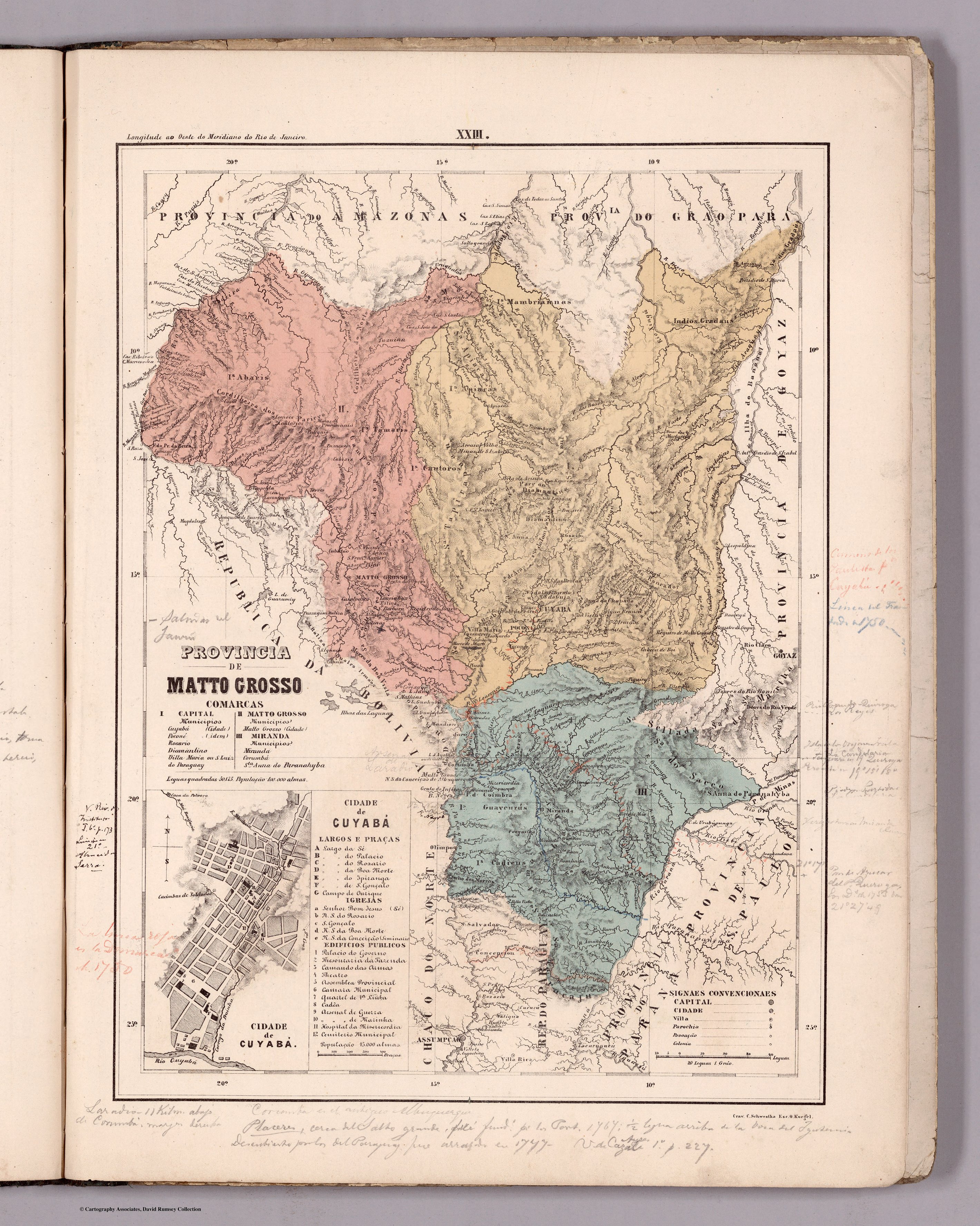
PROVINCIA DE MATTO GROSSO
Map 1800 - 1850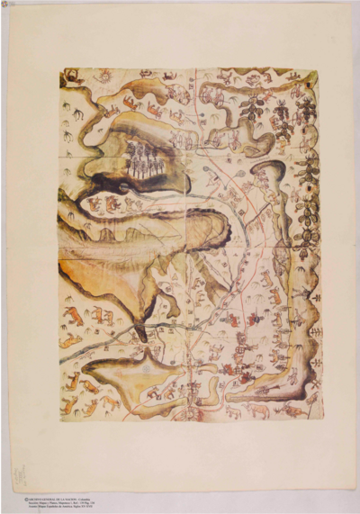
Plano del valle del río de San Miguel, desde sus fuentes hasta San Francisco de Chamacuero
Map 1580
CARTA DO SUL DO IMPERIO BRASIL, comprehandendo as PROVINCIAS RIO GRANDE do SUL, STA. CATHARINA e PARANA
Map 1885
PUEBLO MASTANAHUA
Map 2021![De cuando el río dejó de ser río para convertirse en otra cosa [When the River Ceased to Be a River and Became Something Else]](https://dnet8ble6lm7w.cloudfront.net/art_sm/APER061.png)
De cuando el río dejó de ser río para convertirse en otra cosa [When the River Ceased to Be a River and Became Something Else]
Artwork![Serie Historia de la peruvian corporaishion [History of the Peruvian Corporaishion Series]](https://dnet8ble6lm7w.cloudfront.net/art_sm/APER037.png)
Serie Historia de la peruvian corporaishion [History of the Peruvian Corporaishion Series]
Artwork
MAPA DE SAN PEDRO AZCAPOTZALTONGO
Map 1500 - 1599