Citation
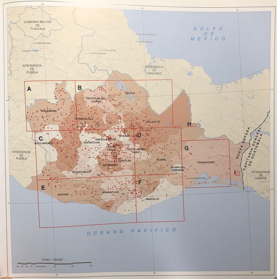
Tanck de Estrada, Dorothy. Atlas Ilustrado de los Pueblos de Indios: Nueva España, 1800. México: El Colegio de México, 2005. N/A - NO DIGITAL ACCESS
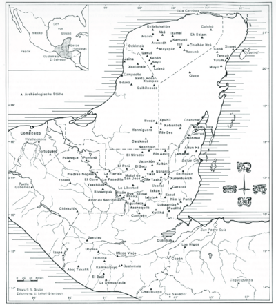
MAP OF THE YUCATAN PENINSULA WITH MAJOR ARCHEOLOGICAL SITES
Map 2019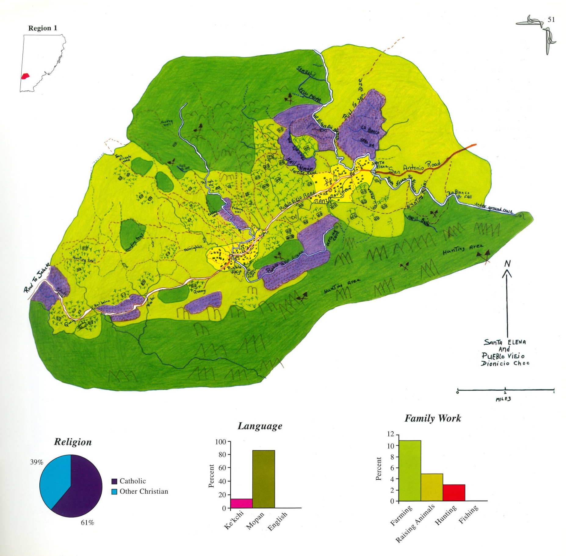
Santa Elena and Pueblo Viejo
Map 1997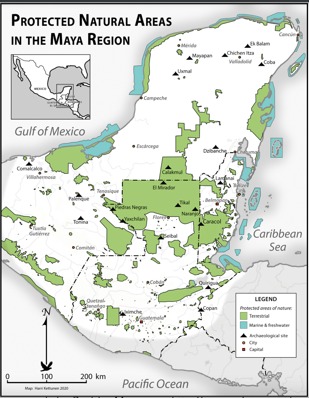
Protected Natural Areas in the Maya Region
Map 2000 - 2100
PLANO QUE SE ADJUNTA AL PROCESO QUE SIGUEN LOS INDÍGENAS DE LA COMUNIDAD DE COLAMBO;LOJA CONTRA DIEGO BRICINO A QUIEN ACUSAN DE HABERSE APROPIADO DE LAS TIERRAS DE ESTA COMUNIDAD
Map 1697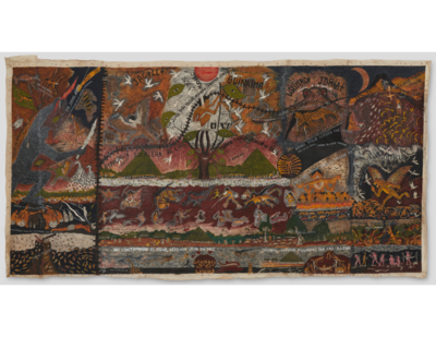
Huitoto Cosmovision
Artwork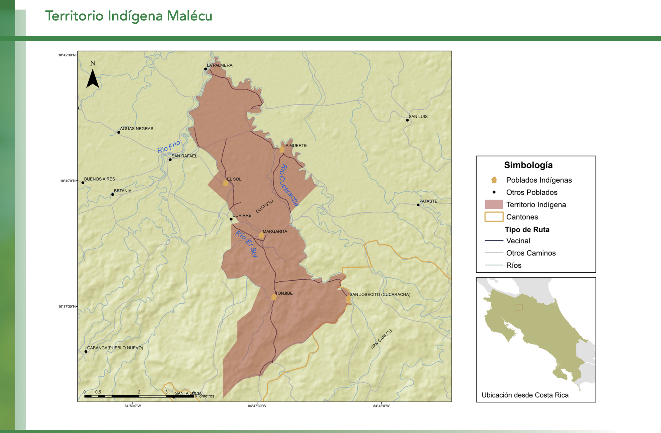
"Territorio Indígena Malécu"
Map 2010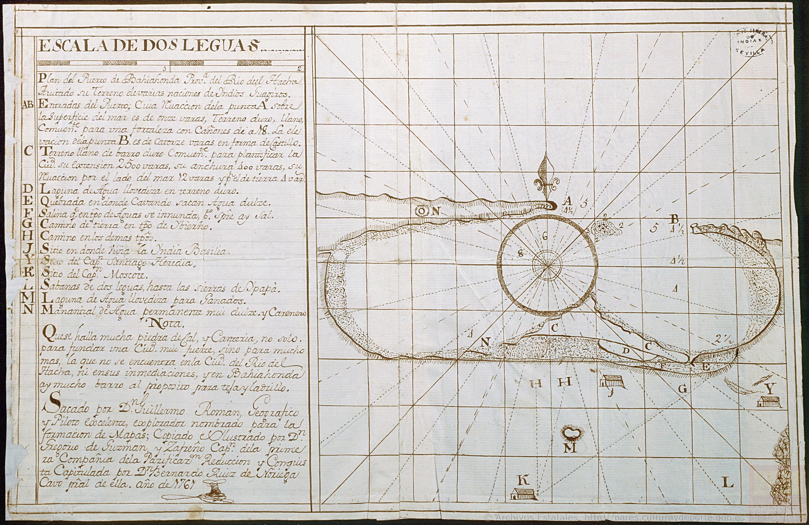
Plan del Puerto de Bahiahonda, Provincia del Rio del Hacha, Auitado su terreno de varias naciones de Yndios Guagiros
Map 1761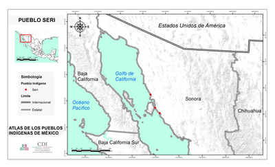
PUEBLO SERI
Map 2020