Citation
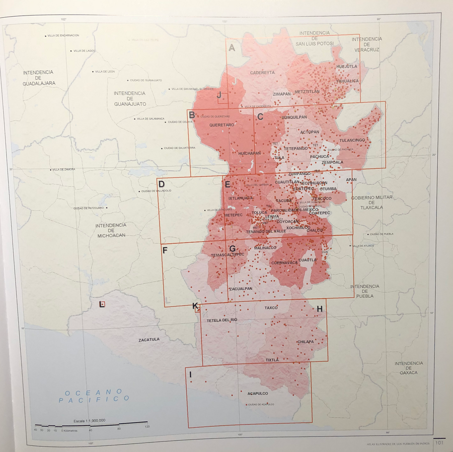
Tanck de Estrada, Dorothy. Atlas Ilustrado de los Pueblos de Indios: Nueva España, 1800. México: El Colegio de México, 2005. N/A - NO DIGITAL ACCESS
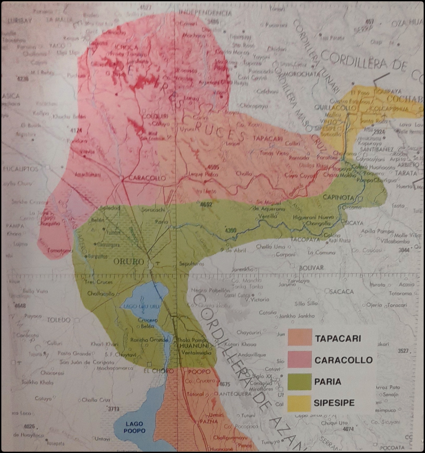
EL SEÑORÍO AYMARA DE LOS SURAS EN EL SIGLO XVI
Map 1500 - 1699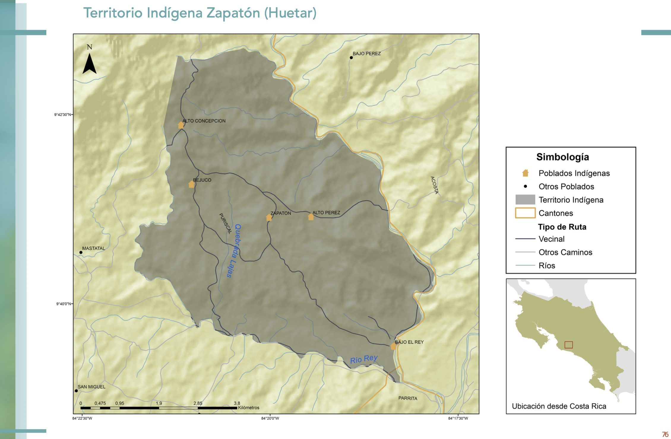
"Territorio Indígena Zapatón (Huetar)"
Map 2010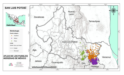
SAN LUIS POTOSÍ
Map 2015
Geographic Map of the Nicaragua with three plans and views.
Map 1855![Plano que conti[en]e las Provincias de Sonora, Pimerías, Papaguería, Apachería, Rios Gila y Colorado y tierras descubiert[a]s hasta el Puerto de S[a]n Fran[cis]co en la California Septentrional y jasta el Pueblo de Oraybe en la Provincia de el Moqui, con arreglo á los diarios de el Coronel D[o]n Ant[oni]o Crespo y de los P.P. Misioneros Fr[ray] Pedro Font y Fr[ay] Francisco Garcés de q[uie]n, los viajes desde la nación Jabajaba en el Río Colorado hasta la misión de S[a]n Gabriel, a las Naciones que están al Norte de esta Misión, su regreso á los Jamajabas y camino que hizo al Moqui, están señalados con lineas de puntos: con cuia señal se manifiesta también la línea de Presidios de esta frontera](https://dnet8ble6lm7w.cloudfront.net/maps_sm/MEX/MEX0188.png)
Plano que conti[en]e las Provincias de Sonora, Pimerías, Papaguería, Apachería, Rios Gila y Colorado y tierras descubiert[a]s hasta el Puerto de S[a]n Fran[cis]co en la California Septentrional y jasta el Pueblo de Oraybe en la Provincia de el Moqui, con arreglo á los diarios de el Coronel D[o]n Ant[oni]o Crespo y de los P.P. Misioneros Fr[ray] Pedro Font y Fr[ay] Francisco Garcés de q[uie]n, los viajes desde la nación Jabajaba en el Río Colorado hasta la misión de S[a]n Gabriel, a las Naciones que están al Norte de esta Misión, su regreso á los Jamajabas y camino que hizo al Moqui, están señalados con lineas de puntos: con cuia señal se manifiesta también la línea de Presidios de esta frontera
Map 1778
Relación Geográfica de Zapotitlán
Map 1579
Indigenous Peoples of Nicaragua: Showing traditional lands of seven currently recognized people and groups.
Map 2022
Coste de Guiane depuis le cap de nord jusqu'à Cayenne, par François Duvillard, sergent, traiteur, voyageur, en la susdite cote de Guiane.
Map 1727