Citation
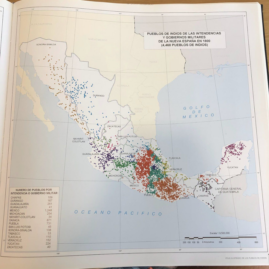
Tanck de Estrada, Dorothy. Atlas Ilustrado de los Pueblos de Indios: Nueva España, 1800. México: El Colegio de México, 2005. N/A - NO DIGITAL ACCESS
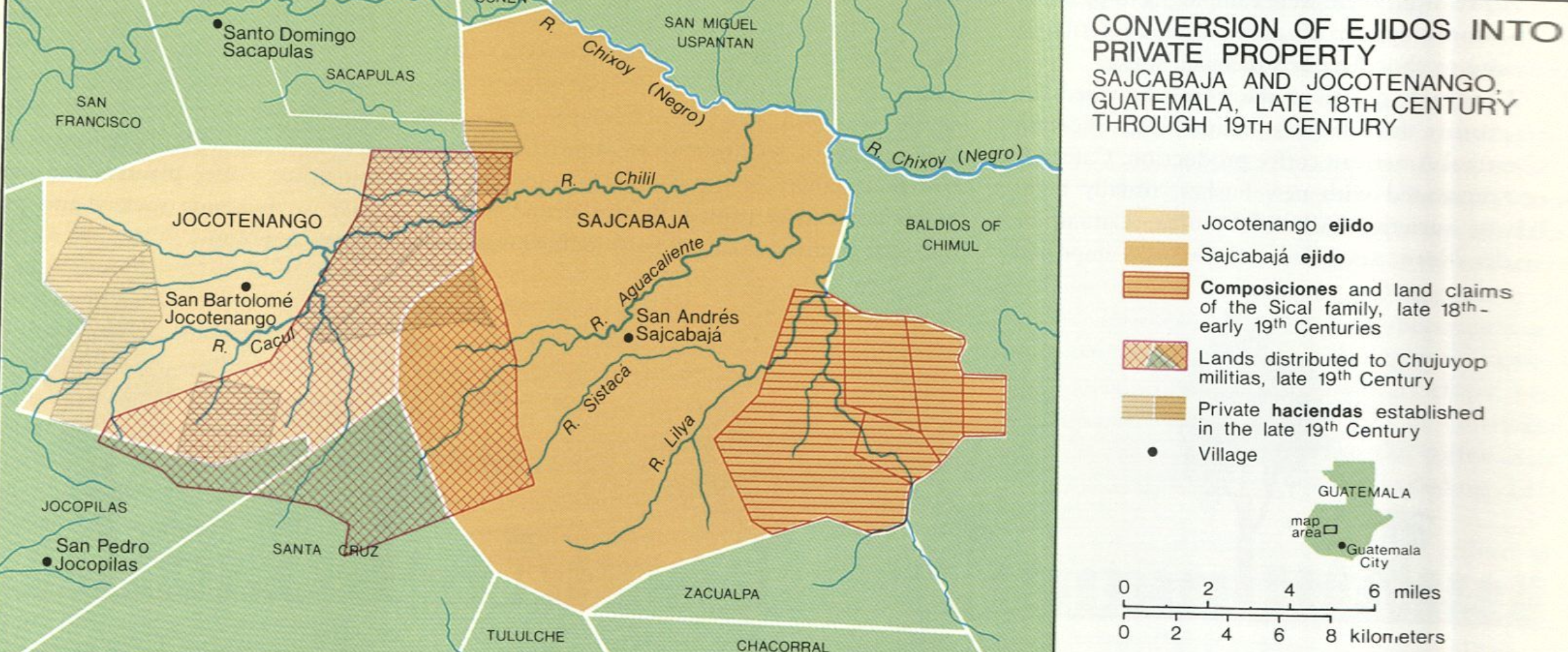
Conversion of Ejidos into Private Property, Sajcabaja and Jocotenango, Guatemala, Late 18th Century through 19th Century
Map 1700 - 1800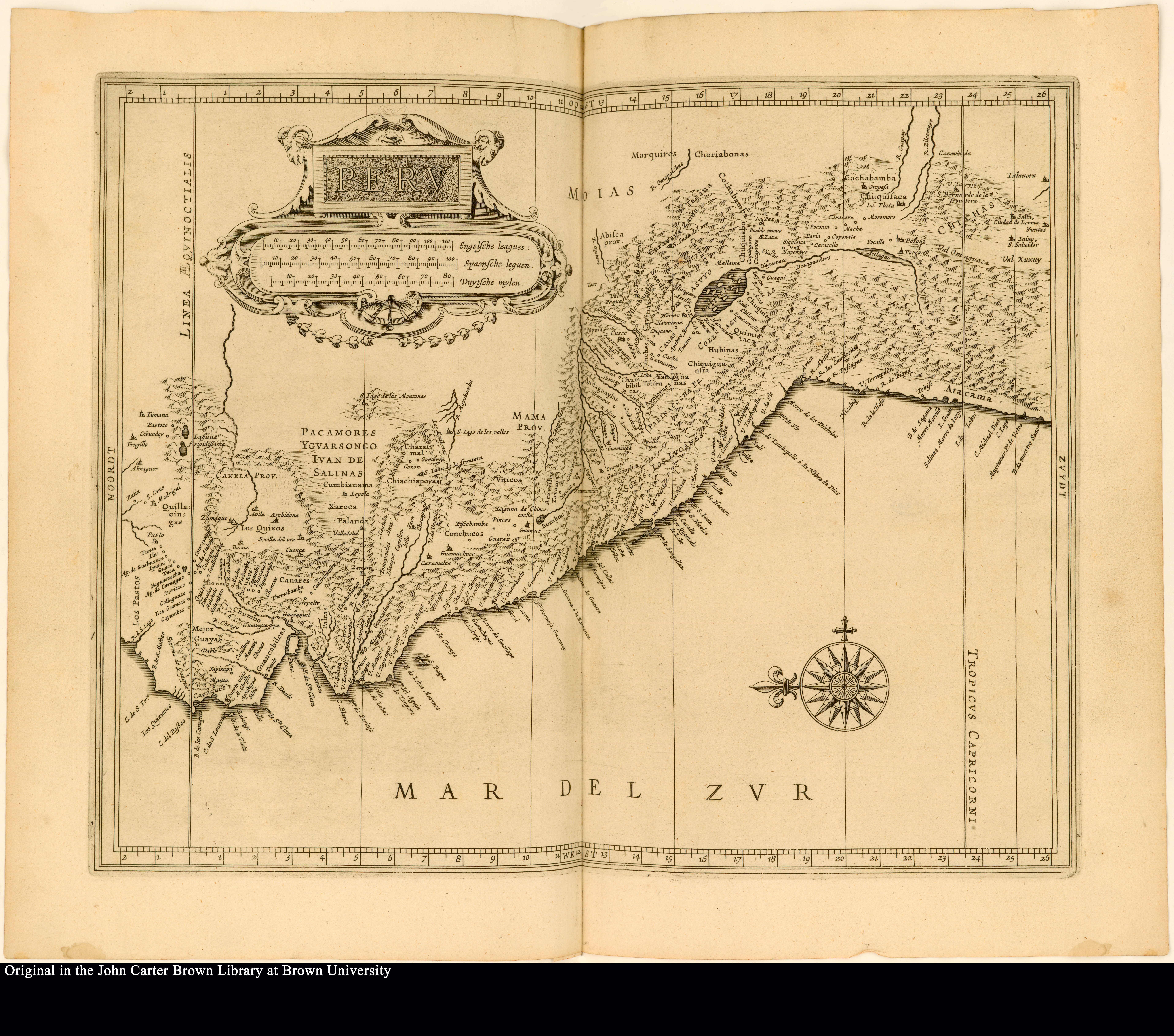
Peru
Map 1625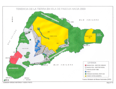
Tenencia de Tierra en Isla de Pascua hacia 2003
Map 2003
Mapa Nova Cartografia Social dos Babaçuais: Mapeamento Social da Região Ecológica do Babaçu
Map 2014 - 2017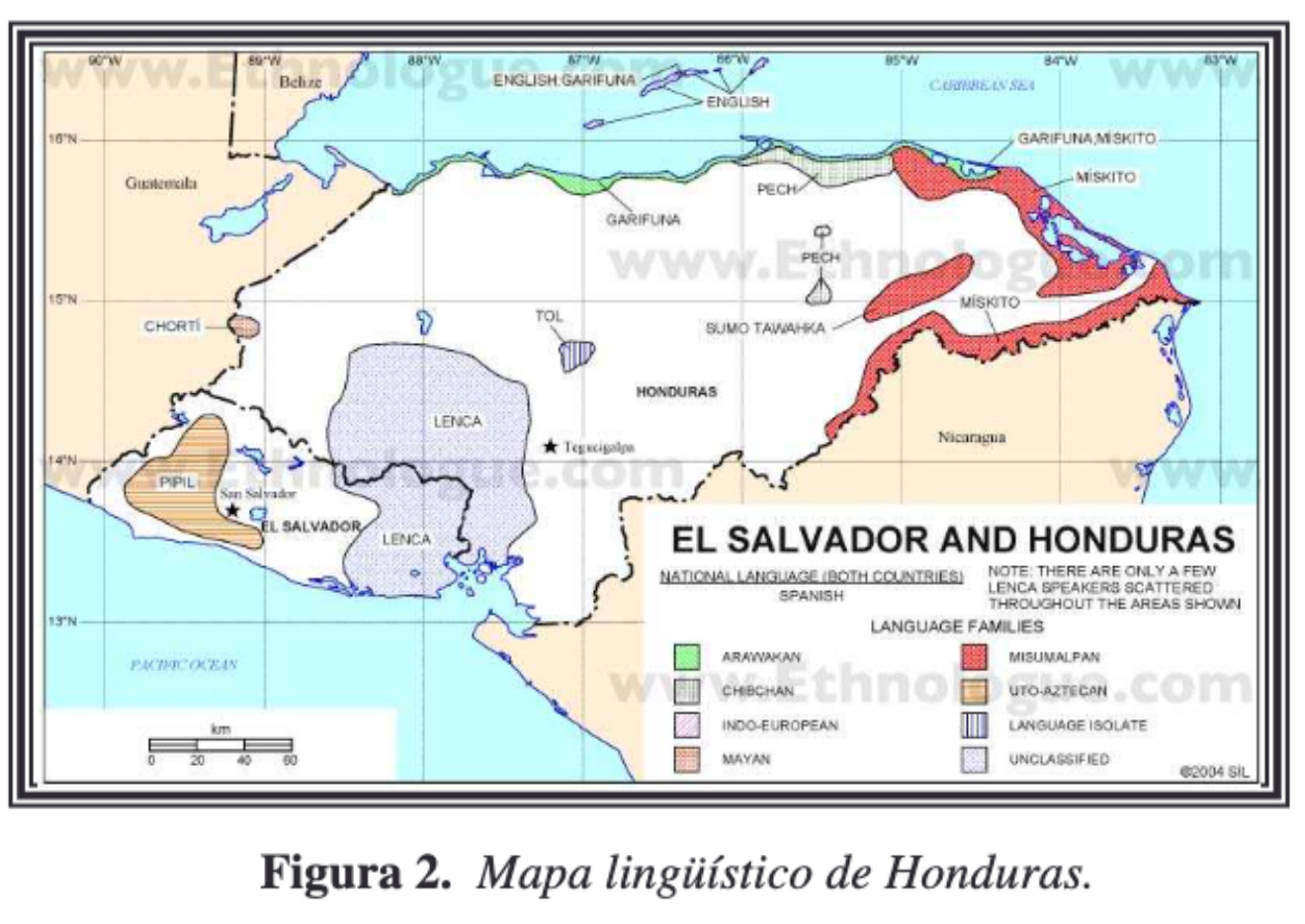
Mapa linguístico de Honduras
Map 2004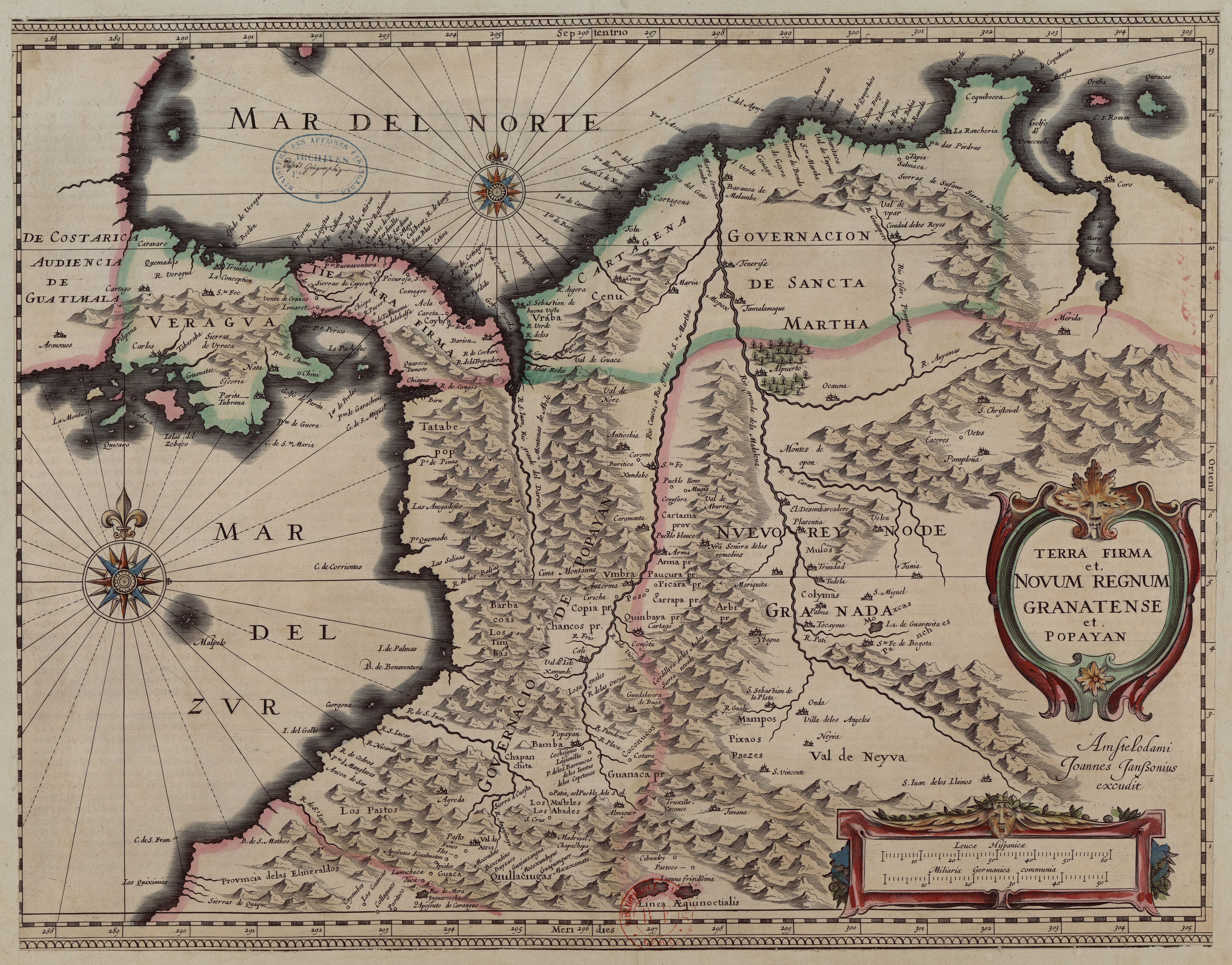
Terra Firma et Novum Regnum Granatense et Popayan
Map 1635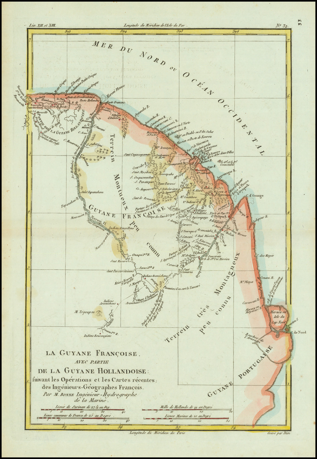
La Guyane Francoise, avec partie de la Guyane Hollandoise: suivant les Opérations et les Cartes récentes;des Ingênieurs-Géographes François.
Map 1787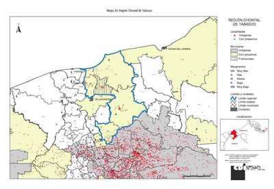
REGIÓN CHONTAL DE TABASCO
Map 2000