Citation
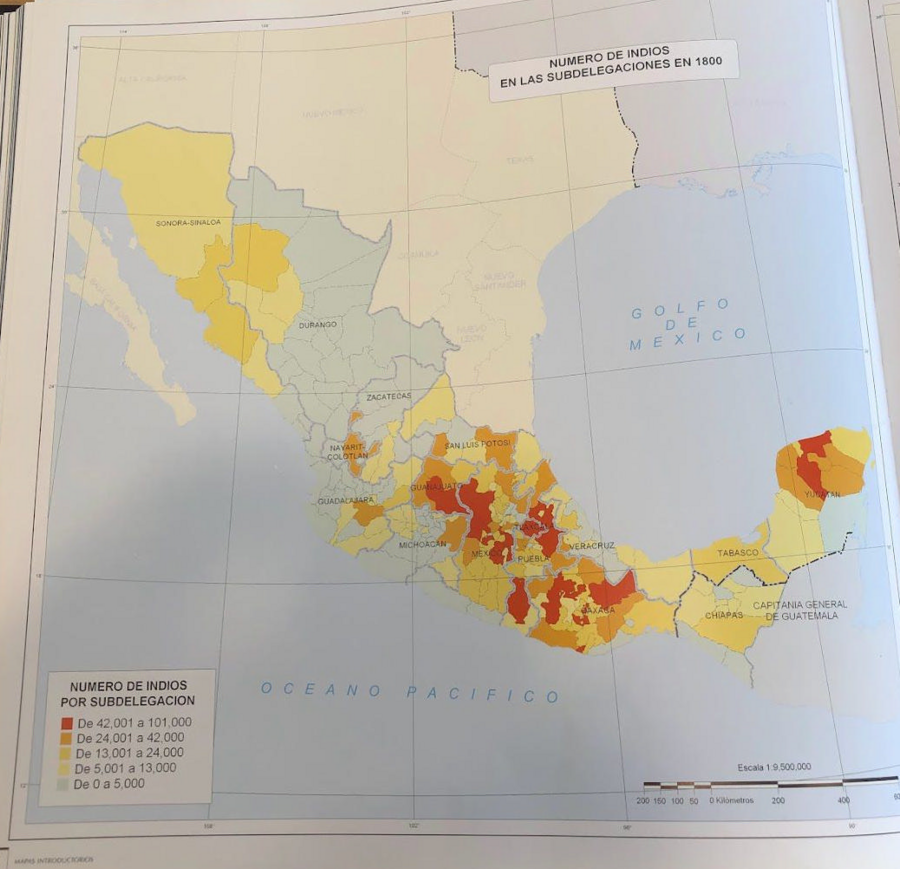
Tanck de Estrada, Dorothy. Atlas Ilustrado de los Pueblos de Indios: Nueva España, 1800. México: El Colegio de México, 2005. N/A - NO DIGITAL ACCESS
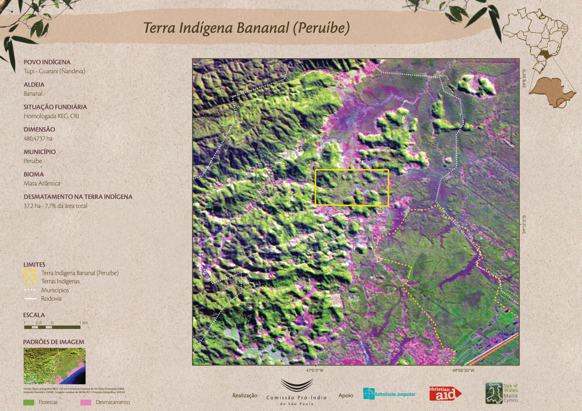
Terra Indígena Bananal (Peruíbe)
Map 2011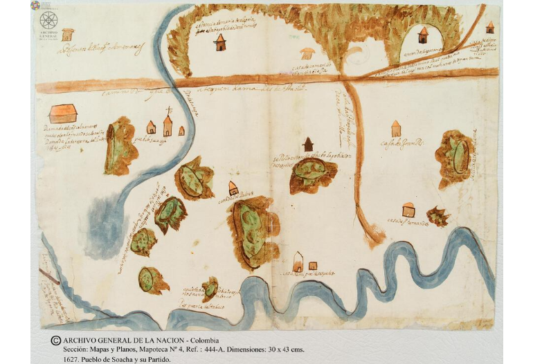
Pueblo de Soacha
Map 1627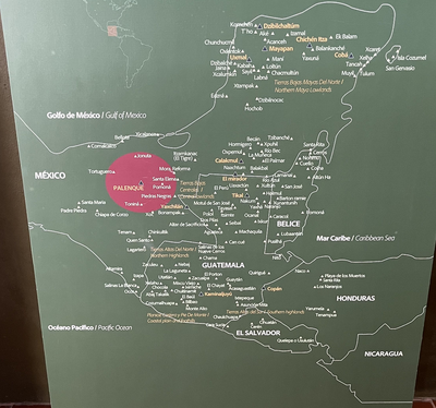
MAYA CITIES
Map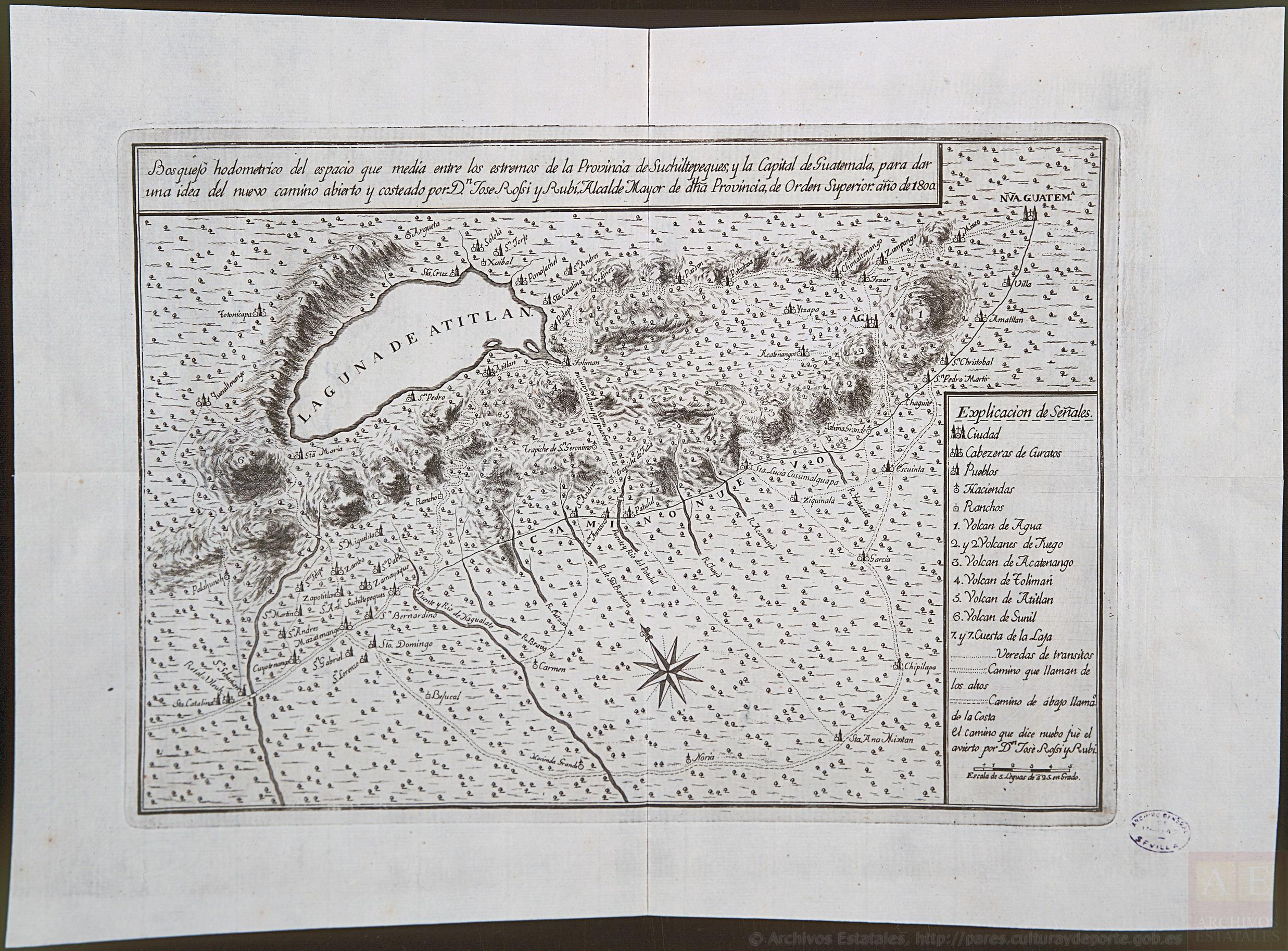
Bosquejo hodométrico del expacio que media entre los extremos de la Provincia de Suchiltepeques y la Capital de Guatemala, para dar una idea del nuevo camino abierto y costeado por D. José Rossi y Rubí, Alcalde mayor de dicha Provincia, de orden superior, año de 1800.
Map 1800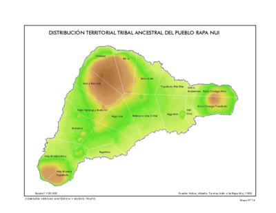
Distribución Territorial Tribal Ancestral del Pueblo Rapa Nui.
Map 1400![[Embouchure de l'Oyapock].](https://dnet8ble6lm7w.cloudfront.net/maps/FGU/FGU0062.jpeg)
[Embouchure de l'Oyapock].
Map 1700 - 1799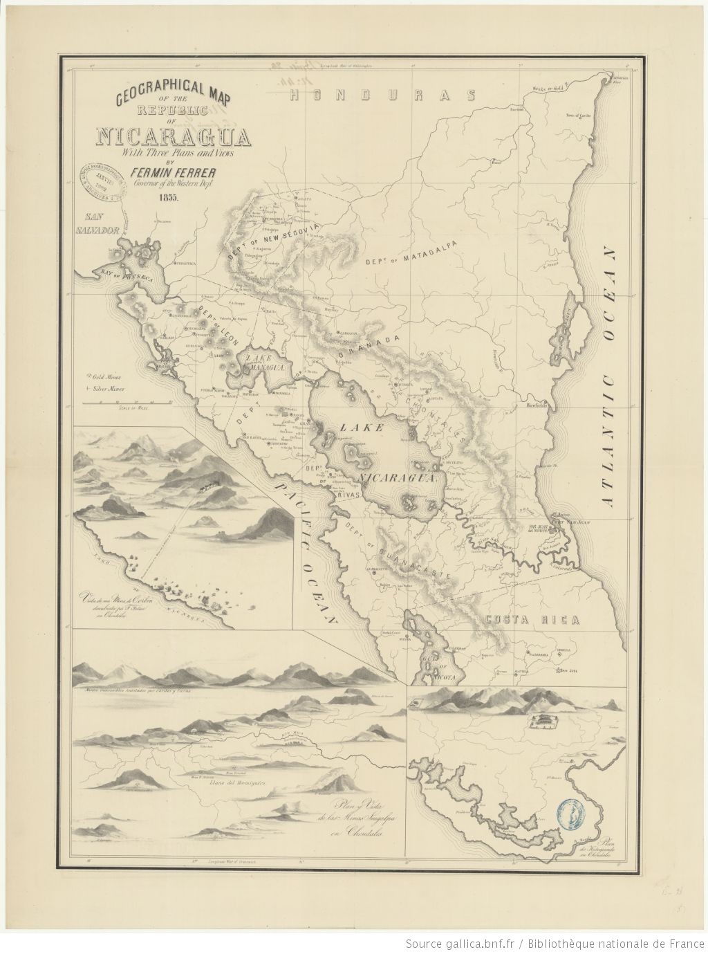
Geographic Map of the Nicaragua with three plans and views.
Map 1855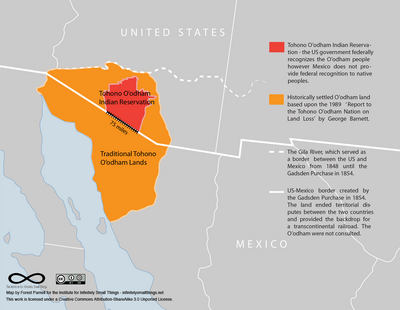
Tohono O’odham Nation Map
Map