Citation
Tanck de Estrada, Dorothy. Atlas Ilustrado de los Pueblos de Indios: Nueva España, 1800. México: El Colegio de México, 2005. N/A - NO DIGITAL ACCESS

PUEBLO BORA
Map 2021
PROVINCIE DEL PARA E DEL MARAGNONE
Map 1600 - 1699
Population density of Cuba
Map -4000
SKETCH MAP OF THE CAPUCHIN MISSIONS IN GUAYANA ABOUT 1779
Map 1779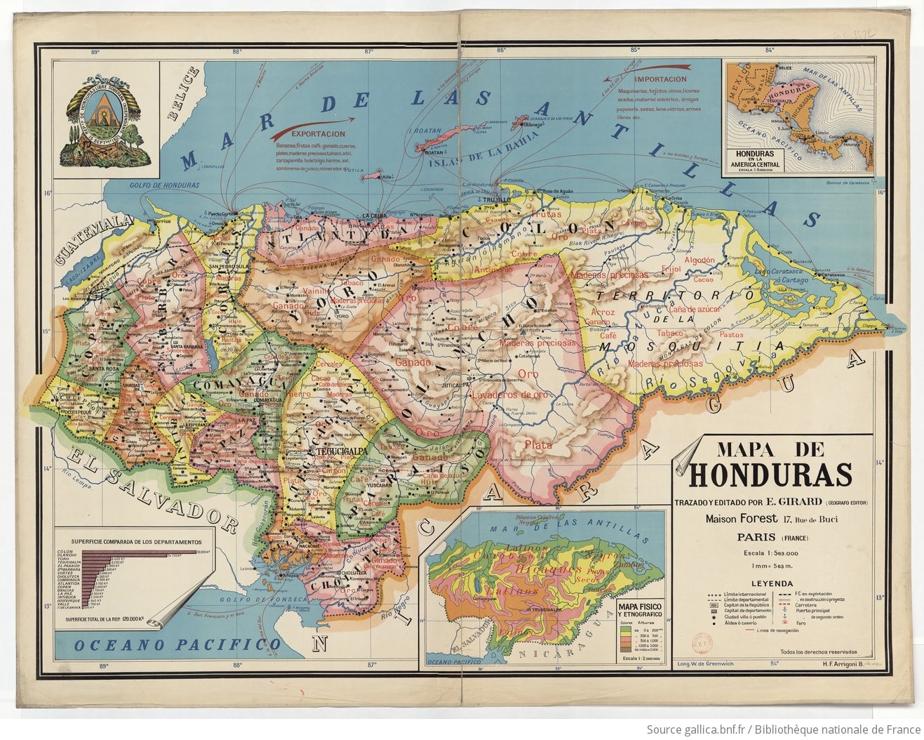
Mapa de Honduras, with Mapa Físico y Etnográfico (insert)
Map 1929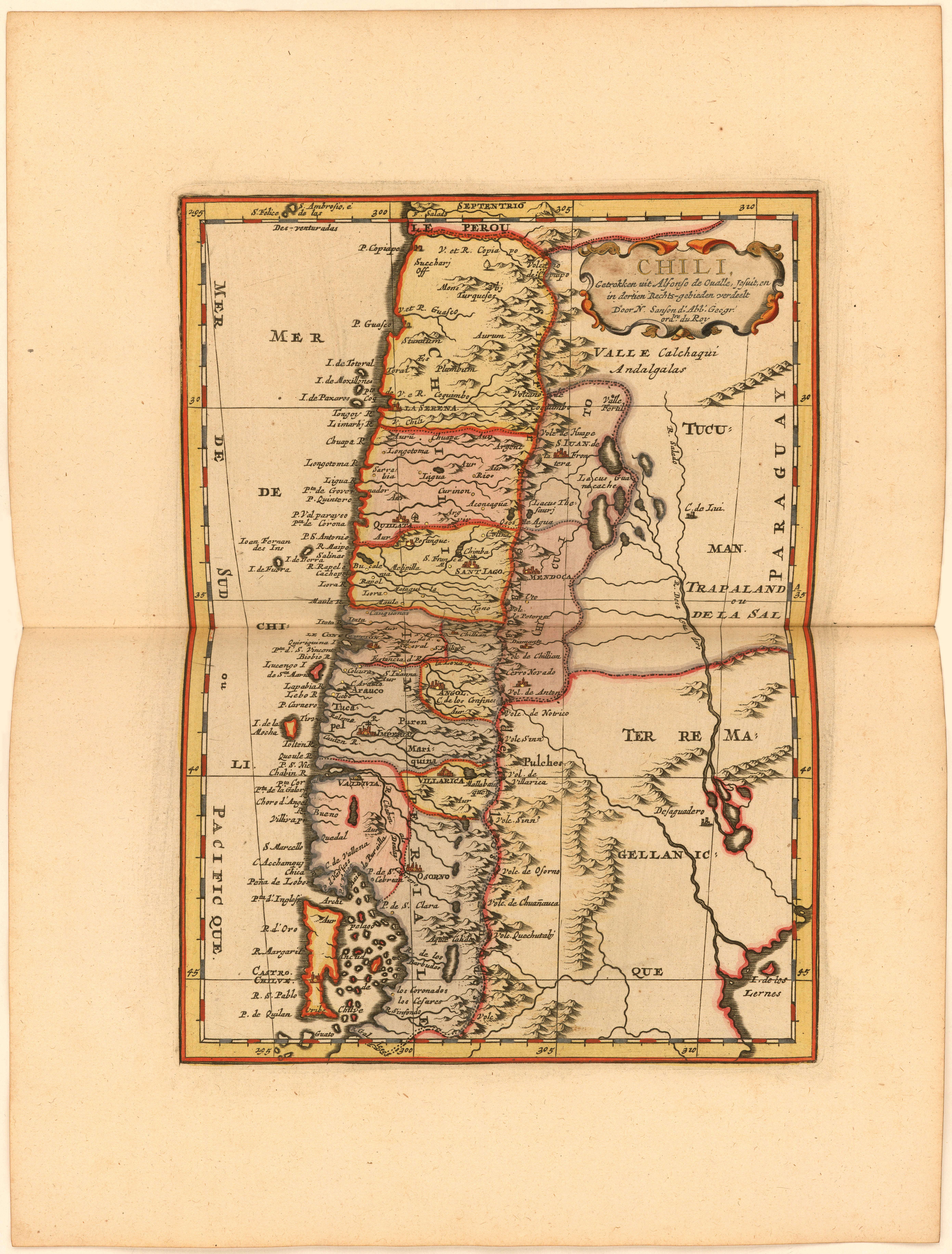
Chili, Getrokken uit Alfonso de Ovalle, Jesuit, en in dertien Rechts-gebieden verdeelt Door N. Sanson d.'Abb. Geogr. ordre. du Roy
Map 1600 - 1667![Los amarillos [The Yellow Ones]](https://dnet8ble6lm7w.cloudfront.net/art_sm/ACOL017.png)
Los amarillos [The Yellow Ones]
Artwork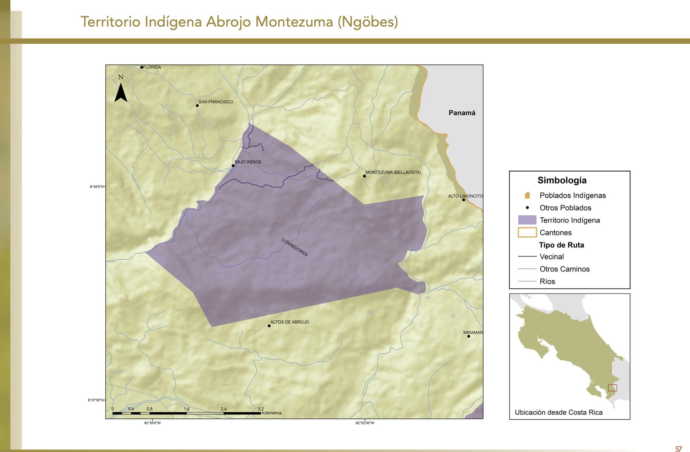
"Territorio Indígena Abrojo Montezuma (Ngöbes)"
Map 2010