Citation
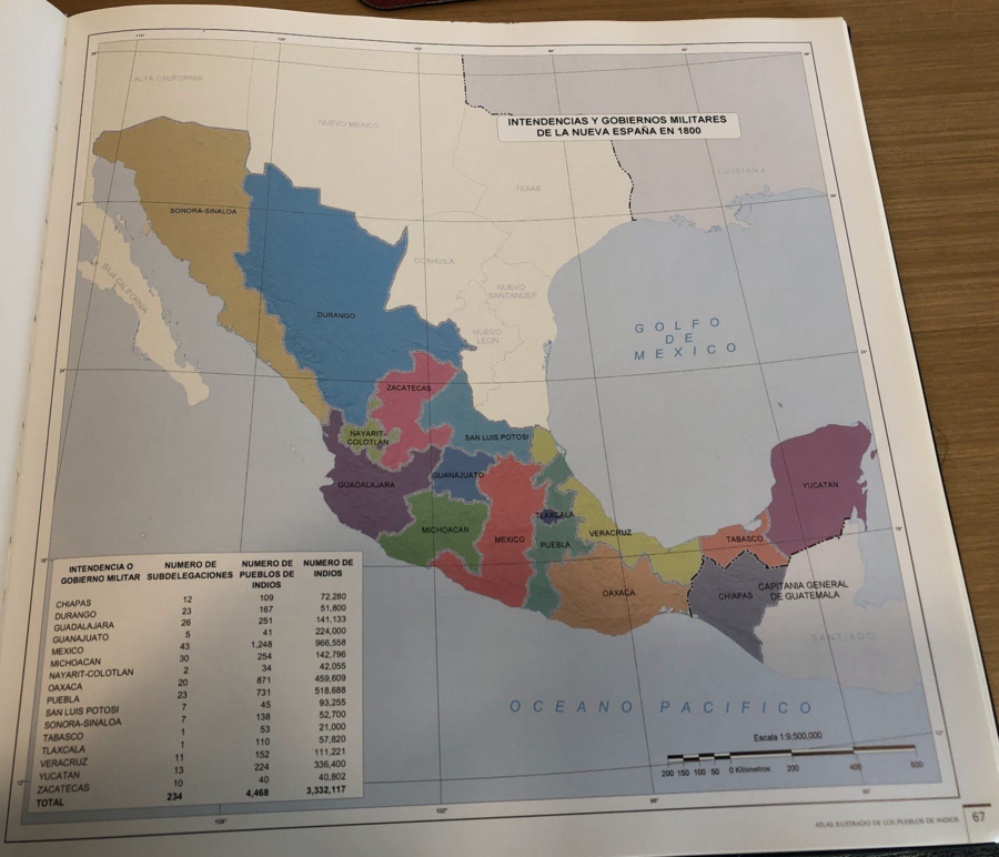
Tanck de Estrada, Dorothy. Atlas Ilustrado de los Pueblos de Indios: Nueva España, 1800. México: El Colegio de México, 2005.
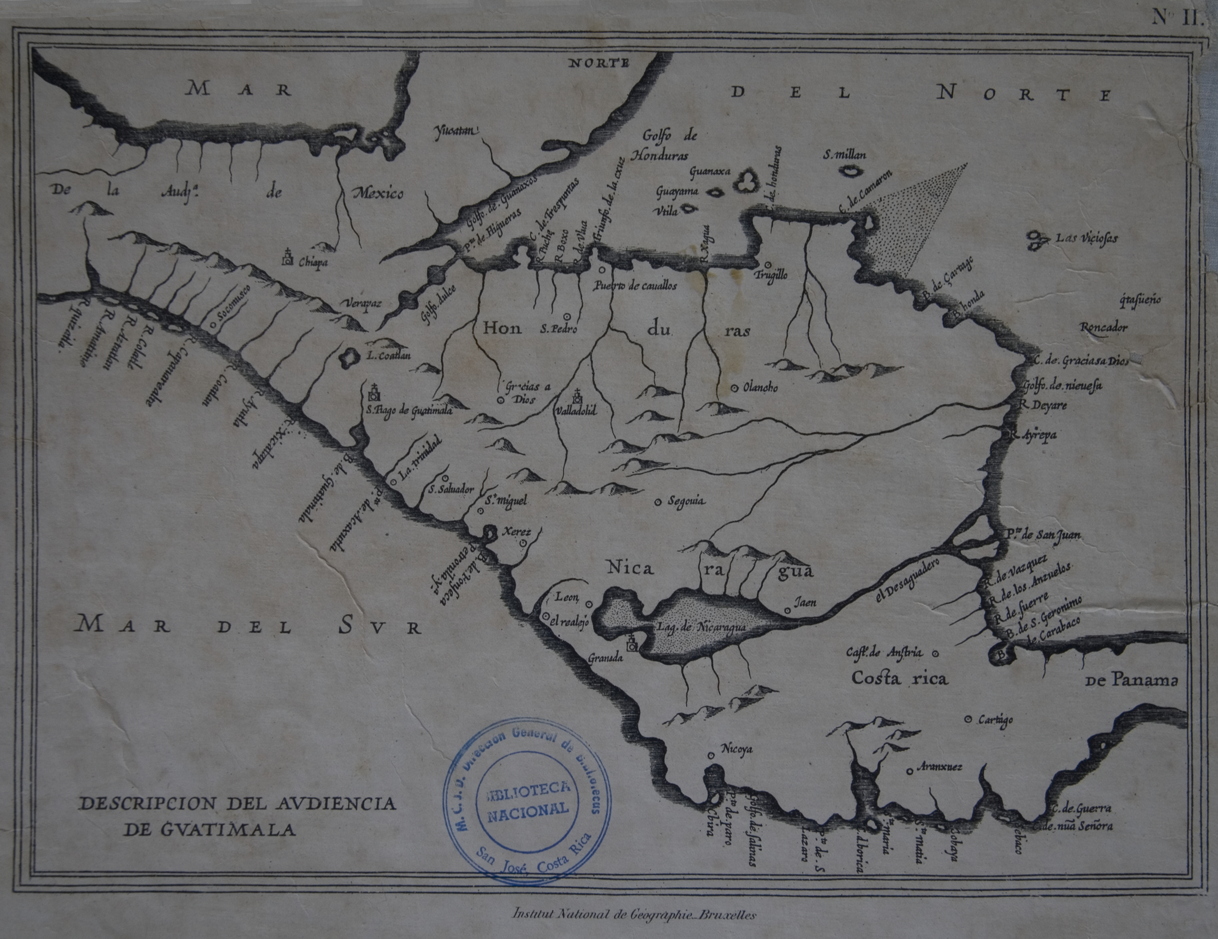
Descripción de las Indias Occidentales: Audiencia de Guatemala-Madrid
Map 1600 - 1699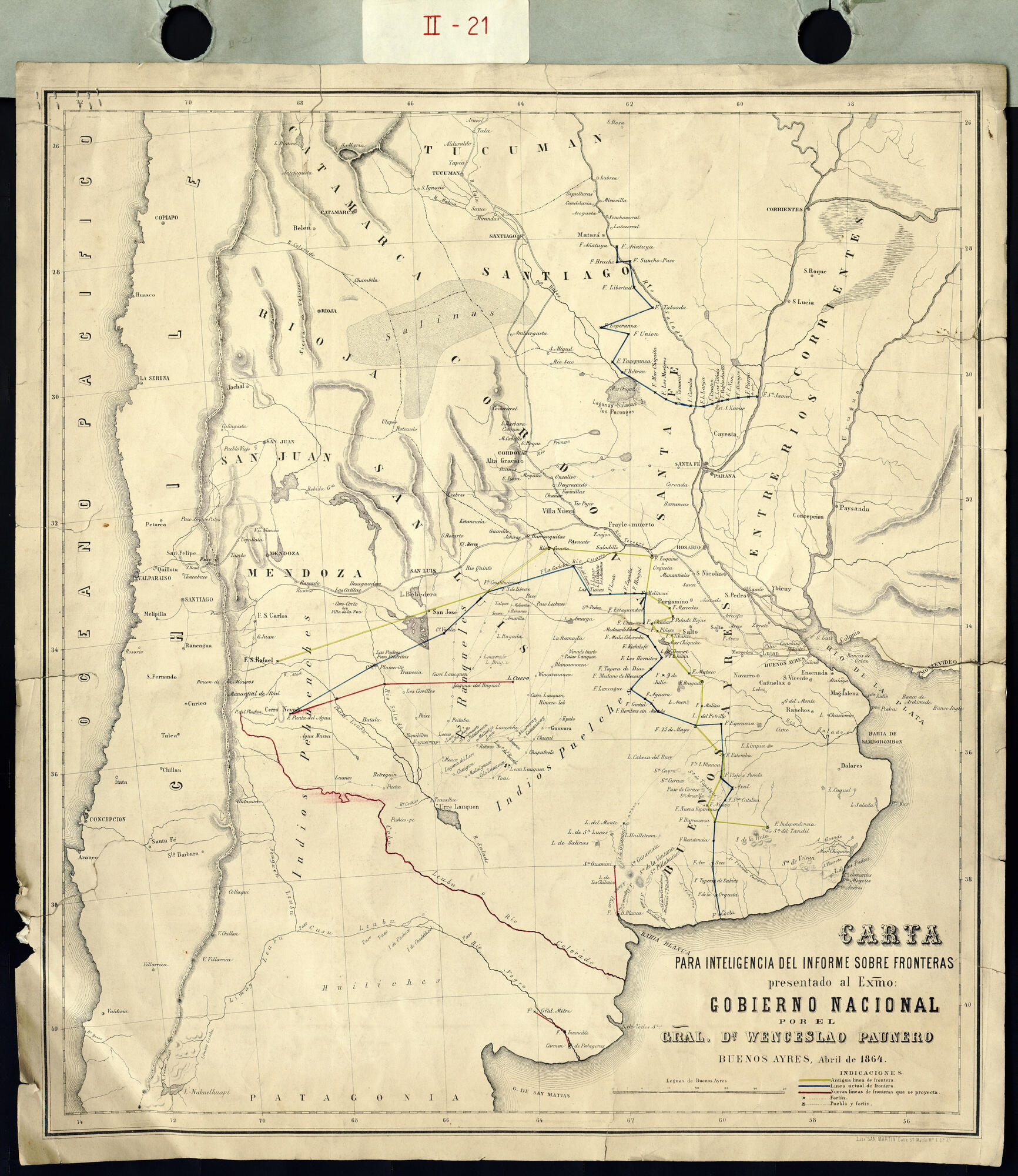
Carta para la inteligencia del informe sobre fronteras presentado al Excelentísimo Gobierno nacional por el General Don Wenceslao Paunero. Impreso
Map 1850 - 1880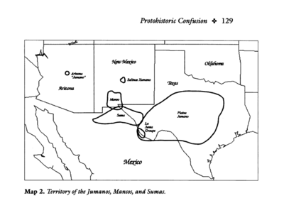
Territory of the Jumanos, Mansos, and Sumas
Map 1997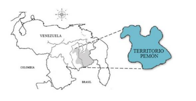
No Title
Map 2014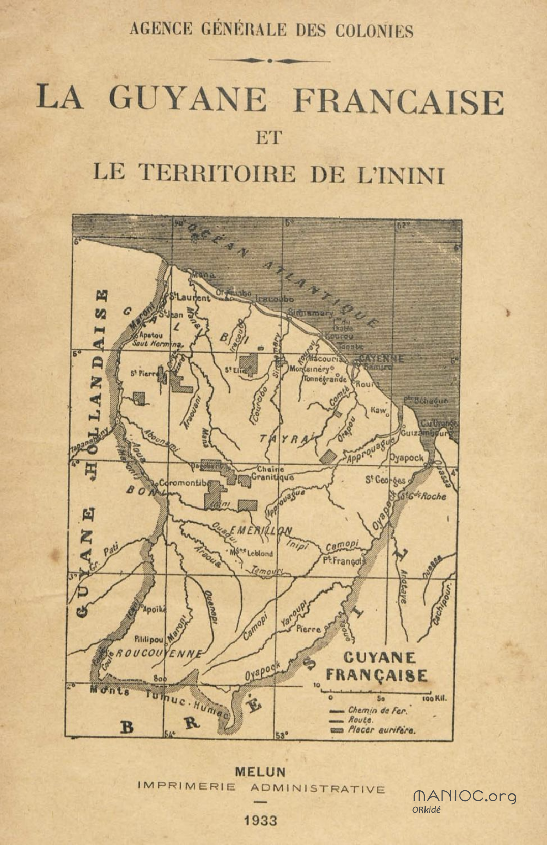
La Guyane française et le territoire de l'Inini.
Map 1933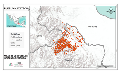
PUEBLO MAZATECO
Map 2020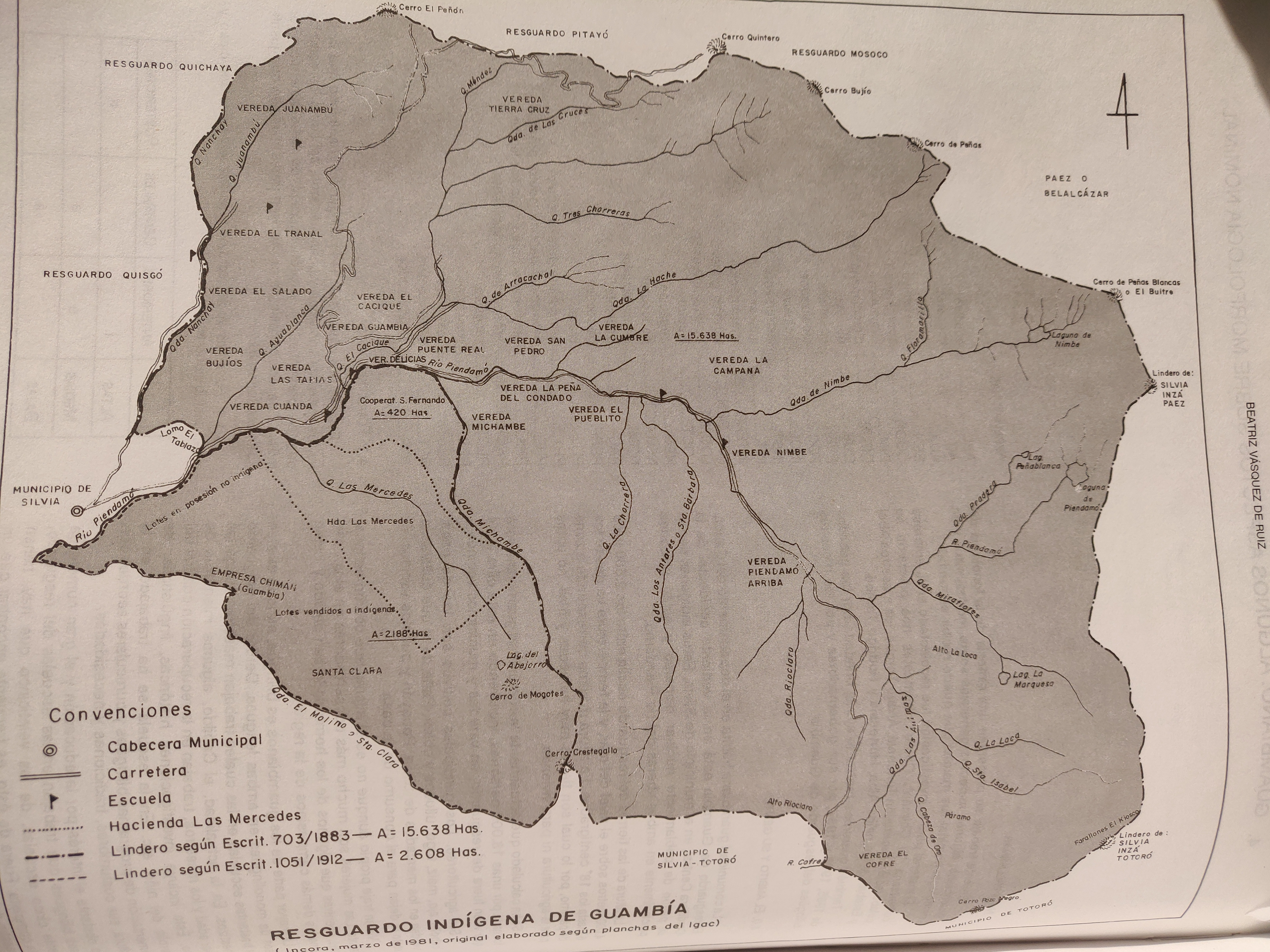
RESGUARDO INDÍGENA DE GUAMBÍA
Map 1981
Carte de la Guyane Française.
Map 1951