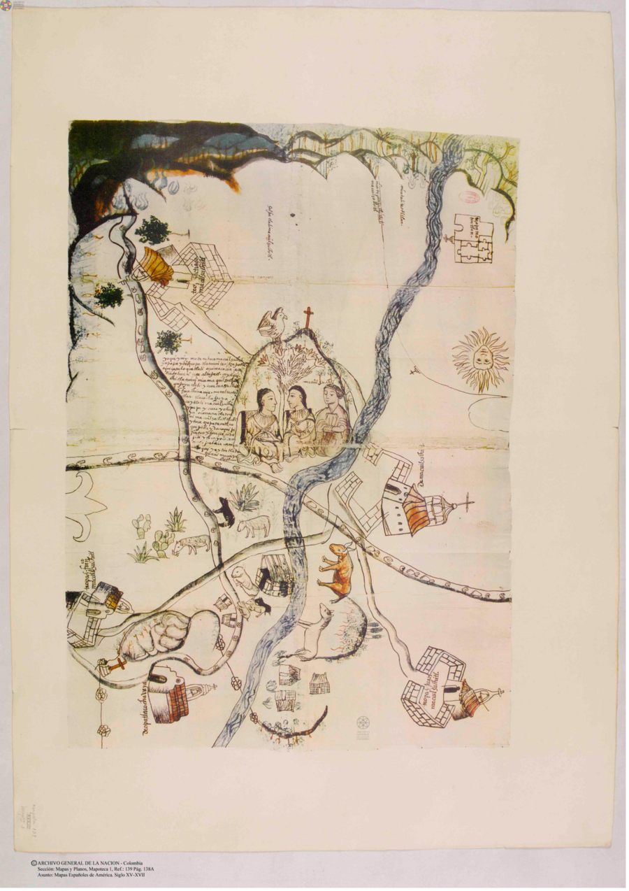
Citation
Mapas españoles de América, siglos XV-XVII. Madrid: Editorial Maestre, 1951. http://consulta.archivogeneral.gov.co/ConsultaWeb/imagenes.jsp?id=3251550&idNodoImagen=3251551&ini=1&total=410
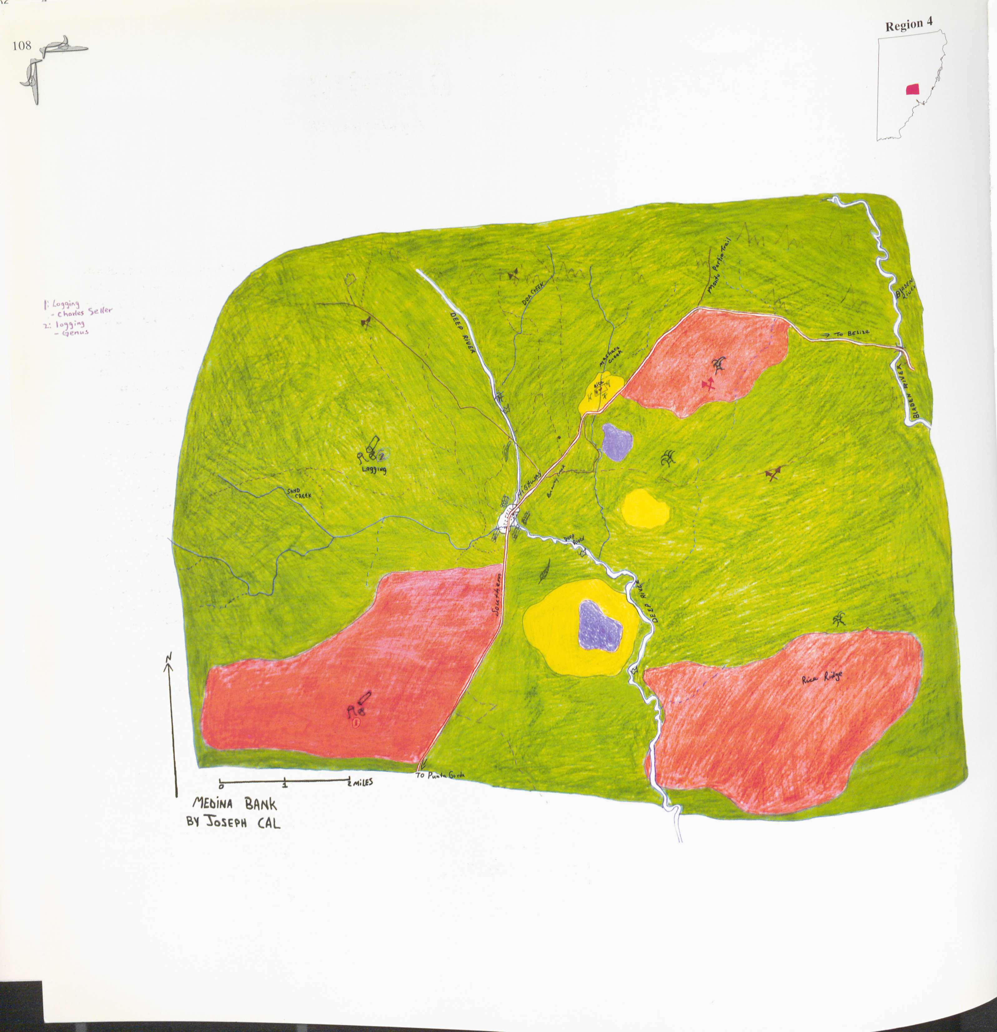
Medina Bank
Map 1997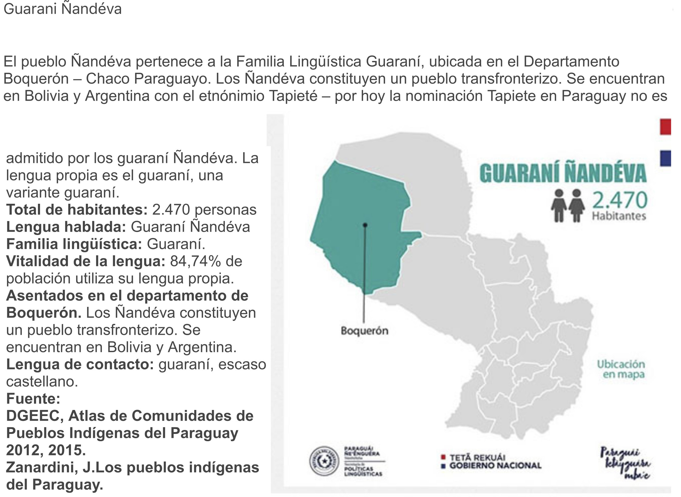
GUARANÍ ÑANDÉVA
Map 2015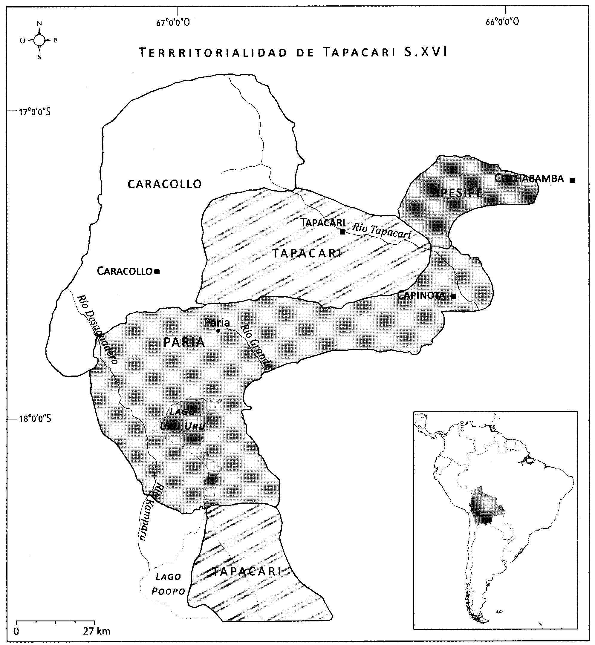
EL SEÑORÍO AYMARA DE LOS SURAS: COLONIAS DE SURA BAJO EL DOMINIO INCA EN EL SIGLO XVI
Map 1500 - 1599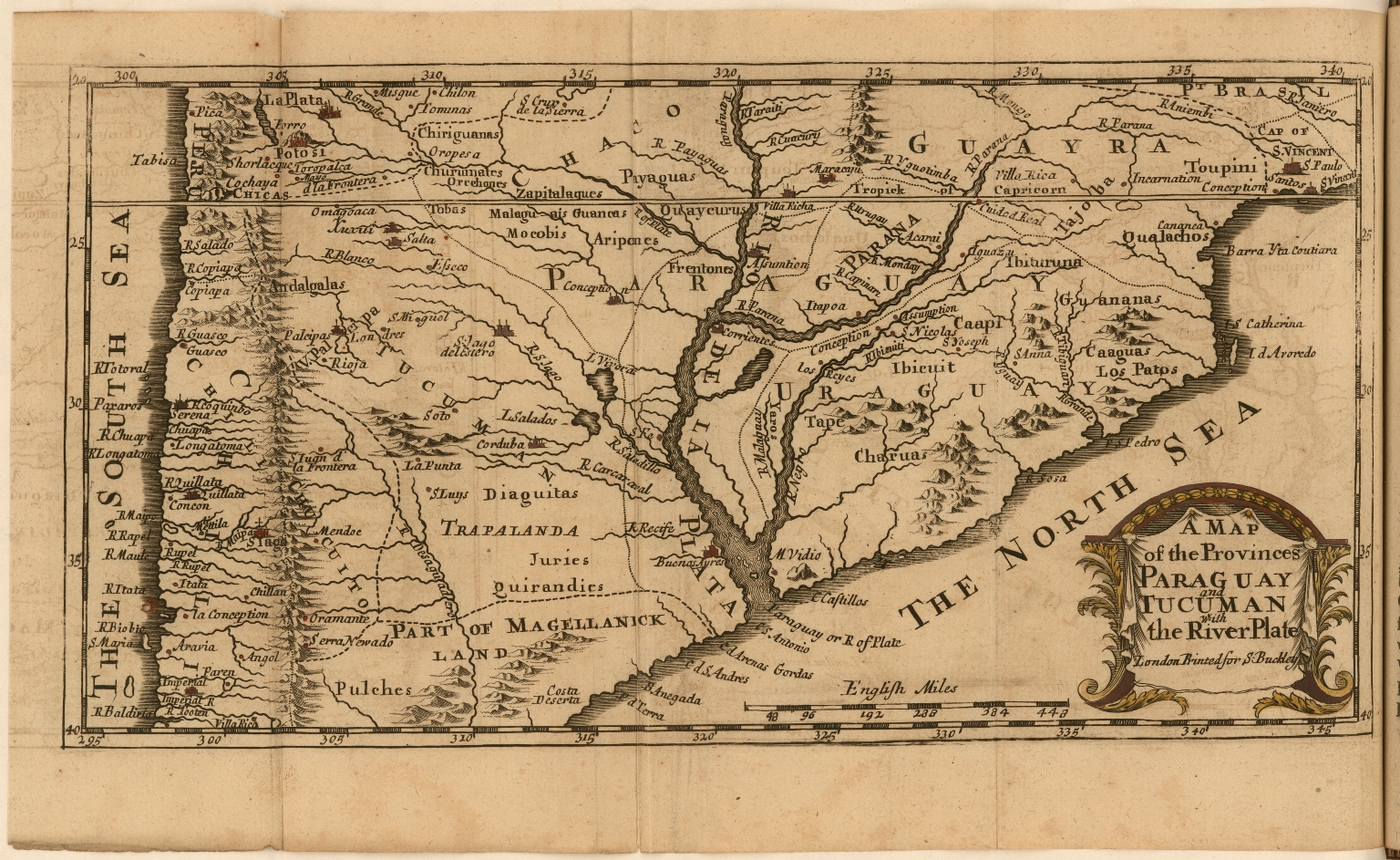
A Map of the Provinces Paraguay and Tucuman with the River Plate
Map 1698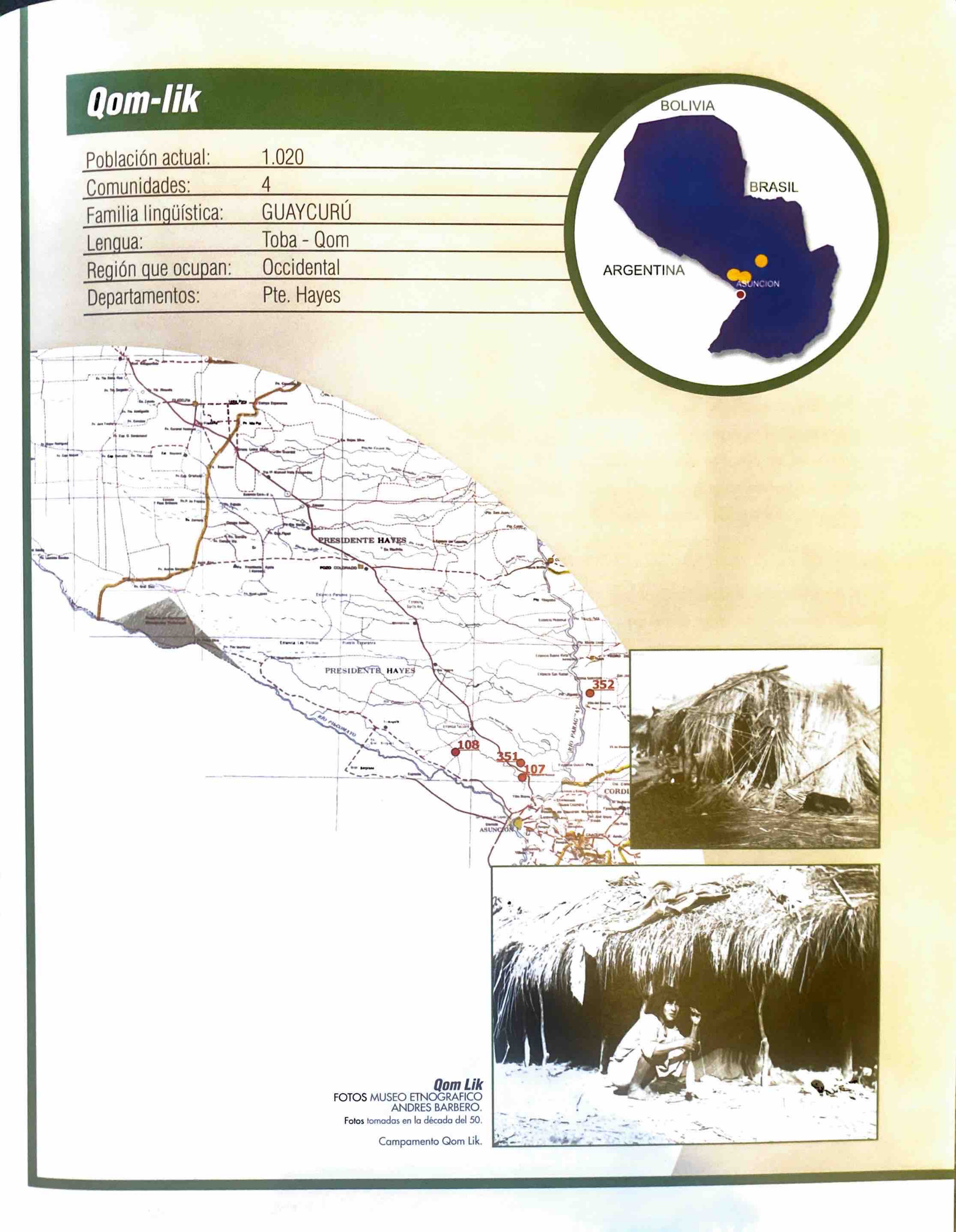
Qom-lik
Map 2001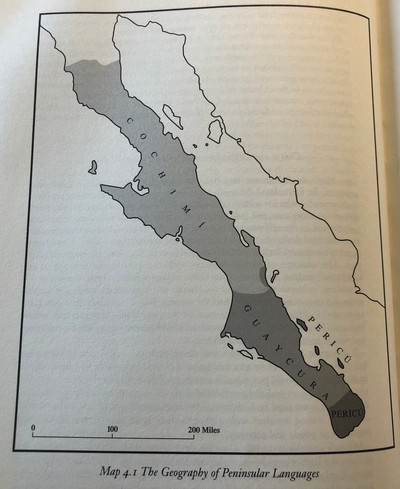
The Geography of Peninsular Languages
Map 1994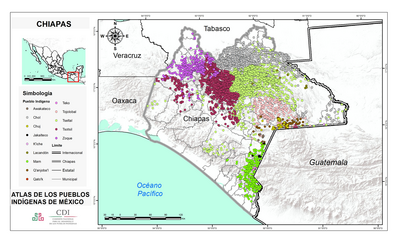
CHIAPAS
Map 2015
Carte du gouvernement de Cayenne dans l'Amerique méridionale.
Map 1696