
Citation
Gruzinski, Serge. Painting the Conquest: the Mexican Indians and the European Renaissance. Paris: Unesco-Flammarion, 1992. NO ONLINE ACCESS TO SOURCE
RESGUARDOS Y TERRITORIOS INDIGENAS EN COLOMBIA
Map 2015
CARTA DEL DEPARTAMENTO DEL ORINOCO O DE MATURIN
Map 1827
Map of the basin of La Plata : based upon the results of the expedition under the command of Thos. J. Page;U.S. Navy;in the years 1853;-'54;-'55;& 56 and of the adjacent countries
Map 1853 - 1856
ALDEIAS OMAGUAS/KAMBEBA
Map 2020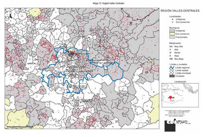
REGIÓN VALLES CENTRALES
Map 2000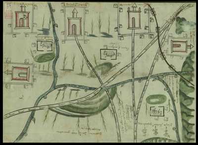
San Juan Baptista, San Luys Tezontla y Santa María Nochtongo. Oaxaca, 1579
Map 1579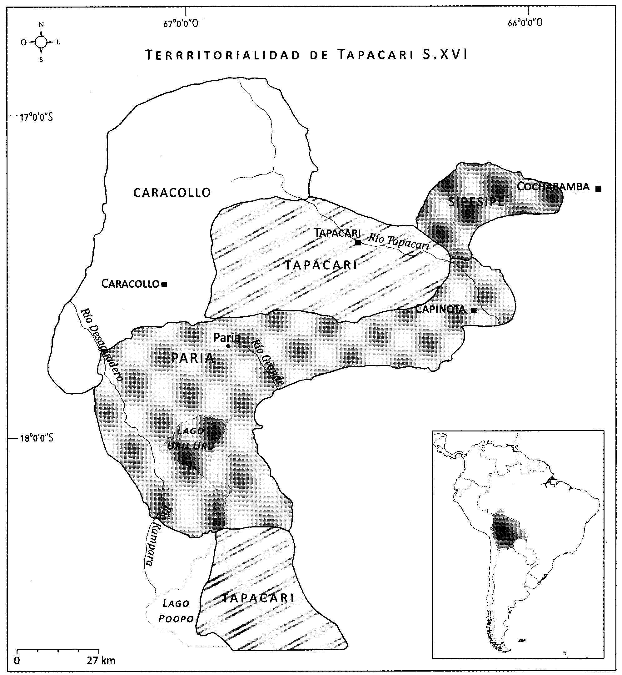
EL SEÑORÍO AYMARA DE LOS SURAS: COLONIAS DE SURA BAJO EL DOMINIO INCA EN EL SIGLO XVI
Map 1500 - 1599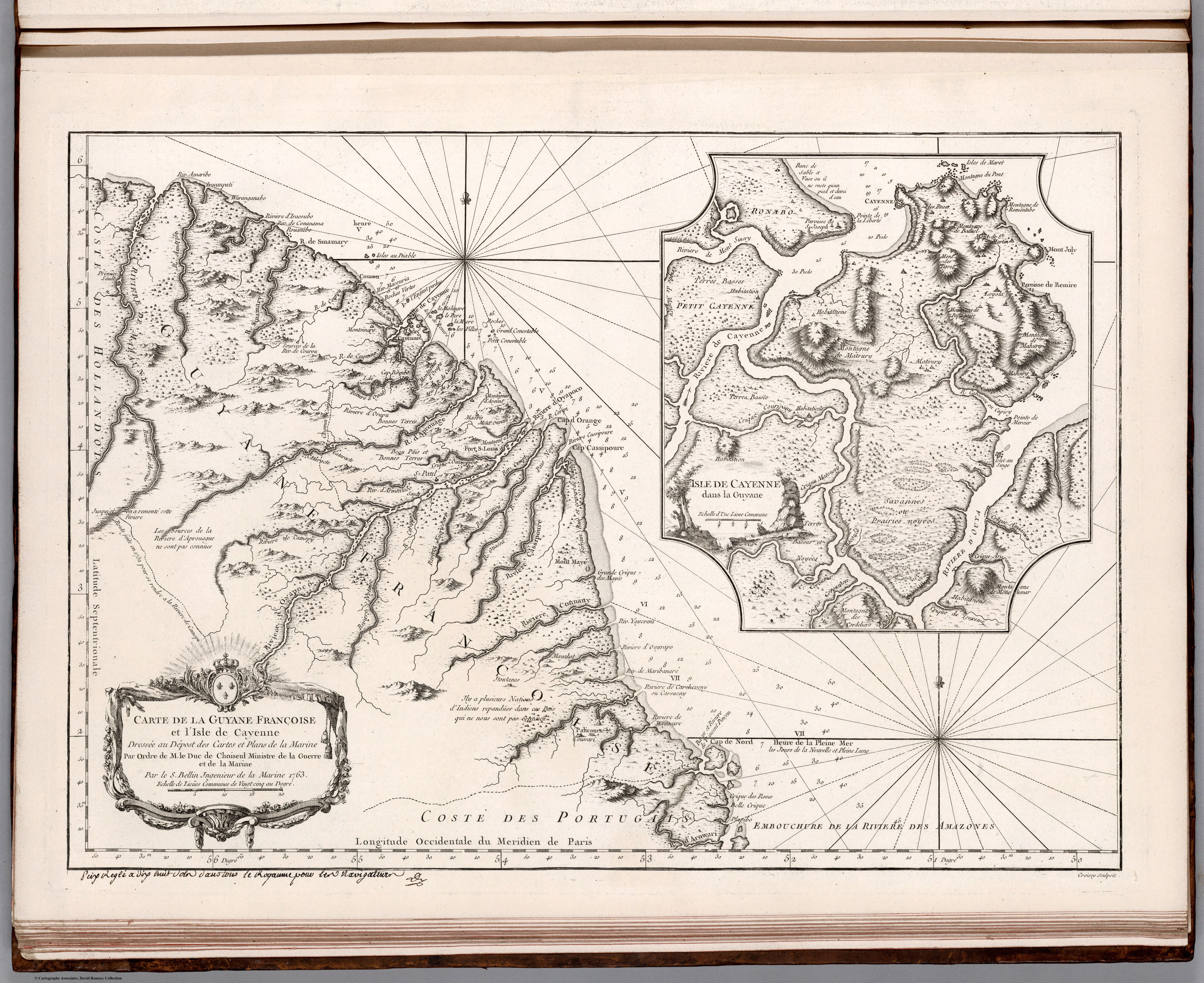
Carte de la Guyane Françoise et l'Isle de Cayenne. Dressée au Dépost des Cartes et Plans de la Marine Par Ordre de M. le Duc de Choiseul Ministre de la Guerre et de la Marine.
Map 1763