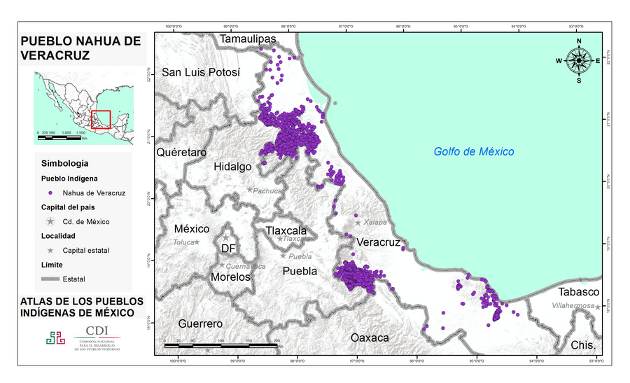
Peoples
- NAHUA DE VERACRUZ
Citation
Instituto Nacional de los Pueblos Indígenas. "Nahuas de Veracruz – Ubicación." Atlas de los Pueblos Indígenas de México. Accessed August 14, 2021. http://atlas.inpi.gob.mx/nahuas-de-veracruz-ubicacion/.
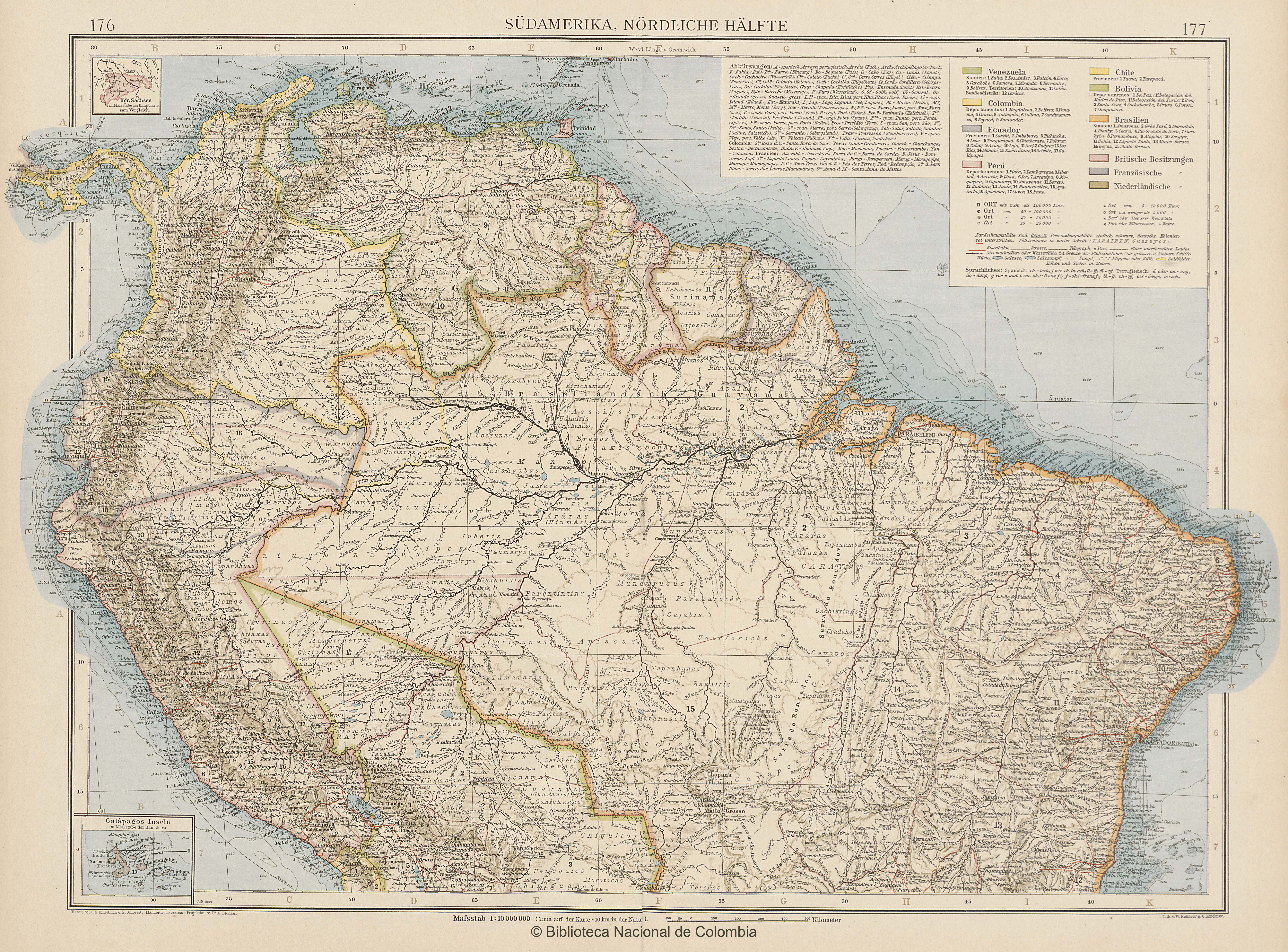
SÜDAMERIKA, NÖRDLICHE HÄLFTE
Map 1902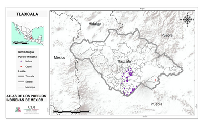
TLAXCALA
Map 2015![Victoria regia [Giant Water Lily]](https://dnet8ble6lm7w.cloudfront.net/art/APER015.jpg)
Victoria regia [Giant Water Lily]
Artwork
Government map of Nicaragua : from the latest surveys ordered by President Patricio Rivas and Genl. William Walker ;executed under the supervision of the Señor Fermín Ferrer;Governor of the Western Department;1856
Map 1800 - 1856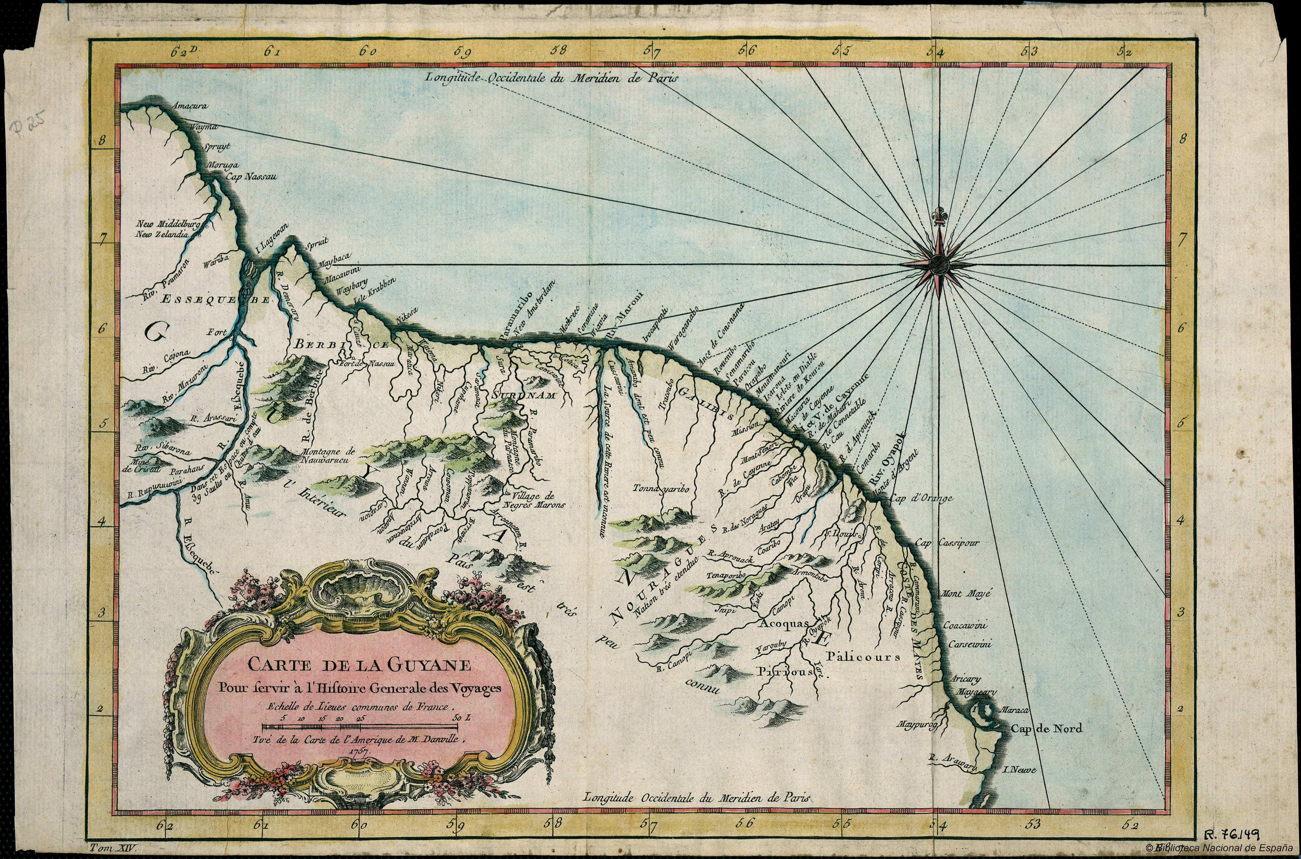
Carte de la Guyana pour servir à l'Histoire Generale des Voyages.
Map 1757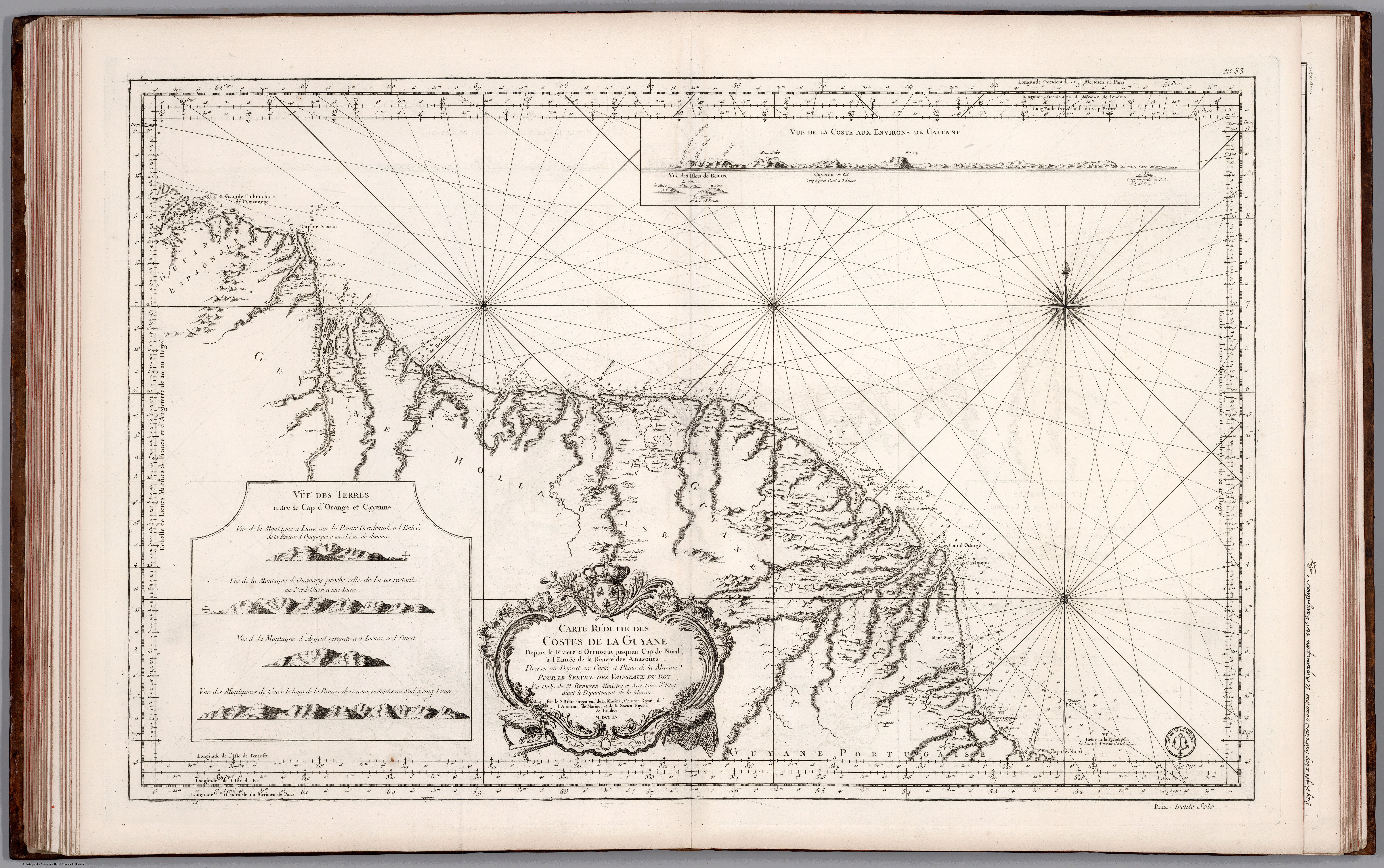
Carte Réduite des Costed de la Guyane Despuis la Riviere d'Orenoque jusqu'au Cap de Nord à l'Entrée de la Riviere des Amazones.
Map 1760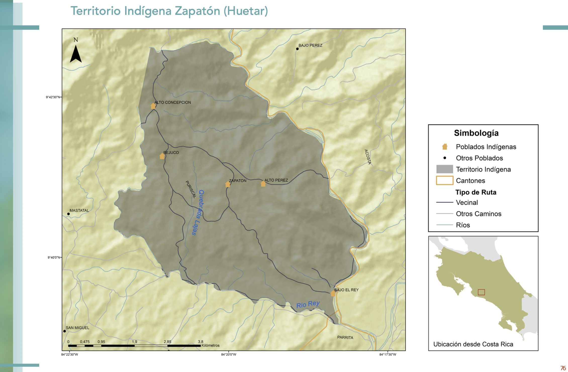
"Territorio Indígena Zapatón (Huetar)"
Map 2010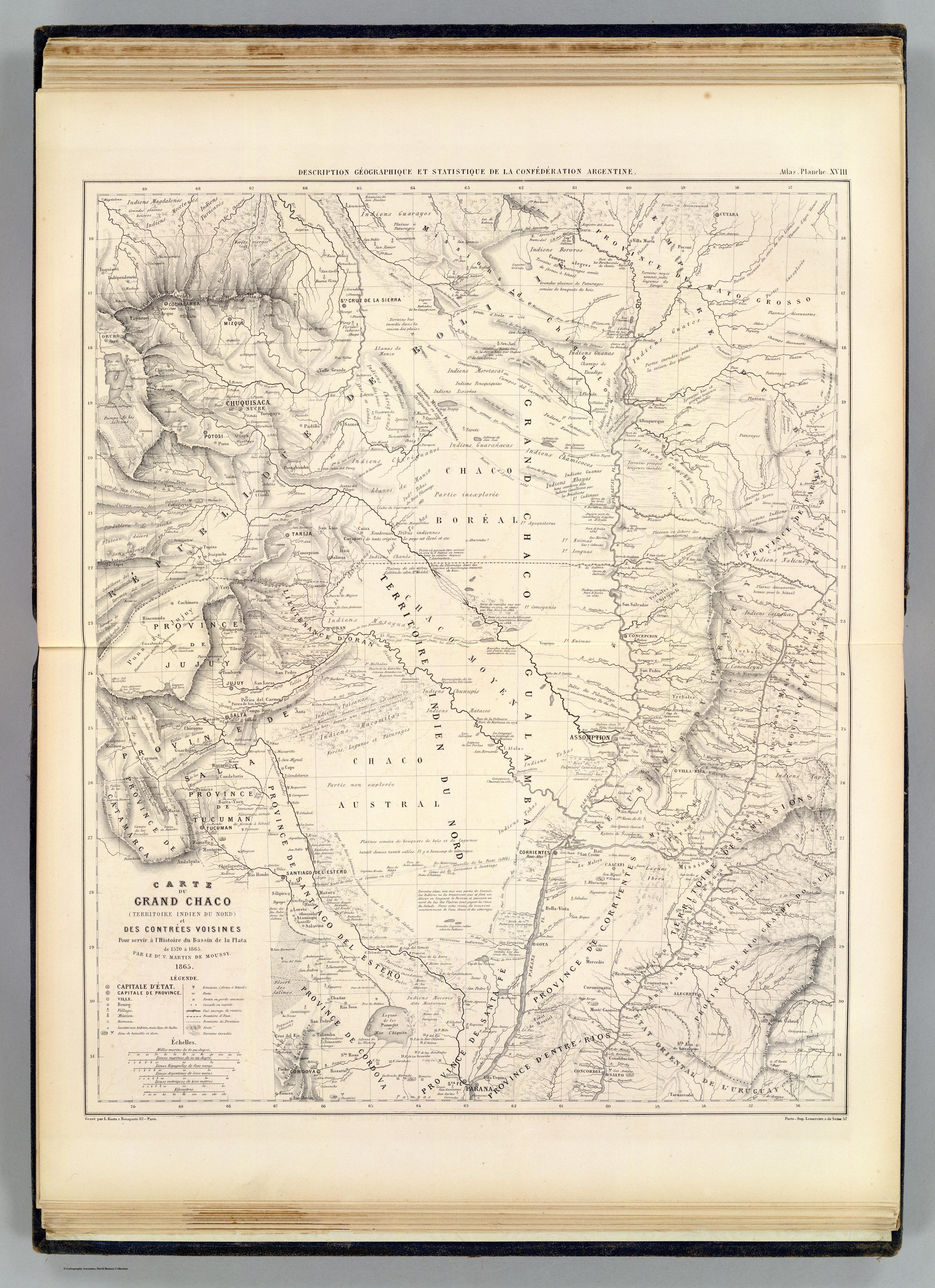
CARTE DU GRAND CHACO (TERRITOIRE INDIEN DU NORD) et DES CONTRÉES VOISINES
Map 1520