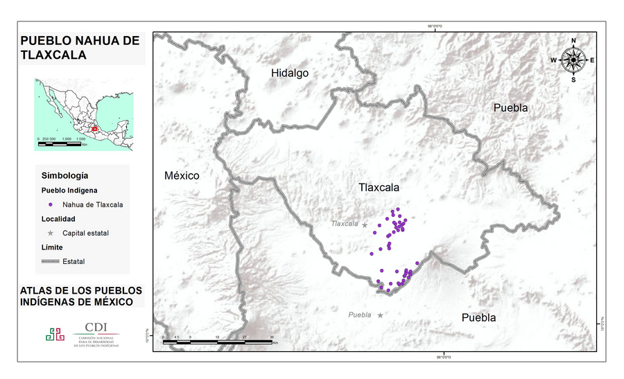
Peoples
- NAHUA DE TLAXCALA
Citation
Instituto Nacional de los Pueblos Indígenas. "Nahuas de Tlaxcala – Ubicación." Atlas de los Pueblos Indígenas de México. Accessed August 14, 2021. http://atlas.inpi.gob.mx/nahuas-de-tlaxcala-ubicacion/.
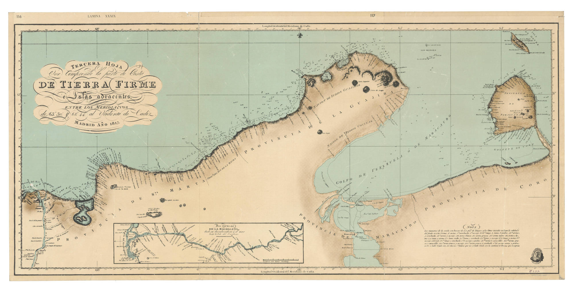
Tierra Firme e islas adyacentes
Map 1817
Rio De La Plata, Uruguay, Southern Brazil
Map 1720 - 1760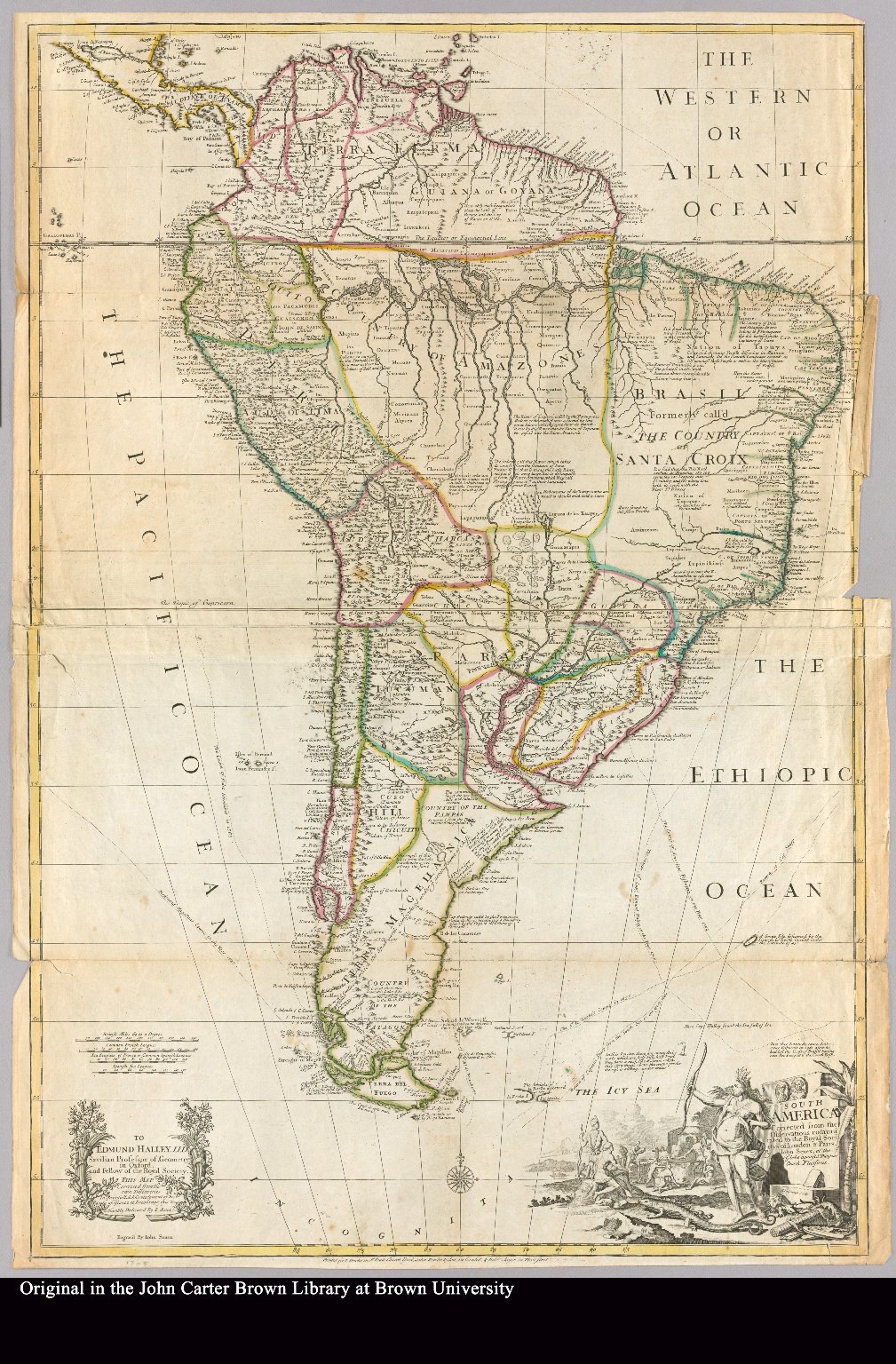
South America corrected from the observation communicated to the Royal Society"s of London & Paris by John Senex, at the Globe against St. Dunstans Church Fleetstreet.
Map 1755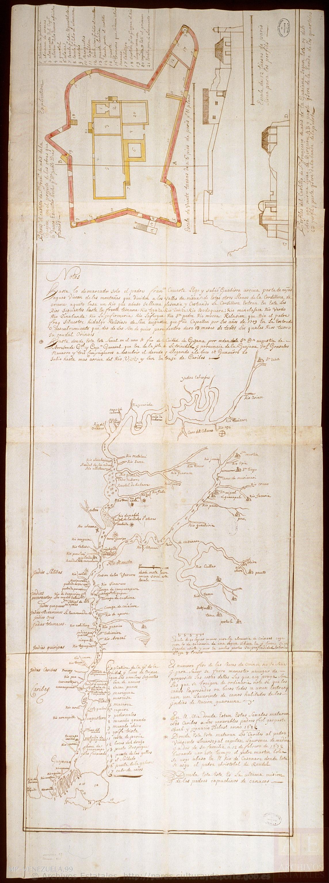
Mapa del Orinoco con planta y dos perfiles del castillo de San Francisco de Asís, en la Guayana.
Map 1736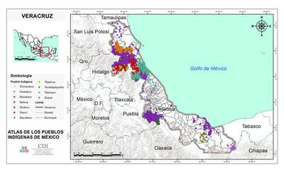
VERACRUZ
Map 2015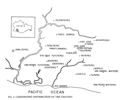
Geographic Distribution of the Chatino
Map 1969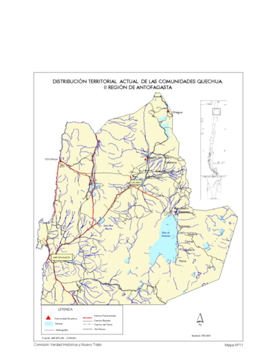
Distribucion Territorial Actual de las Comunidades Quechua
Map 1993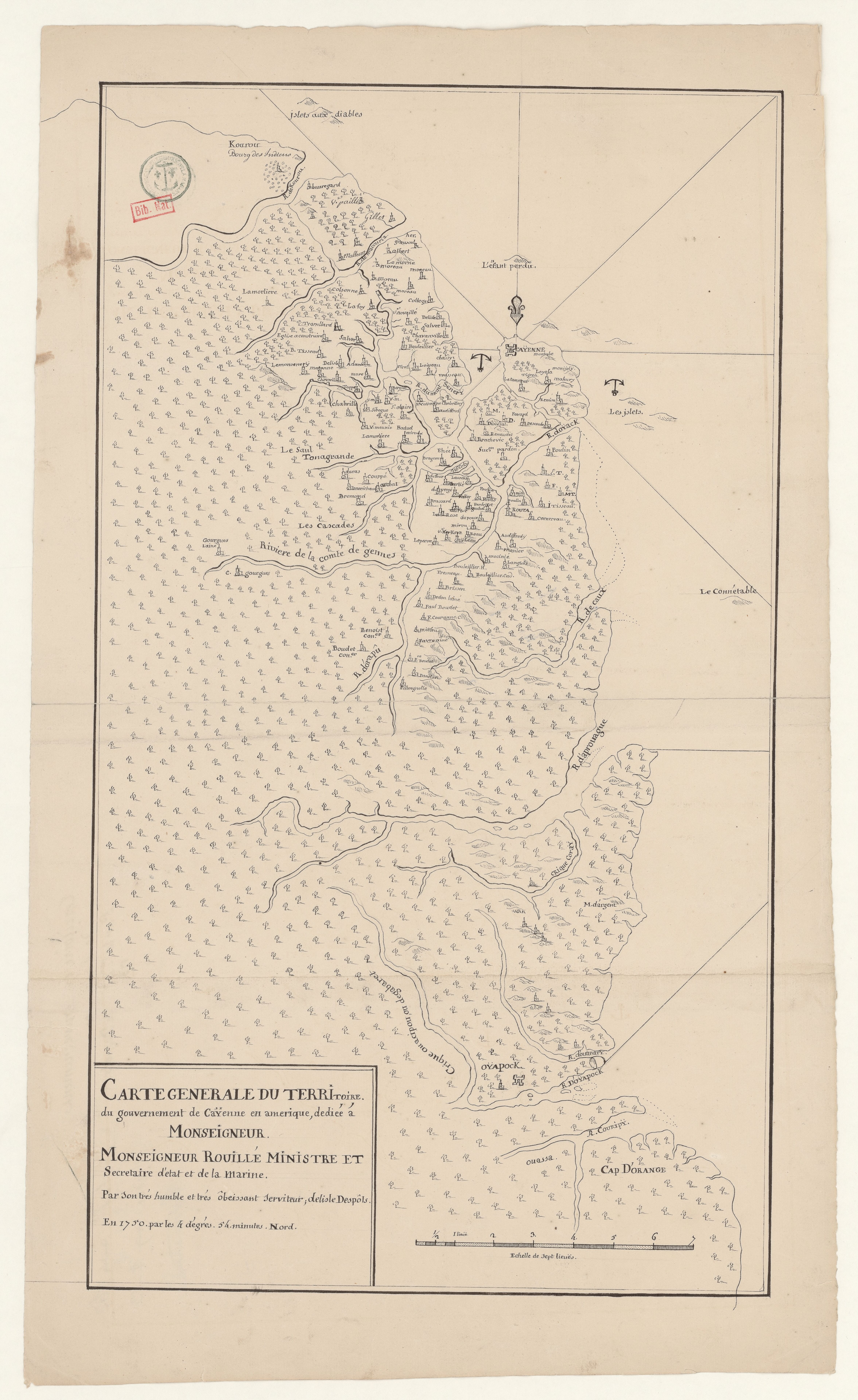
Carte générale du territoire du gouvernement de Caÿenne en amerique
Map 1750