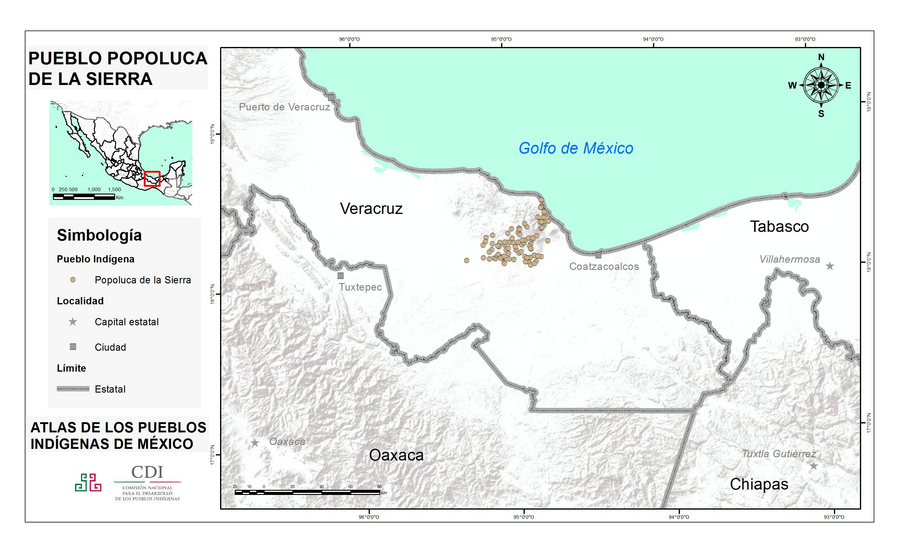
Peoples
- POPOLUCA
Citation
Instituto Nacional de los Pueblos Indígenas. "Popolucas de la Sierra – Ubicación." Atlas de los Pueblos Indígenas de México. Accessed July 7, 2021. http://atlas.inpi.gob.mx/popolucas-de-la-sierra-ubicacion/.
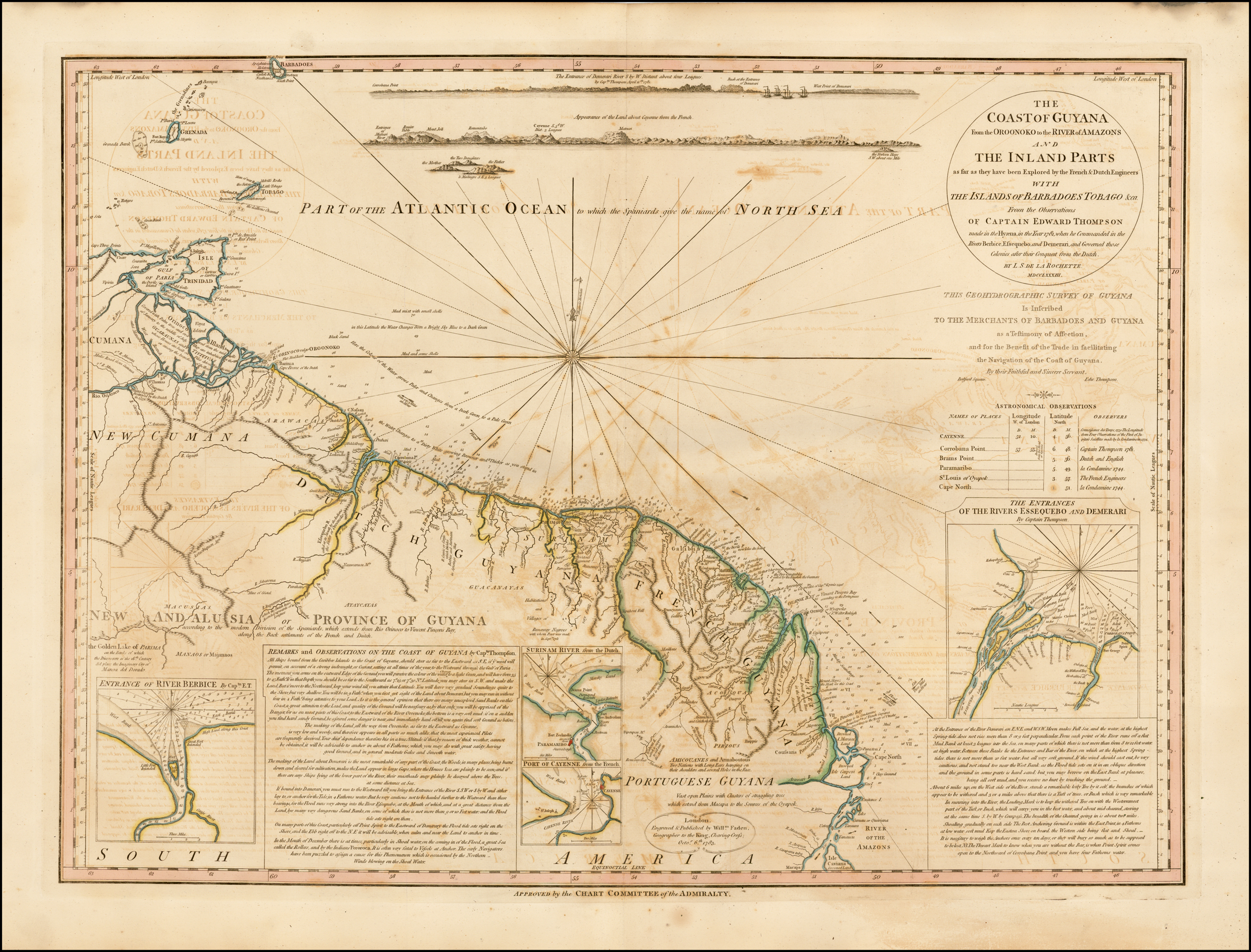
COAST OF GUYANA FROM THE OROONOKO TO THE RIVER OF AMAZONS AND THE INLAND PARTS AS FAR AS THEY HAVE BEEN EXPLORED BY THE FRENCH & DUTCH ENGINEERS WITH THE ISLANDS OF BARBADOS TOBAGO & CA.
Map 1781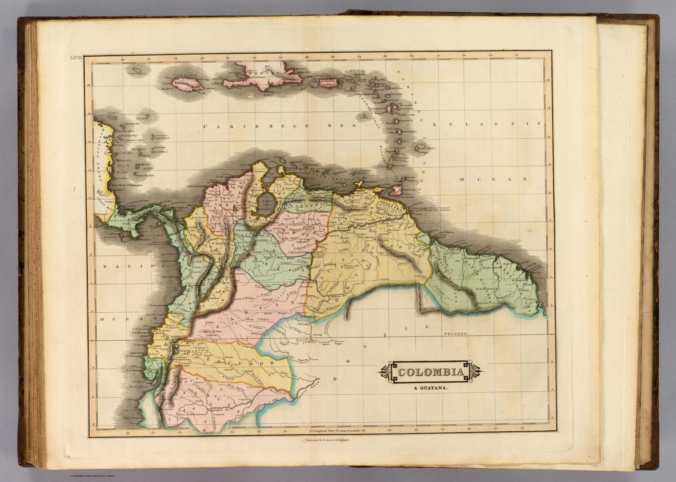
COLOMBIA & GUAYANA
Map 1800 - 1899![Nos roban las palabras o A Calzón quitado, o Insurrecciones que son heréticas resurrecciones [They steal our words or Barefaced, or Insurrections that are Heretical Resurrections]](https://dnet8ble6lm7w.cloudfront.net/art_sm/AMEX006.png)
Nos roban las palabras o A Calzón quitado, o Insurrecciones que son heréticas resurrecciones [They steal our words or Barefaced, or Insurrections that are Heretical Resurrections]
Artwork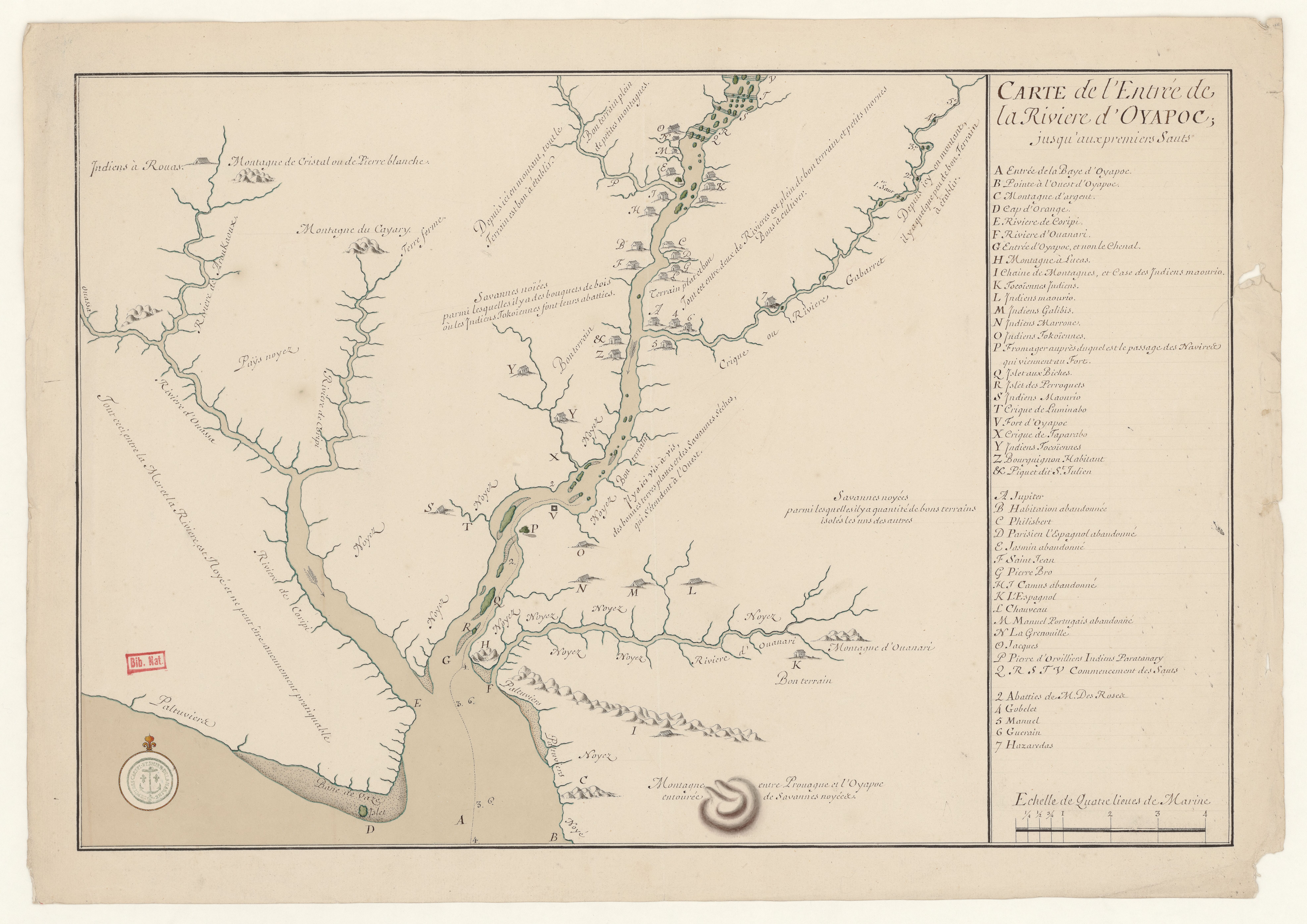
Carte de l'entrée de la Rivière d'Oyapoc jusqu'aux premiers sauts.
Map 1700 - 1799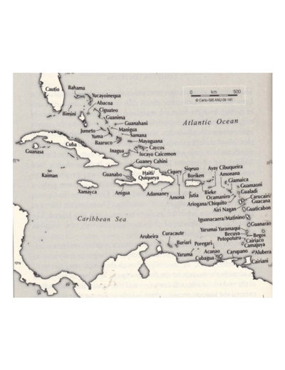
The Taino names of the Caribbean islands based on Jalil Sued-Badillo
Map 2003![El mundo entero está mirando: Todas las mujeres son bienvenidas [The Entire World Is Watching: All Women Are Welcome]](https://dnet8ble6lm7w.cloudfront.net/art_sm/ACOL032.png)
El mundo entero está mirando: Todas las mujeres son bienvenidas [The Entire World Is Watching: All Women Are Welcome]
Artwork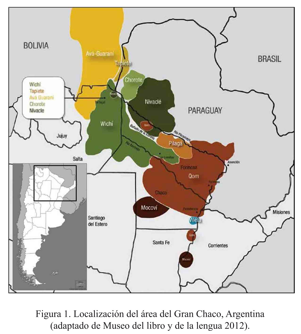
Localización del área del Gran Chaco, Argentina
Map 2016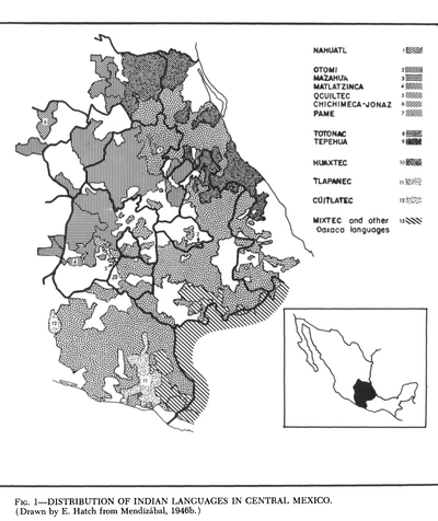
Distribution of Indian Languages in Central Mexico
Map 1969