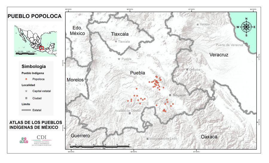
Peoples
- POPOLOCA
Citation
Instituto Nacional de los Pueblos Indígenas. "Popolocas – Ubicación." Atlas de los Pueblos Indígenas de México. Accessed August 12, 2021. http://atlas.inpi.gob.mx/popolocas-ubicacion/.
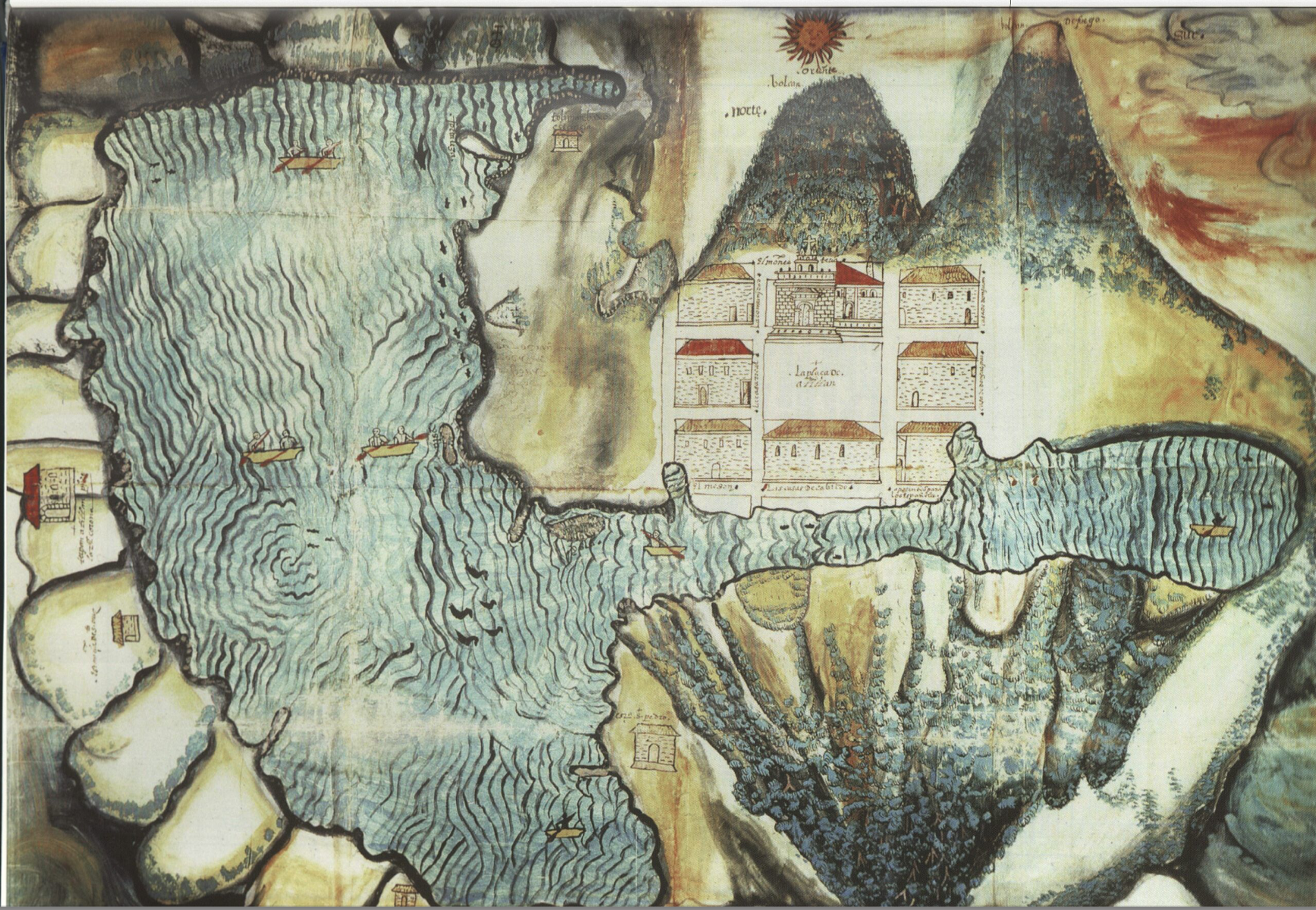
Asiento del pueblo de Santiago Atitlán c 1585.
Map 1585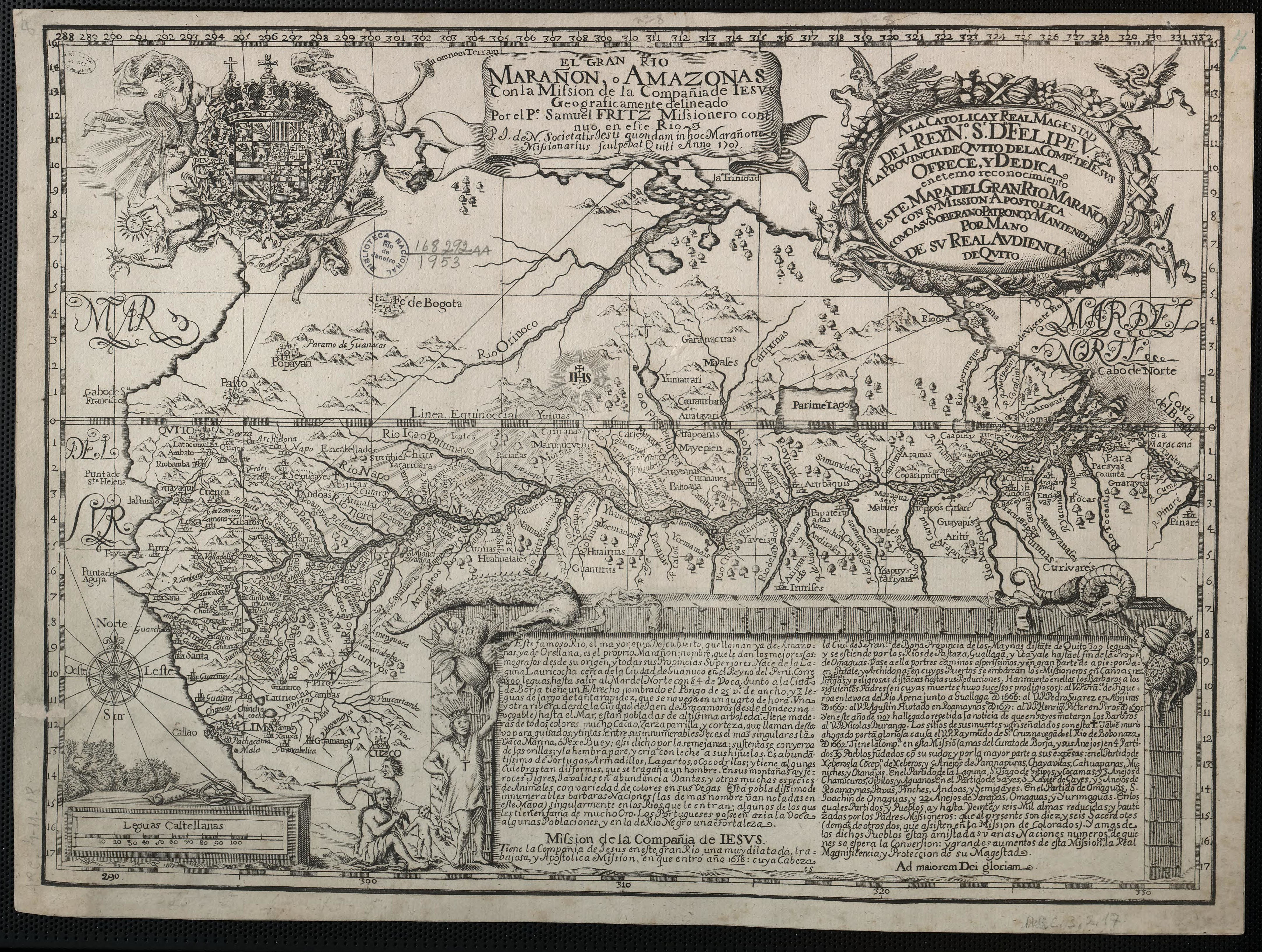
The Marañon or Amazon River with the Mission of the Society of Jesus
Map 1686 - 1707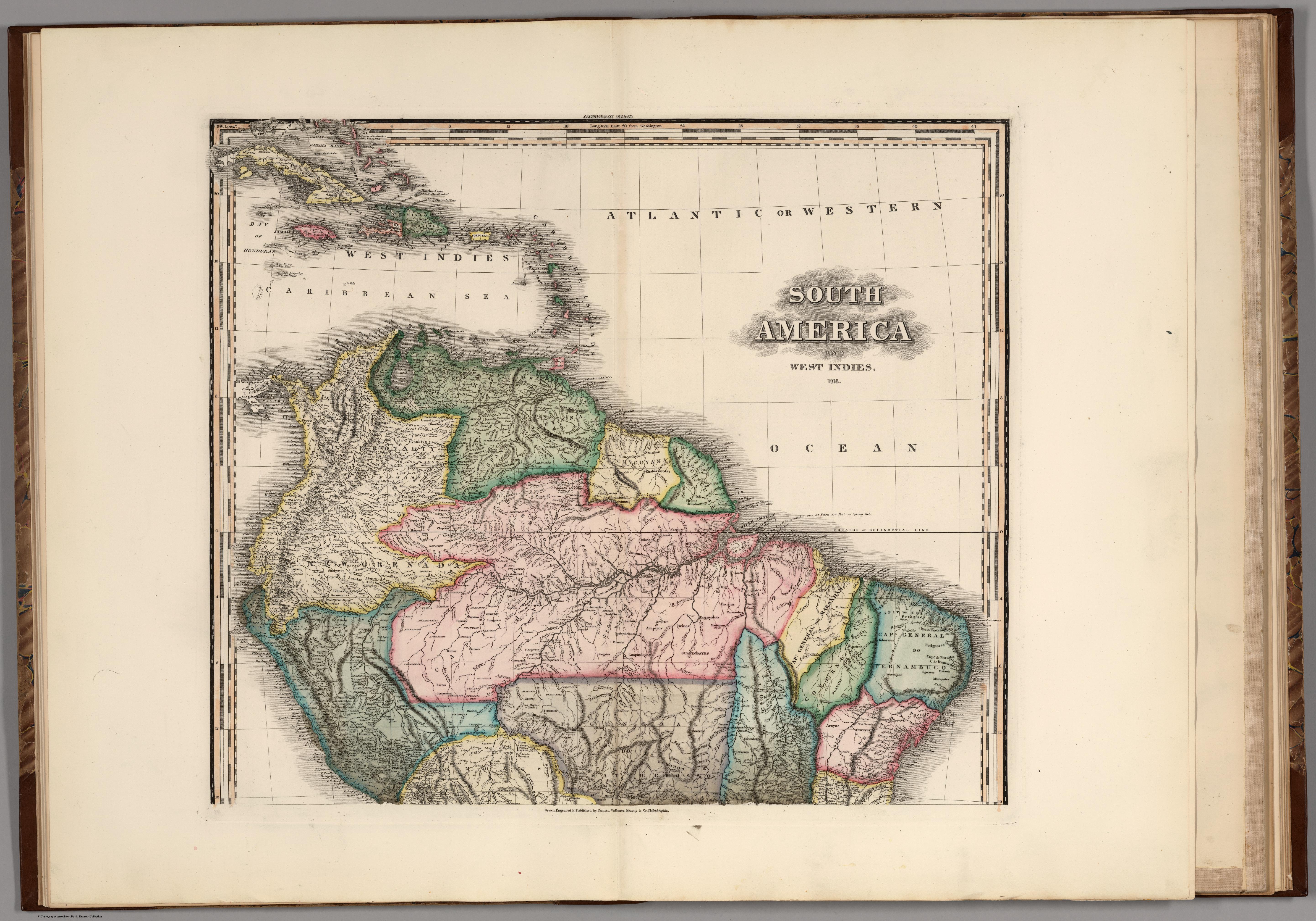
South America and West Indies. 1818
Map 1818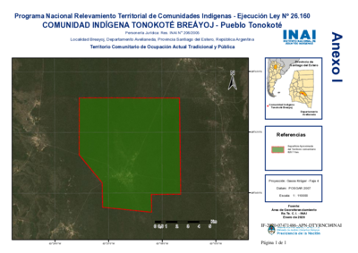
Comunidad Indígena Tonokoté Breáyoj - Pueblo Tonokoté
Map 2020![Rainha do Rio Niger [Queen of the Niger River]](https://dnet8ble6lm7w.cloudfront.net/art_sm/ABRA025.png)
Rainha do Rio Niger [Queen of the Niger River]
Artwork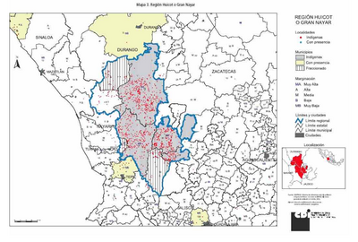
REGIÓN HUICOT O GRAN NAYAR
Map 2000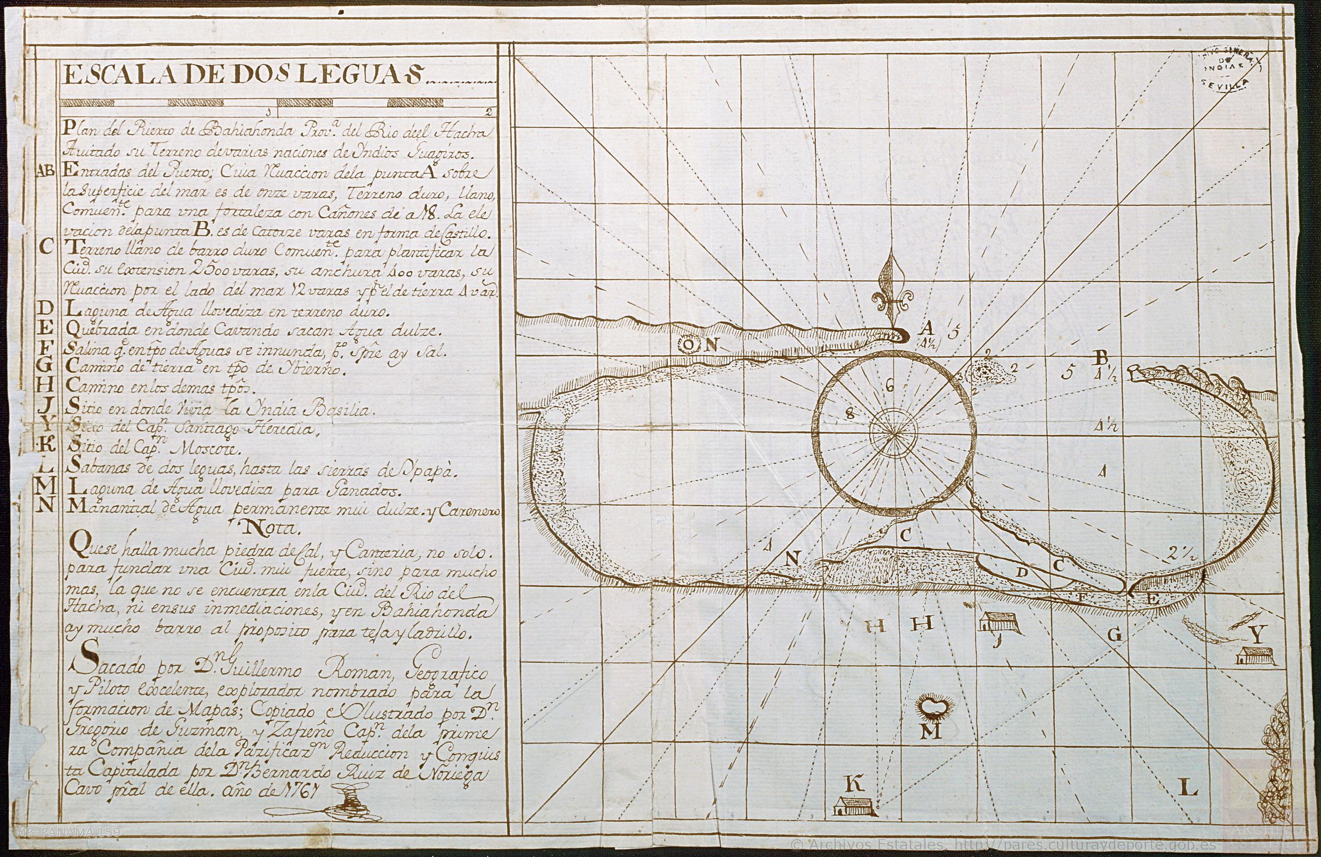
Plan del Puerto de Bahiahonda, Provincia del Rio del Hacha, Auitado su terreno de varias naciones de Yndios Guagiros
Map 1761![El descubrimiento del Amazonas [The Discovery of the Amazon]](https://dnet8ble6lm7w.cloudfront.net/art_sm/APER060.png)
El descubrimiento del Amazonas [The Discovery of the Amazon]
Artwork