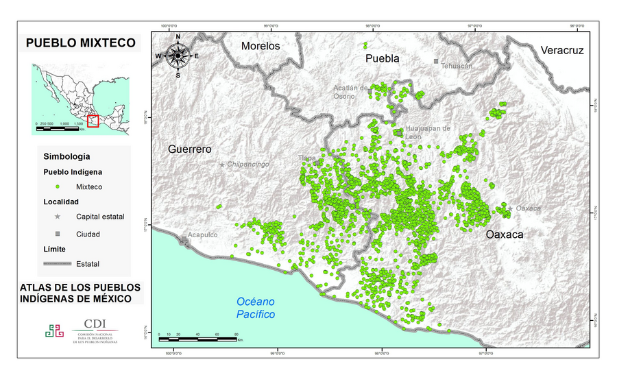
Peoples
- MIXTECO
Citation
Instituto Nacional de los Pueblos Indígenas. "Mixtecos – Ubicación." Atlas de los Pueblos Indígenas de México. Accessed July 7, 2021. http://atlas.inpi.gob.mx/mixtecos-ubicacion/.
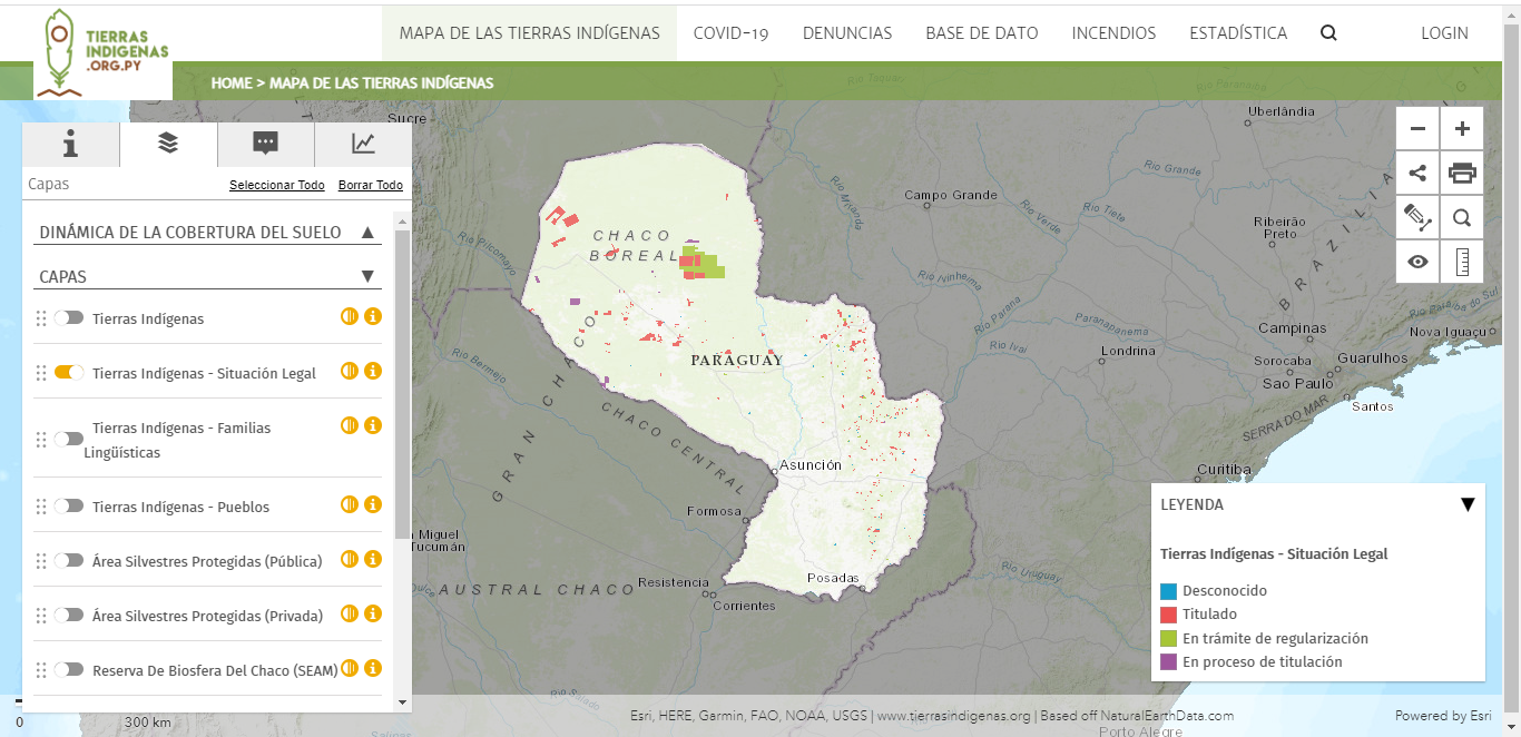
Mapa de las tierras indígenas - Situación legal
Map 2017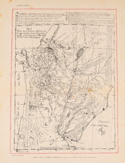
Parte de la América Meridional
Map 1764 - 1767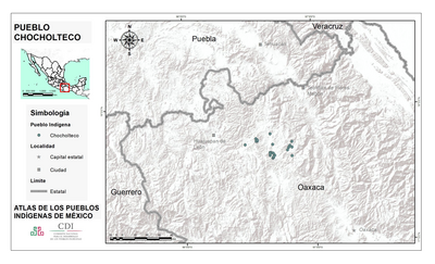
PUEBLO CHOCHOLTECO
Map 2020
CARTA GEOGRÁFICA DEL ECUADOR POR DR. TEODORO WOLF;PUBLICADA POR ORDEN DEL SUPREMO GOBIERNO DE LA REPÚBLICA Y TRABAJADA BAJO LAS PRESIDENCIAS DE LOS EE. SEÑORES DR. D.J.M. PLÁCIDO CAAMAÑO Y DR. D. ANTONIO FLORES. 1892 ... INSTITUTO GEOGRAFICO DE H. WAGNER & E. DEBES EN LEIPZIG. (WITH) LA REGION ORIENTAL DEL ECUADOR. (WITH) ARCHIPIÉLAGO DE GALÁPAGOS.
Map 1892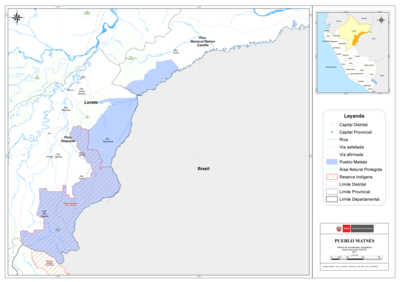
PUEBLO MATSÉS
Map 2021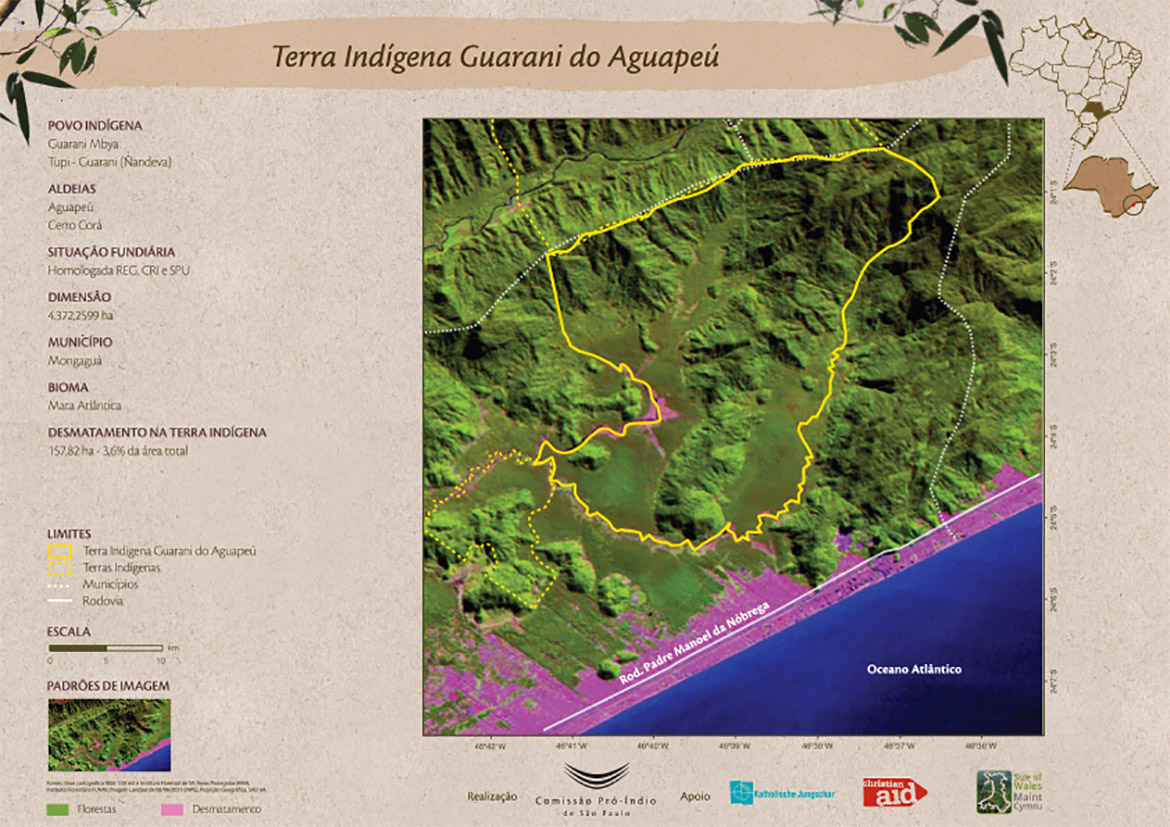
Terra Indígena Guarani do Aguapeú
Map 2011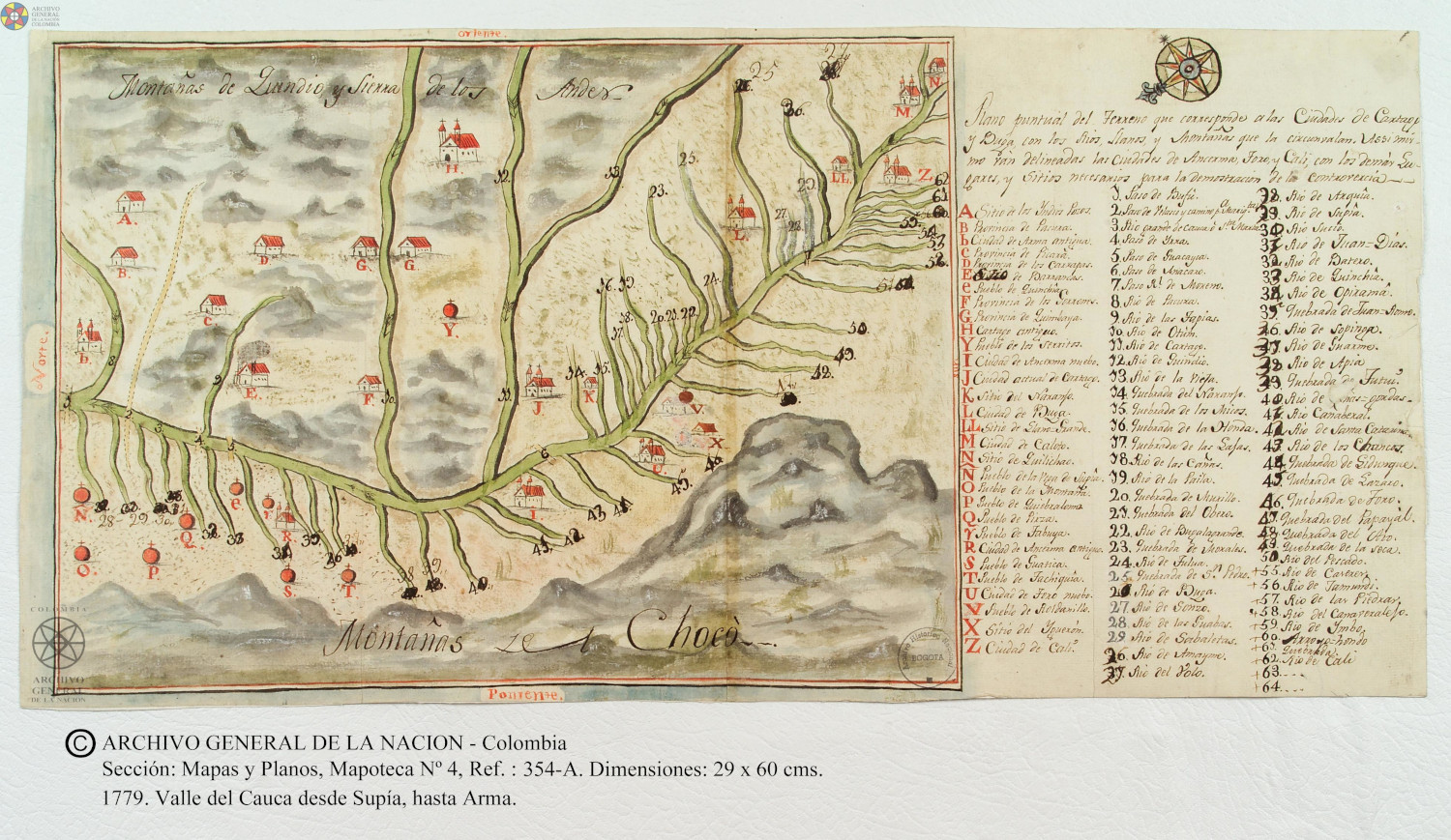
Plano puntual del terreno que corresponde a las ciudades de Cartago y Buga con los rios, llanos, y montañas que las circunvalan.
Map 1779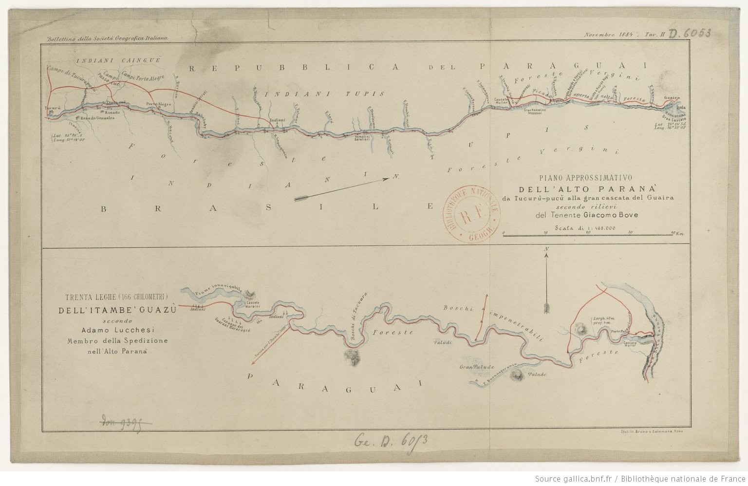
PIANO APPROSSIMATIVO DELL’ ALTO PARANA` da Tucurù-pucù alla gran cascata del Guaira
Map 1884