
Peoples
- MAM
Citation
Instituto Nacional de los Pueblos Indígenas. "Mames – Ubicación." Atlas de los Pueblos Indígenas de México. Accessed April 29, 2021. http://atlas.inpi.gob.mx/mames-ubicacion/.
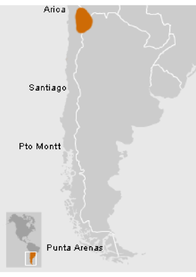
Atacameños - Location
Map 2012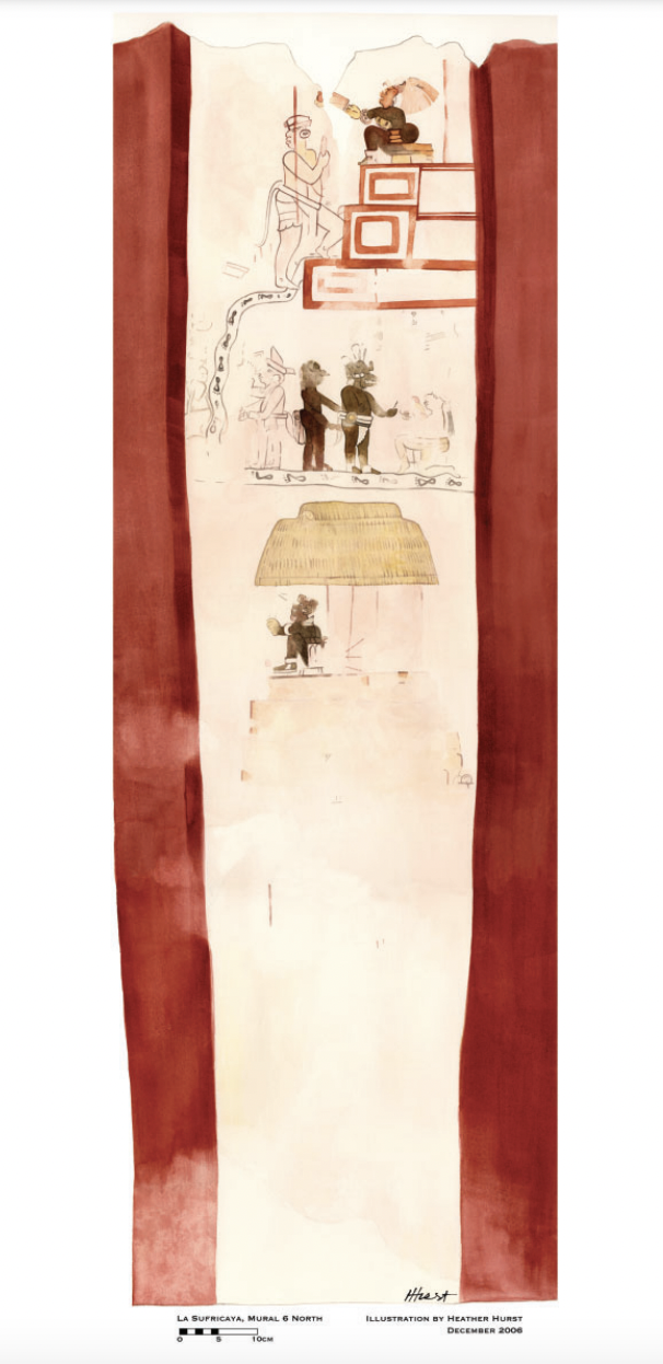
Reproduction of a 4th century mural painted on the wall of a royal residence at La Sufricaya in the Peten region of Guatemala. Mural 6 North.
Map 300 - 400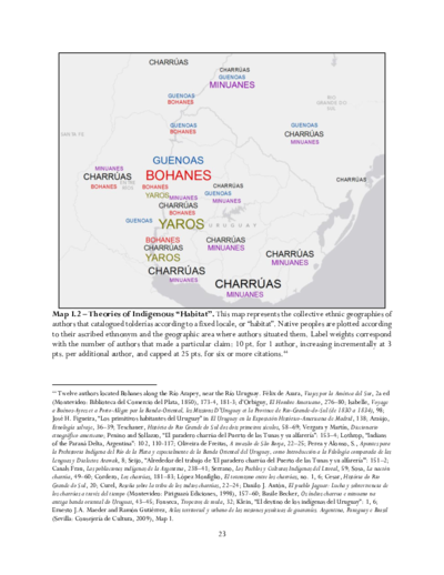
Theories of Indigenous “Habitat”.
Map 1680 - 1805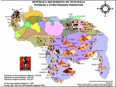
REPÚBLICA BOLIVARIANA DE VENEZUELA PUEBLOS Y COMUNIDADES INDÍGENAS
Map 2004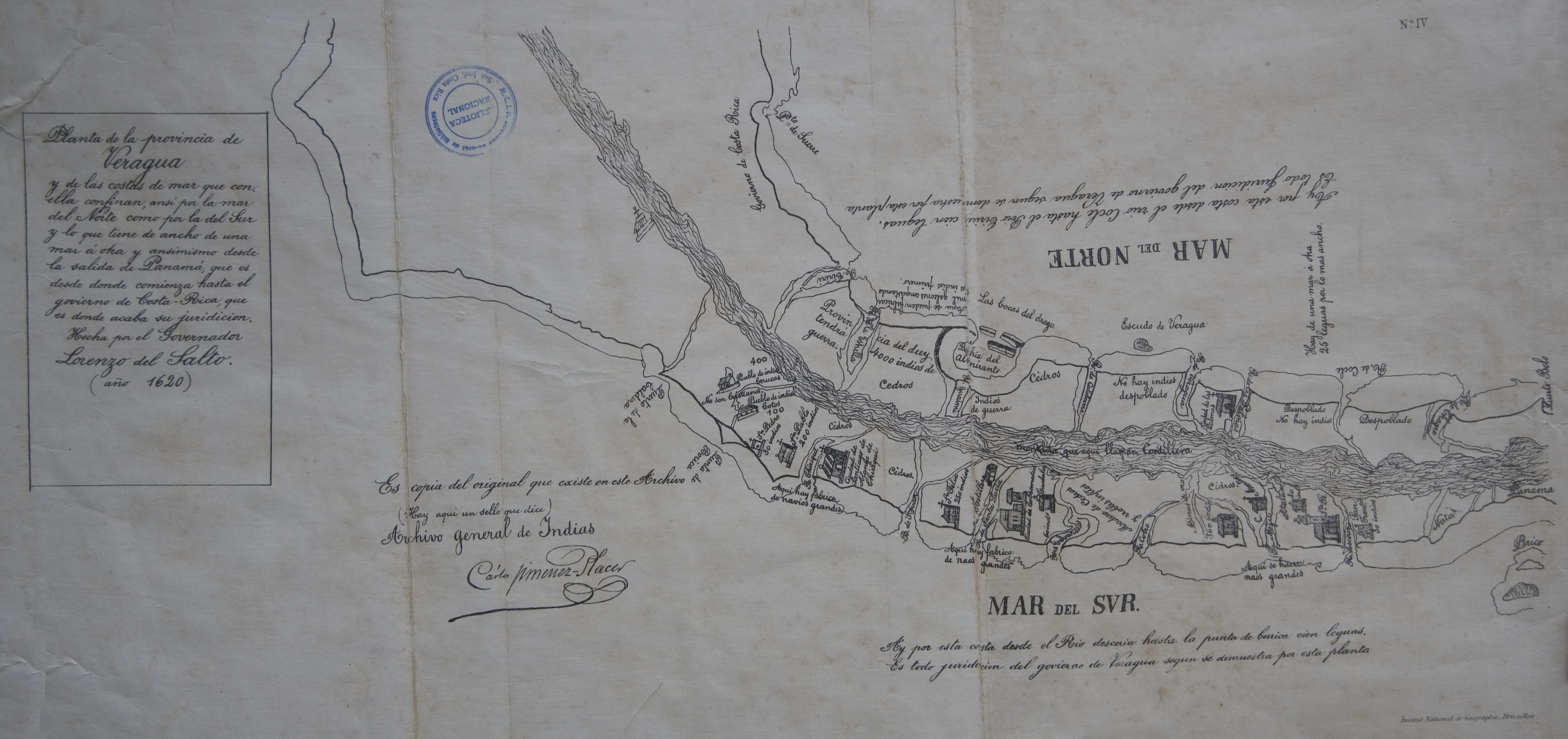
Veragua y parte de Costa-Rica
Map 1600 - 1699
Plano de la Yntendencia de Arequipa. Hecho de orden del Exmo. Sor. Virrey Fr. Dn. Francisco Gil y Lemos, año de 1792
Map 1792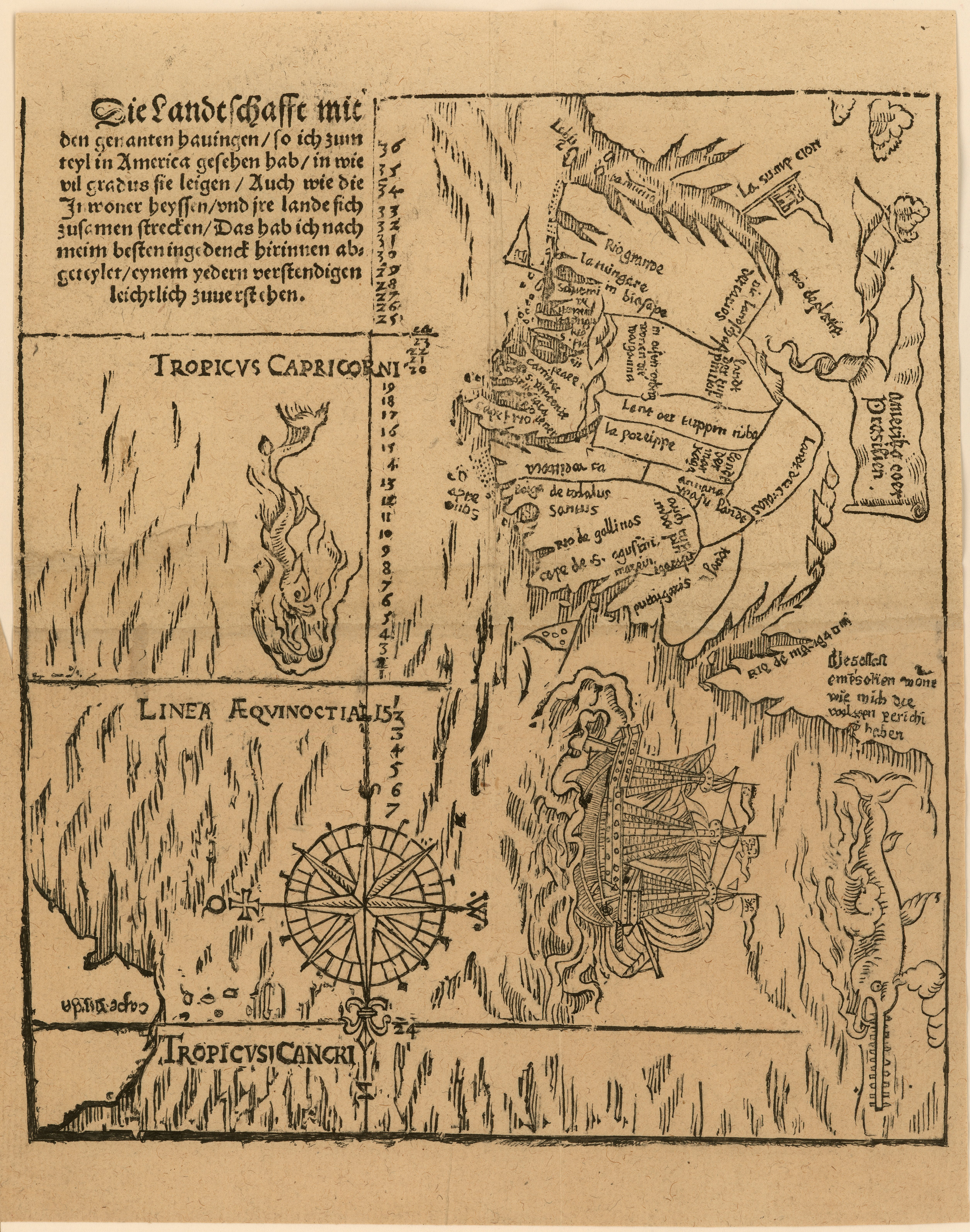
Die landtschafft mit den genanten hauingen so ich zum teyl in America gesehen hab...
Map 1500 - 1550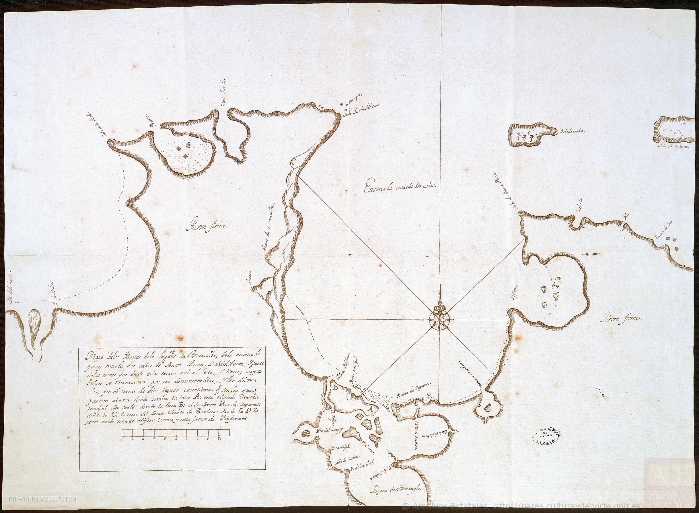
Mapa de las barras de la laguna de Maracaibo;de la ensenada que ay entre los dos cabos de Sancta Anna y Chichibacoa;y parte de las costas que desde ellos corren assí al este y vueste;cuyos paízes se reconocerán por sus demonstratibos;y las distancias por el tronco de dies leguas castellanas que son las que parecen abaxo
Map 1740 - 1750