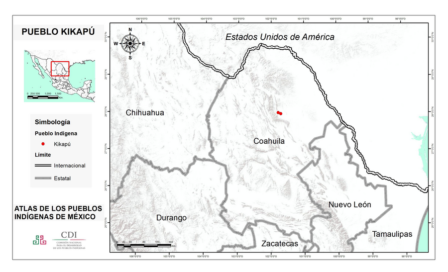
Peoples
- KIKAPU
Citation
Instituto Nacional de los Pueblos Indígenas. "Kikapúes – Ubicación." Atlas de los Pueblos Indígenas de México. Accessed July 7, 2021. http://atlas.inpi.gob.mx/kikapues-ubicacion/.
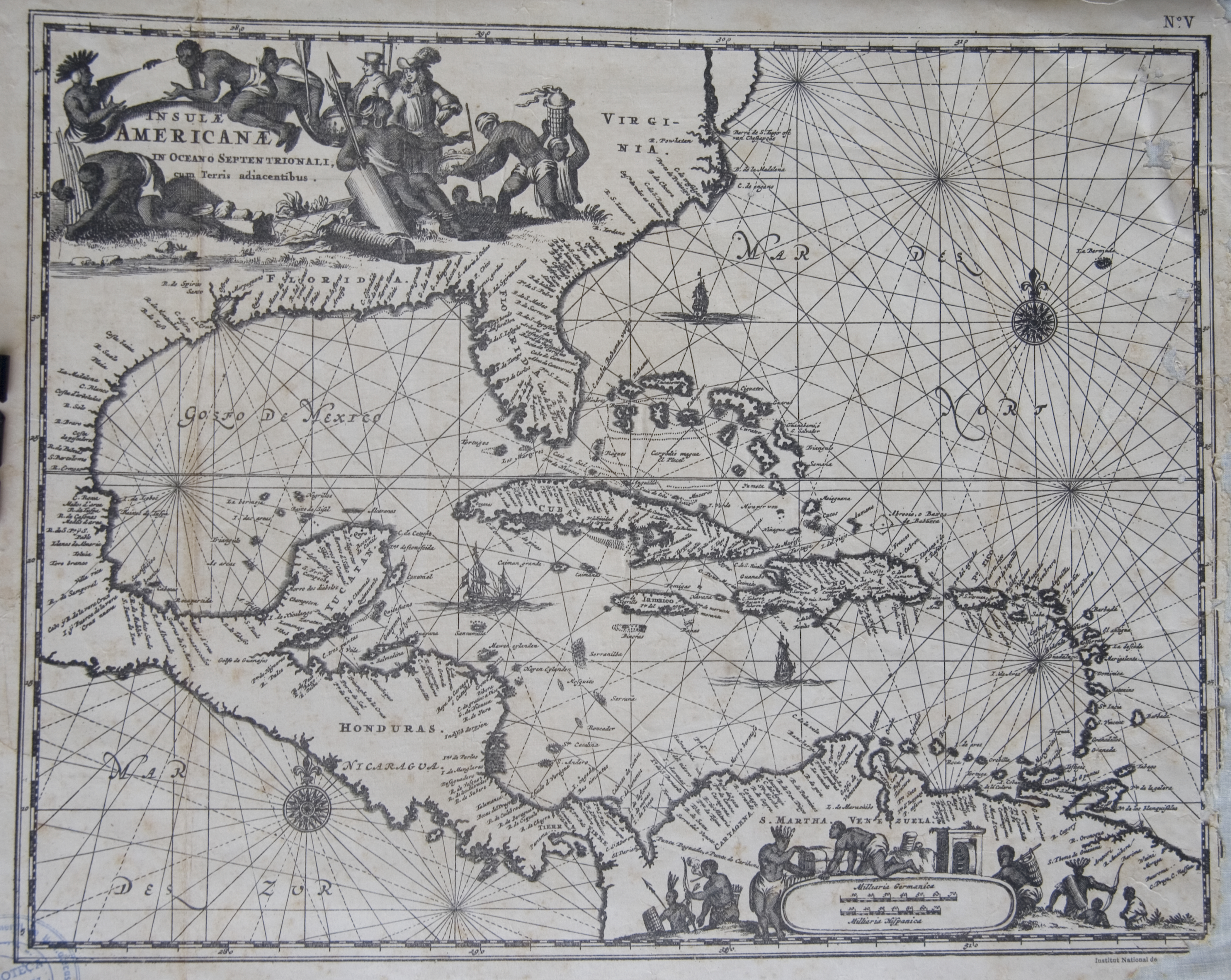
Islas Antillas y costas de tierra firme.
Map 1500 - 1599![El diablo del dengue [The Dengue Devil]](https://dnet8ble6lm7w.cloudfront.net/art/APER057.jpg)
El diablo del dengue [The Dengue Devil]
Artwork![Transversiva Post Andina Revolucionaria: El Regreso [Revolutionary Post-Andean Transversiva: The Return]](https://dnet8ble6lm7w.cloudfront.net/art_sm/AECU022.png)
Transversiva Post Andina Revolucionaria: El Regreso [Revolutionary Post-Andean Transversiva: The Return]
Artwork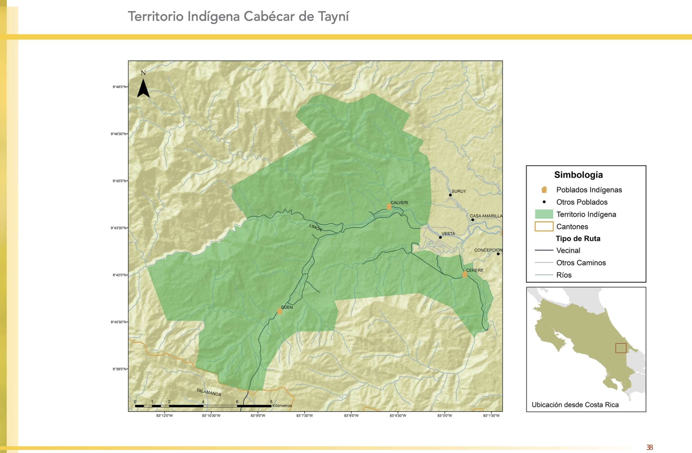
"Territorio Indígena Cabécar de Tayní"
Map 2010![Chic Material [Material Chic]](https://dnet8ble6lm7w.cloudfront.net/art_sm/AARG020.png)
Chic Material [Material Chic]
Artwork![El manifiesto PrEP [The PrEP Manifesto]](https://dnet8ble6lm7w.cloudfront.net/art_sm/ACOL002.png)
El manifiesto PrEP [The PrEP Manifesto]
Artwork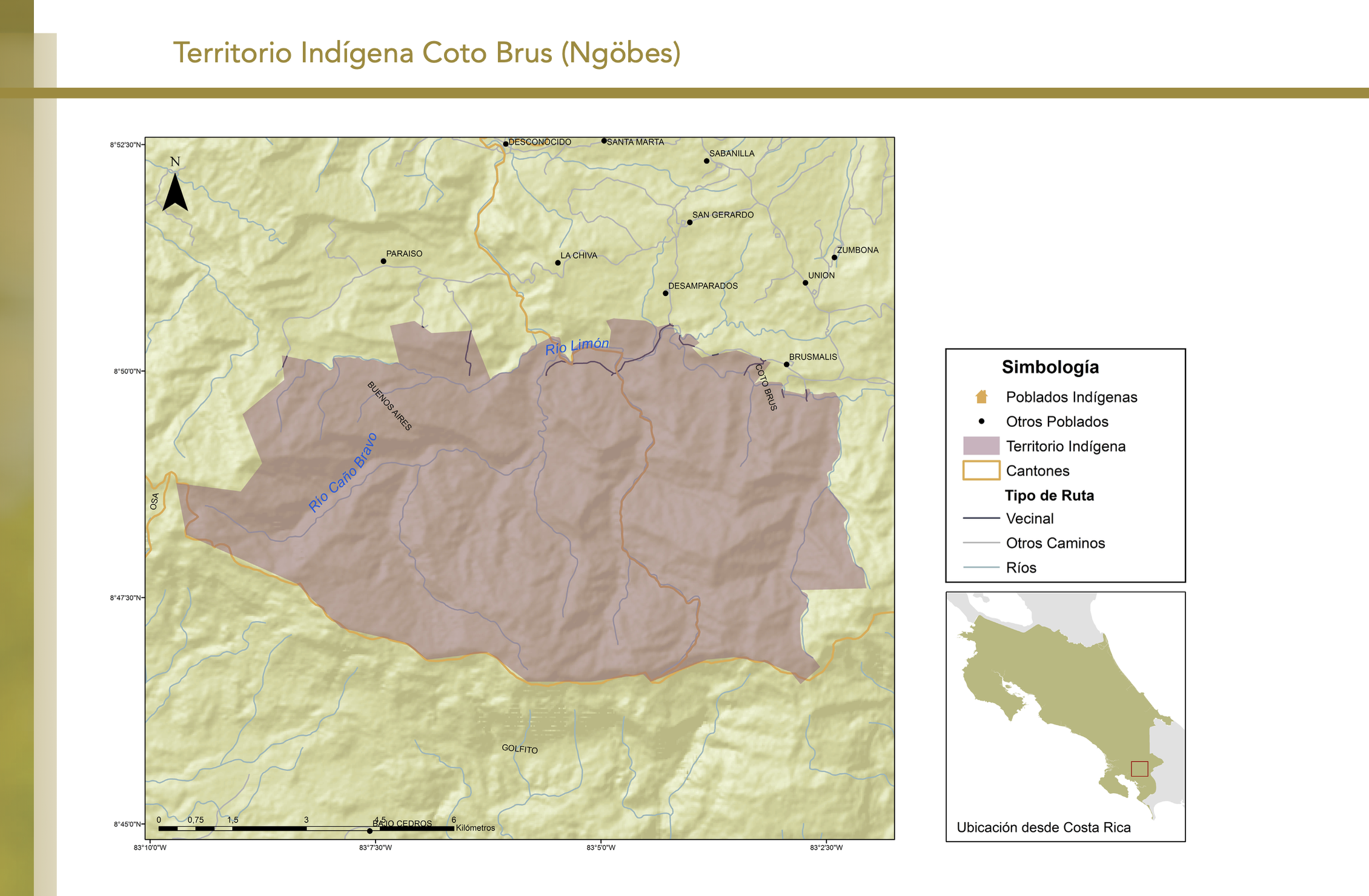
"Territorio Indígena Coto Brus (Ngöbes)"
Map 2010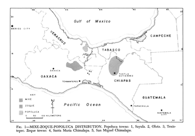
Mixe-Zoque-Popoluca Distribution
Map 1969