
Peoples
- CHUJ
Citation
Instituto Nacional de los Pueblos Indígenas. "Chujes – Ubicación." Atlas de los Pueblos Indígenas de México. Accessed April 30, 2021. http://atlas.inpi.gob.mx/chuj-ubicacion/.
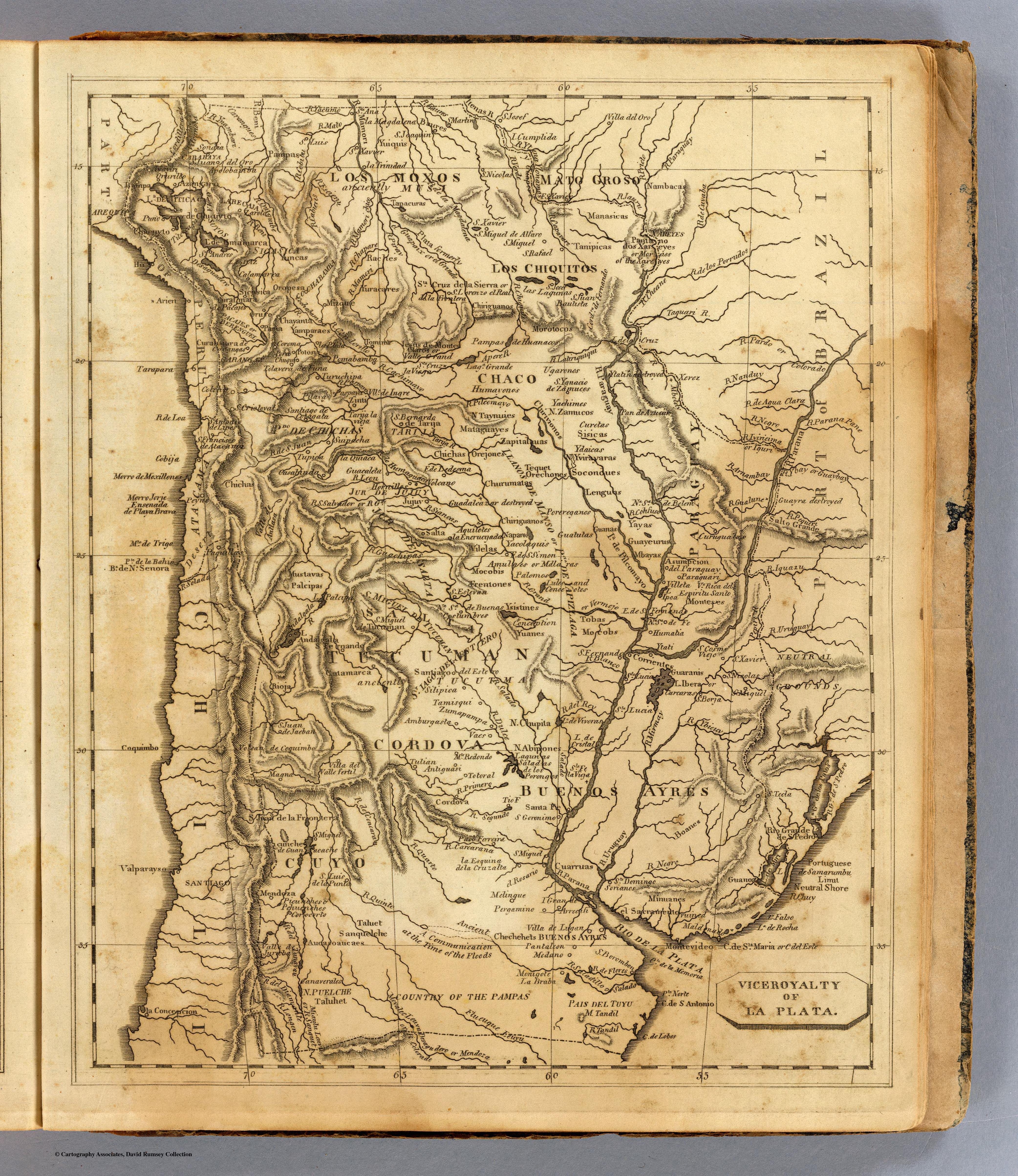
Viceroyalty of La Plata
Map 1812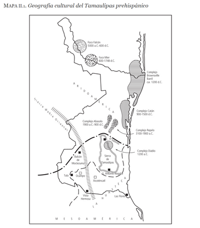
Geografia cultural del Tamaulipas prehispánico
Map -5000 - 599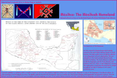
Mexico at the time of the conquest (1519), showing the extent of the Culhua Mexica (Aztec Empire) and of the Maya holdings
Map 1519![Tierra [Earth]](https://dnet8ble6lm7w.cloudfront.net/art_sm/AECU011.png)
Tierra [Earth]
Artwork![Kapewẽ Pukenibu / Ponte de jacaré [Kapewẽ Pukenibu / Jacaré Bridge]](https://dnet8ble6lm7w.cloudfront.net/art_sm/ABRA029.png)
Kapewẽ Pukenibu / Ponte de jacaré [Kapewẽ Pukenibu / Jacaré Bridge]
Artwork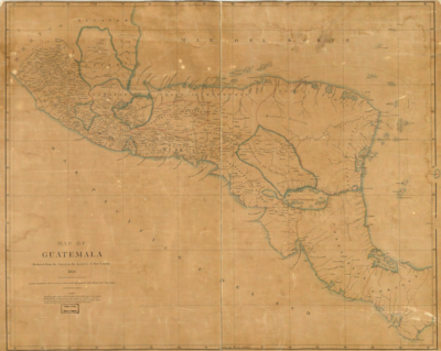
Map of Guatemala: reduced from the survey in the archives of that country.
Map 1826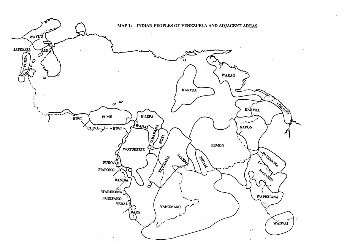
INDIAN PEOPLES OF VENEZUELA AND ADJACENT AREAS
Map 1995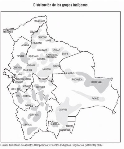
Distribución de los Grupos Indígenas de Bolivia
Map 2000 - 2010