
Peoples
- CHONTAL DE TABASCO
Citation
Instituto Nacional de los Pueblos Indígenas. "Chontales de Tabasco – Ubicación." Atlas de los Pueblos Indígenas de México. http://atlas.inpi.gob.mx/4328-2/.
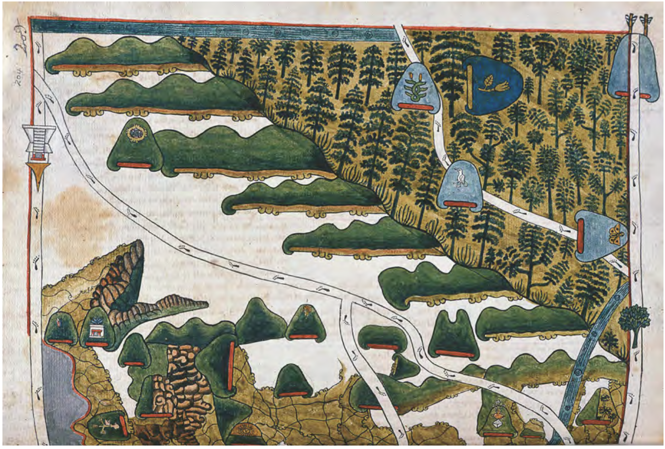
MAPA DE TEPETLAOZTOC
Map 1500 - 1599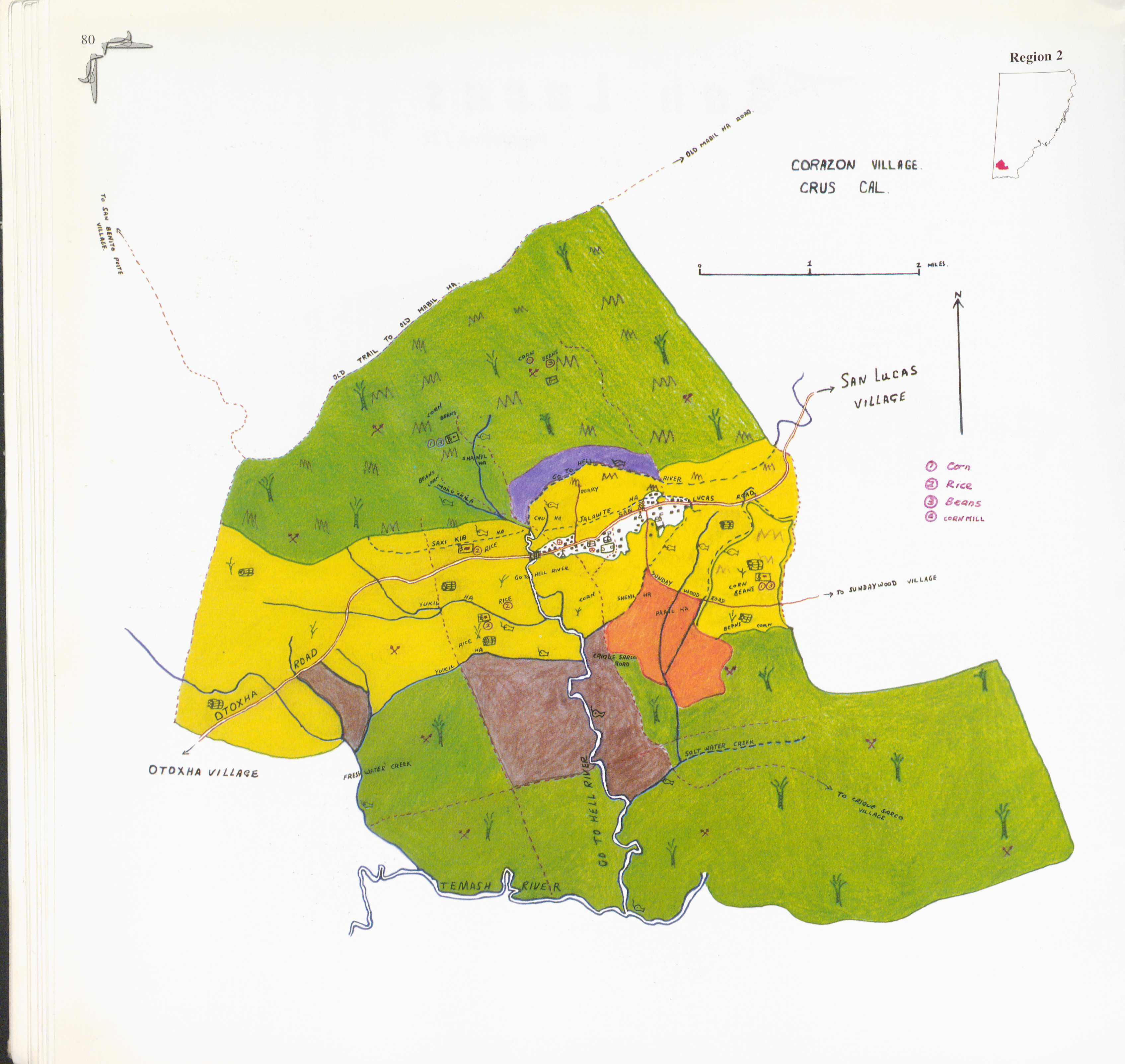
Corazon
Map 1997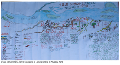
ALDEIAS OMAGUAS/KAMBEBA
Map 2020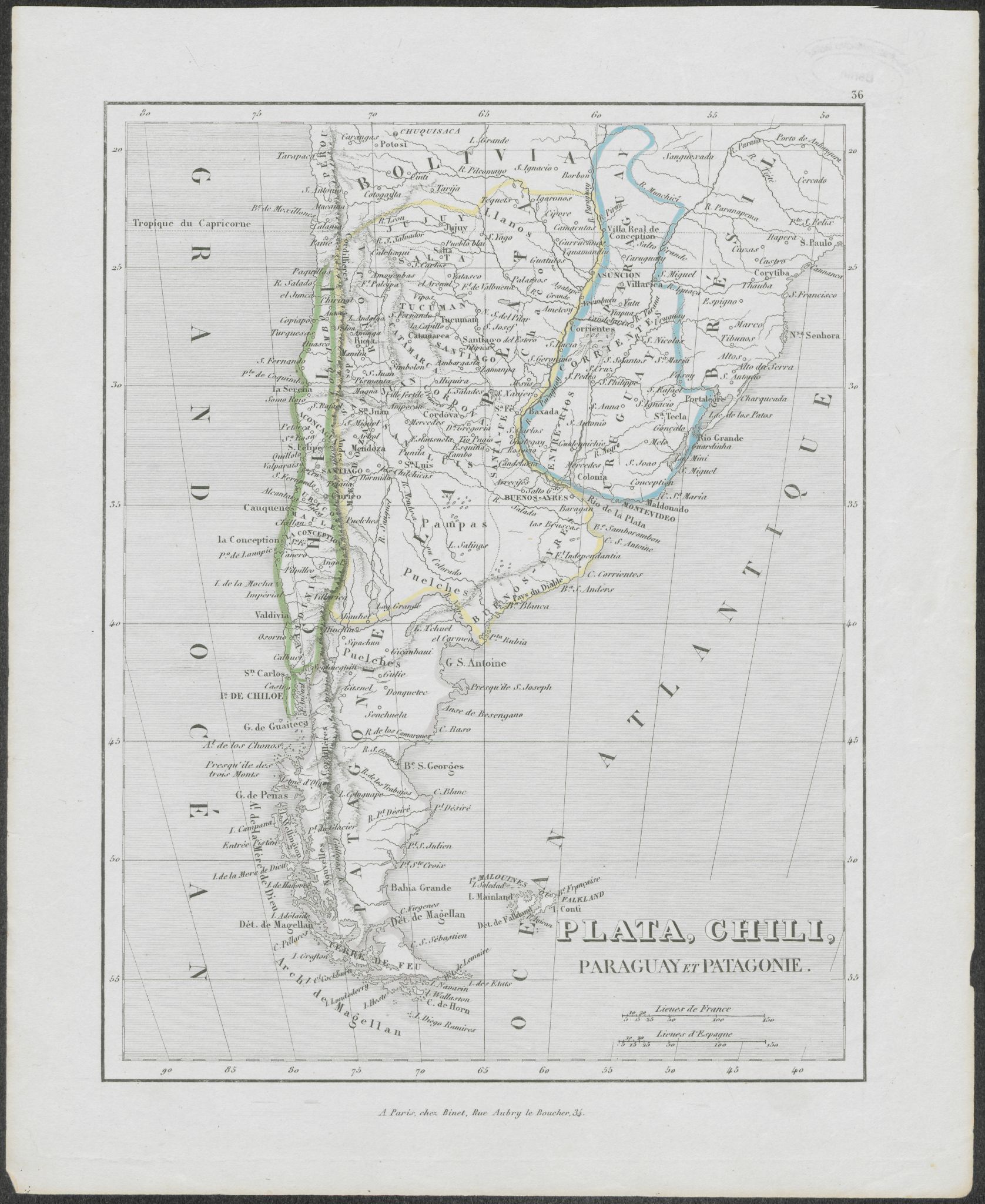
Plata, Chili, Paraguay Et Patagonie
Map 1800 - 1880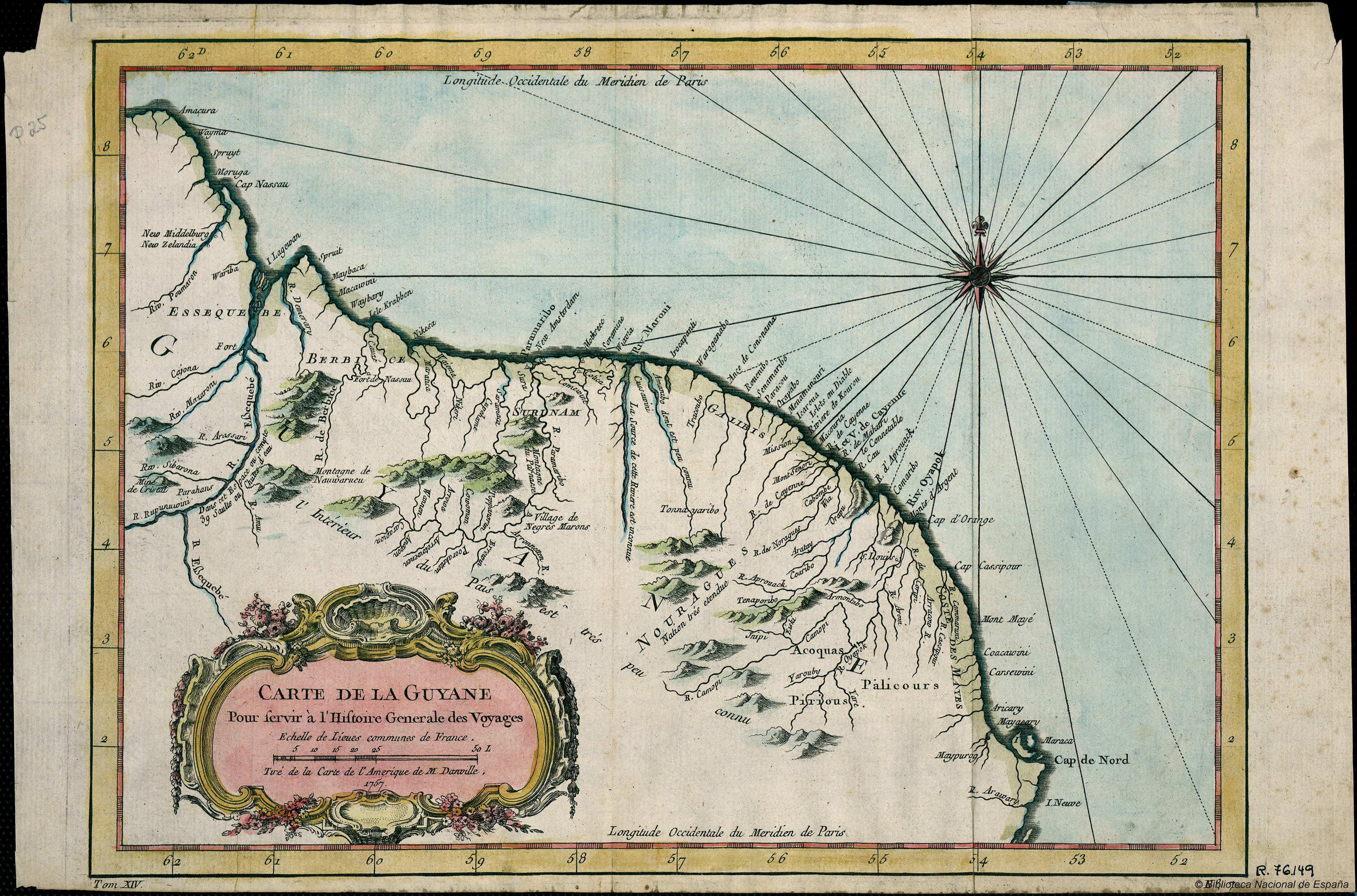
Carte de la Guyana pour servir à l'Histoire Generale des Voyages.
Map 1757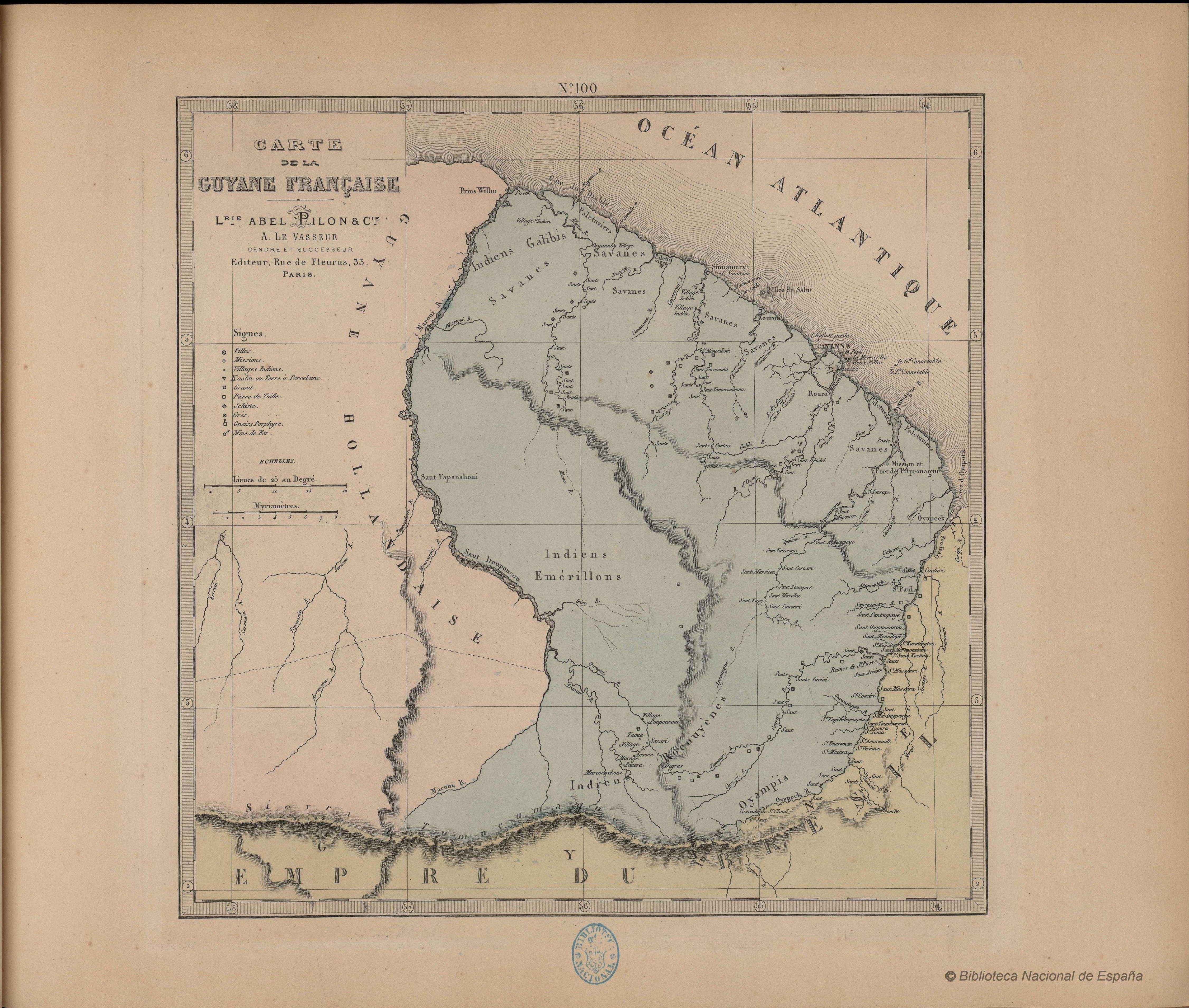
N. 100. Carte de la Guyane Française
Map 1878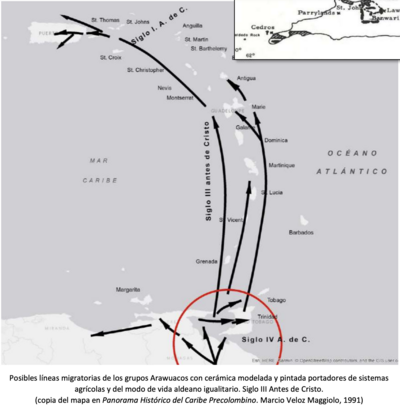
Posibles líneas migratorias de los grupos Arawuacos con cerámica modelada y pintada portadores de sistemas agrícolas y del modo de vida aldeano igualitario. Siglo III Antes de Cristo.
Map -400 - -100
Map representing the linguistic diversity that existed in Central America and the Gulf of Fonseca at the time of contact with the Spanish
Map 1522