
Peoples
- CHONTAL DE TABASCO
Citation
Instituto Nacional de los Pueblos Indígenas. "Chontales de Tabasco – Ubicación." Atlas de los Pueblos Indígenas de México. http://atlas.inpi.gob.mx/4328-2/.
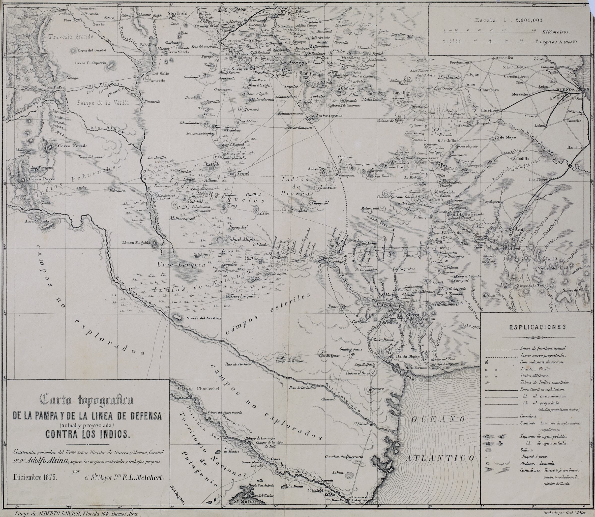
Carta topográfica de la Pampa y de la línea de defensa contra los indios.
Map 1875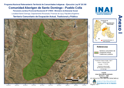
Comunidad Aborigen de Santo Domingo - Pueblo Colla
Map 2020
Orí Odé
Artwork
Serie Fatherland / Padre Patria
Artwork
The modern departments of Ahuachapán, La Libertad, Santa Ana, and Sonsonate (highlighted in red) now contain the highest concentration of Indigenous communities in El Salvador.
Map 2010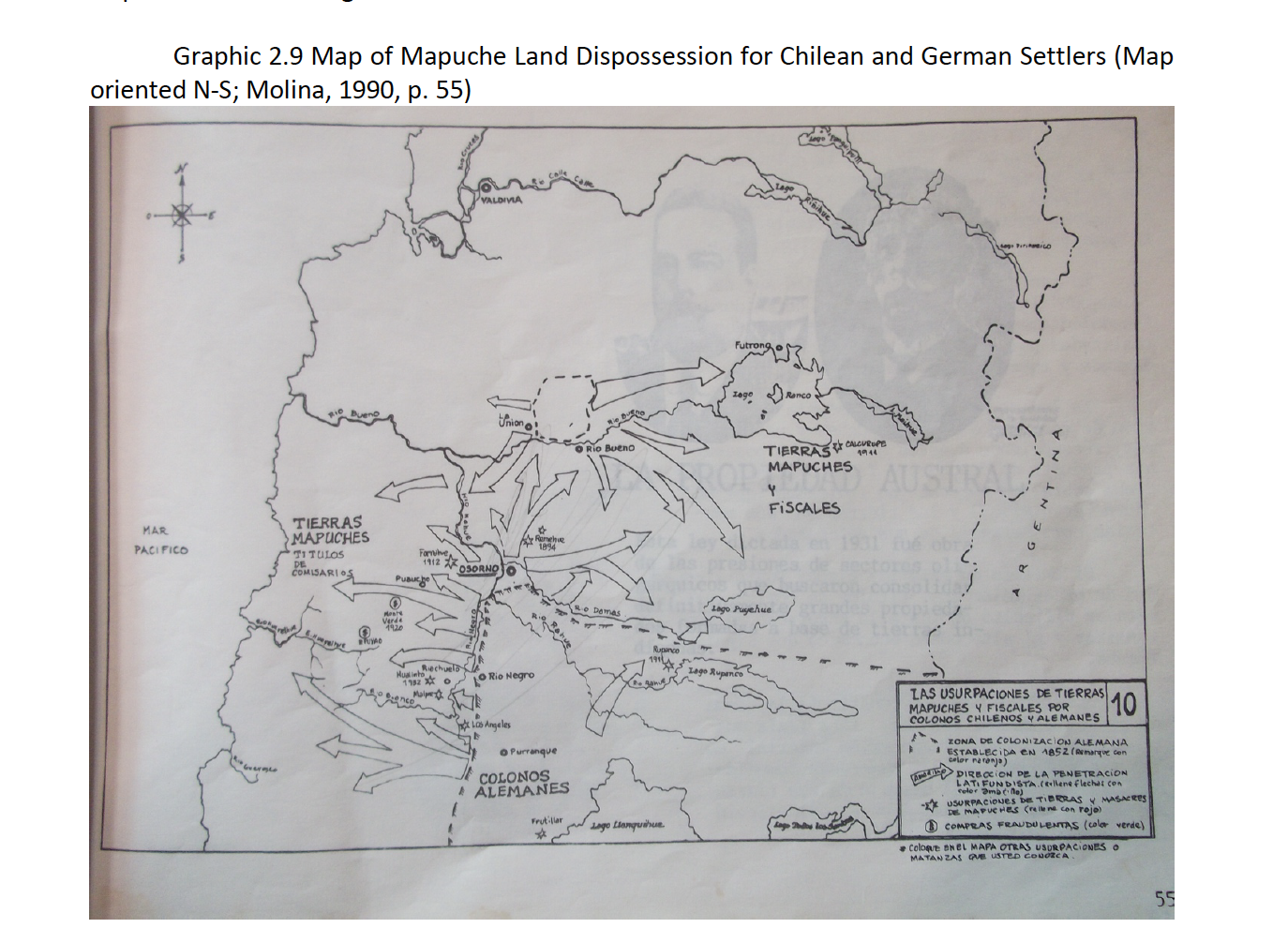
Map of Mapuche Land Dispossession for Chilean and German Settlers
Map 1911 - 1952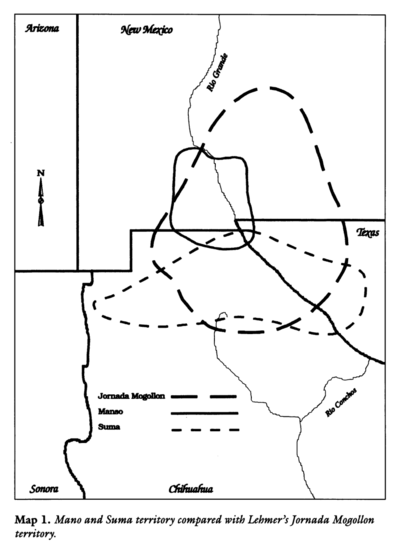
Mano and Sutna territory compared with Lehtner's Jornada Mogotton territory
Map 1997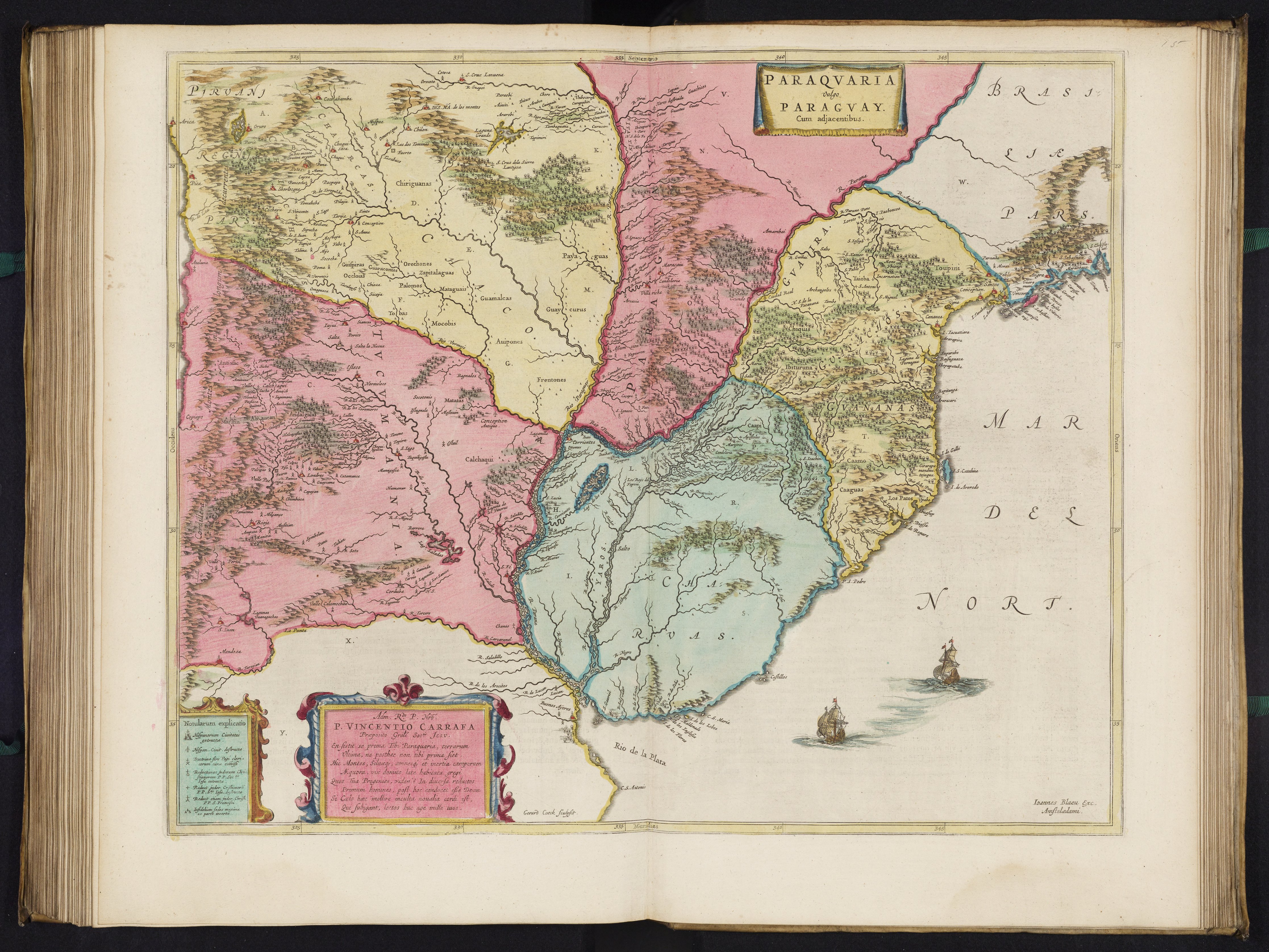
PARAQVARIA vulgo PARAGVAY.
Map 1600 - 1699