
Peoples
- TARAHUMARAS
Citation
University of Kansas. "Sierra Tarahumara Study Area - Online GIS." PRMapping. Last modified November 5, 2007. https://prmapping.ku.edu/Mexico_Indigena/SVG/Sierra_taramhumara_idiomas_zonas_procede/index.html
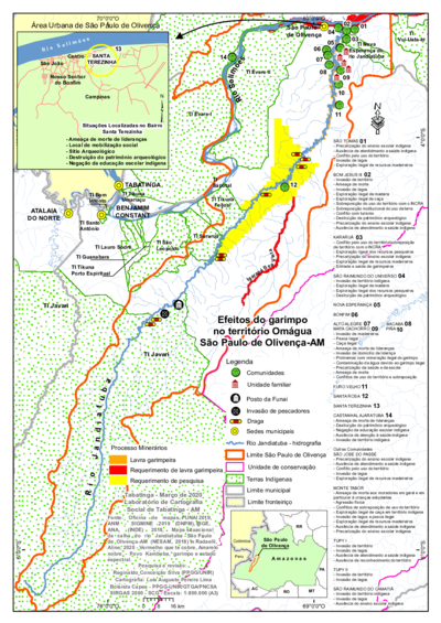
Efeitos do garimpo no território Omágua São Paulo de Olivença-AM
Map 2000 - 2099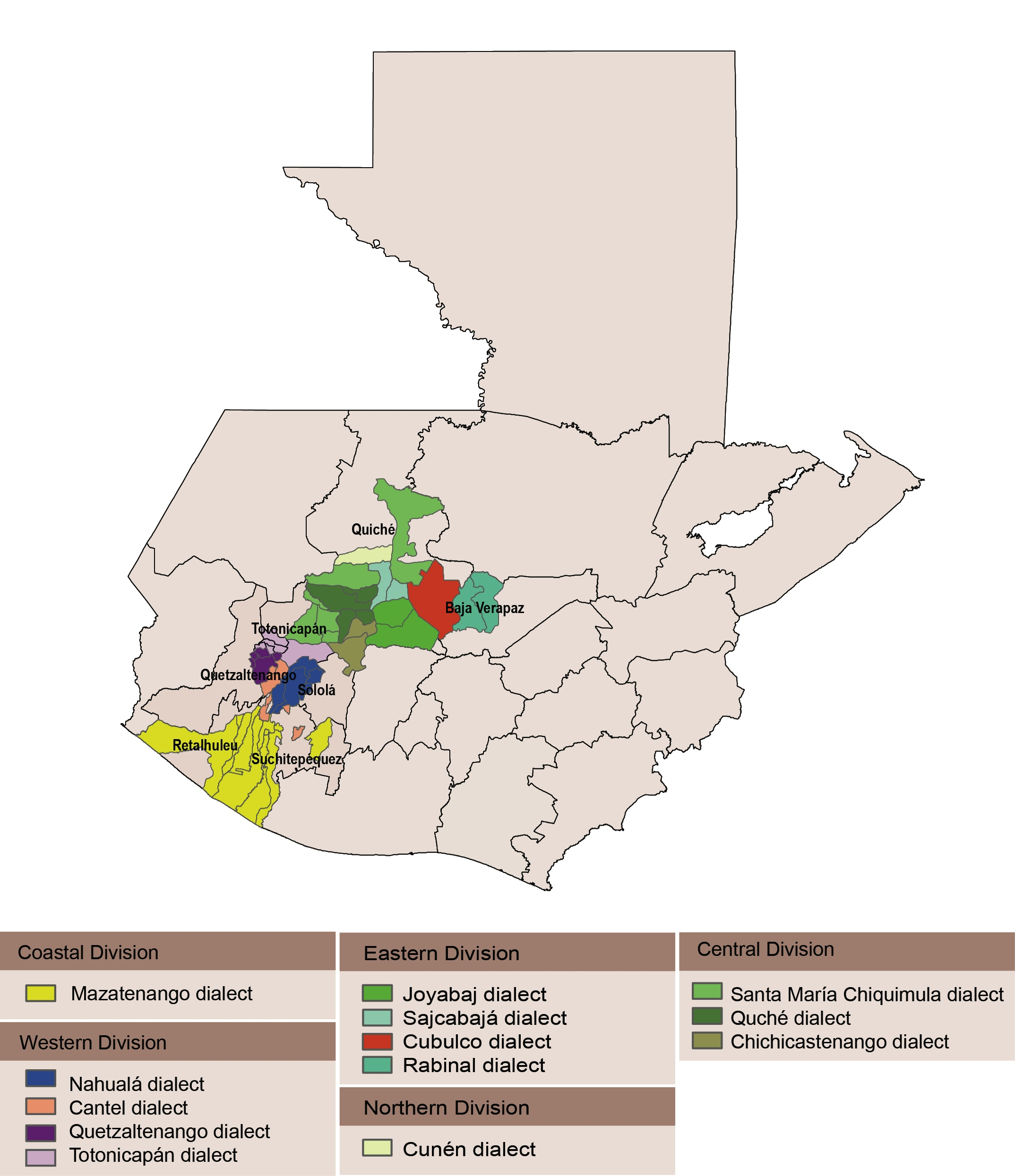
Dialect geography of K'ichee'
Map
Fig. 1 Map of the Guianas with schematic locations of the indigenous groups relevant to our study, based on the linguistic map of South America (http://www.muturzikin.com/cartesamerique/ 7.htm). Carib-speaking groups are indicated in yellow, Arawak-speaking groups in blue, Tupi-speaking Wayãpi in pink and the Warao-speaking group in green
Map 2000 - 2024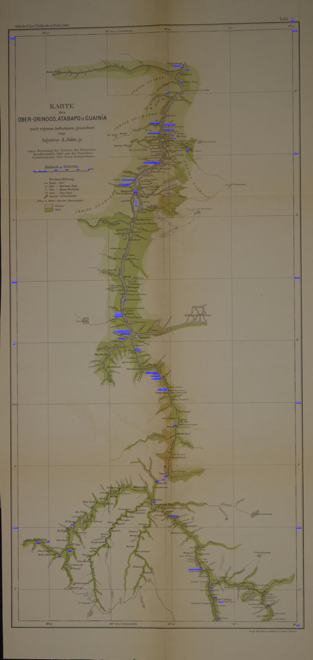
KARTE des OBER-ORINOCO;ATABAPO U GUAINÍA
Map 1909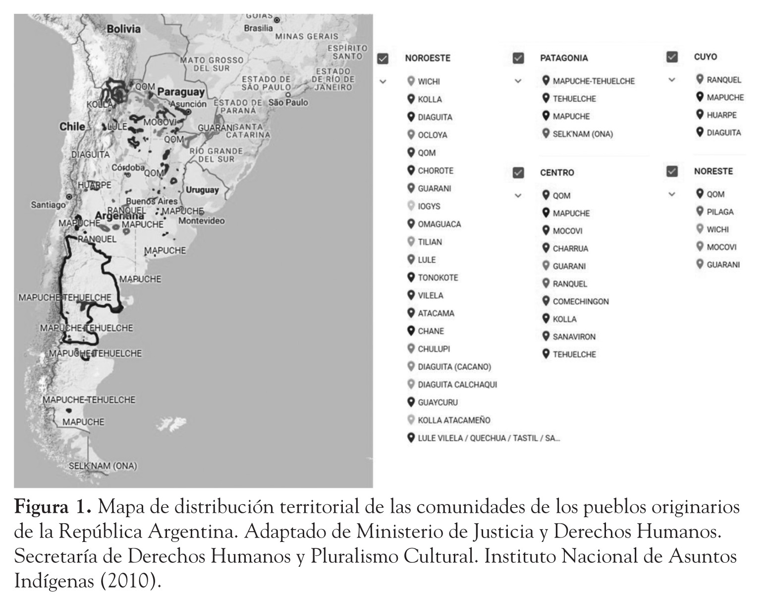
La problemática de los pueblos originarios en la Argentina y el impacto social de la gestión de los bosques nativos
Map 2018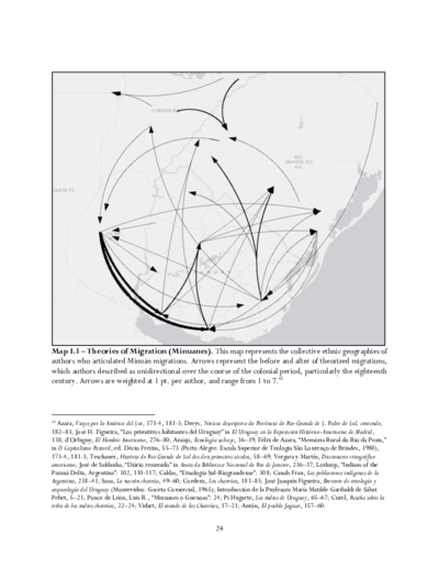
Theories of Migration (Minuanes).
Map 1680 - 1805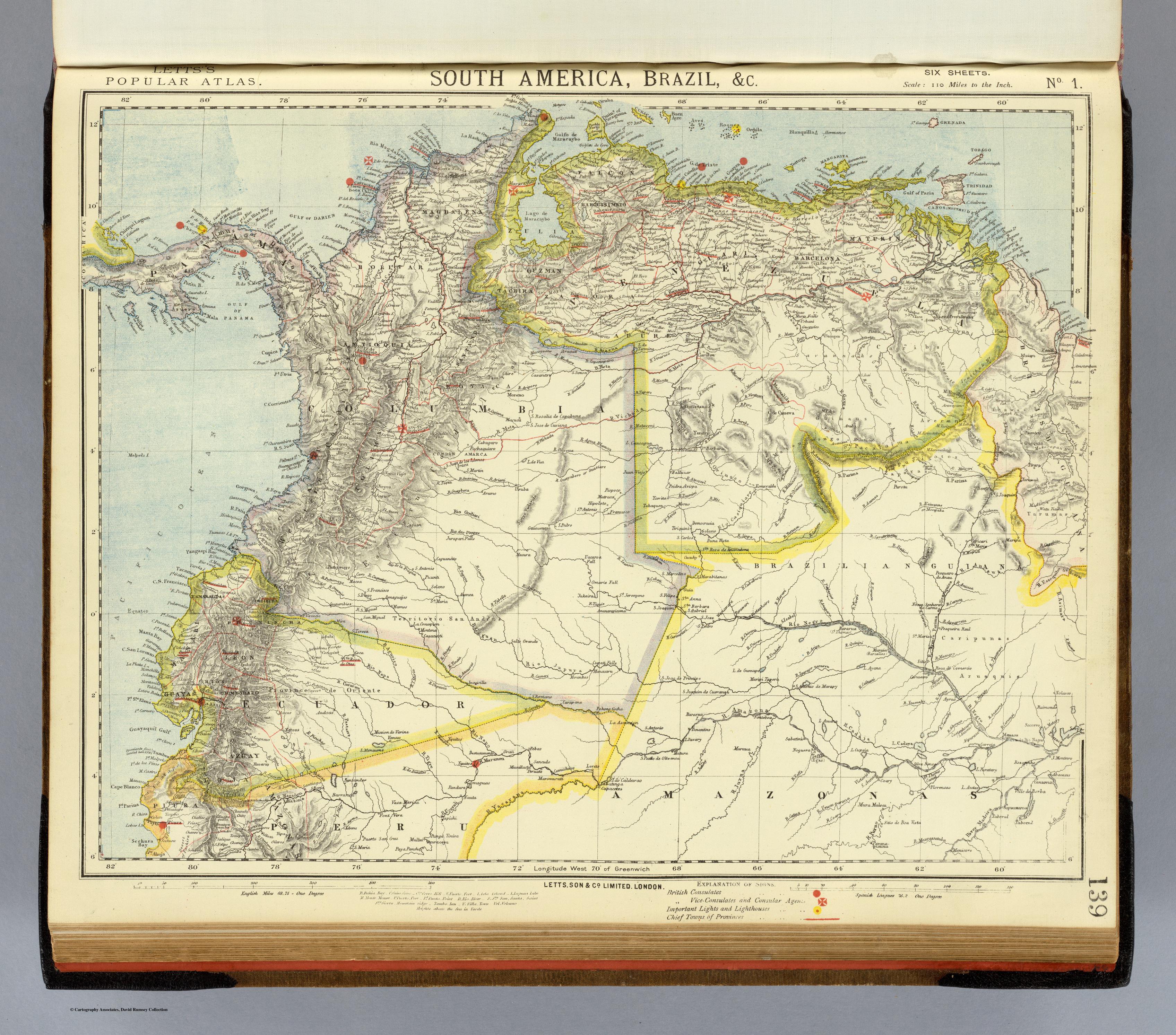
SOUTH AMERICA;BRAZIL;&C.
Map 1883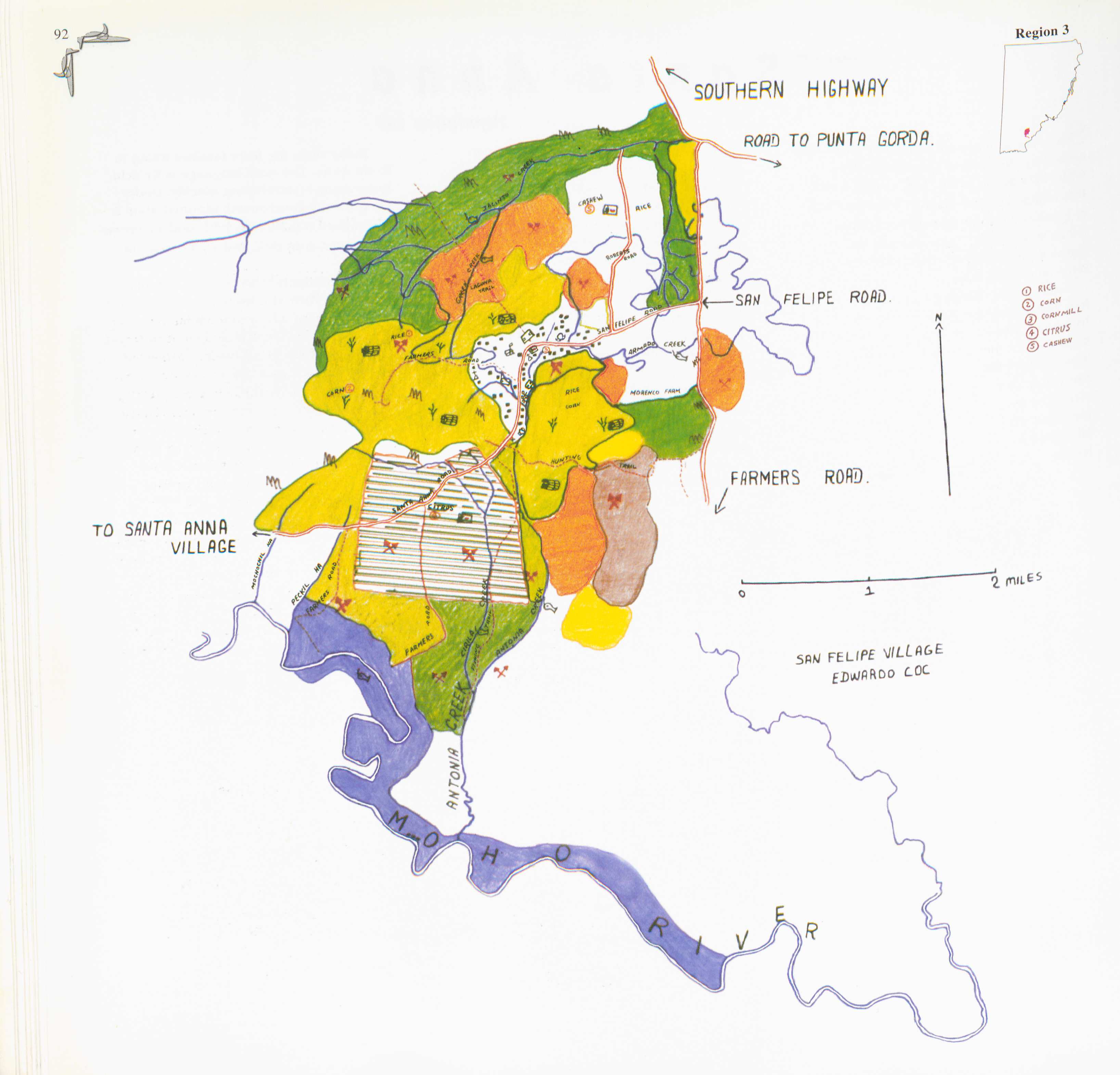
San Felipe
Map 1997