
Peoples
- PIMAS ALTOS
- OPATAS
- SERIS
- PIMAS BAJOS
- YAQUIS
- MAYOS
Citation
Trejo Contreras, Zulema. "Indigenous People and Nation-State Building, 1840-1870." Frontera Norte 26, no. 51 2014: 5-24. http://www.scielo.org.mx/pdf/fn/v26n51/v26n51a1.pdf.
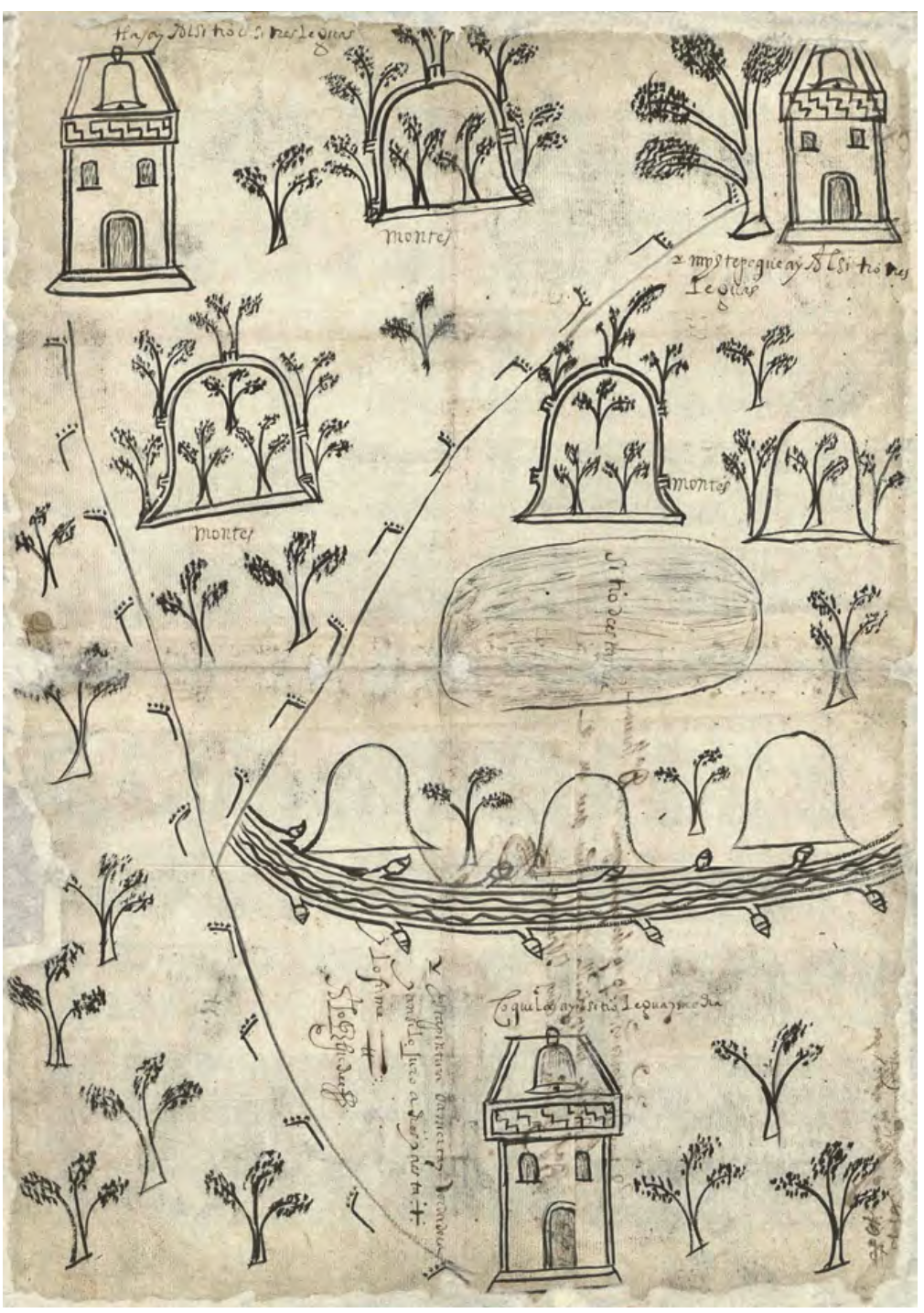
MAPA DE SANTA MARÍA CUPILA
Map 1500 - 1599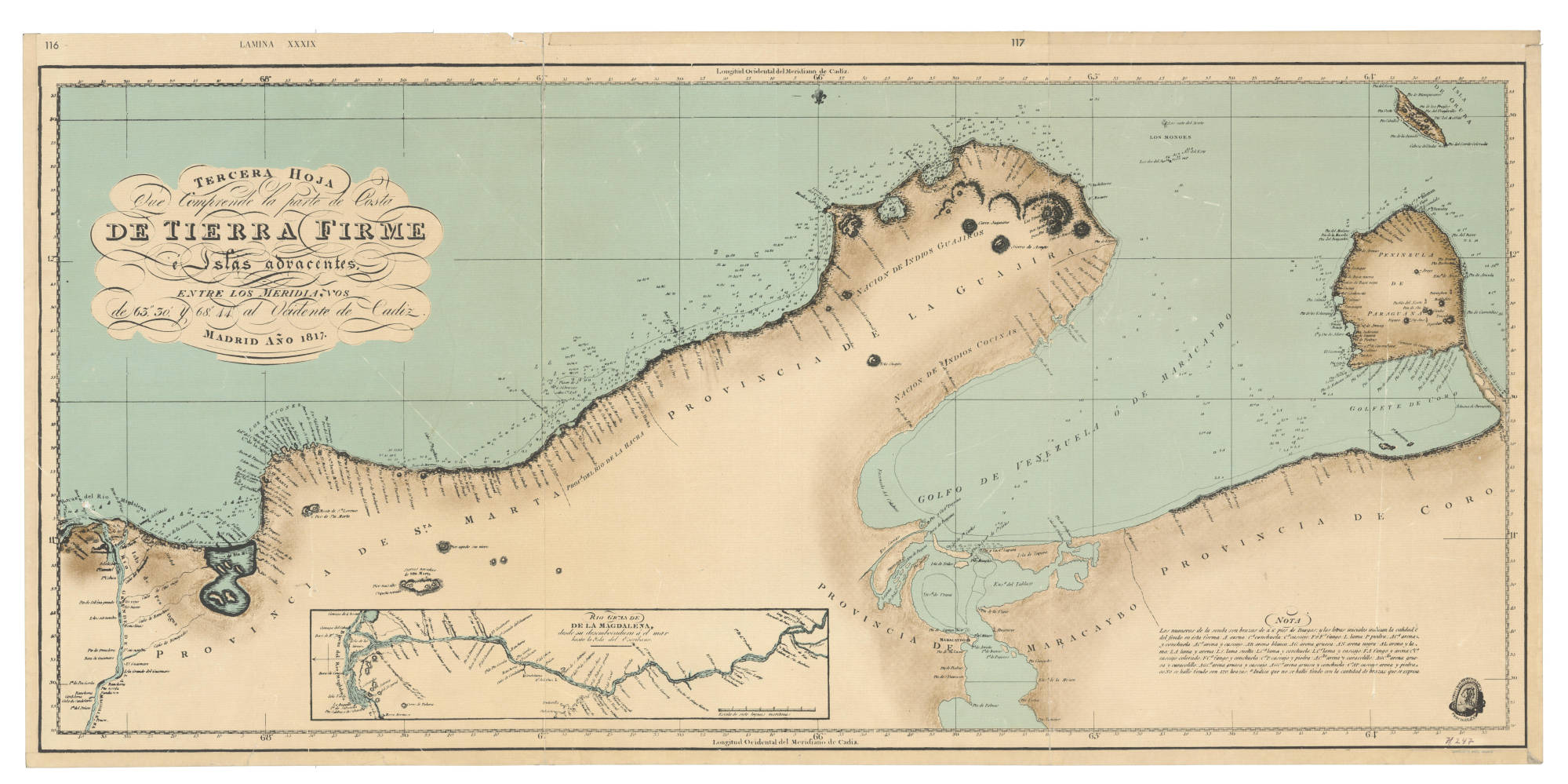
TIERRA FIRME E ISLAS ADYACENTES
Map 1817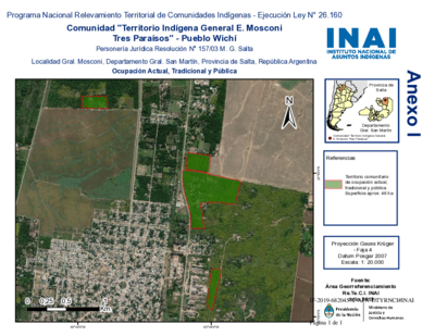
Comunidad "Territorio Indígena General E. Mosconi Tres Paraísos" - Pueblo Wichí
Map 2020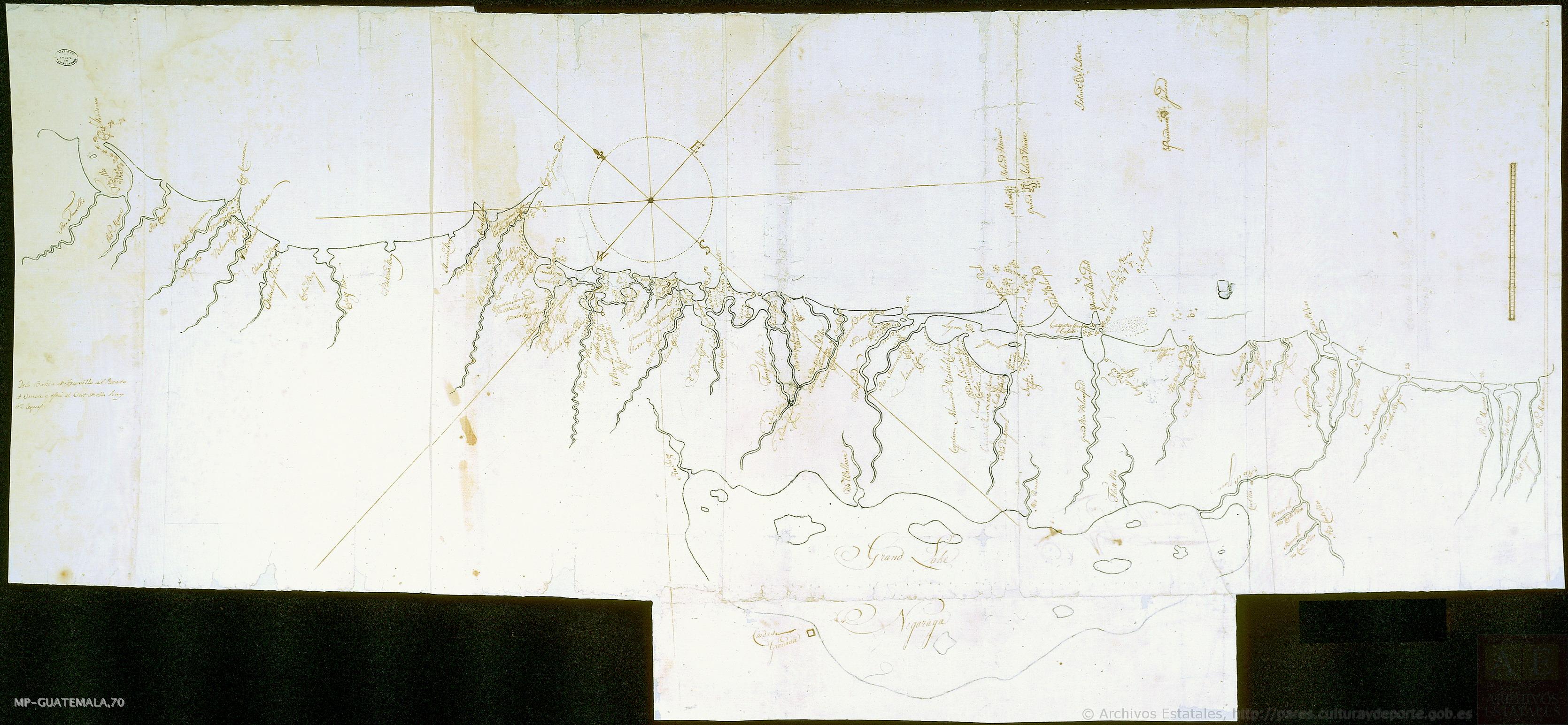
Mapa de costa comprendida entre Trujillo (Honduras) y la desembocadura del río de Matina.
Map 1768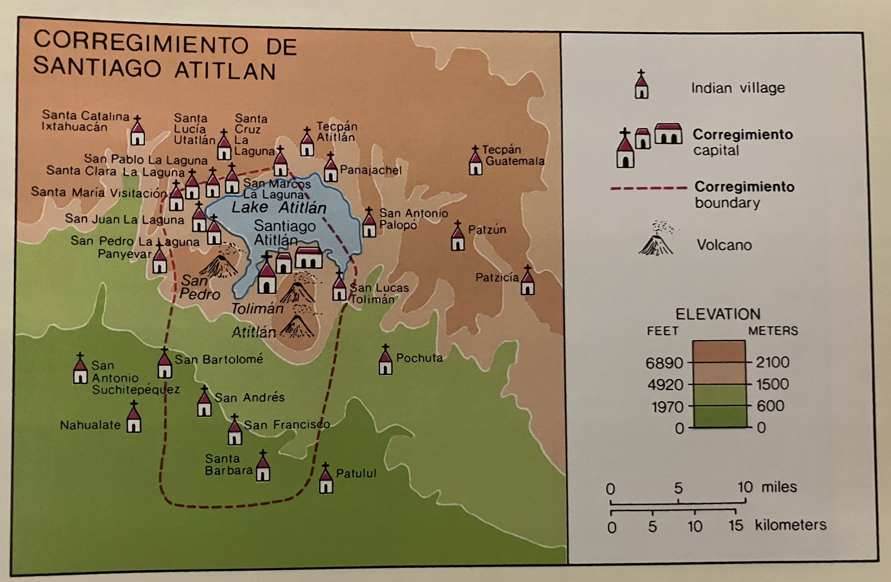
Corregimiento de Santiago Atitlan
Map 1550 - 1580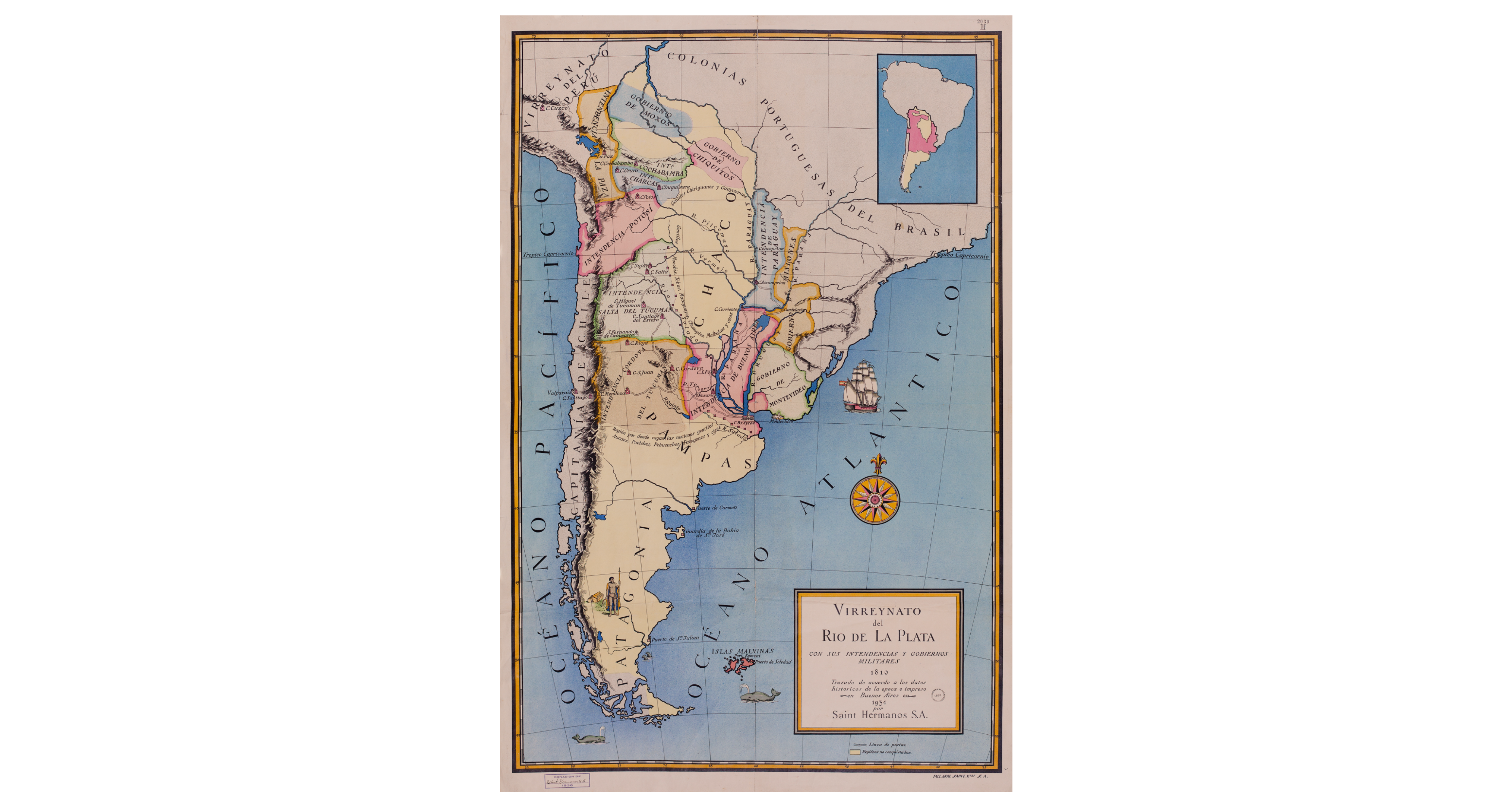
Virreynato del Río de La Plata con sus intendencias y gobiernos militares: 1810
Map 1810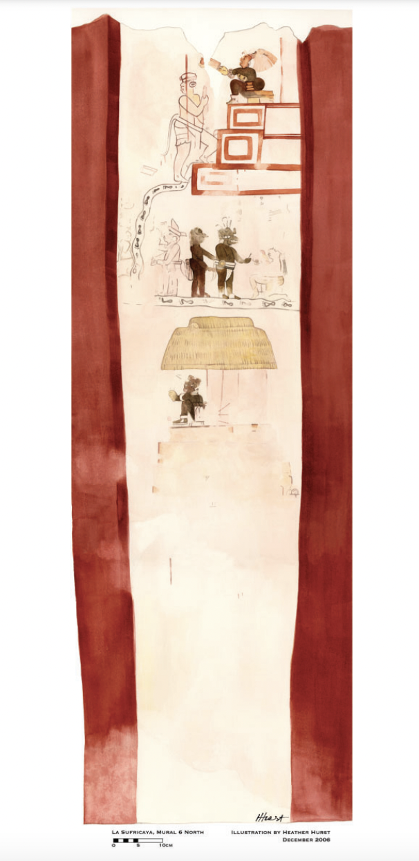
Reproduction of a 4th century mural painted on the wall of a royal residence at La Sufricaya in the Peten region of Guatemala. Mural 6 North.
Map 300 - 400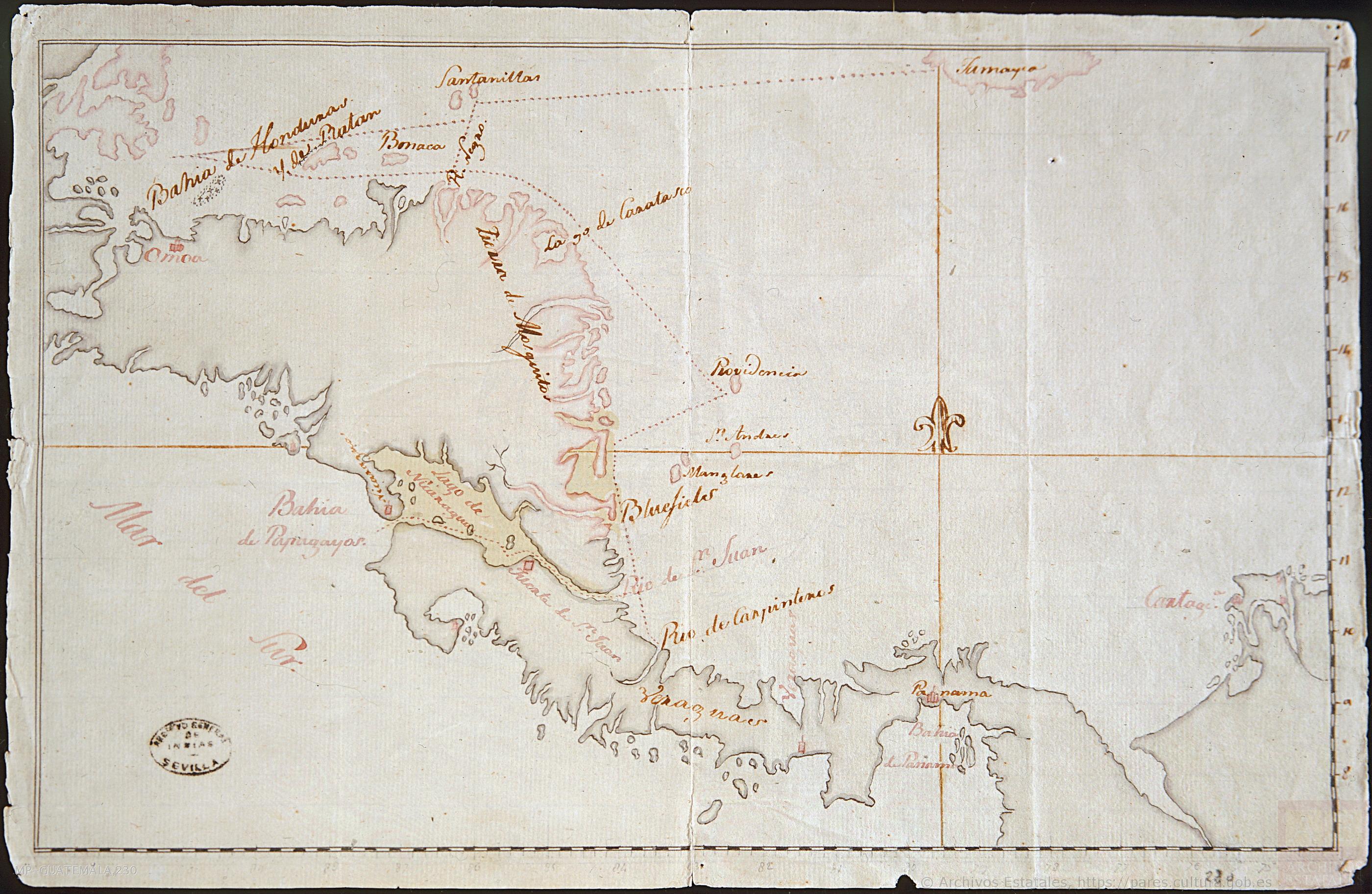
Mapa de la América Central comprendida entre el Golfo Dulce y Cartagena de Indias;por el Norte y entre la Bahía de Fonseca de Panamá por el Sur.
Map 1777