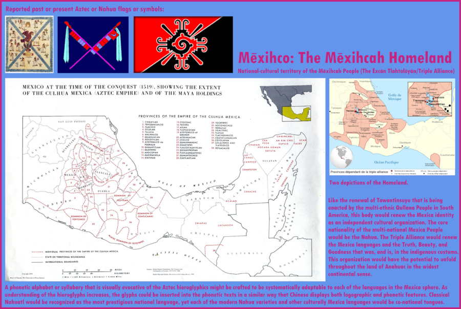
Peoples
- TRIPLE ALLIANCE
- MAYA
Citation
"Mexihco: The Mexihca Homeland." Infographic. Accessed May 4, 2021. https://lh3.googleusercontent.com/-CQEKE0h1Ntw/Tanbw5gY_PI/AAAAAAAAZdE/oji_KP6SFEc/s2048-Ic42/Mexica%252520Homeland.png.
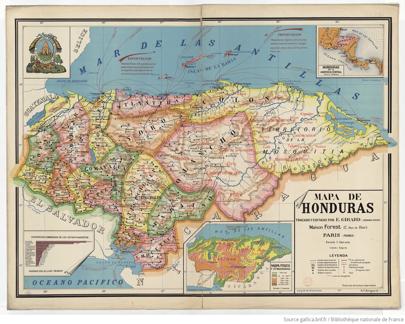
Mapa de Honduras, with Mapa Físico y Etnográfico (insert)
Map 1929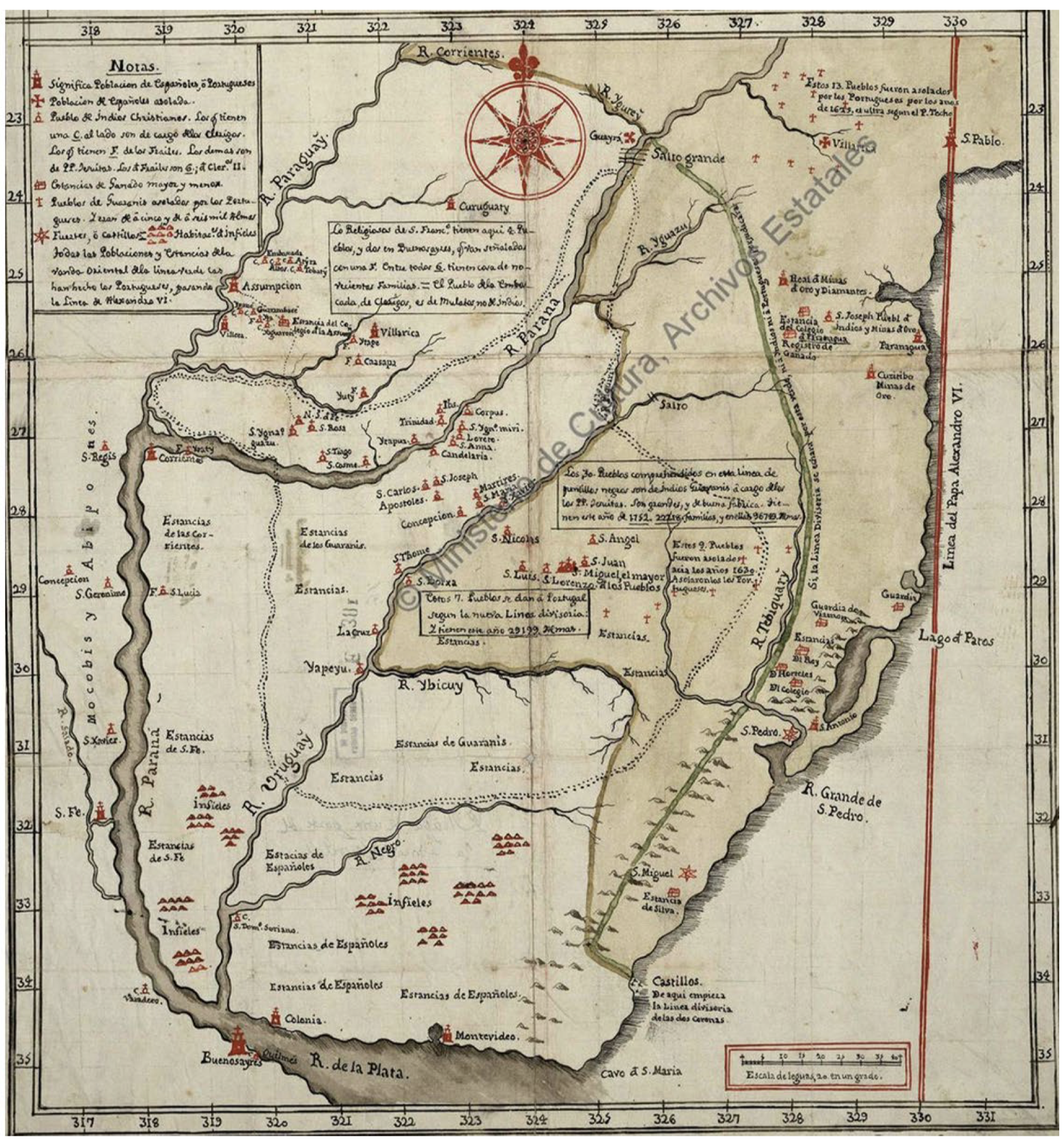
Mapa De La Gobernación Del Paraguay Y Buenos Aires, Con La Línea Divisoria De Las Tierras De España Y Portugal_1752.
Map 1752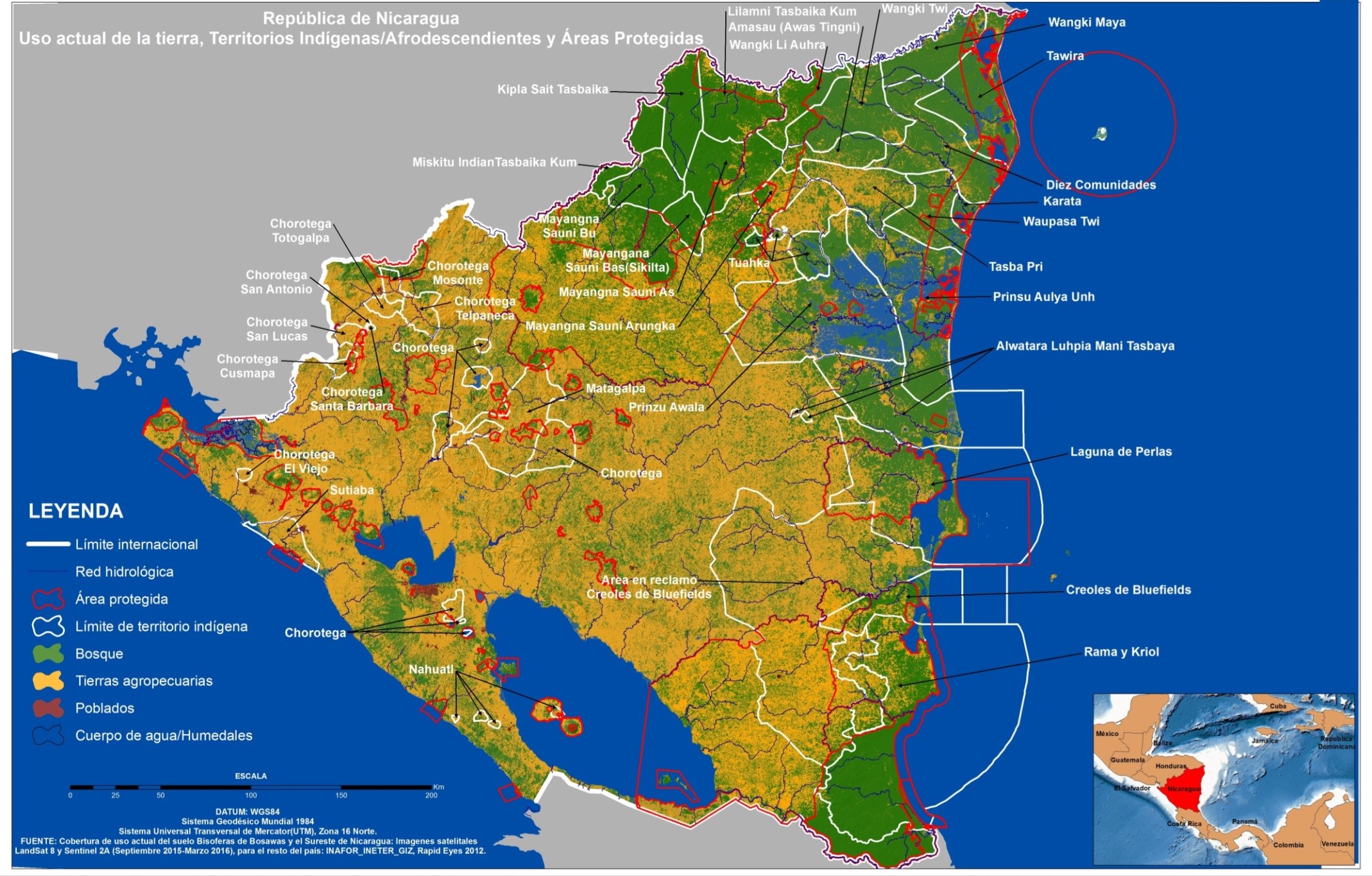
República de Nicaragua: uso actual de la tierra;Territorios Indígenas/Afrodescendientes y Areas Protegidas
Map 2012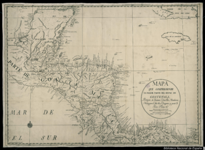
Mapa que comprehende la mayor parte del reyno de Goatemala;Provincias de Yucatan;Vera-Paz;Honduras;Nicaragua;Costa-Rica;Veraguas y parte de Tierra Firme.
Map 1738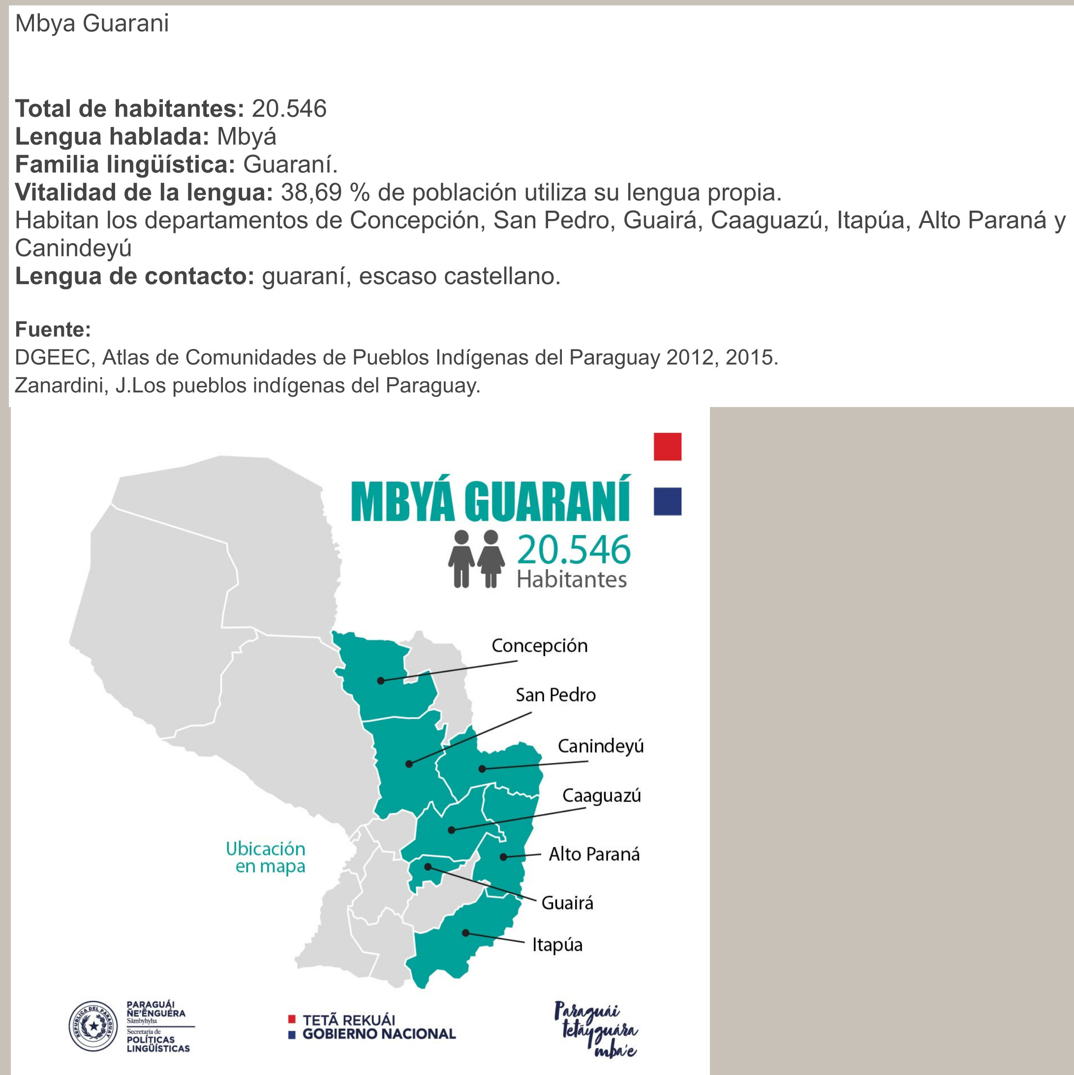
MBYÁ GUARANÍ
Map 2015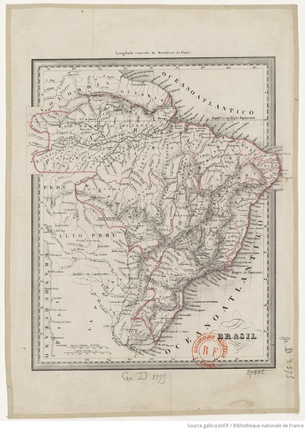
BRASIL
Map 1835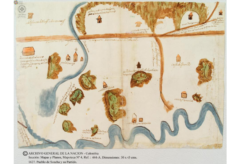
Pueblo de Soacha
Map 1627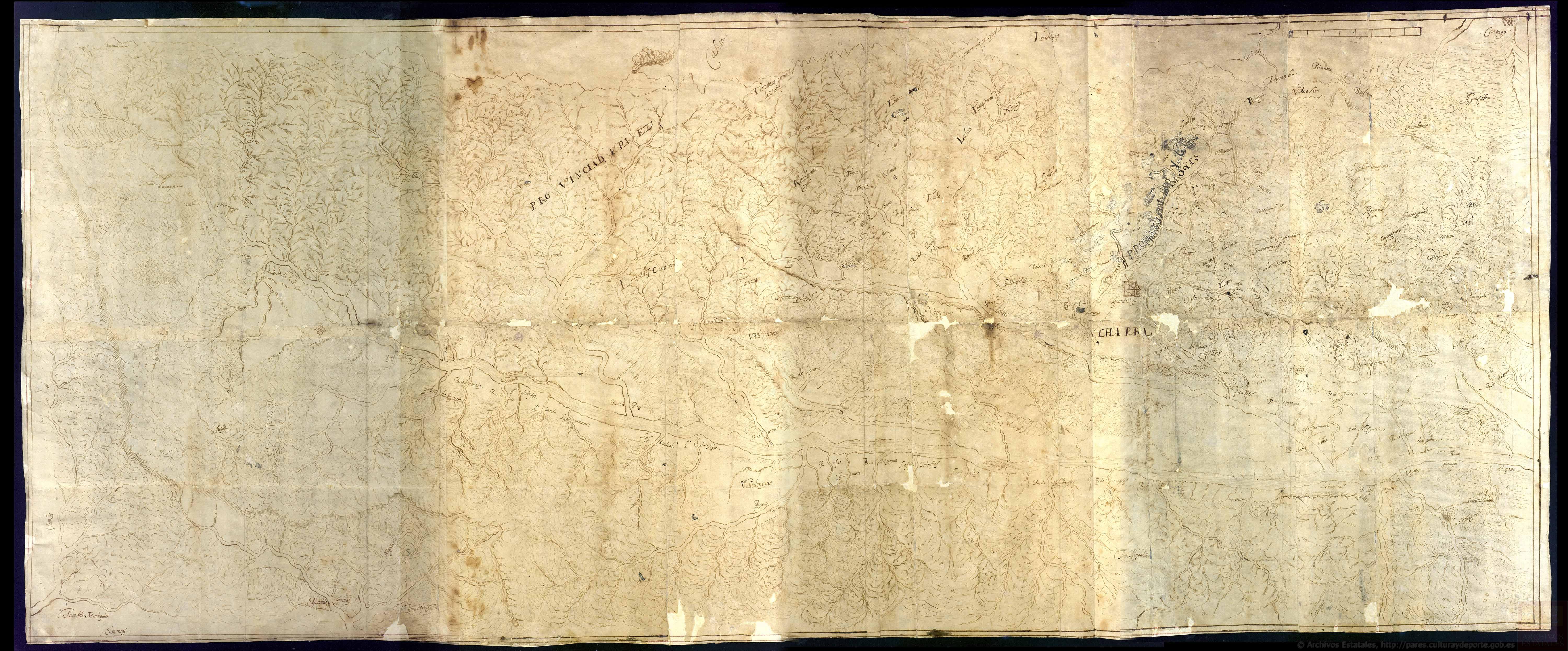
Discrepçion y mapa del territorio que ocupan los indios pijaos
Map 1608