
Citation
Burley, David V., Robyn P. Woodward, Shea Henry, and Ivor C. Conolley. "Jamaican Taíno Settlement Configuration at the Time of Christopher Columbus." Latin American Antiquity 28, no. 3 .2017. : 337-52. https://doi.org/10.1017/laq.2017.14.
![[Partie de l'Oyapock]](https://dnet8ble6lm7w.cloudfront.net/maps/FGU/FGU0054.jpeg)
[Partie de l'Oyapock]
Map 1700 - 1799![Plan que comprehende todo el terreno que ocupan los jentiles del Darién y Calidonia en la Costa del Norte y confines de las provincias immediatas, con todo lo que posee la de el Real de Santa María y Rios que derraman en el Grande de Chuchunaque según lo últimamente añadido por el Governad[o]r D[o]n Andrés Ariza, a el Plan que le entregó el Brigadier de Yngenieros D[o]n Antonio Arebalo con el suplemento a el de la situación de el Golfo de el Darién, Bocas, y derrames de el Rio Atrato, y de la costa hasta la Ensenada de Tolú para la ynteligencia de las ventajas que proporcionan las poblaciones que se deven establecer en aquellos parajes enmendado todo y formado en punto mayor por el cap[itá]n de Ynfantería D[o]n Antonio de la Torre;con la advertencia de que todo el Pais es muy fragoso de Montañas, por atrabesarle la Cordillera de los Andes](https://dnet8ble6lm7w.cloudfront.net/maps/COL/COL0077.jpg)
Plan que comprehende todo el terreno que ocupan los jentiles del Darién y Calidonia en la Costa del Norte y confines de las provincias immediatas, con todo lo que posee la de el Real de Santa María y Rios que derraman en el Grande de Chuchunaque según lo últimamente añadido por el Governad[o]r D[o]n Andrés Ariza, a el Plan que le entregó el Brigadier de Yngenieros D[o]n Antonio Arebalo con el suplemento a el de la situación de el Golfo de el Darién, Bocas, y derrames de el Rio Atrato, y de la costa hasta la Ensenada de Tolú para la ynteligencia de las ventajas que proporcionan las poblaciones que se deven establecer en aquellos parajes enmendado todo y formado en punto mayor por el cap[itá]n de Ynfantería D[o]n Antonio de la Torre;con la advertencia de que todo el Pais es muy fragoso de Montañas, por atrabesarle la Cordillera de los Andes
Map 1784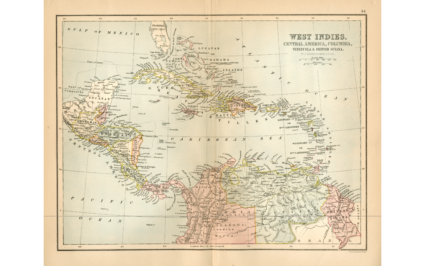
WEST INDIES;CENTRAL AMERICA;COLUMBIA;VENEZUELA & BRITISH GUIANA
Map 1876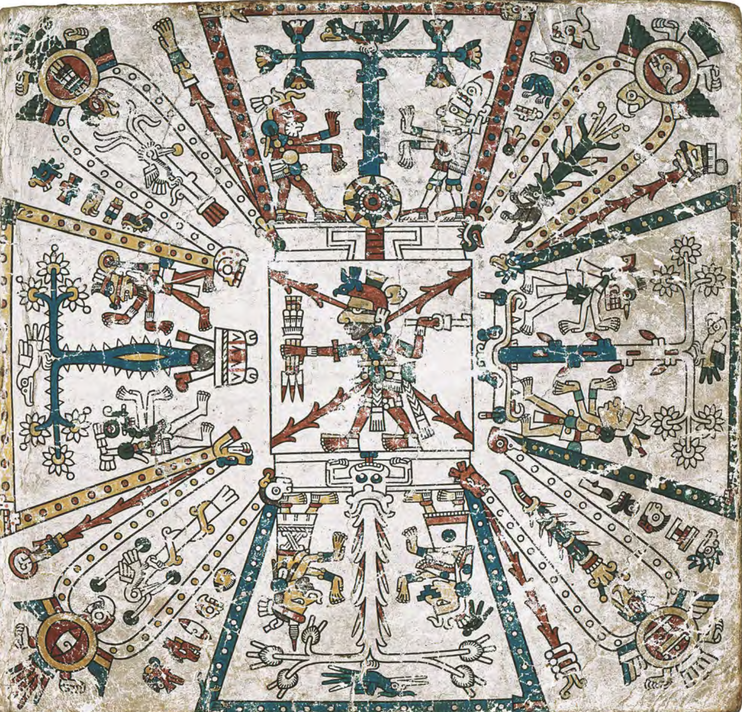
CÓDICE FEJÉRVARY-MAYER, FOLIO 1
Map 1400 - 1599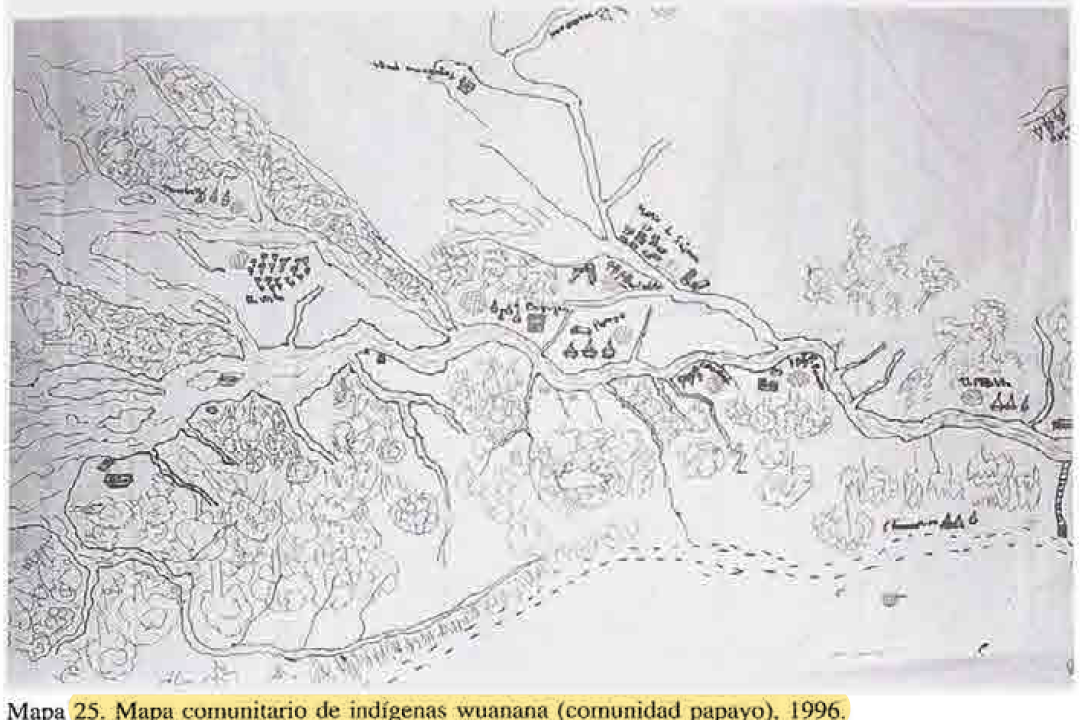
MAPA COMUNITARIA DE INDIGENAS WUANANA
Map 1996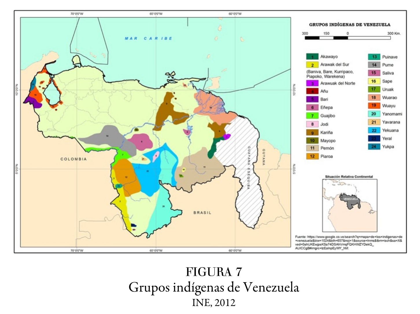
Grupos indígenas de Venezuela
Map 2012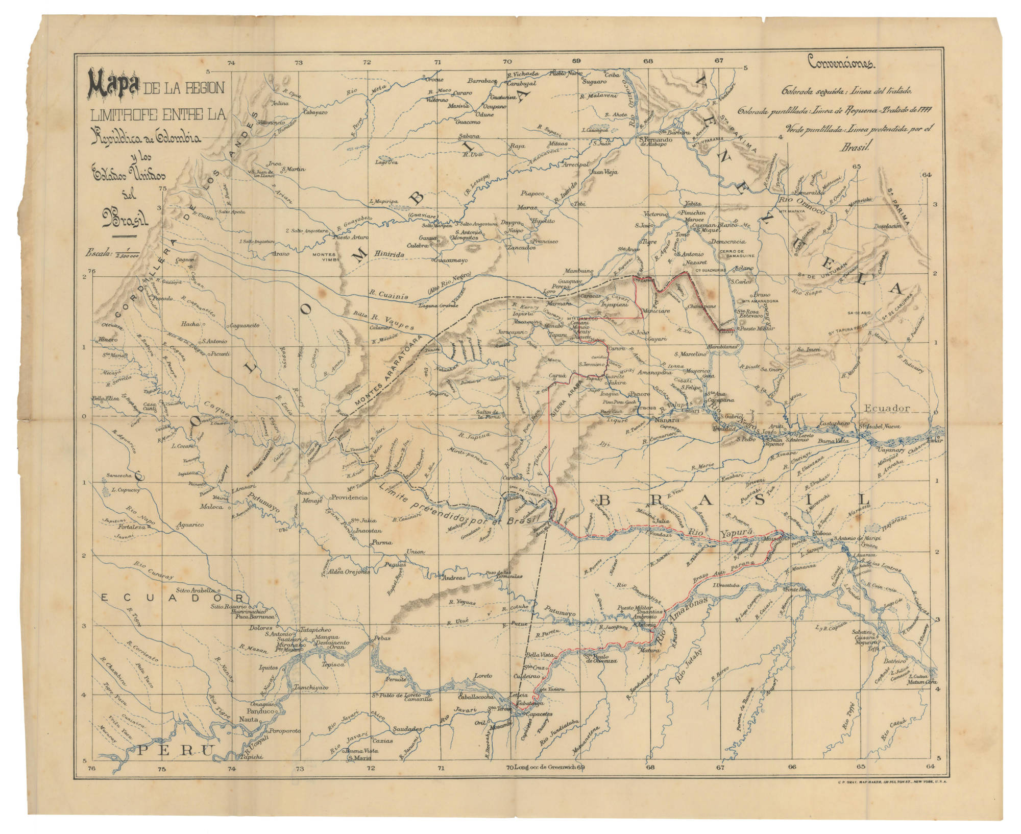
MAPA DE LA REGIÓN LIMÍTROFE ENTRE LA República de Colombia y los Estados Unidos de Brasil
Map 1900 - 1999![Preliminary Map;portion of north east [sic] Nicaragua: Brown's Camp to Pis Pis District.](https://dnet8ble6lm7w.cloudfront.net/maps/NIC/NIC0040.jpg)
Preliminary Map;portion of north east [sic] Nicaragua: Brown's Camp to Pis Pis District.
Map 1927