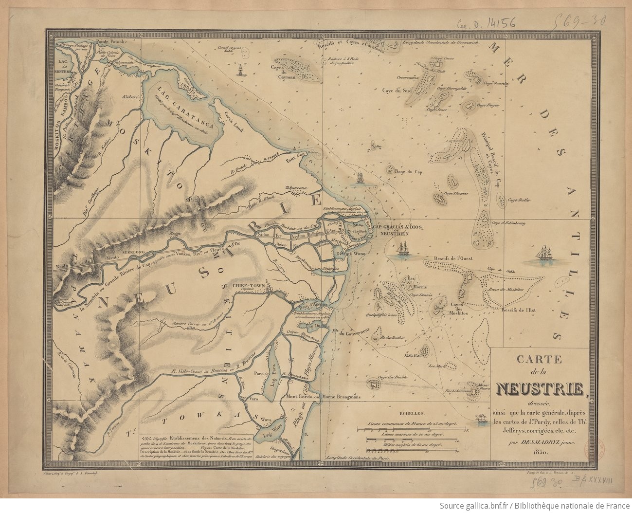
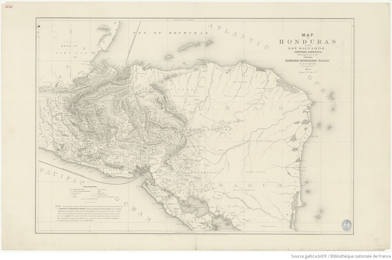
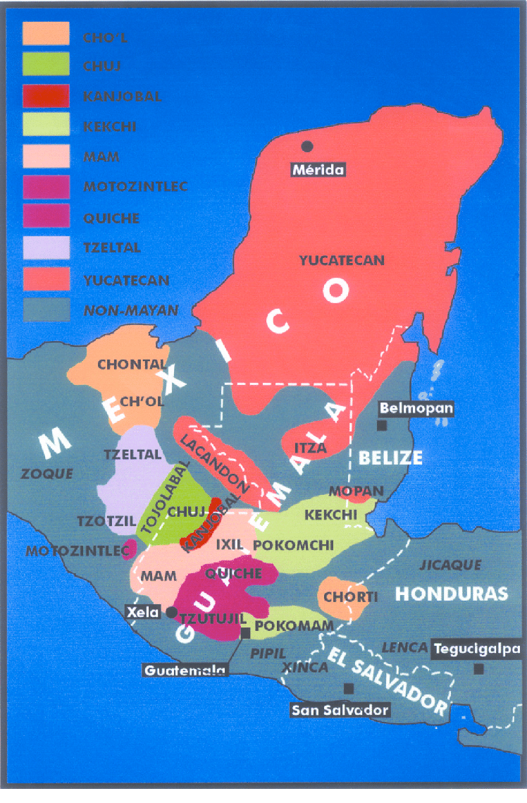
Dispossesions in the Americas

Dispossesions in the Americas

  • Home
  • Explore
  • About
  • Authors
  • Art
  • Bodies
  • Curricula
  • Cultural Heritage
  • Maps
  • Territories
Back to Explore
Map 1854

Map of Honduras and San Salvador, Central America, Showing the line of the proposed Honduras Interoceanic Railway

  • SQUIER, EPHRAIM GEORGE;HITCHCOCK, D.C.

Published: 1854

  • Download Image

Peoples

  • XICAQUE
  • THUACOS
  • JUACOS
  • CARIB
  • SECO
  • POYAS
  • PAYAS
  • SAMBOS
  • TOACAS
  • TOWKAS
  • COOKRA
  • WOOLWA
  • RAMA
  • CHONTALES

Citation

Squier, E.G. Map of Honduras and San Salvador, Central America, Showing the line of the proposed Honduras Interoceanic Railway. Map. New York, USA, 1854. Accessed August 10, 2023. https://gallica.bnf.fr/ark:/12148/btv1b53171836z/f1.item.r=Honduras.zoom#.

  • Download Image

Reading in Spanish

Map 1854

Map of Honduras and San Salvador, Central America, Showing the line of the proposed Honduras Interoceanic Railway

  • SQUIER, EPHRAIM GEORGE;HITCHCOCK, D.C.

Published: 1854

  • Download Image
  • Download Image

Related Content

Insulae Americanae in Oceano Septentrionali ac Regiones Adiacentes, a C. de May usque ad Lineam Aequinoctialem.

Insulae Americanae in Oceano Septentrionali ac Regiones Adiacentes, a C. de May usque ad Lineam Aequinoctialem.

Map 1700 - 1799
Croquis III. (b) La región andina septentrional ecuatoriana (Moreno Yanez;1989;2)

Croquis III. (b) La región andina septentrional ecuatoriana (Moreno Yanez;1989;2)

Map -500 - 1530
MAPAS DAS PROVINCIAS ETNOGRÁFICAS NO TERRITÓRIO DO RIO GRANDE DO SUL

MAPAS DAS PROVINCIAS ETNOGRÁFICAS NO TERRITÓRIO DO RIO GRANDE DO SUL

Map 1500 - 1600
Mapa de los pueblos indigenas Bolivia

Mapa de los pueblos indigenas Bolivia

Map 2010
ZENU

ZENU

Map
Rio De La Plata, Uruguay, Southern Brazil

Rio De La Plata, Uruguay, Southern Brazil

Map 1720 - 1760
PUEBLO OLUTECO

PUEBLO OLUTECO

Map 2020
PUEBLO MAM

PUEBLO MAM

Map 2020

Dispossessions in the Americas

A project by

University of Pennsylvania

Copyright 2024

With support from

Mellon Foundation

Site design & development

Element 84

Art Credits

Squier, E.G. Map of Honduras and San Salvador, Central America, Showing the line of the proposed Honduras Interoceanic Railway. Map. New York, USA, 1854. Accessed August 10, 2023. https://gallica.bnf.fr/ark:/12148/btv1b53171836z/f1.item.r=Honduras.zoom#.

Site Pages

  • Home
  • Explore
  • About
  • Authors
  • Art
  • Bodies
  • Curricula
  • Cultural Heritage
  • Maps
  • Territories