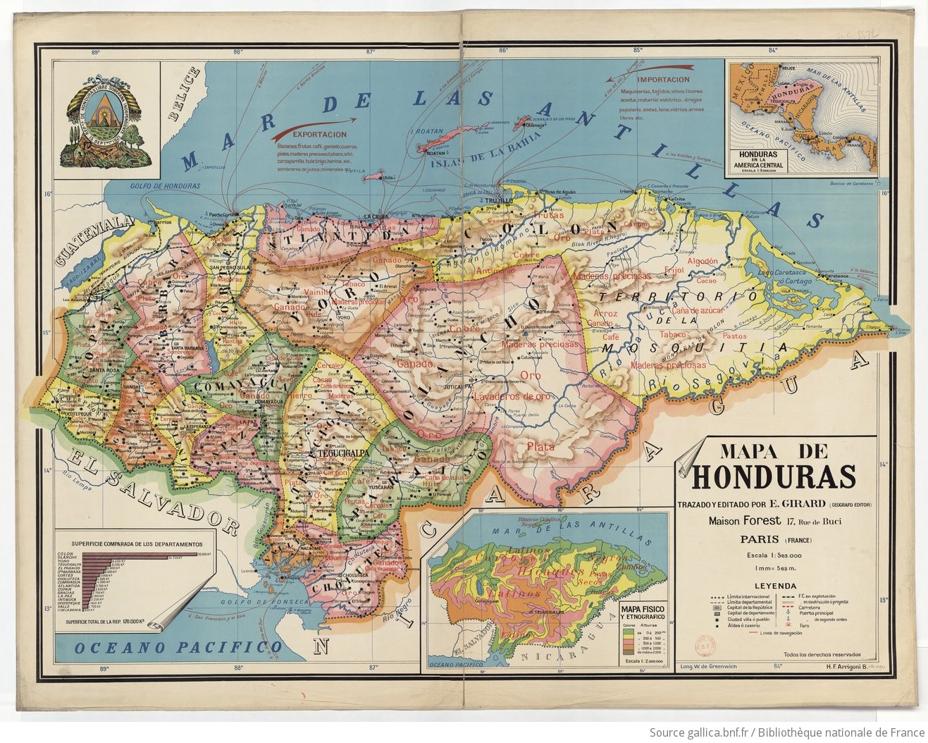
Peoples
- HICAQUES
- TOACAS
- SECOS
- PAYAS
- NEGROS
- ZAMBOS
- CARIBES
Citation
Girard, E. Mapa de Honduras. Map. Paris, France, 1929. Accessed August 10, 2023. https://gallica.bnf.fr/ark:/12148/btv1b53065318x.r=Honduras?rk=321890;0.
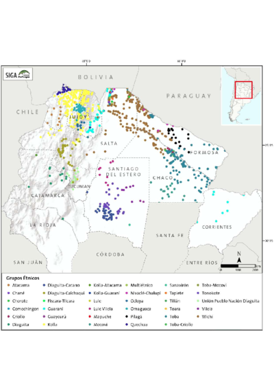
Etnias Norte Grande
Map 2015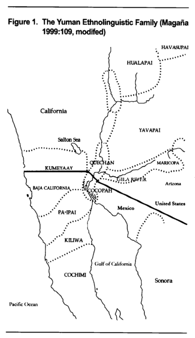
The Yuman Ethnolinguistic Family
Map 2016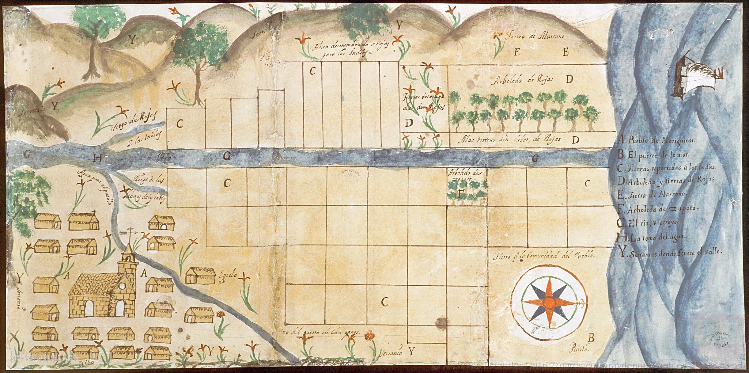
Plano del pueblo de Mariguitar y de las tierras repartidas a los indios
Map 1703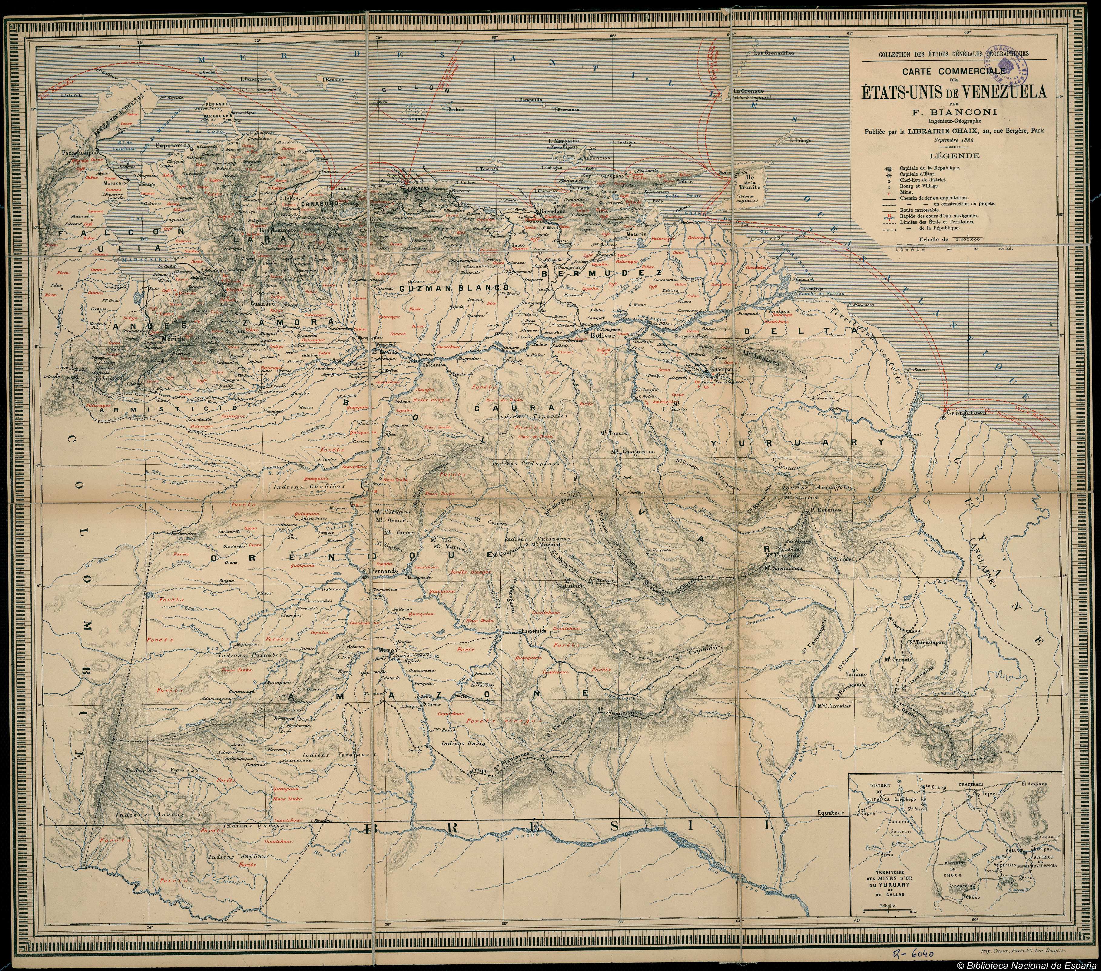
CARTE COMMERCIALE des ÉTATS UNIS de VENEZUELA
Map 1888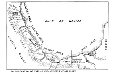
Location of Nahuat Area on Gulf Coast Plain
Map 1969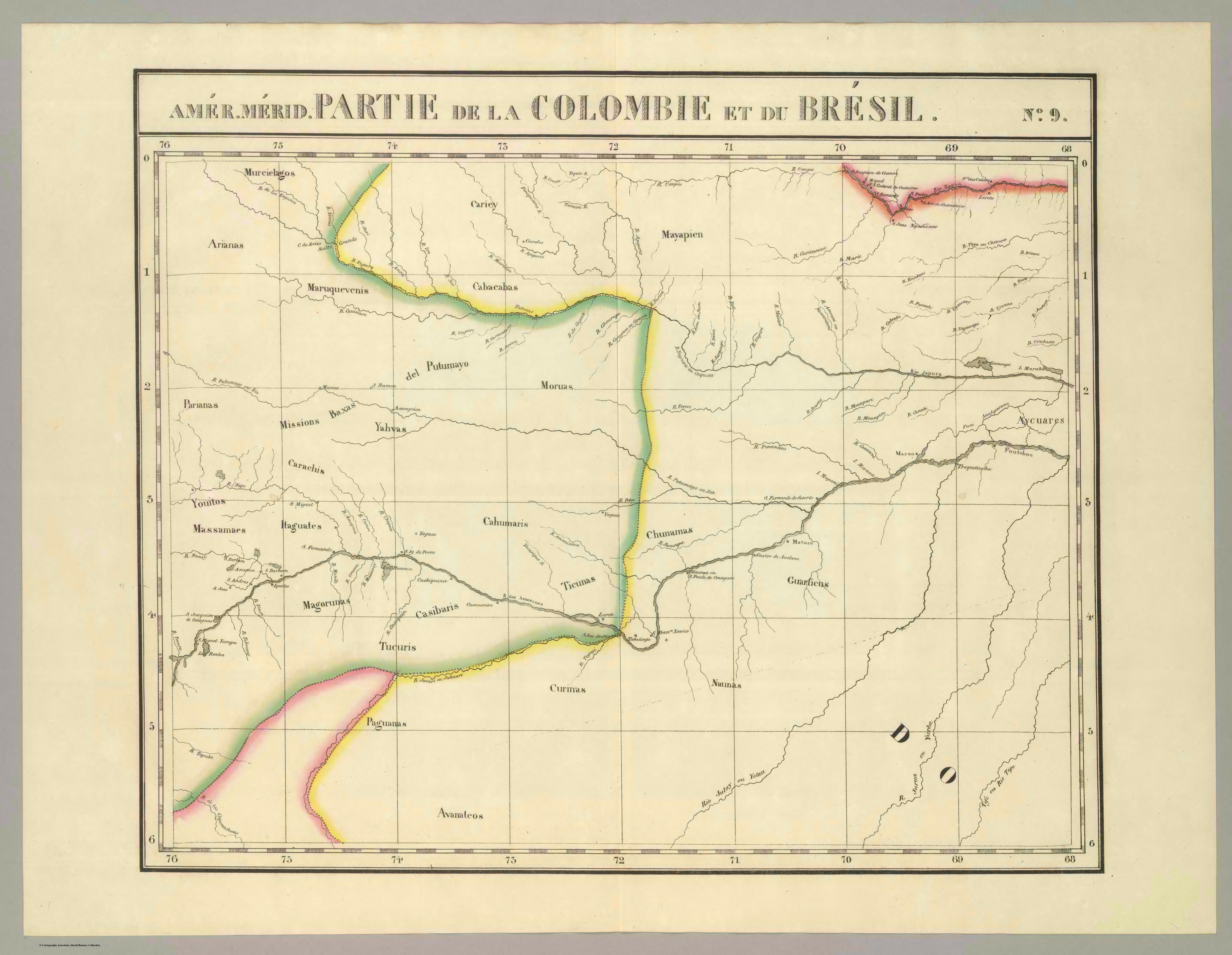
Partie de la Colombie et du Bresil. Amer. Merid. no. 9. (Dresse par Ph. Vandermaelen;lithographie par H. Ode. Cinquieme partie - Amer. merid. Bruxelles. 1827)
Map 1827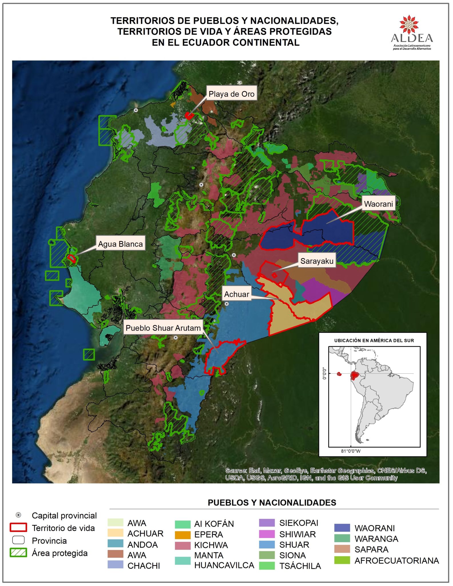
TERRITORIOS DE LOS PUEBLOS Y NACIONALIDADES;TERRITORIOS DE VIDA Y AREAS PROTEGIDAS EN EL ECUADOR CONTINENTAL
Map 2016 - 2018![Ani Xeati de los animales [Ani Xeati of the Animals]](https://dnet8ble6lm7w.cloudfront.net/art_sm/APER062.png)
Ani Xeati de los animales [Ani Xeati of the Animals]
Artwork