Peoples
- MOSQUITO
Citation
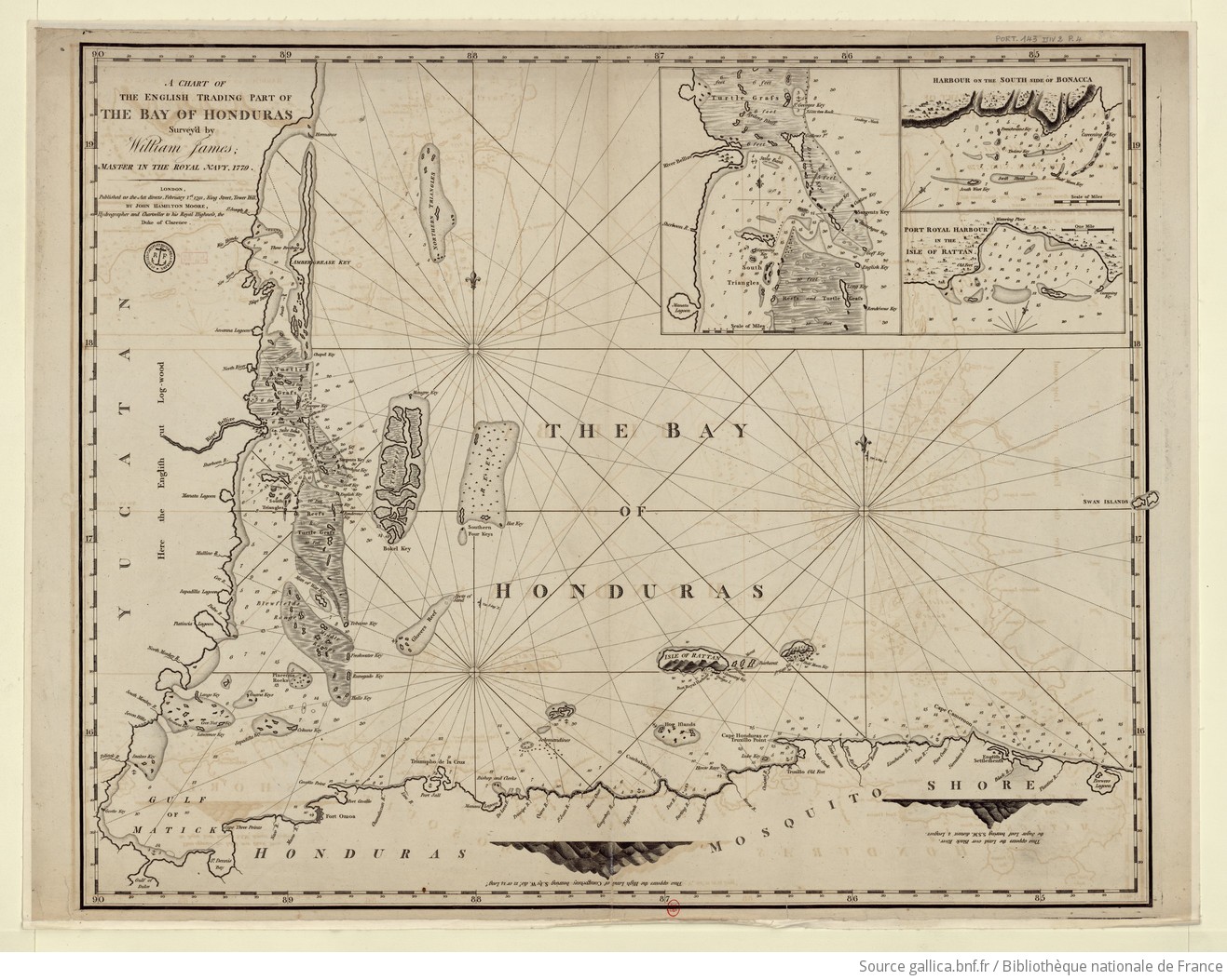
James, William. A chart of the English trading part of the bay of Honduras. Map. London, England: John Hamilton Moore, 1791. Accessed August 6, 2023. https://gallica.bnf.fr/ark:/12148/btv1b5970793n/f1.item.r=Honduras.zoom#.
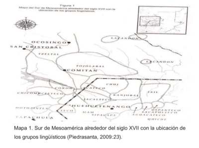
Sur de Mesamérica alrededor del siglo XVII con los grupos lingüísticos
Map 1800 - 1900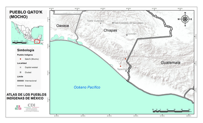
PUEBLO QATO'K
Map 2020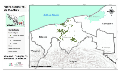
PUEBLO CHONTAL DE TABASCO
Map 2020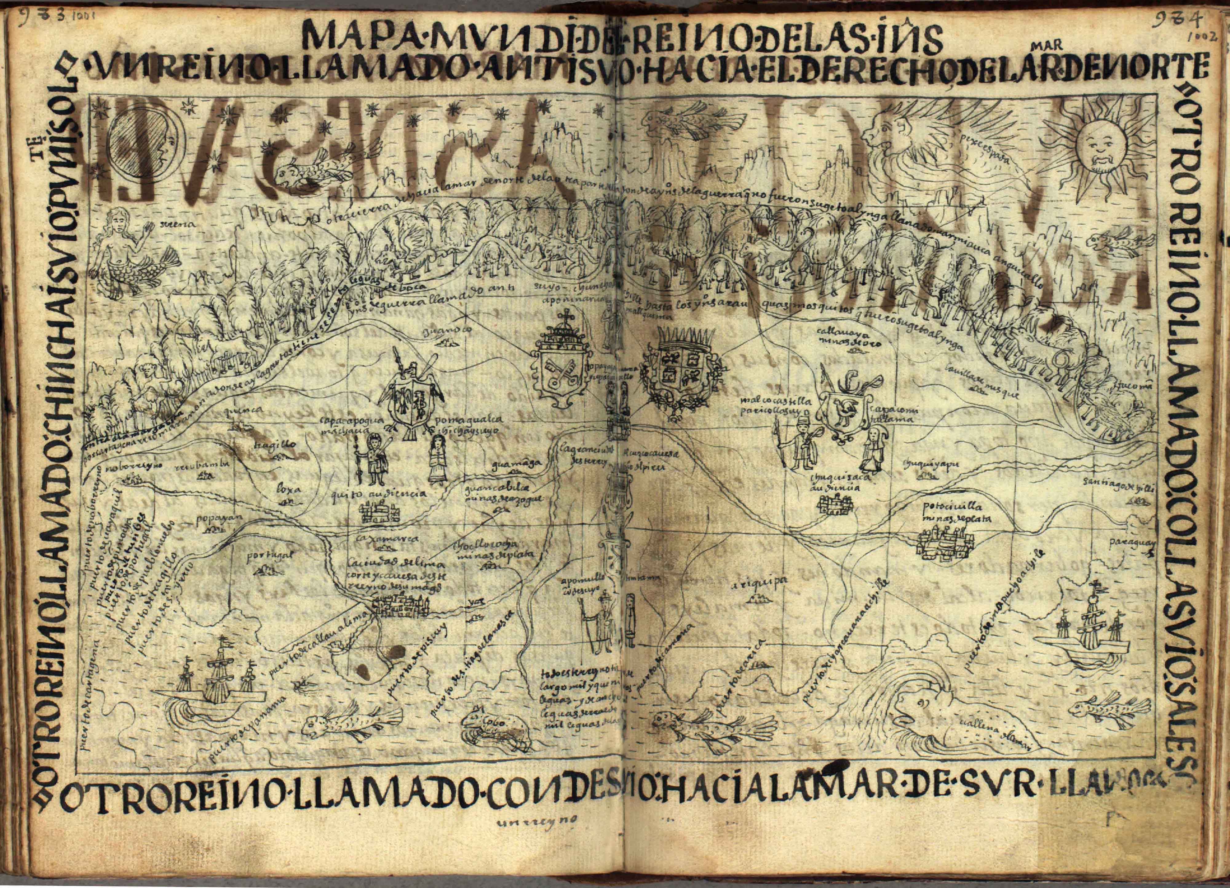
Mapa Mundi
Map 1615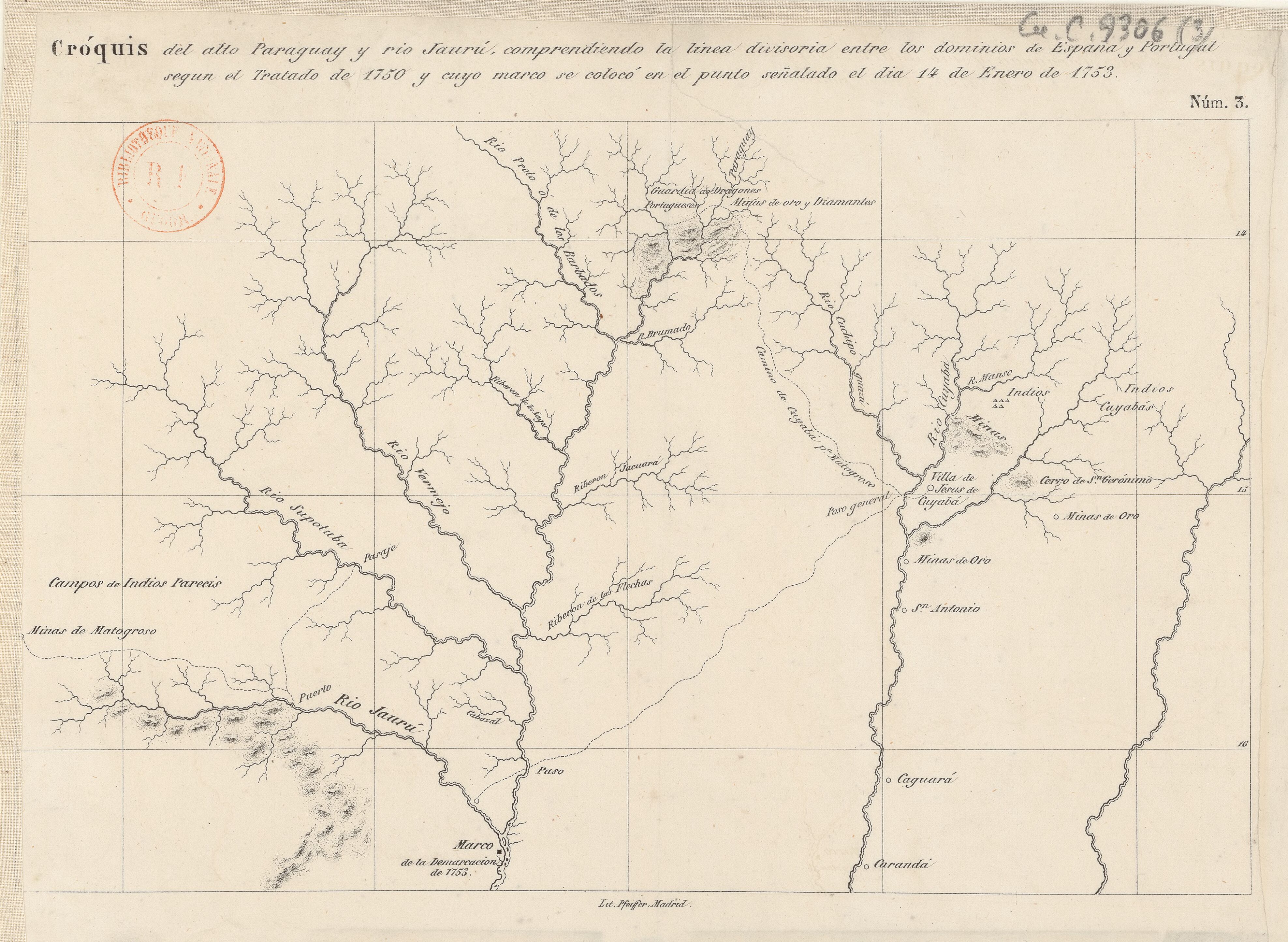
Cróquis del alto Paraguay y rio Jaurú, comprendiendo la linea divisoria entre los dominios de España y Portugal según el Tratado de 1750 y cuyo marco se colocó en el punto señalado el día 14 de Enero de 1753.
Map 1750 - 1850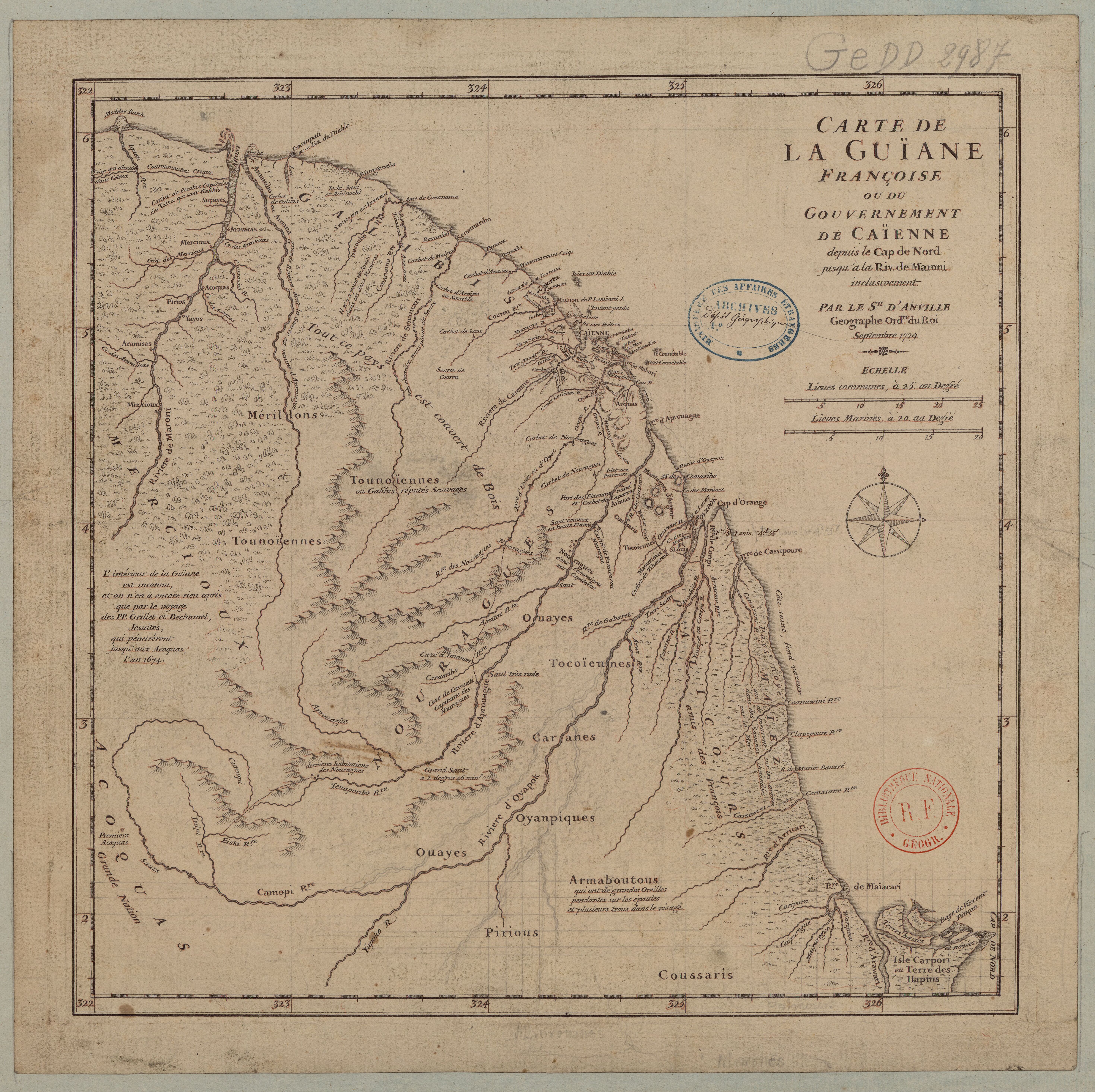
Carte de la Guïane françoise ou du gouvernement de Caïenne depuis le Cap de Nord jusqu'àla rivière de Maroni inclusivement.
Map 1729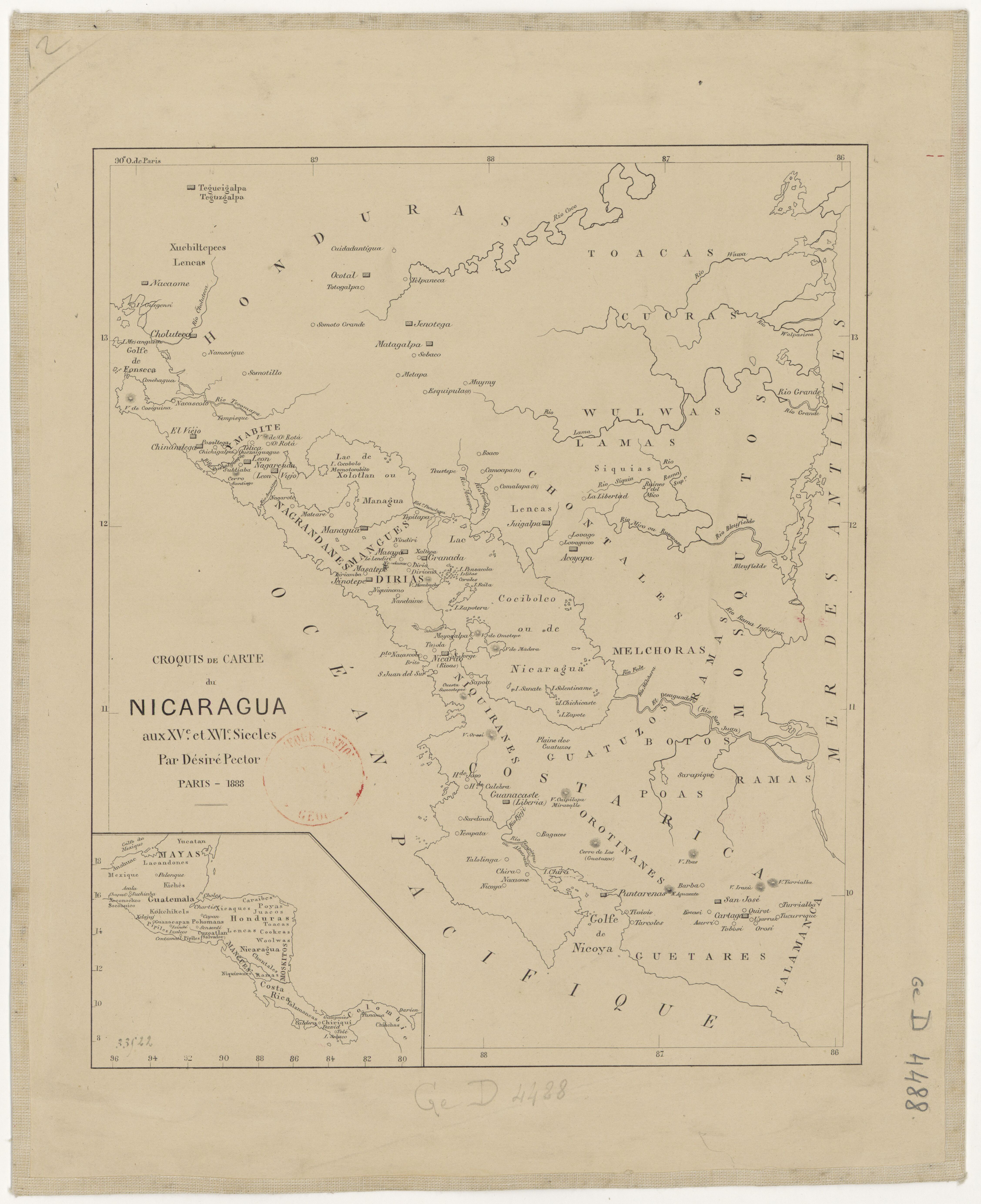
Croquis de carte du Nicaragua aux XVe et XVIe siécles/ par Désiré Pector.
Map 1880 - 1888![Tierra de nadie [No Man's Land]](https://dnet8ble6lm7w.cloudfront.net/art_sm/AMEX011.png)
Tierra de nadie [No Man's Land]
Artwork