
Peoples
- TAWAHKA
Citation
Davidson, William V. Ethnic Geography of Honduras, 2001: Tables and Maps based on the National Census. Memphis, TN, 2011. PDF. http://williamvdavidson.com/pdf/Ethnic-Geography-of-Honduras-2001-Davidson.pdf
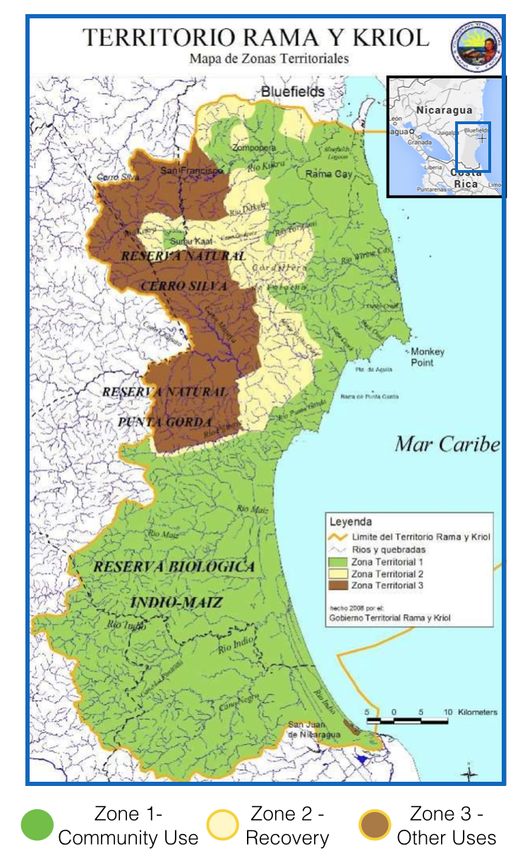
Territorio Rama y Kriol: Mapa de Zonas Territoriales. Three Zones proposed by the PADA to ensure a sustainable future for the communities of Rama and Kriol
Map 2000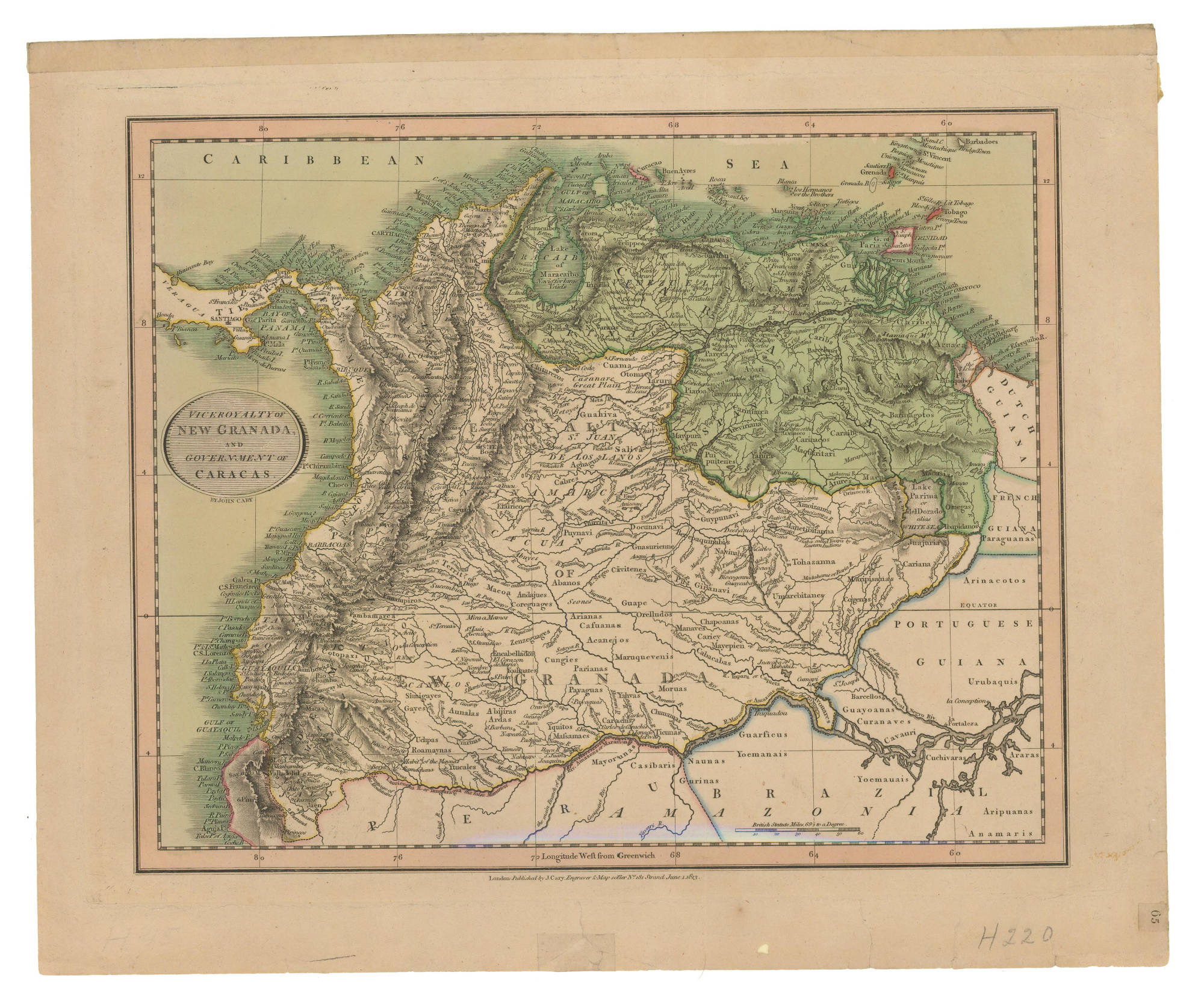
VICEROYALTY OF NEW GRANADA AND GOVERNMENT OF CARACAS
Map 1813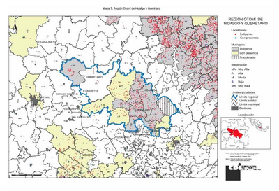
REGIÓN OTOMI DE HIDALGO Y QUERETARO
Map 2000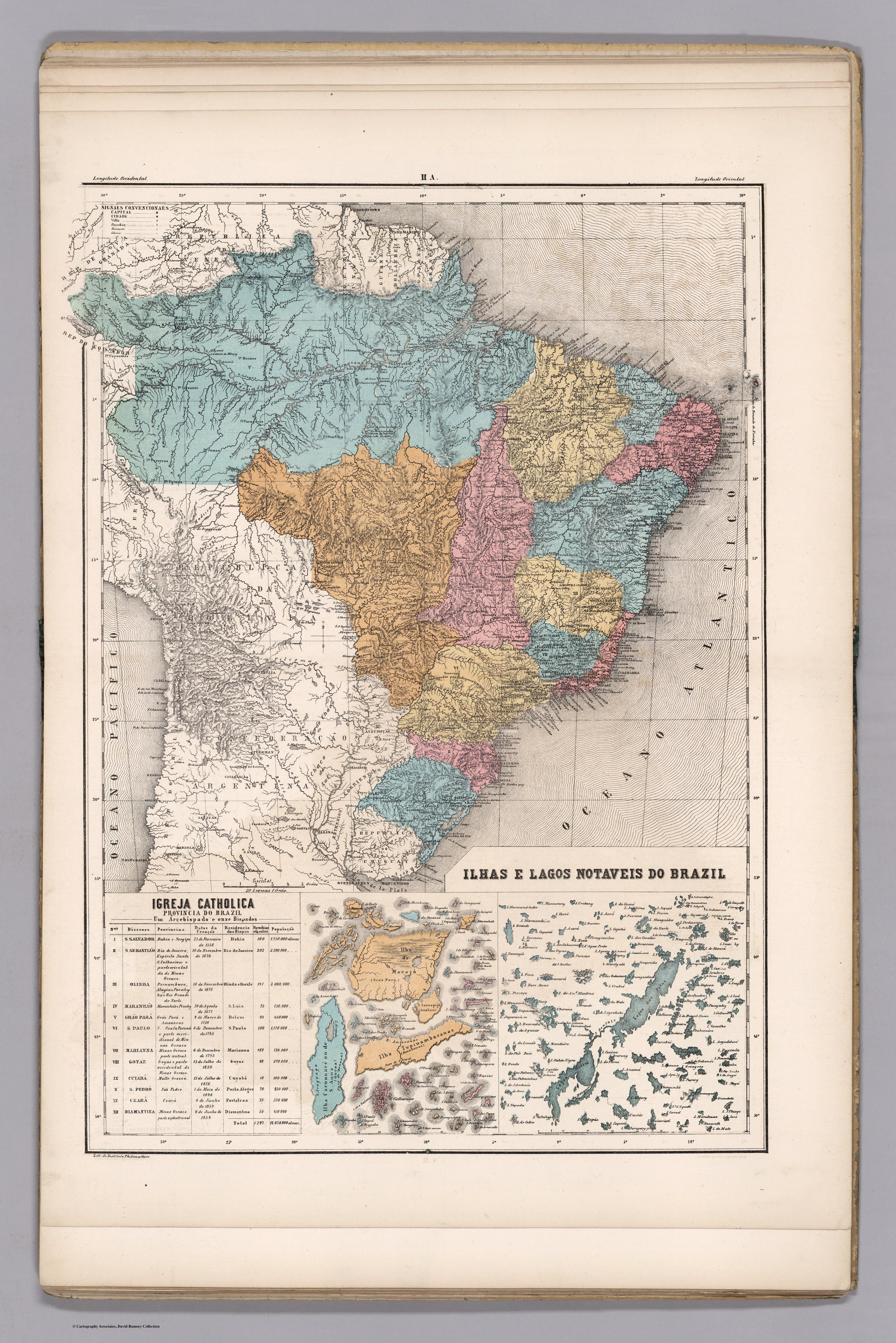
ILHAS E LAGOS NOTAVEIS DO BRAZIL
Map 1800 - 1899
Carte Du Bresil. Prem. Partie ;Depuis la Riviere des Amazones jusquà la Baye de Tous les Sants;Pour servir à l'Histoire Générale des Voyages
Map 1700 - 1750
Carte de la Moskitie oú se fonde la Neustrie
Map 1830
TERRITORIO TEÄRIME SIRI’KOI AERIME SUITITI
Map 2012
Pueblos Indios del Norte Chico y Zona Central de Chile en el Siglo XVI y XVII
Map 1500 - 1600