
Peoples
- TOLUPAN
Citation
Davidson, William V. Ethnic Geography of Honduras, 2001: Tables and Maps based on the National Census. Memphis, TN, 2011. PDF. http://williamvdavidson.com/pdf/Ethnic-Geography-of-Honduras-2001-Davidson.pdf
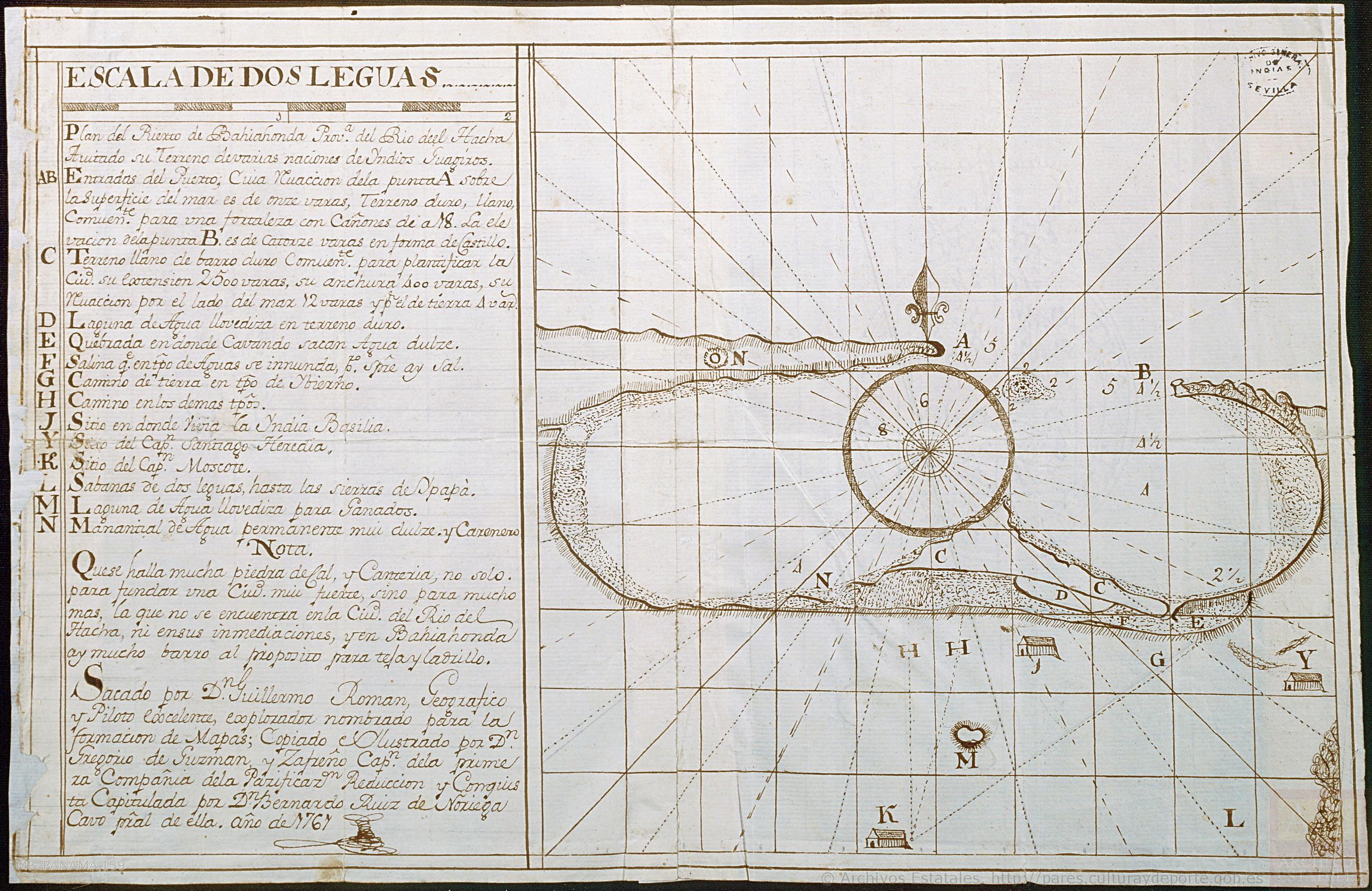
Plan del Puerto de Bahiahonda, Provincia del Rio del Hacha, Auitado su terreno de varias naciones de Yndios Guagiros
Map 1761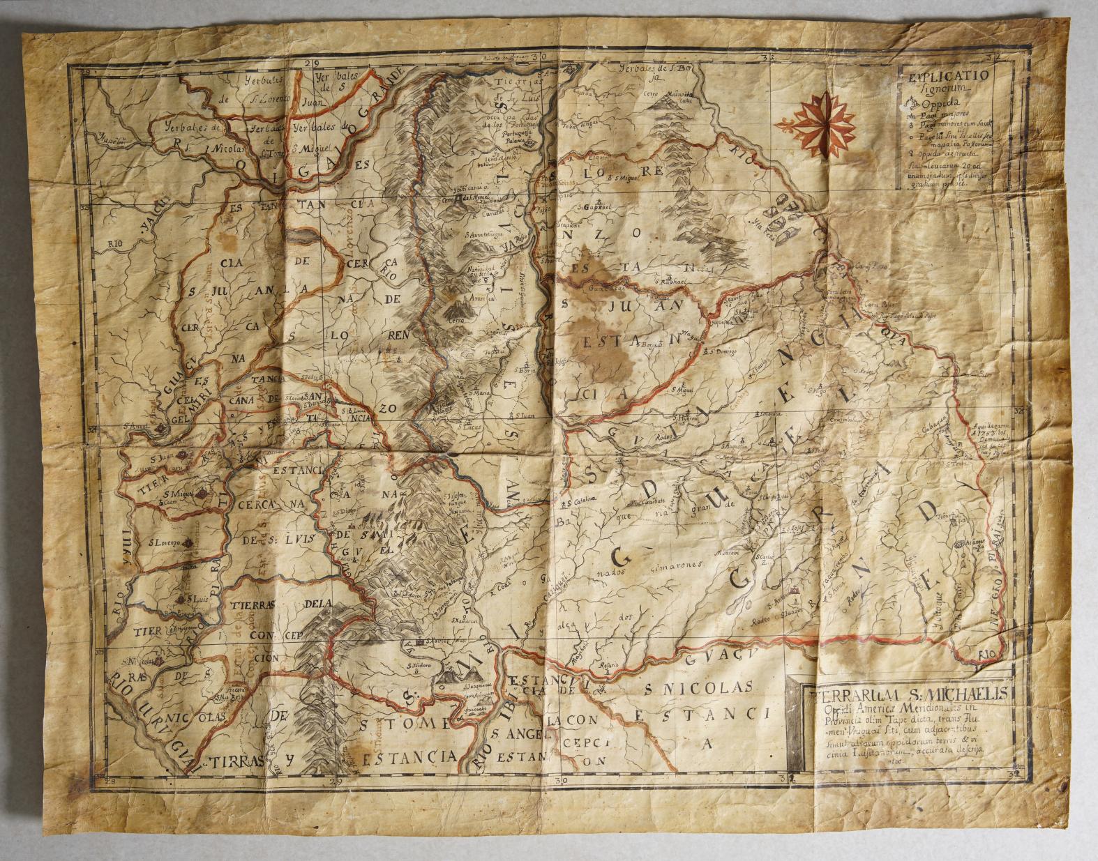
TERRARUM S: MICHAELIS oppidi Americae meridionalis in provincia olim Tape dicta, trans Flumen Vruguai siti, cum adjacentibus simul aliorum oppidorum terris & vicinia Lusitanorum, accurata descriptio.
Map 1750 - 1760![El punto de no retorno [The Point of No Return]](https://dnet8ble6lm7w.cloudfront.net/art_sm/ACOL020.png)
El punto de no retorno [The Point of No Return]
Artwork![Retrato de Lourdes [Portrait of Lourdes]](https://dnet8ble6lm7w.cloudfront.net/art/ABRA023.jpg)
Retrato de Lourdes [Portrait of Lourdes]
Artwork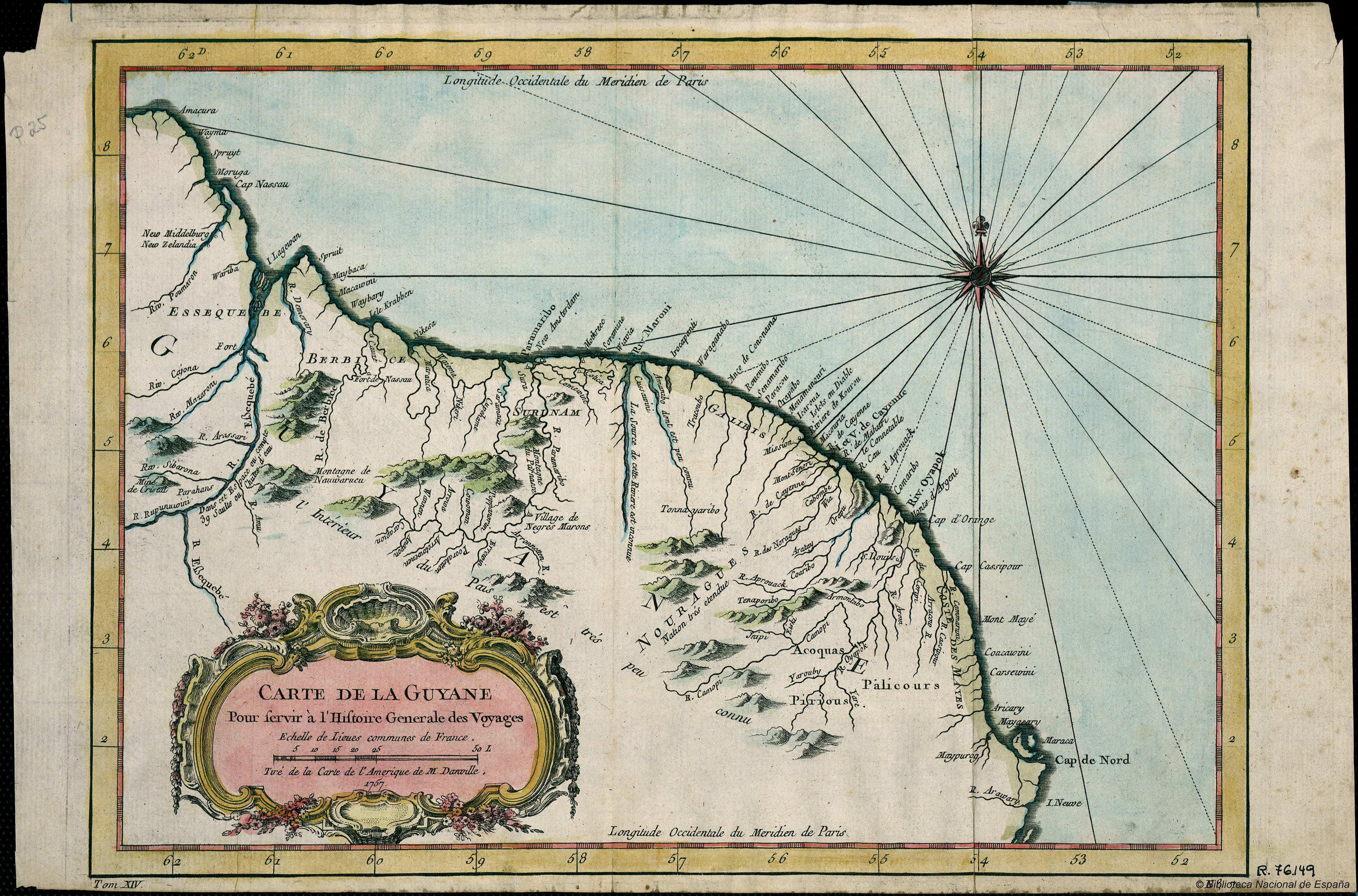
Carte de la Guyana pour servir à l'Histoire Generale des Voyages.
Map 1757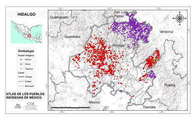
HIDALGO
Map 2015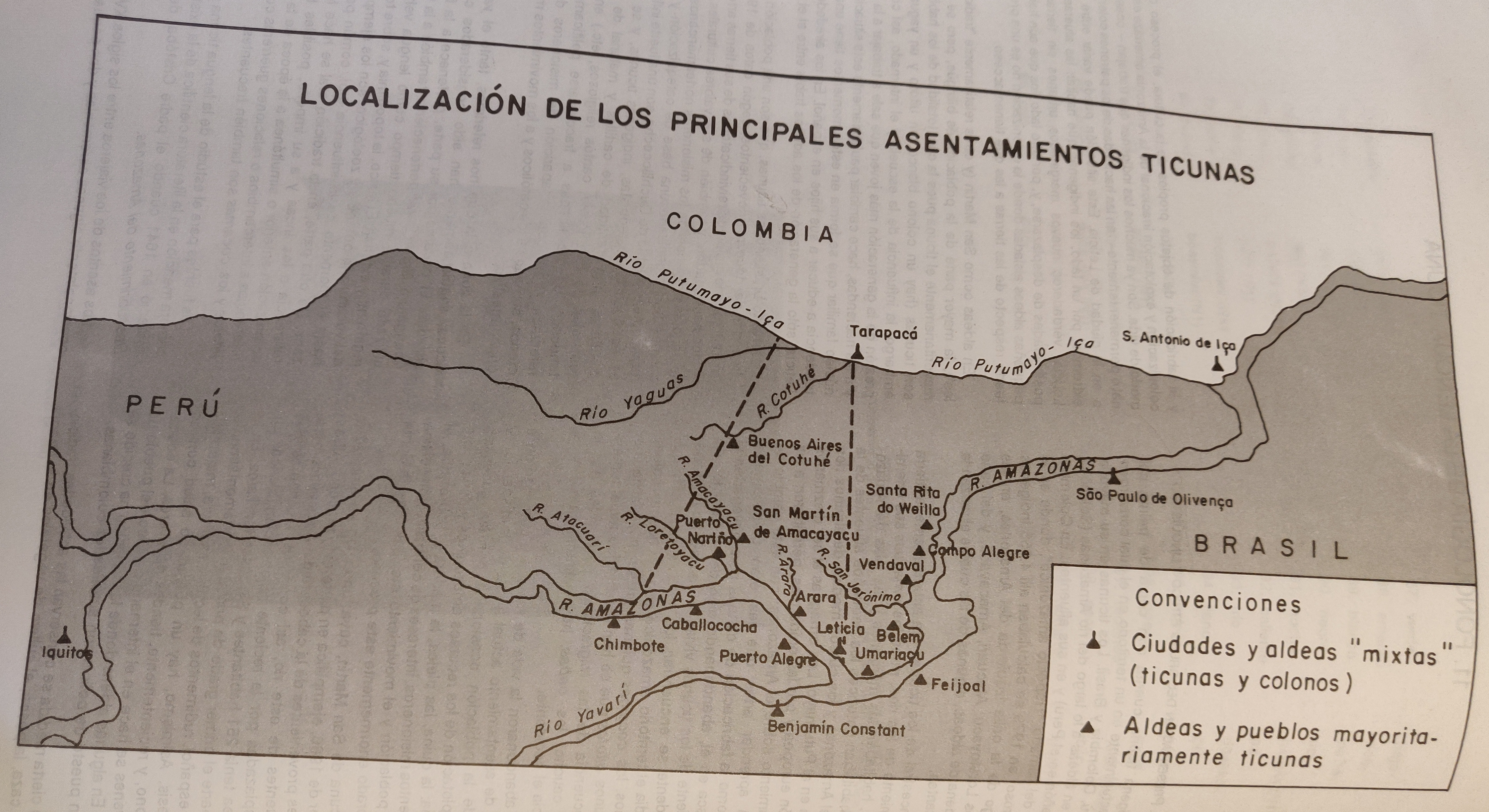
LOCALIZACIÓN DE LOS PRINCIPALES ASENTAMIENTOS TICUNAS
Map 2000
Serie Fatherland / Padre Patria
Artwork