Peoples
- CHORTI
Citation
Davidson, William V. Ethnic Geography of Honduras, 2001: Tables and Maps based on the National Census. Memphis, TN, 2011. PDF. http://williamvdavidson.com/pdf/Ethnic-Geography-of-Honduras-2001-Davidson.pdf
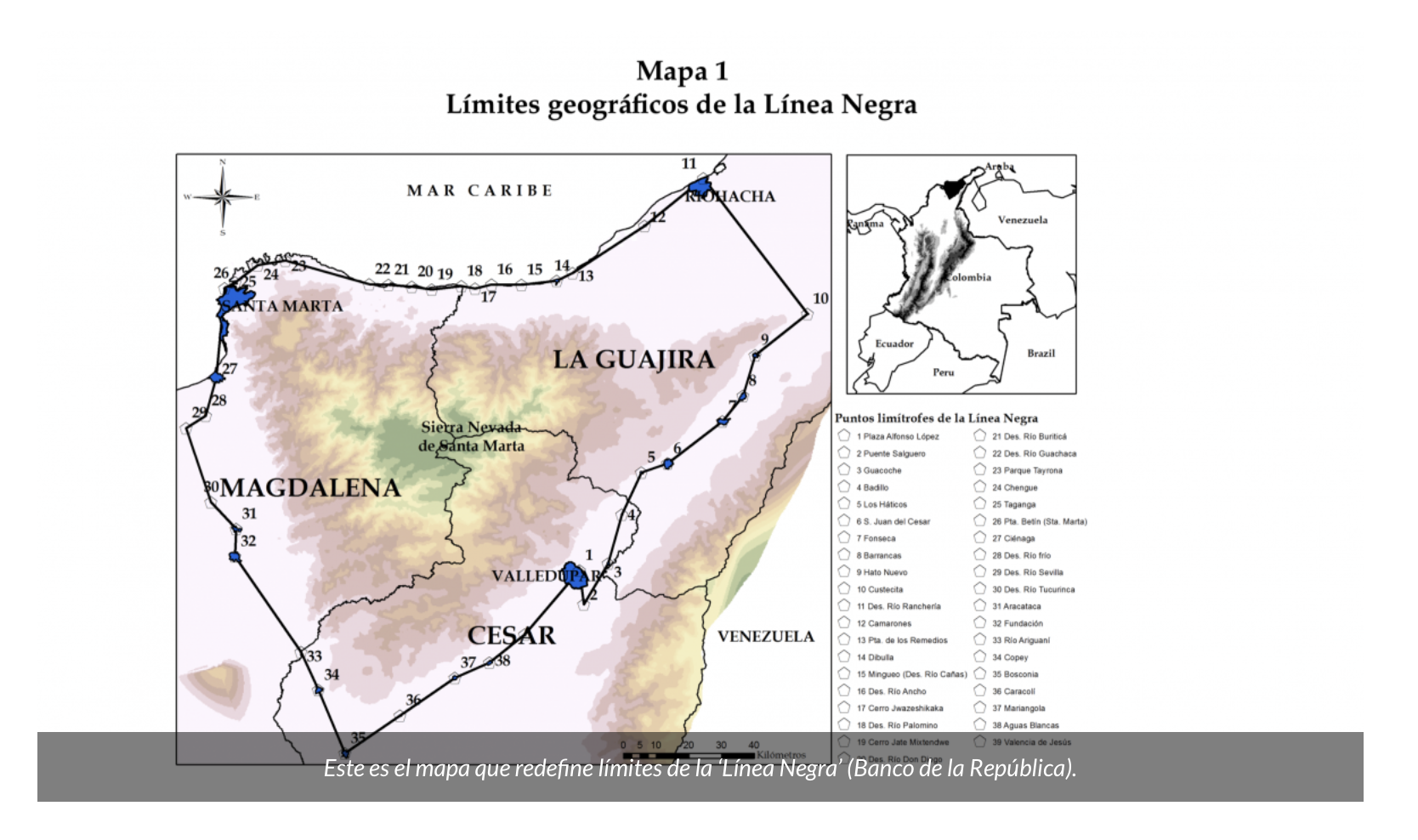
MAPA 1 LÍMITES GEOGRAFICOS DE LA LÍNEA NEGRA
Map 2018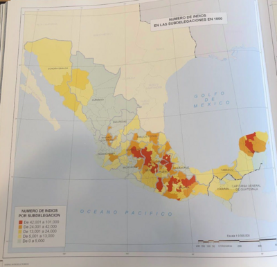
NÚMERO DE INDIOS EN LAS SUBDELEGACIONES EN 1800
Map 1800
Fig. 1 Map of the Guianas with schematic locations of the indigenous groups relevant to our study, based on the linguistic map of South America (http://www.muturzikin.com/cartesamerique/ 7.htm). Carib-speaking groups are indicated in yellow, Arawak-speaking groups in blue, Tupi-speaking Wayãpi in pink and the Warao-speaking group in green
Map 2000 - 2024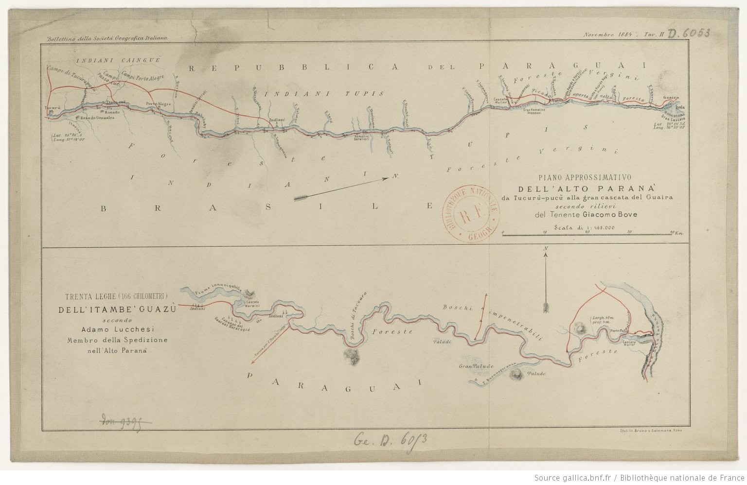
PIANO APPROSSIMATIVO DELL’ ALTO PARANA` da Tucurù-pucù alla gran cascata del Guaira
Map 1884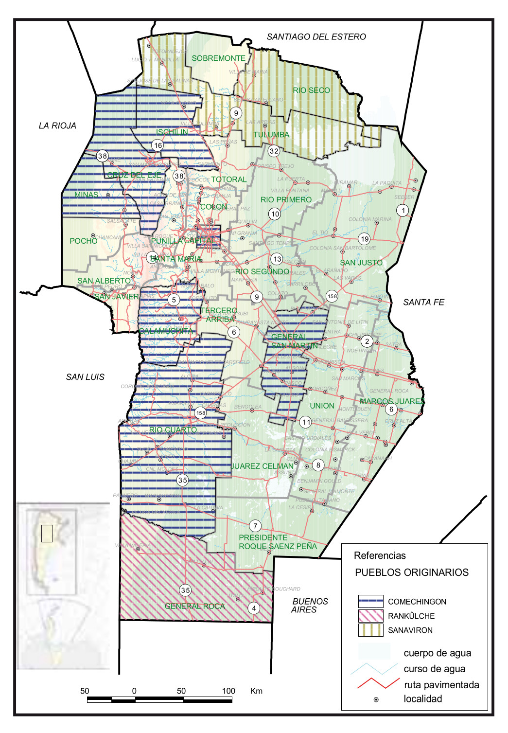
Pueblos Originarios, Córdoba
Map 2016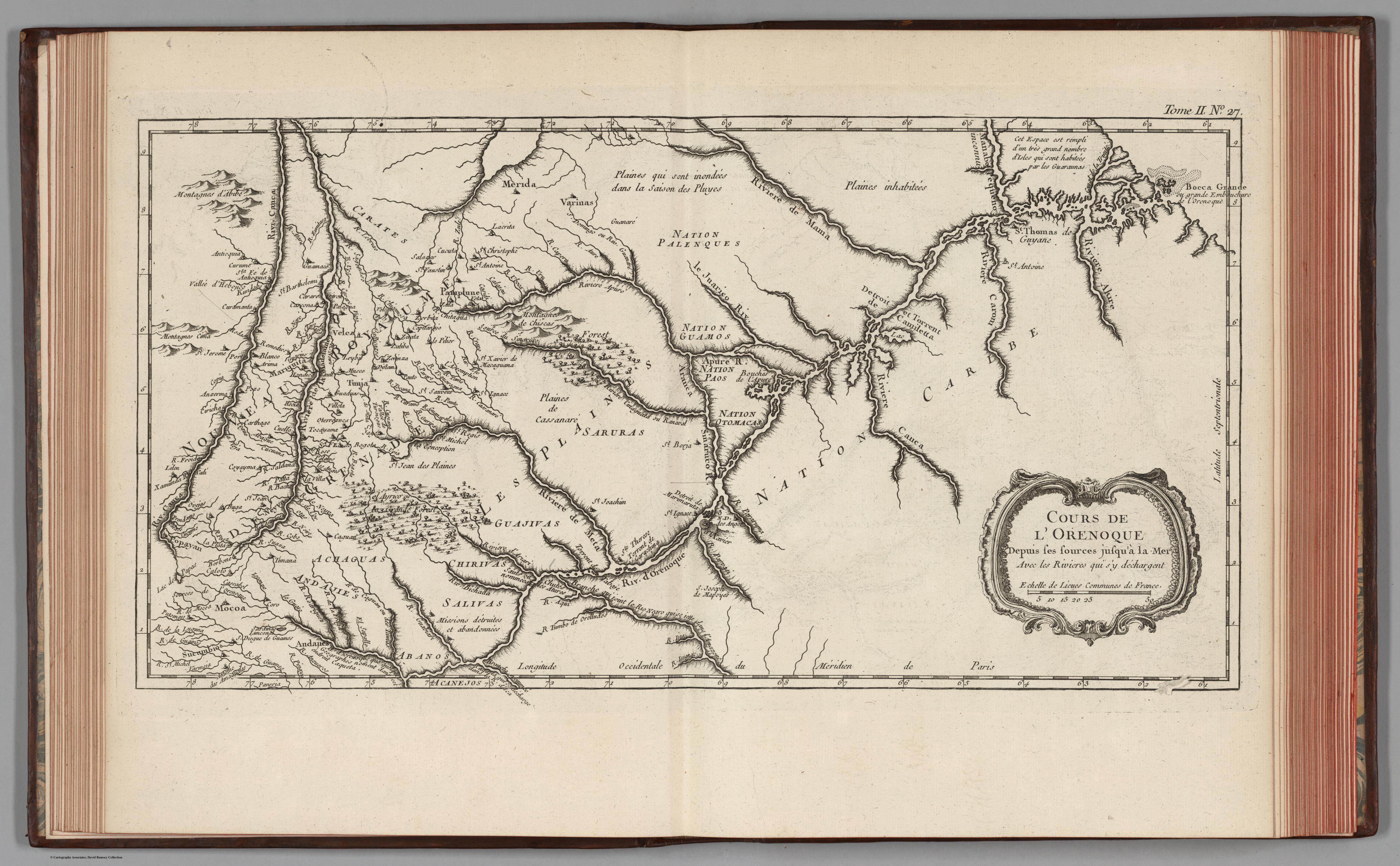
Cours de l’Orenoque Depuis ses sources jusqu'à la Mer Avec les Rivieres qui s'y déchargent
Map 1764
PUEBLO MIXE
Map 2020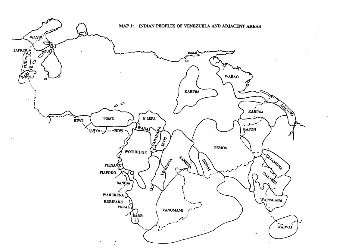
INDIAN PEOPLES OF VENEZUELA AND ADJACENT AREAS
Map 1995