Peoples
- GARIFUNA
Citation
Davidson, William V. Ethnic Geography of Honduras, 2001: Tables and Maps based on the National Census. Memphis, TN, 2011. PDF. http://williamvdavidson.com/pdf/Ethnic-Geography-of-Honduras-2001-Davidson.pdf
Die LANDSCHAFT nider = Paraguaria
Map 1728
CARACCAS AND GUIANA
Map 1814
ESTADOS UNIDOS DO BRAZIL
Map 1902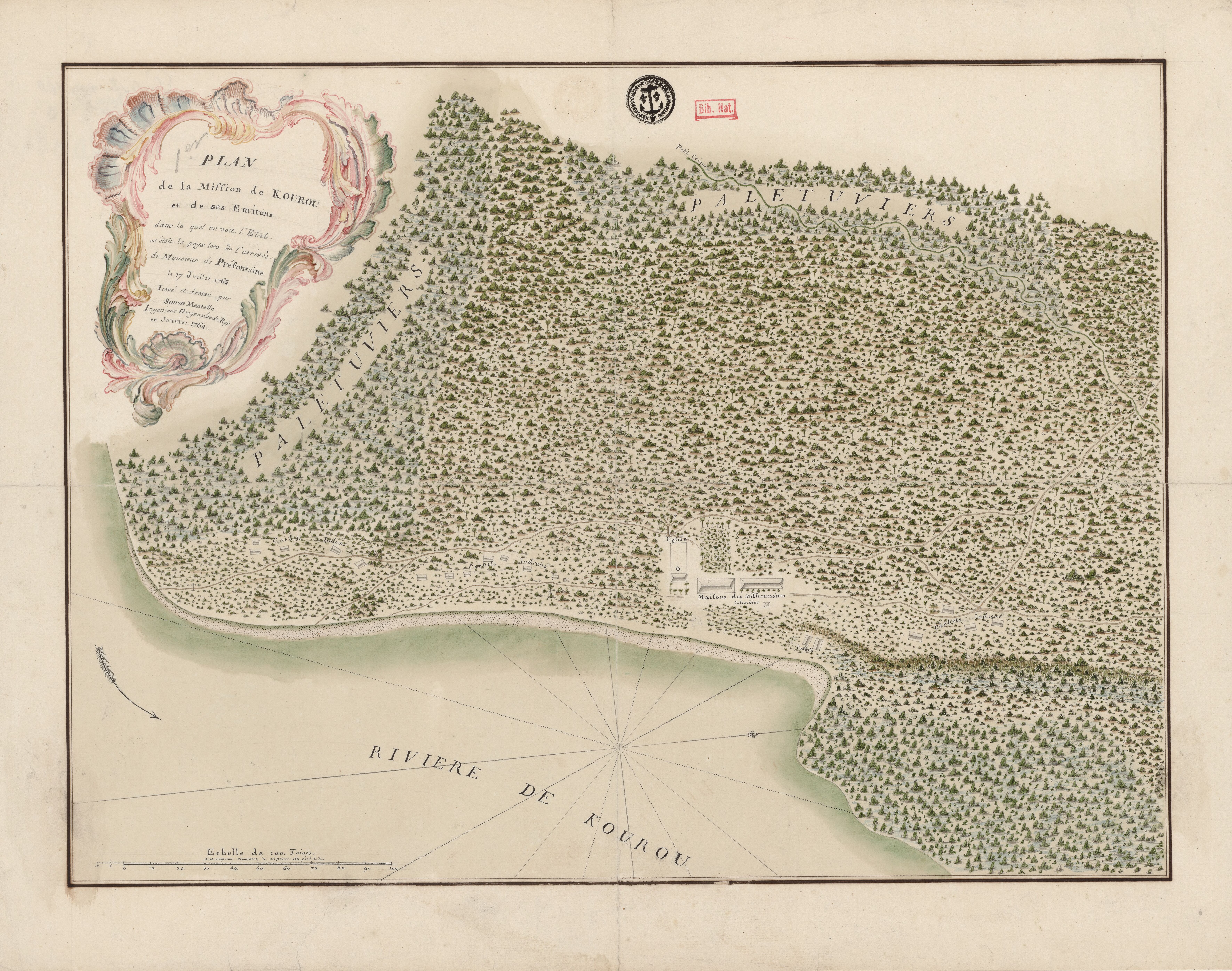
Plan de la Mission de Kourou et de ses Environs dans lequel on voit l'Etat dans lequel étoit le pays lors de l'arrivée de Monsieur de Préfontaine le 17 juillet 1763
Map 1763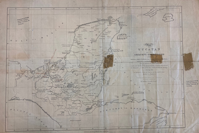
MAP OF YUCATAN AND THE ADJACENT TERRITORIES OF THE ITZAEX OR MAYA INDIANS, THE TIPUANS, QUECHEACHES, MOPANES, LACANDONES, CHOLES, & WITH THE DISTRICT OF VERA PAZ
Map 1854![Jornadas de limpieza (tercera jornada) [Cleaning Sessions (Third Day)]](https://dnet8ble6lm7w.cloudfront.net/art_sm/ACOL013.png)
Jornadas de limpieza (tercera jornada) [Cleaning Sessions (Third Day)]
Artwork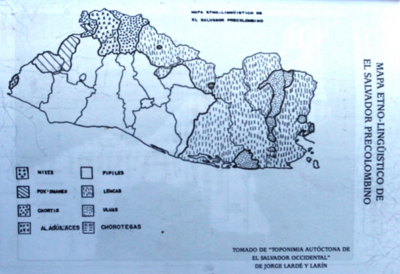
MAPA ETNO-LINGÜISTICO DE EL SALVADOR PRECOLOMBINO
Map 1523
Map representing the linguistic diversity that existed in Central America and the Gulf of Fonseca at the time of contact with the Spanish
Map 1522