Peoples
- GARIFUNA
Citation
Davidson, William V. Ethnic Geography of Honduras, 2001: Tables and Maps based on the National Census. Memphis, TN, 2011. PDF. http://williamvdavidson.com/pdf/Ethnic-Geography-of-Honduras-2001-Davidson.pdf
The Negro Inglés: Most important municipios, 2001
Map 2001
Mixe Towns
Map 1969![La Gaîté Parisienne [The Parisian Joy Series]](https://dnet8ble6lm7w.cloudfront.net/art_sm/ACOL014.png)
La Gaîté Parisienne [The Parisian Joy Series]
Artwork
CARTA COROGRAFICA DE LA REPÚBLICA DEL ECUADOR / MANUEL VILLAVICENCIO ;LIT. E IMP. DE F. MAYER Y CA.
Map 1817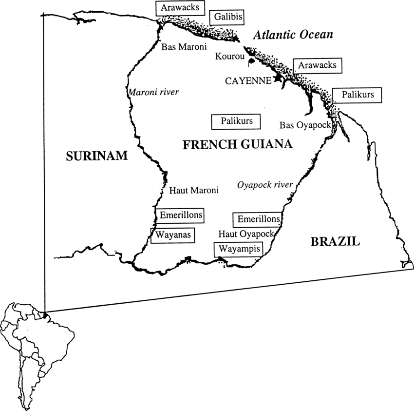
Fig. 1. Map of French Guiana with locations of the various Amerindian groups
Map 1999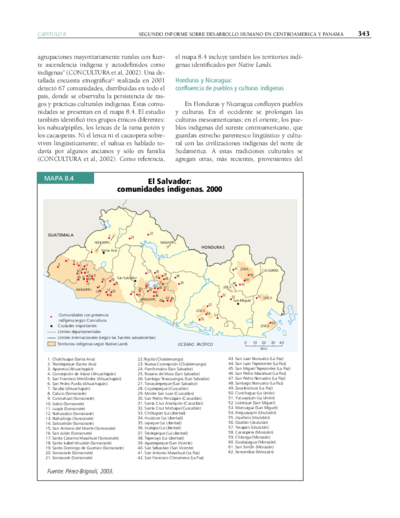
El Salvador: comunidades indígenas. 2000
Map 2000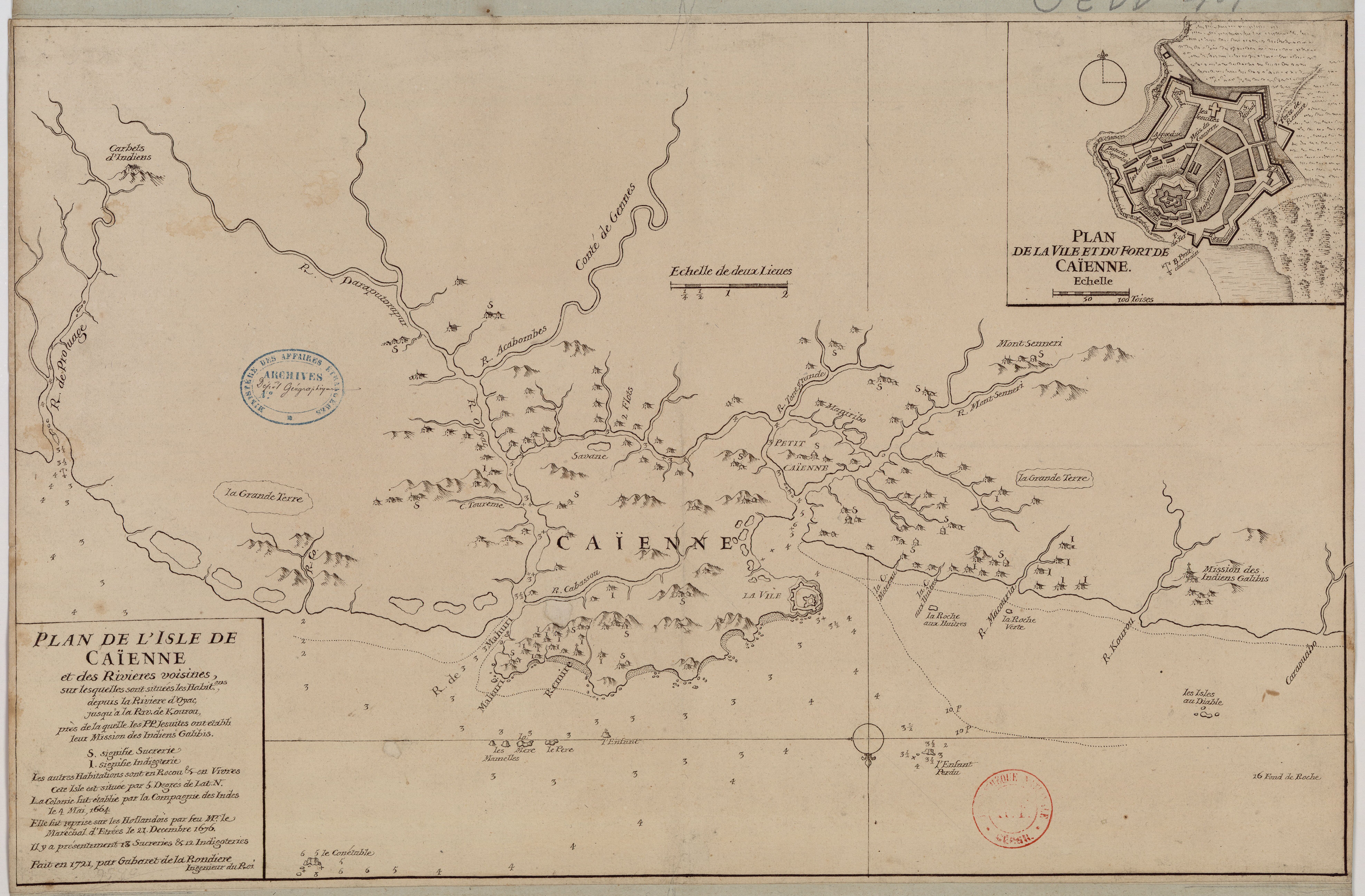
Plan de l'Isle de Cayenne et des rivières voisines, sur lesquelles sont situées les habit.ons, depuis la rivière d'Oyac, jusqu'à la Rivière de Kourou, près de laquelle les PP Jésuites ont établi leur mission des Indiens Galibis.
Map 1721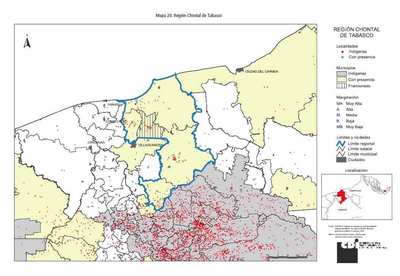
REGIÓN CHONTAL DE TABASCO
Map 2000