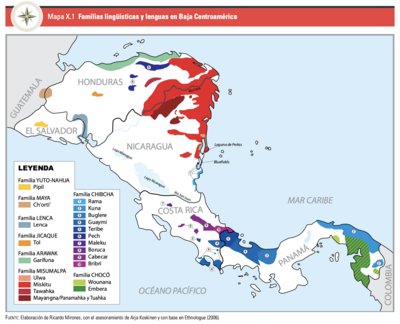
Peoples
- LENCA
- CHORTI
- TOLUPAN
- PECH
- TAWAHKA
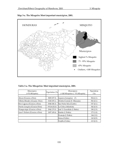
- MISKITO
- GARIFUNA
- NEGROINGLES
Citation
Davidson, William V. Ethnic Geography of Honduras, 2001: Tables and Maps based on the National Census. Memphis, TN, 2011. PDF. http://williamvdavidson.com/pdf/Ethnic-Geography-of-Honduras-2001-Davidson.pdf
![El mundo entero está mirando: Todas las mujeres son bienvenidas [The Entire World Is Watching: All Women Are Welcome]](https://dnet8ble6lm7w.cloudfront.net/art_sm/ACOL032.png)