Peoples
- LENCA
- TOLUPAN
- MISKITO
- PECH
- GARIFUNA
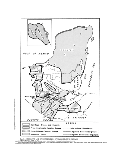
- CHORTI
- TAWAHKA
Citation
Davidson, William V. Ethnic Geography of Honduras, 2001: Tables and Maps based on the National Census. Memphis, TN, 2011. PDF. http://williamvdavidson.com/pdf/Ethnic-Geography-of-Honduras-2001-Davidson.pdf
![[Mapa de América del Sur desde el Ecuador hasta el Estrecho de Magallanes.]](https://dnet8ble6lm7w.cloudfront.net/maps_sm/CNT/CNT0220-0.png)