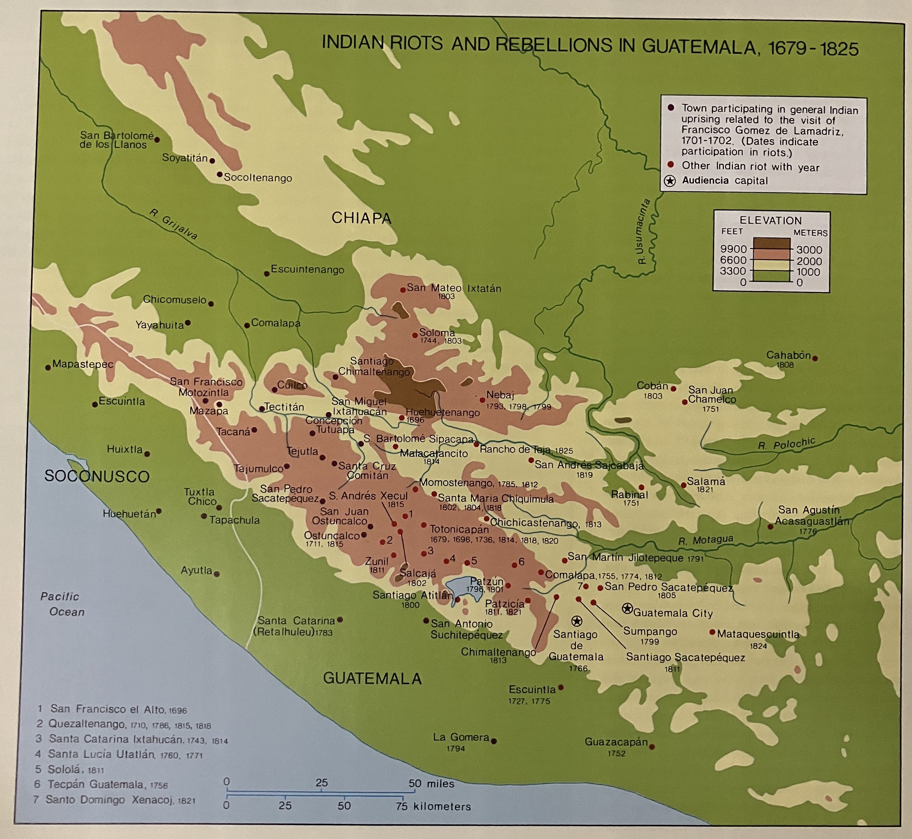
Citation
Cotter, John, "Indian Riots and Rebellions in Guatemala, 1679-1825" IN Hall, Carolyn and Héctor Pérez Brignoli, Historical Atlas of Central America. Norman, University of California Press, 2003.
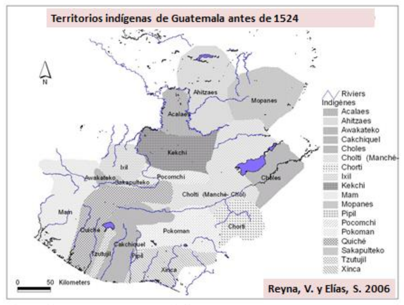
Territorios indígenas de Guatemala antes de 1524
Map 1523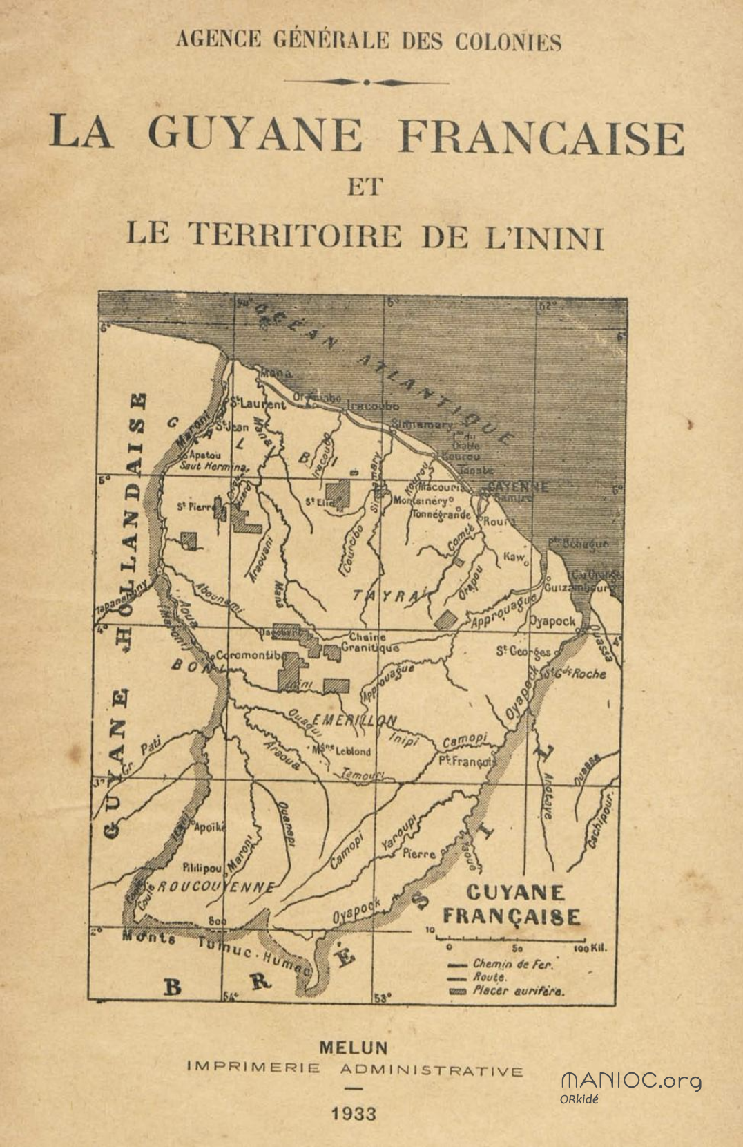
La Guyane française et le territoire de l'Inini.
Map 1933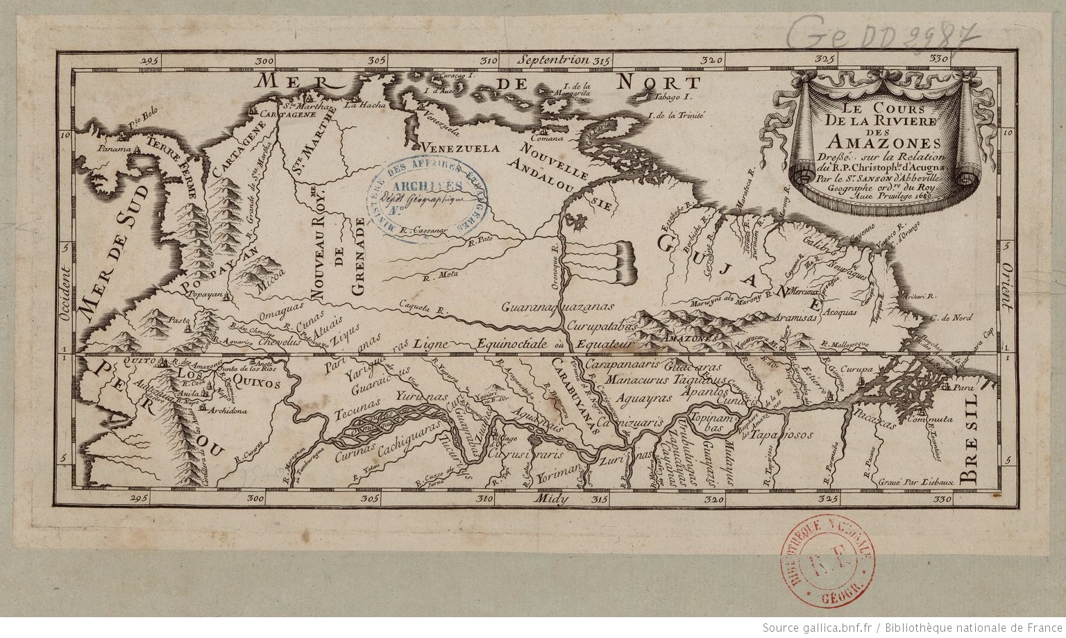
Le Cours de la Riviere des Amazones
Map 1680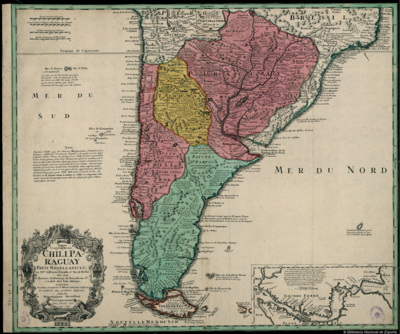
Typus Geographicus Chili, Paraguay
Map 1733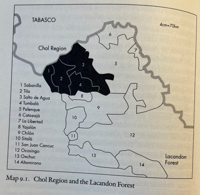
CHOL REGION AND THE LACANDON FOREST
Map 1998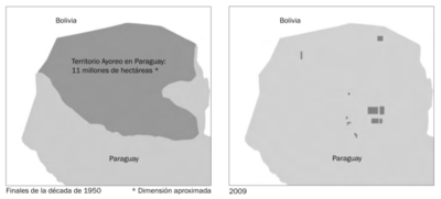
LA USURPACIÓN DEL TERRITORIO AYOREO EN PARAGUAY
Map 1950 - 2009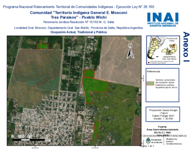
Comunidad "Territorio Indígena General E. Mosconi Tres Paraísos" - Pueblo Wichí
Map 2020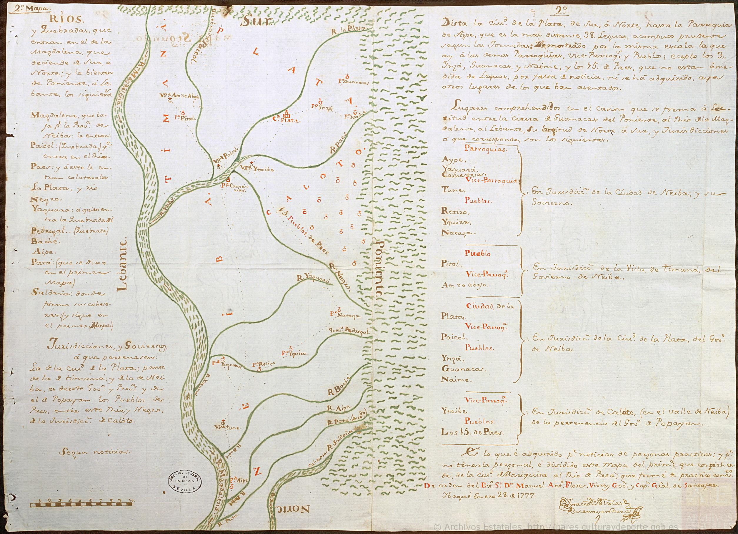
Mapa de las regiones de Neiva, Timaná, Plata y Caloto, en la vertiente izquierda del Magdalena
Map 1777