Peoples
- MAYA
- CLASSIC MAYA
Citation
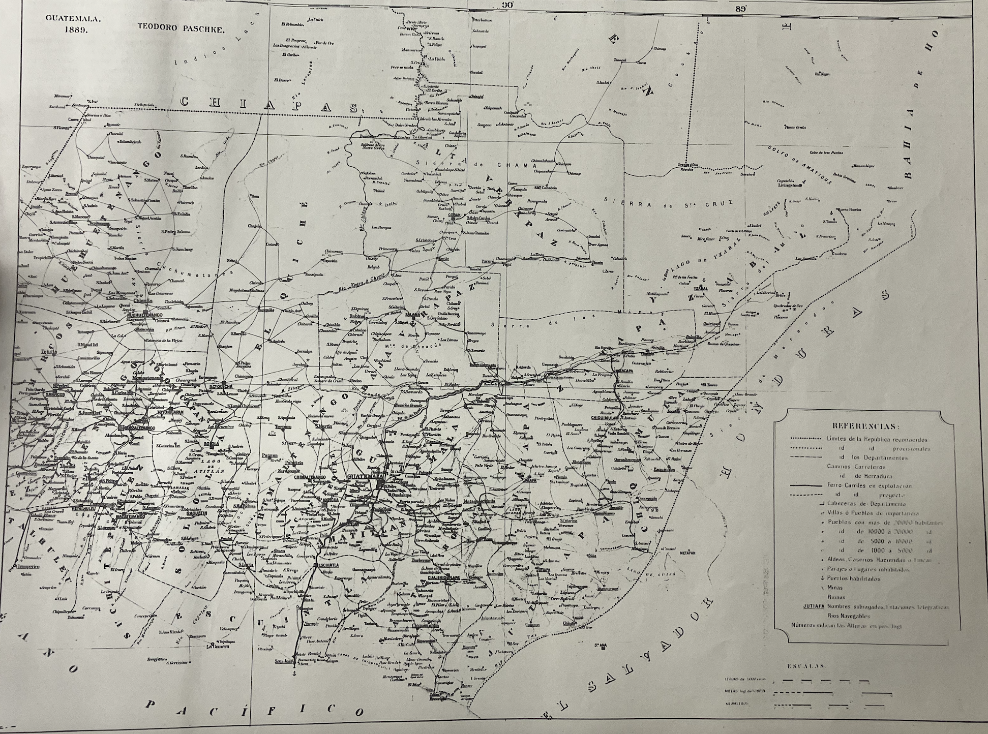
"Mapa de la Republica de Guatemala, America Central" Pashke, 1889.In Cartografia de la America Central, Publicacciones de la Comisión de Limites. Tipografia Nacional: Guatemala, CA, 1929.
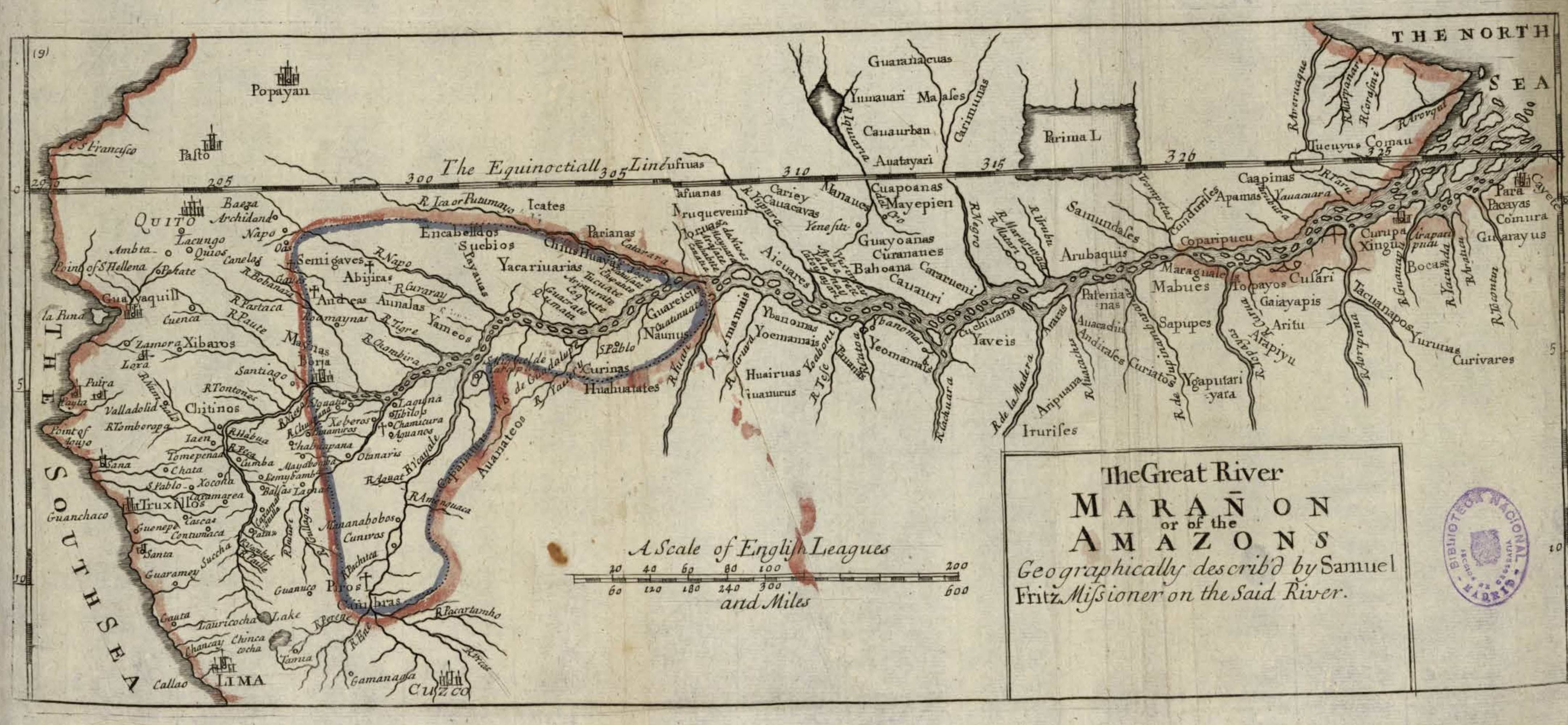
The Great River Marañon or of the Amazons
Map 1717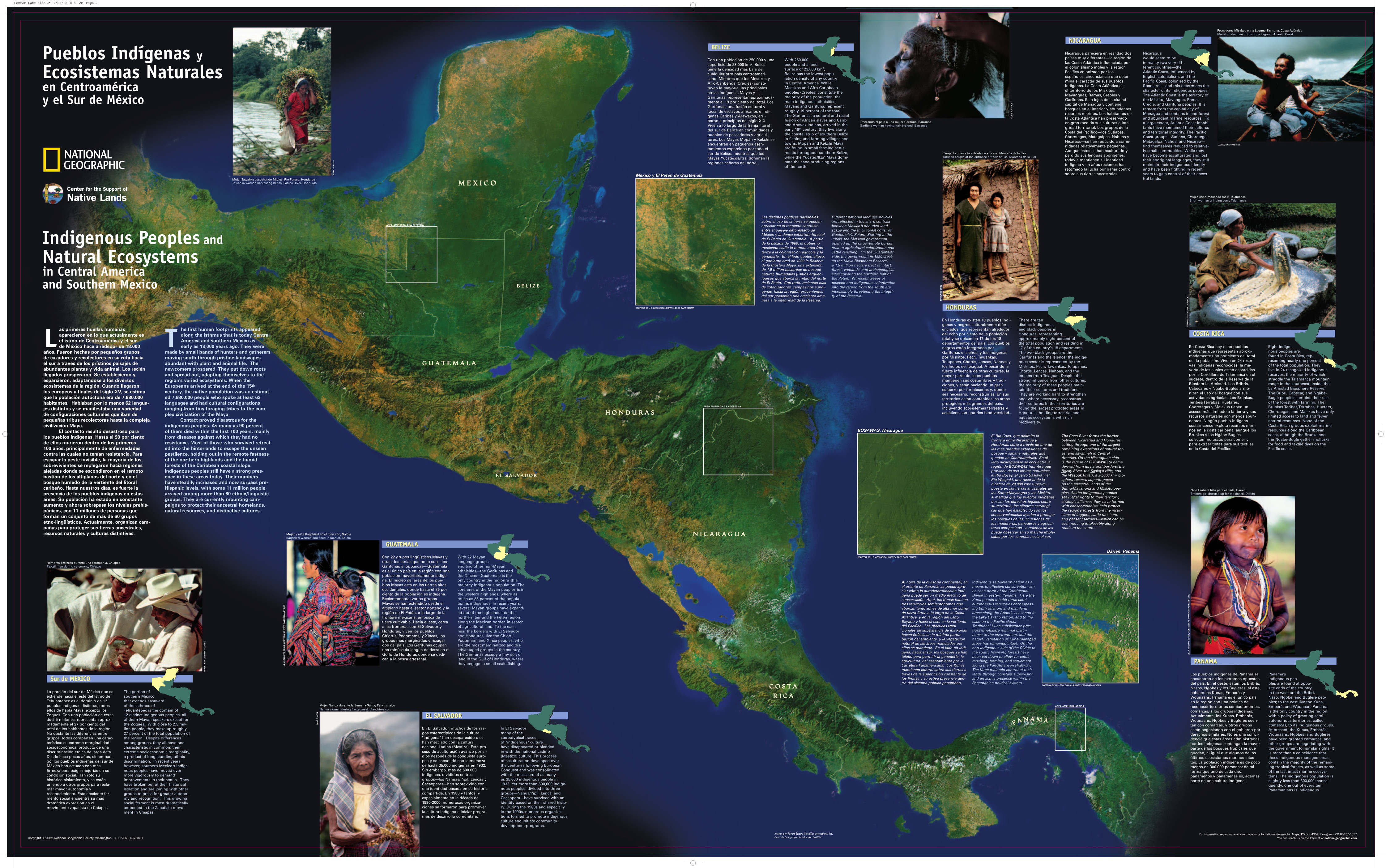
Pueblos Indígenas y Ecosistemas Naturales en Centroamérica y el Sur de México
Map 2000 - 2024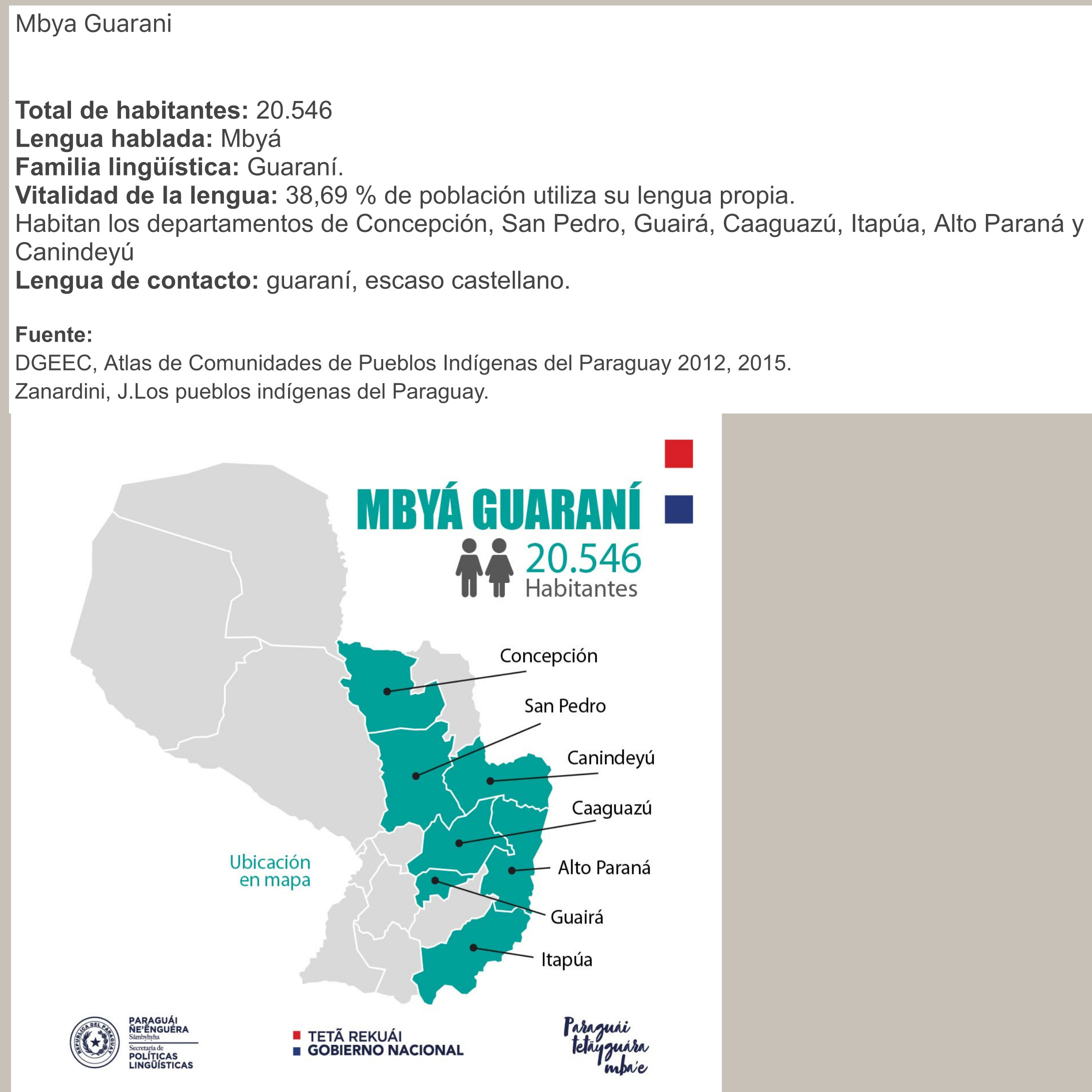
MBYÁ GUARANÍ
Map 2015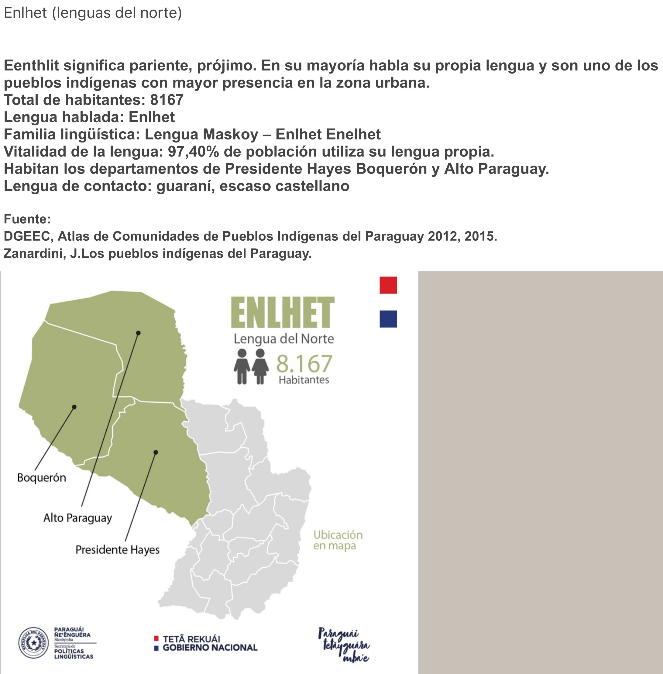
ENLHET Lengua del Norte
Map 2015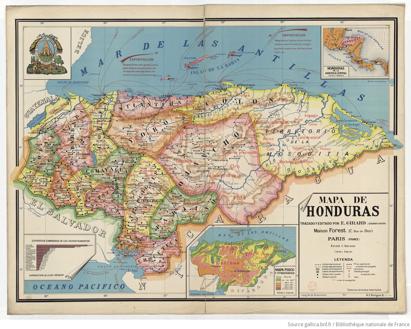
Mapa de Honduras, with Mapa Físico y Etnográfico (insert)
Map 1929![El Vacío [The Void]](https://dnet8ble6lm7w.cloudfront.net/art_sm/ACOL001.png)
El Vacío [The Void]
Artwork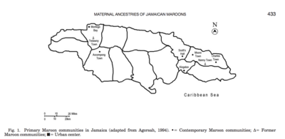
Primary Maroon communities in Jamaica
Map 2015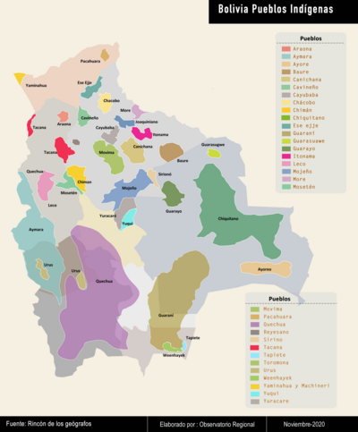
Bolivia Pueblos Indígenas
Map 2020