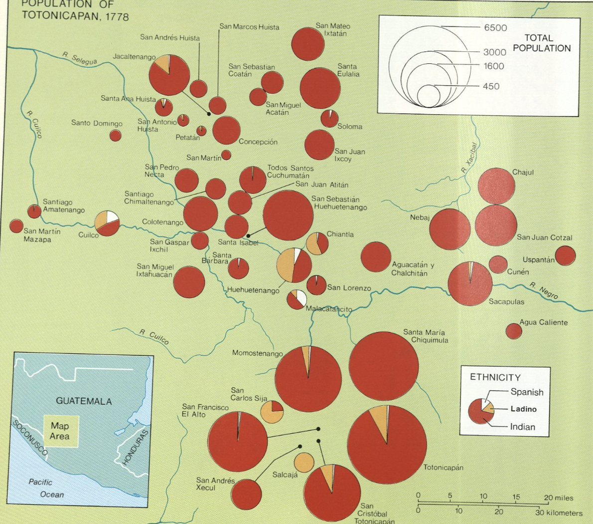
Citation
"Population of Tontonicapan 1778" IN Historical Atlas of Central America by Carolyn Hall and Héctor Pérez Brignoli. PG. 89. University of Oklhoma Press, 2005.
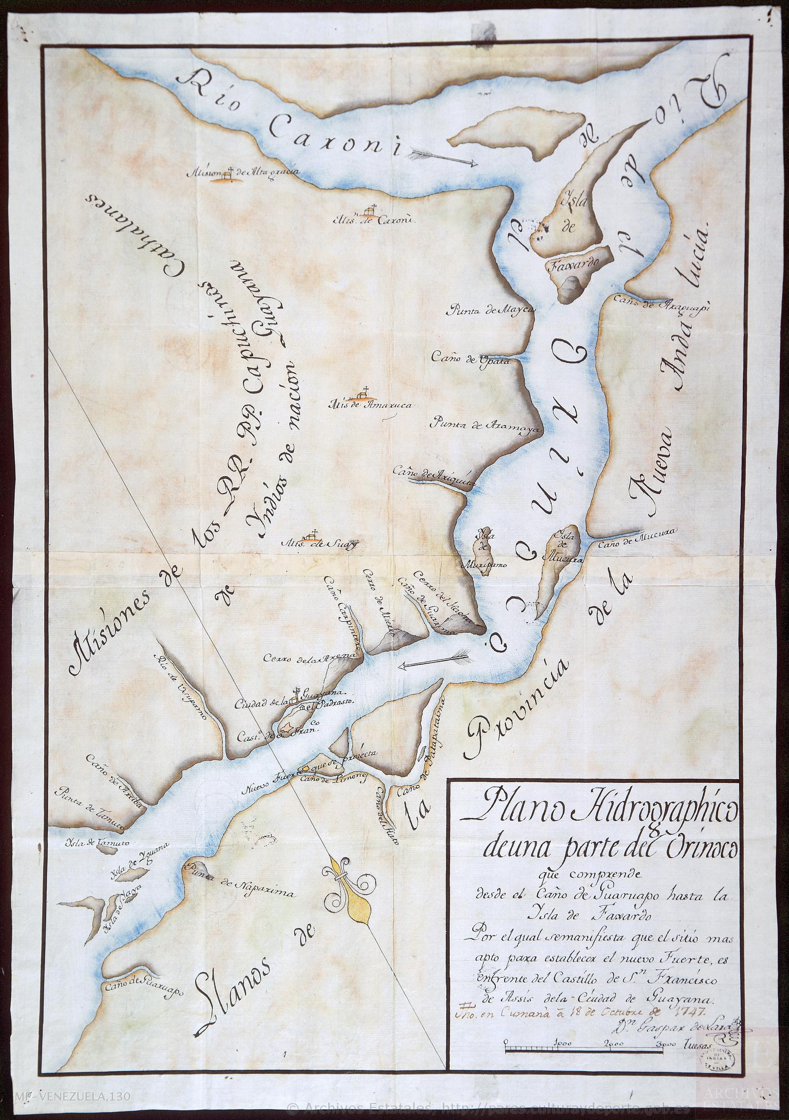
Plano hidrográphico de una parte del Orinoco, que comprende desde el caño de Guaruapo hasta la ysla de Faxardo, por el qual se manifiesta que el sitio más apto para establecer el nuevo fuerte es enfrente del castillo de San Francisco de Assis de la ciudad de Guayana
Map 1747![El dueño de coronavirus [The Owner of Coronavirus]](https://dnet8ble6lm7w.cloudfront.net/art/APER058.jpg)
El dueño de coronavirus [The Owner of Coronavirus]
Artwork
MAPA ÉTNICO DEL RÍO DE LA PLATA
Map 1500 - 1900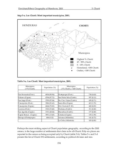
Los Chorti: Most important minicipios, 2001
Map 2001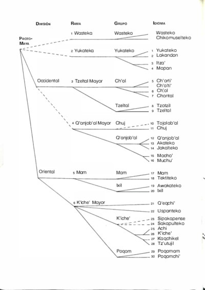
Idiomas Mayas
Map 1970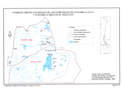
Pueblos del Chanar y el Algarrobo. Los Atacamas del Siglo XVII.
Map 1600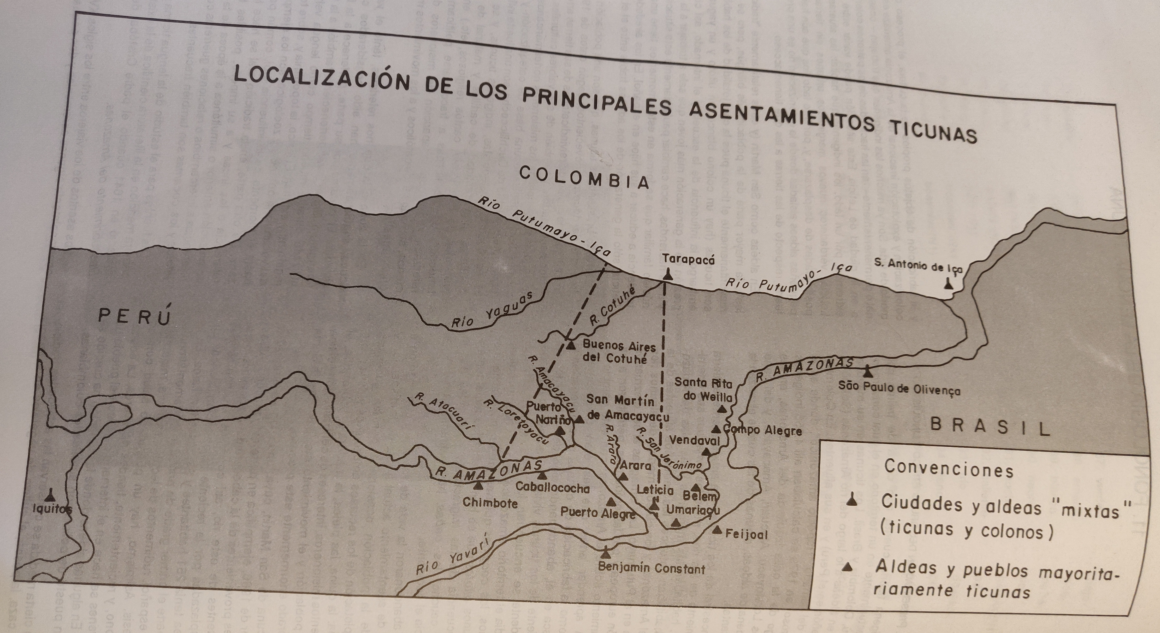
LOCALIZACIÓN DE LOS PRINCIPALES ASENTAMIENTOS TICUNAS
Map 2000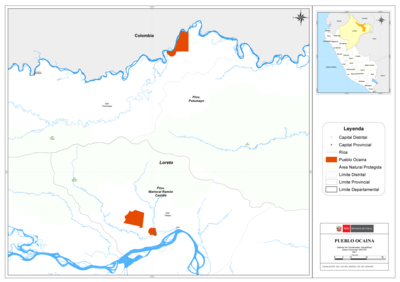
PUEBLO OCAINA
Map 2021