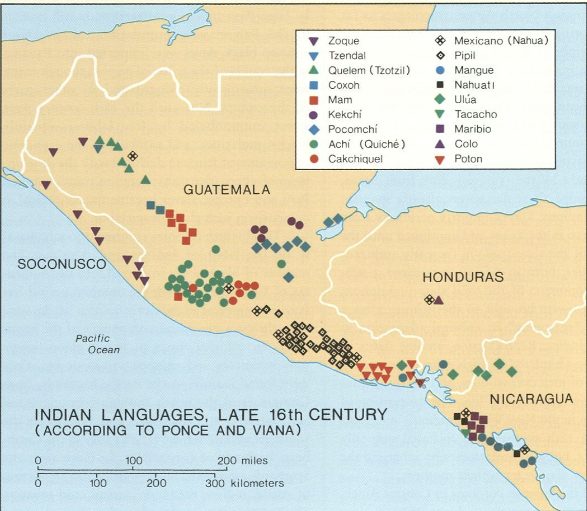
Peoples
- CACKCHIQUEL
- MAM
- POCOMCHI
- QUICHE
Citation
"Indian Languages, Late 16th Century, (According to Ponce and Viana)."IN Historical Atlas of Central America by Carolyn Hall and Héctor Pérez Brignoli. PG. 81. University of Oklhoma Press, 2005.
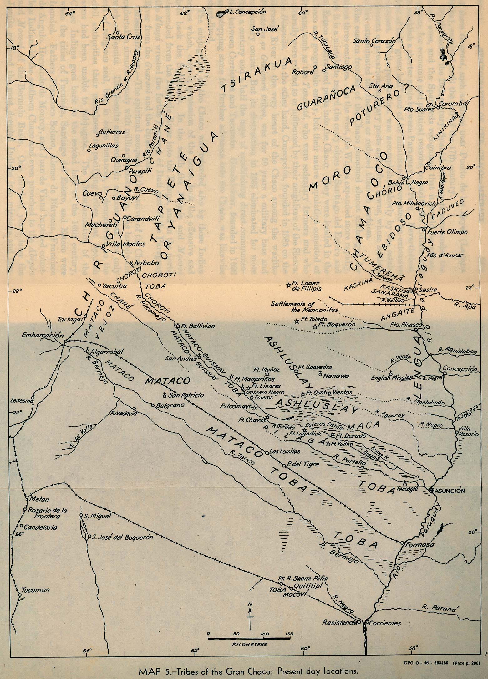
Tribes of the Gran Chaco: Present day locations
Map 1946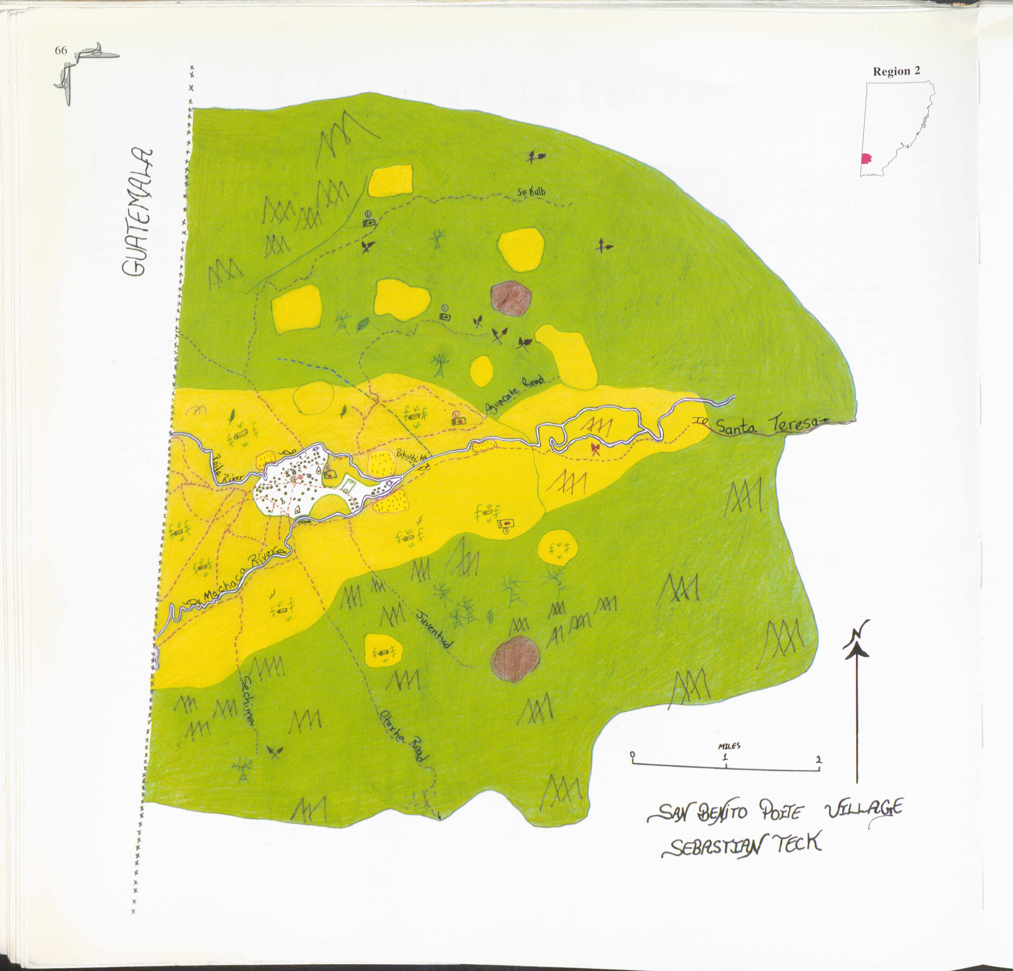
San Benito Poite
Map 1997![O impossível [The Impossible]
Museum of Modern Art of Rio de Janeiro
Donated by the artist](https://dnet8ble6lm7w.cloudfront.net/art_sm/ABRA030.png)
O impossível [The Impossible] Museum of Modern Art of Rio de Janeiro Donated by the artist
Artwork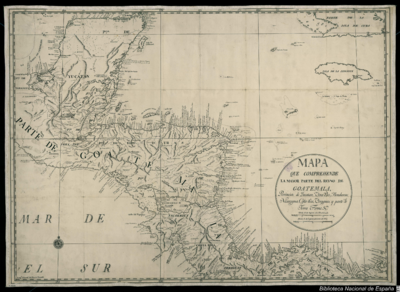
Mapa que comprehende la mayor parte del reyno de Goatemala;Provincias de Yucatan;Vera-Paz;Honduras;Nicaragua;Costa-Rica;Veraguas y parte de Tierra Firme.
Map 1738
PUEBLO TEPEHUA
Map 2020
CHART containing the greater part of the SOUTH SEA to the South of the LINE, with the ISLANDS dispersed thro' the same
Map 1794
Spanish Language Distribution in Late Colonial Period
Map 1600 - 1699
COLOMBIA AND GUIANA
Map 1830