Peoples
- MAYA
Citation
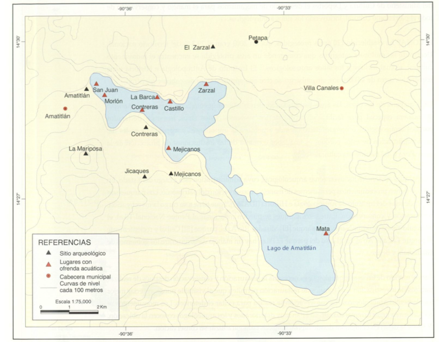
Sitios arqueológicos del Lago de Amatitlán, con lugares de ofrendas acuáticas. Mapa 30. Pg. 63, In Atlas Histórico de Guatemala 2011. Jorge Luján Muñoz. Academia de Geografía e Historia de Guatemala. https://glifos.upana.edu.gt/library/index.php?title=30586&mode=advanced&lang=es&query=@title=Special:GSMSearchPage@process=@field1=clasificacion@value1=R%20911.7281@mode=advanced&recnum=1
![El lago prohibido [The Forbidden Lake]](https://dnet8ble6lm7w.cloudfront.net/art_sm/APER029.png)