Citation
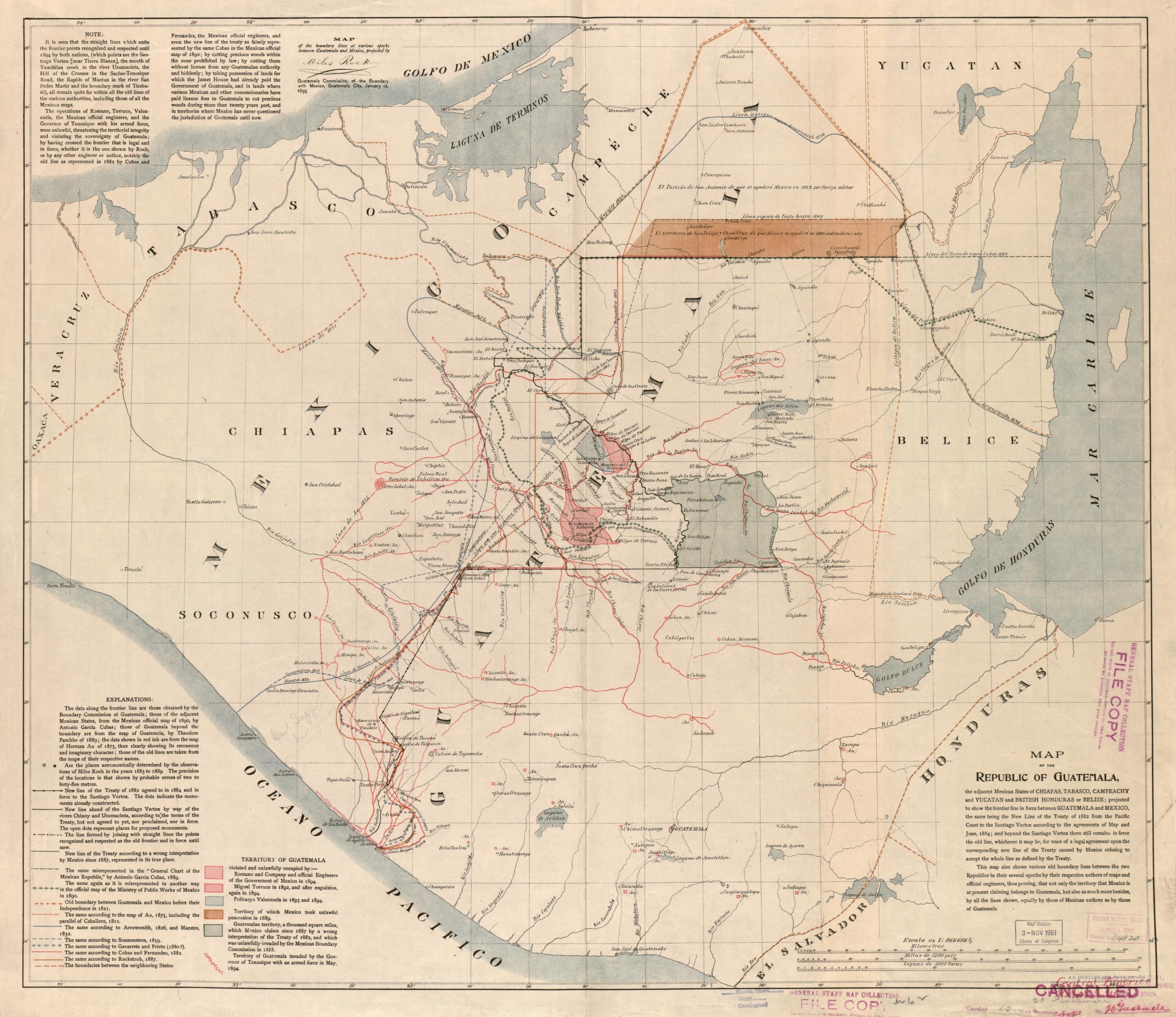
Map of the Republic of Guatemala. Mueller, A.H. Philadelphia, 1895. Library of Congress Geography and Map Division Washington, DC. G4811.F2 1895 .M8 . http://hdl.loc.gov/loc.gmd/g4811f.ct002031
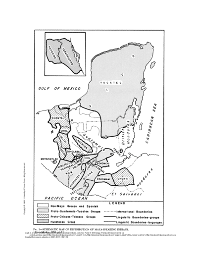
SCHEMATIC MAP OF DISTRIBUTION OF MAYA-SPEAKING INDIANS (From Morley, 1956, pl.7)
Map![Mi vida, tu vida [My Life, Your Life]](https://dnet8ble6lm7w.cloudfront.net/art/ACOL027.jpg)
Mi vida, tu vida [My Life, Your Life]
Artwork
Carte de l'embouchure de l'Amazone
Map 1700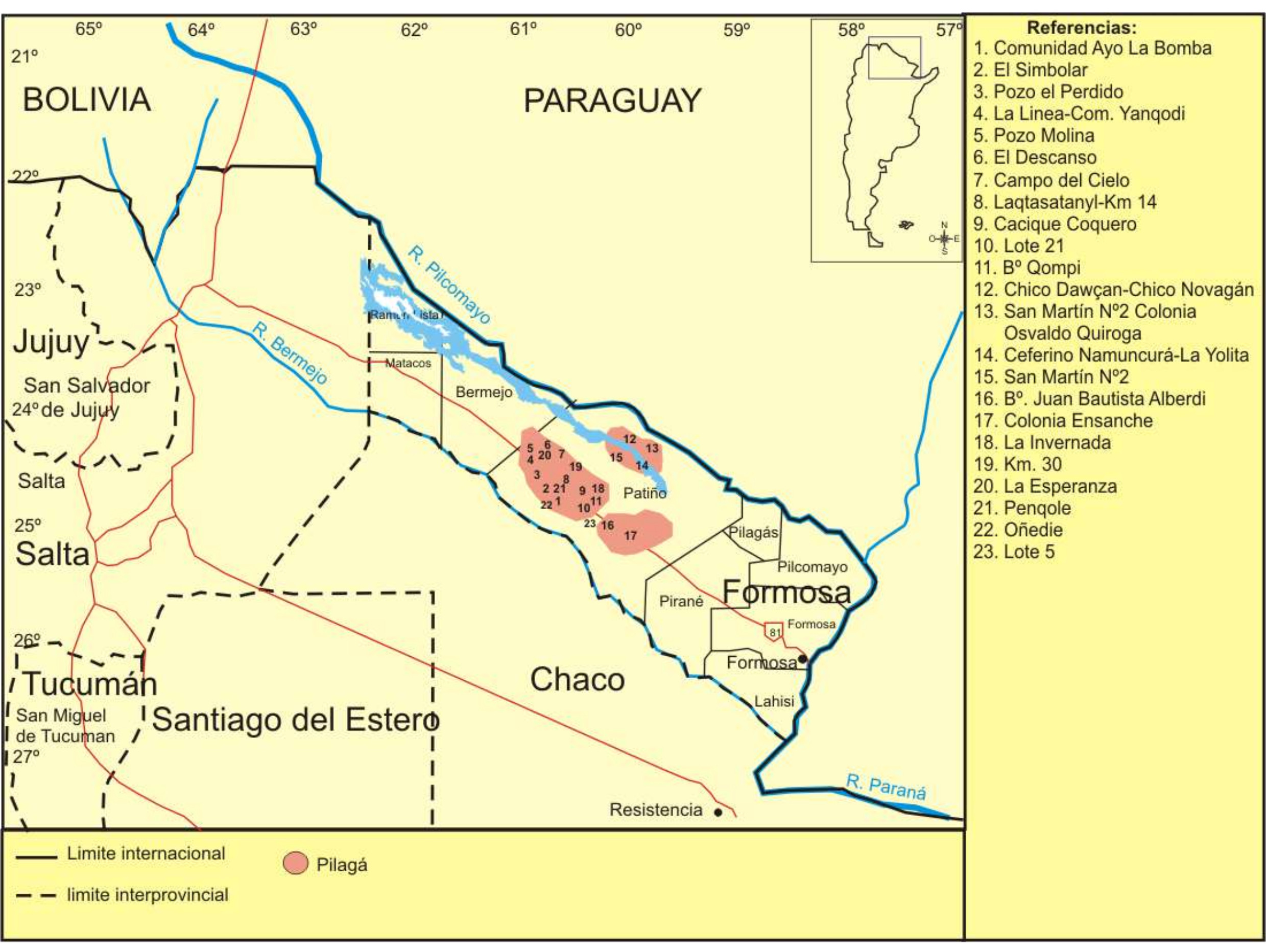
Lengua Pilagá - Ubicación geográfica
Map 2021
ALIMENTOS TRADICIONALES DE LOS PUEBLOS INDÍGENAS DE PARAGUAY
Map
Mapa Corografico De la Provincia de Sta. Marta y parte de las de Cartagena de Yndias, Giron, Pamplona, Maracaybo, Y Rio del Hacha sus confinante
Map 1811![Numero 6⁰. Plano que de muestra la porcion de costades de la Punta de Marabiq[u]e [sic] por la parte del oeste, has[t]as la detirbes por el leste, puertos, cauos yslas &c](https://dnet8ble6lm7w.cloudfront.net/maps/HON/HON0020.jpg)
Numero 6⁰. Plano que de muestra la porcion de costades de la Punta de Marabiq[u]e [sic] por la parte del oeste, has[t]as la detirbes por el leste, puertos, cauos yslas &c
Map 1786 - 1811![De cuando el río dejó de ser río para convertirse en otra cosa [When the River Ceased to Be a River and Became Something Else]](https://dnet8ble6lm7w.cloudfront.net/art_sm/APER061.png)
De cuando el río dejó de ser río para convertirse en otra cosa [When the River Ceased to Be a River and Became Something Else]
Artwork