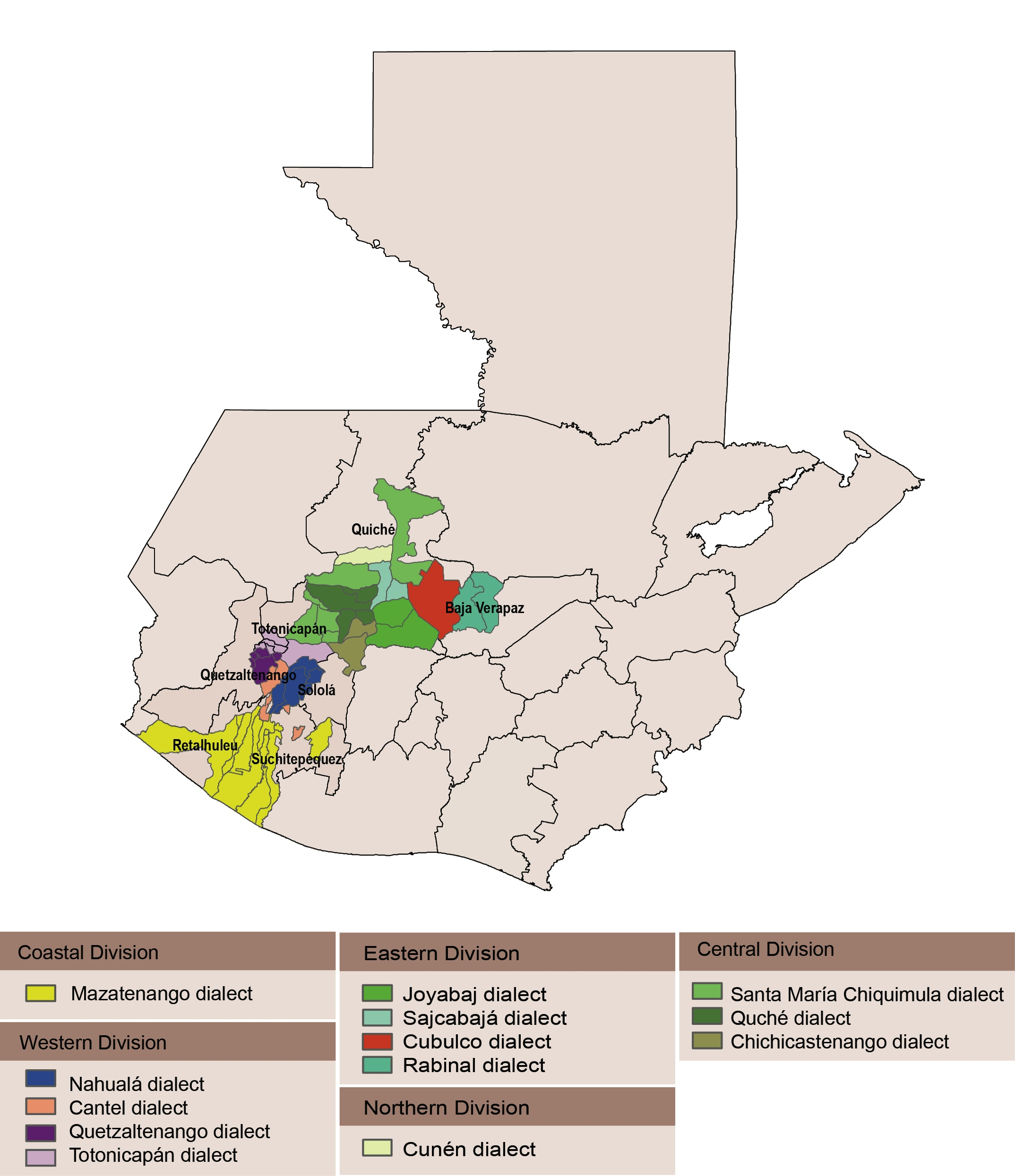
Peoples
- K'ICHEE MAYA
Citation
Dialect Geography of K'ichee'. From: Chqeta'maj le Qach'ab'al Ki'iche': A Beginner to Advanced Level K'iche' Online Course. University of Texas. https://tzij.coerll.utexas.edu/the-language/.AccessedJuly292023.
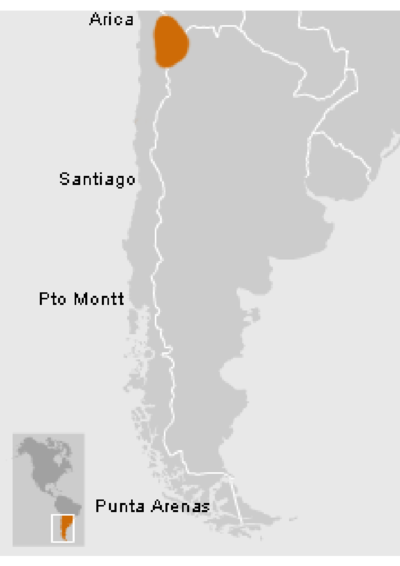
Atacameños - Location
Map 2012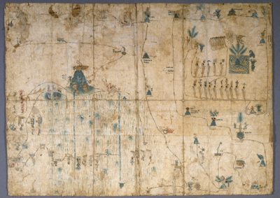
MAPA DE SIGUENZA/MAP OF SIGUENZA
Map 1500 - 1599![Sementerio [Semen-tary]](https://dnet8ble6lm7w.cloudfront.net/art_sm/ACOL018.png)
Sementerio [Semen-tary]
Artwork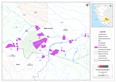
PUEBLO HARAKBUT
Map 2021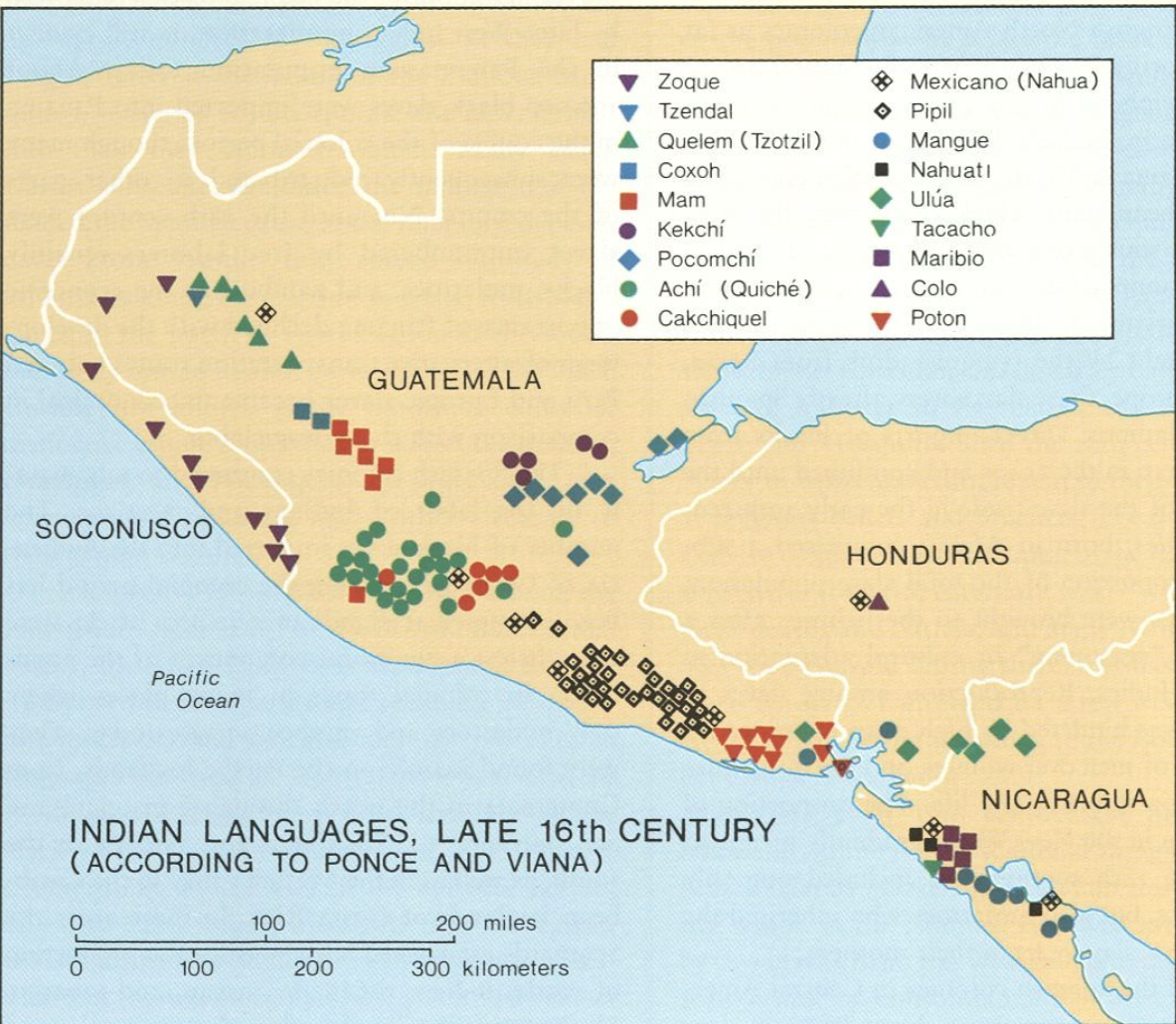
Indian Languages, Late 16th Century, (According to Ponce and Viana).
Map 1500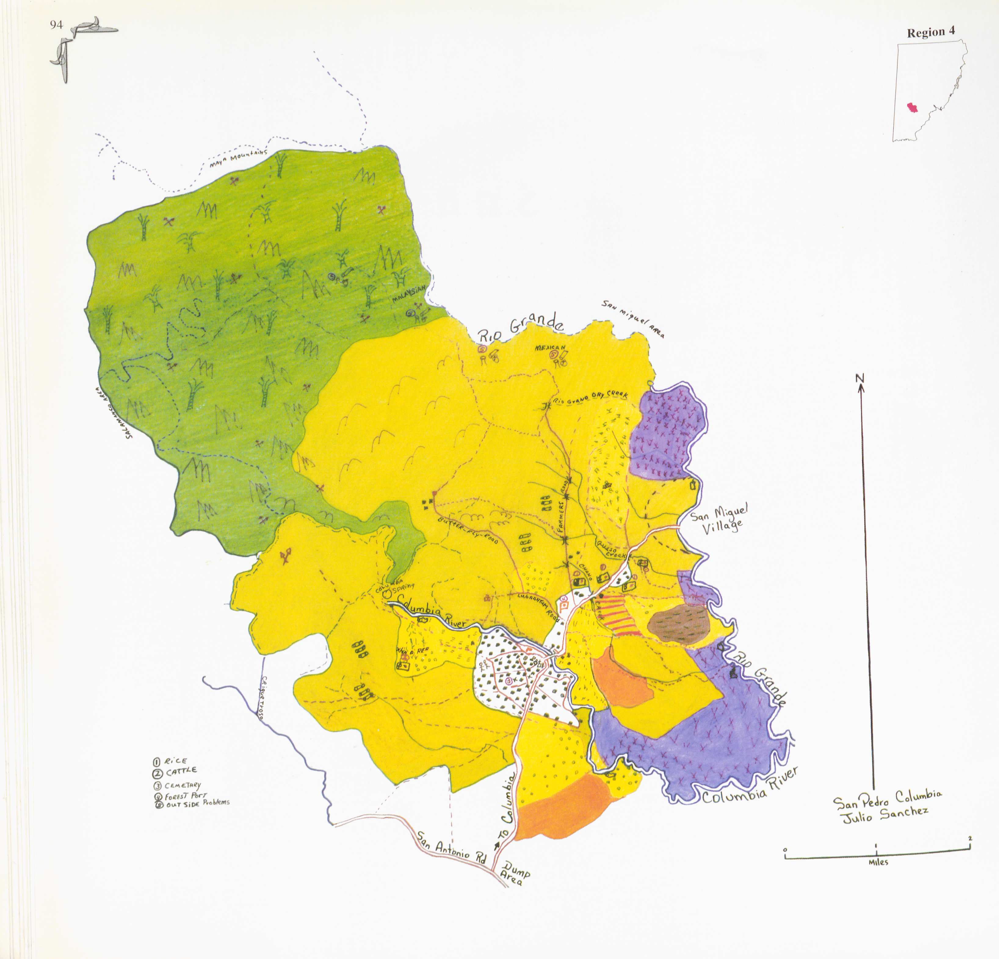
San Pedro Columbia
Map 1997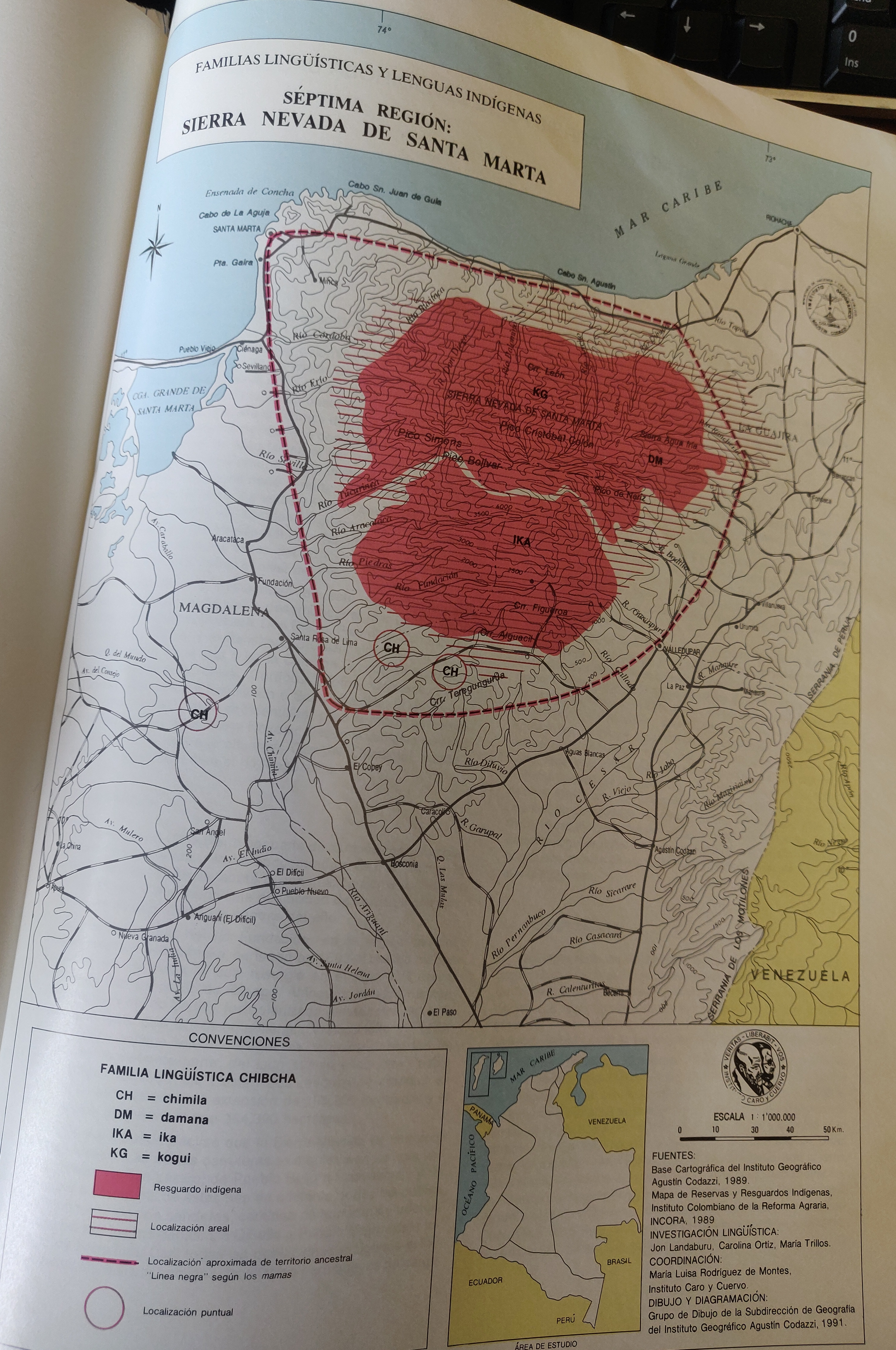
FAMILIAS LINGUÍSTICAS Y LENGUAS INDÍGENAS. SEPTIMA REGION: SIERRA NEVADA DE SANTA MARTA
Map 1989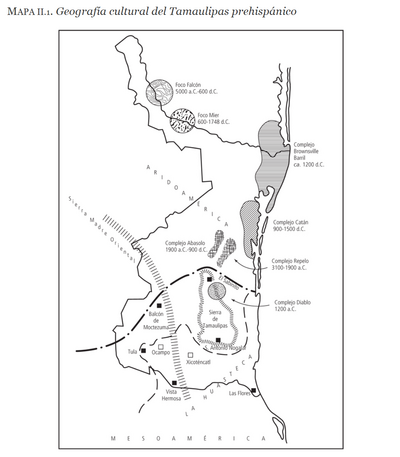
Geografia cultural del Tamaulipas prehispánico
Map -5000 - 599