Citation
Mapa de la Republica de Guatemala, levantado y publicado por orden del Smo Gobierno por Herman, Au, Ing. Au, Herman. 1876. Friederichsen y Co en Hamburgo. Gallica. https://gallica.bnf.fr/ark:/12148/btv1b53021066b/f1.item.zoom
Aldeia Tekoha Mara’E Ey
Map 1989 - 2001
APPROXIMATE BORDERS OF TERRITORY OF THE AYMARA POLITY KARANQAS (OR CARANGAS) IN THE 19TH CENTURY
Map 1894
LA USURPACIÓN DEL TERRITORIO AYOREO EN PARAGUAY
Map 1950 - 2009![Nos roban las palabras o A Calzón quitado, o Insurrecciones que son heréticas resurrecciones [They steal our words or Barefaced, or Insurrections that are Heretical Resurrections]](https://dnet8ble6lm7w.cloudfront.net/art_sm/AMEX006.png)
Nos roban las palabras o A Calzón quitado, o Insurrecciones que son heréticas resurrecciones [They steal our words or Barefaced, or Insurrections that are Heretical Resurrections]
Artwork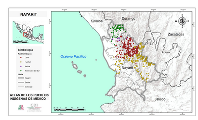
NAYARIT
Map 2015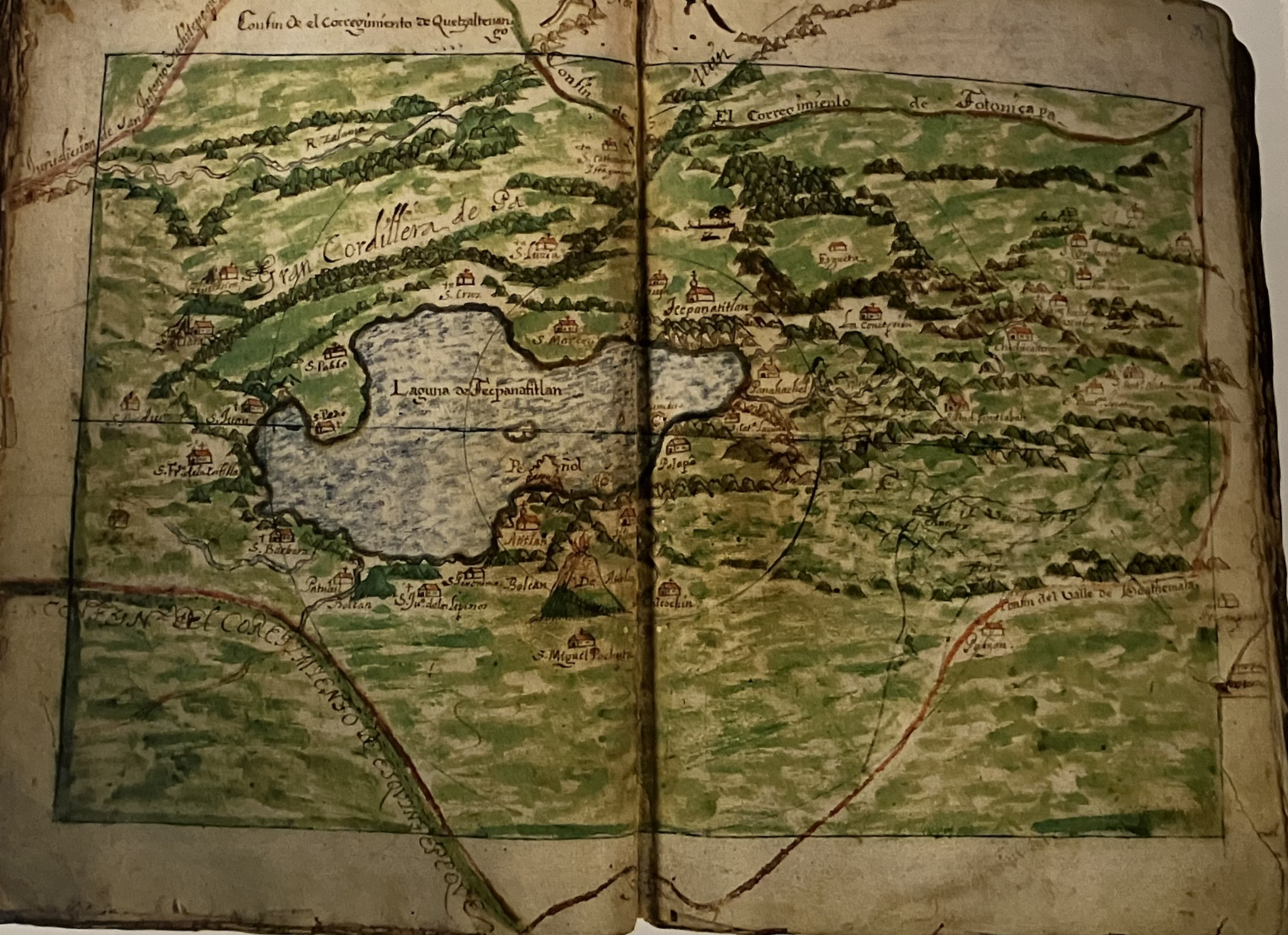
Mapa del Corregimiento de Tecpanatitlan
Map 1690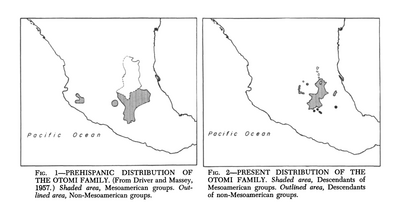
Prehispanic Distribution of the Otomí Family
Map 1969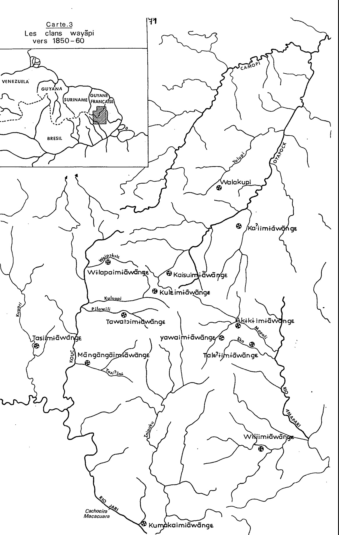
Carte 3. Les clans wayãpi vers 1850-1860
Map 1850 - 1860