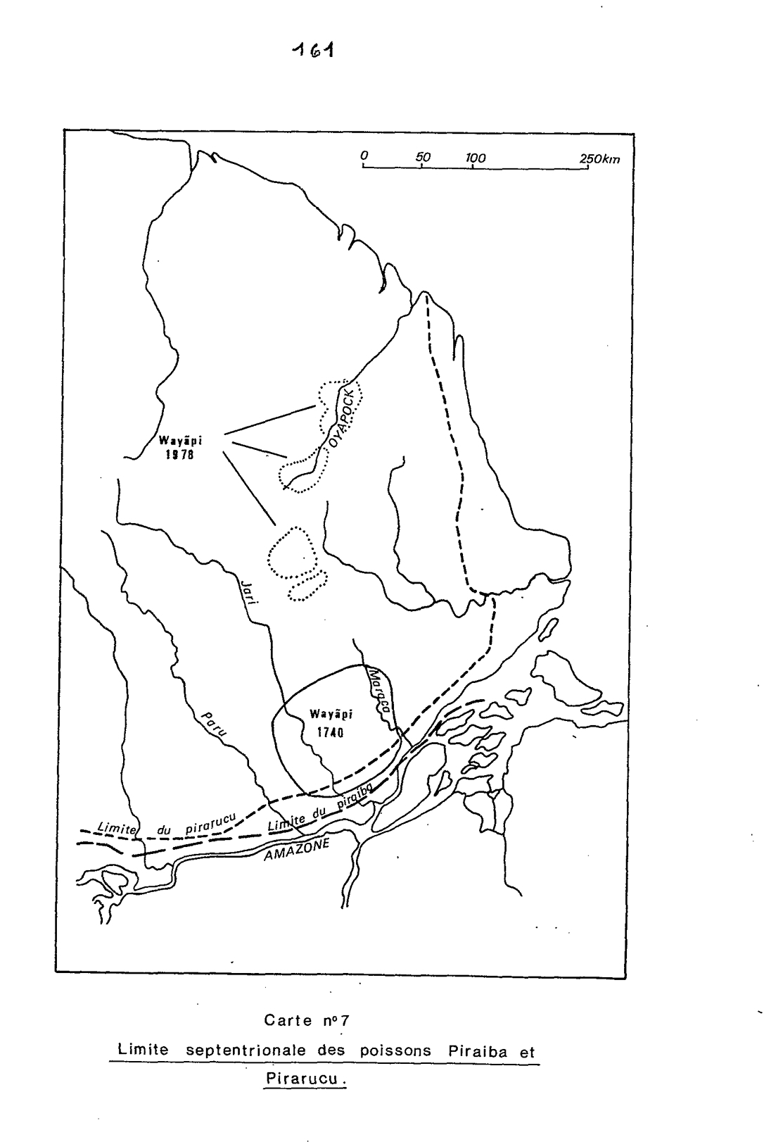
Peoples
- WAYAPI
Citation
Grenand, Pierre. Ainsi parlaient nos ancêtres : essai d'ethnohistoire « waŷapi ». Paris: ORSTOM, 1982.
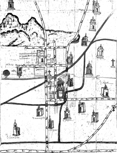
Map of Culhuacan (Valley of Mexico), 1580, Relacion geografica de Culhuacan
Map 1580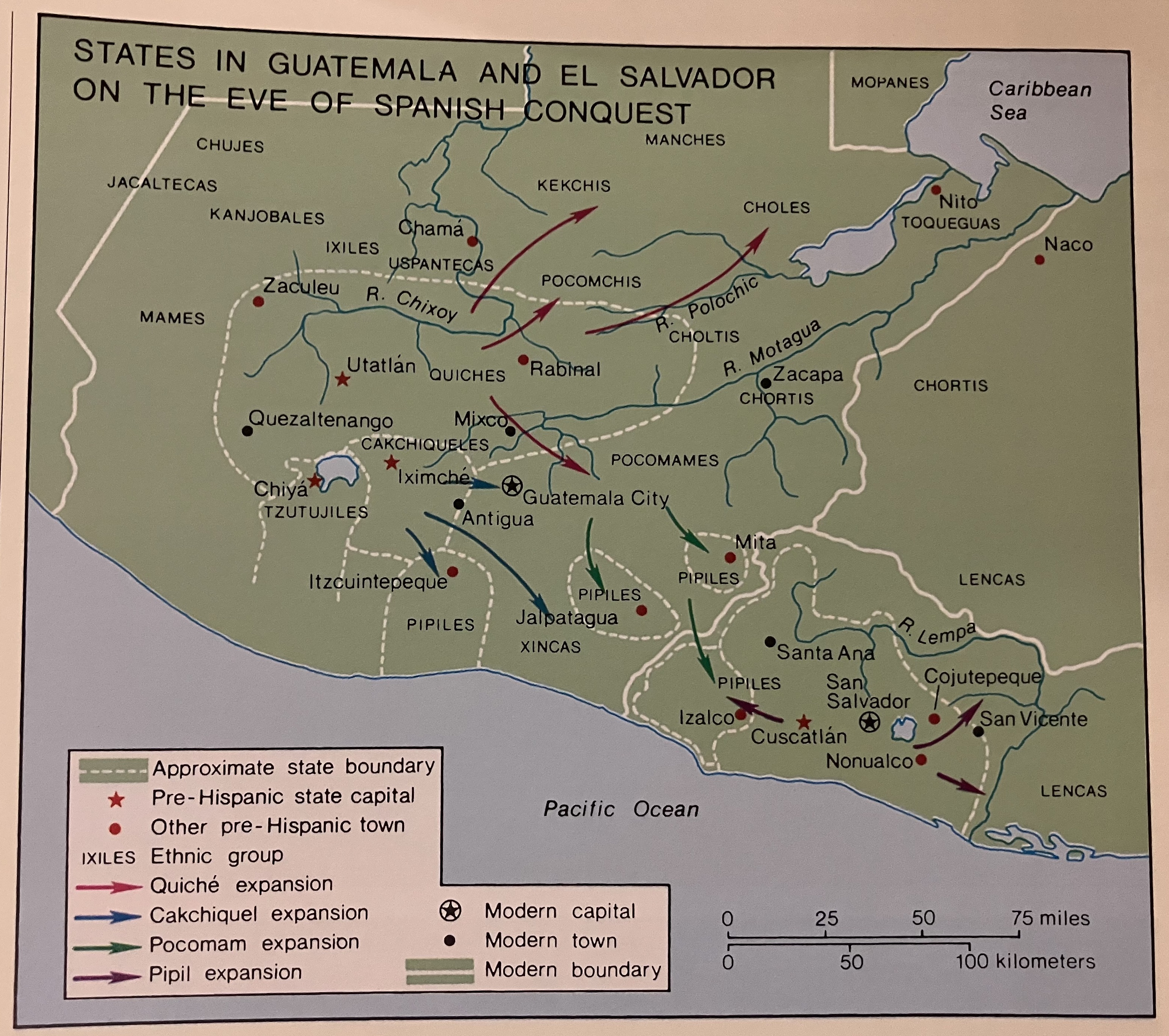
States in Guatemala and el Salvador on the Eve of Spanish Conquest.
Map 1524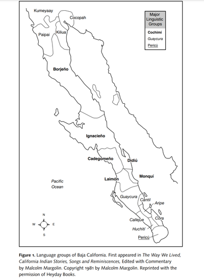
Language Groups of Baja California
Map 1981
Outlines of the physical and political division of South America: Delineated by A. Arrowsmith partly from scarce and original documents, published before the year 1806 but principally from manuscript maps & surveys made between the years 1771 and 1806, corrected from accurate astronomical observations to 1810.
Map 1800 - 1899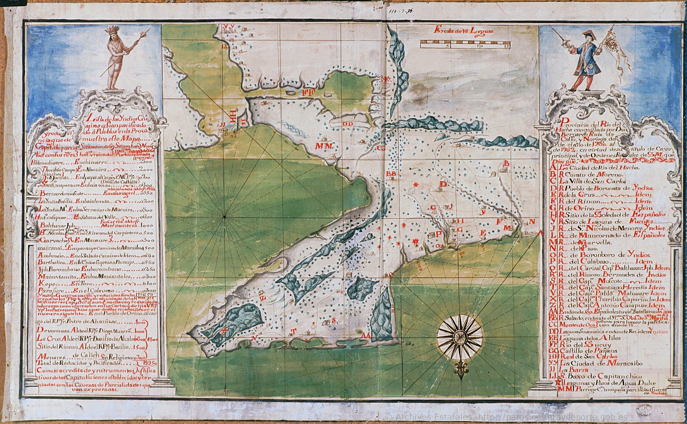
Mapa de la Peninsula Goagira
Map 1762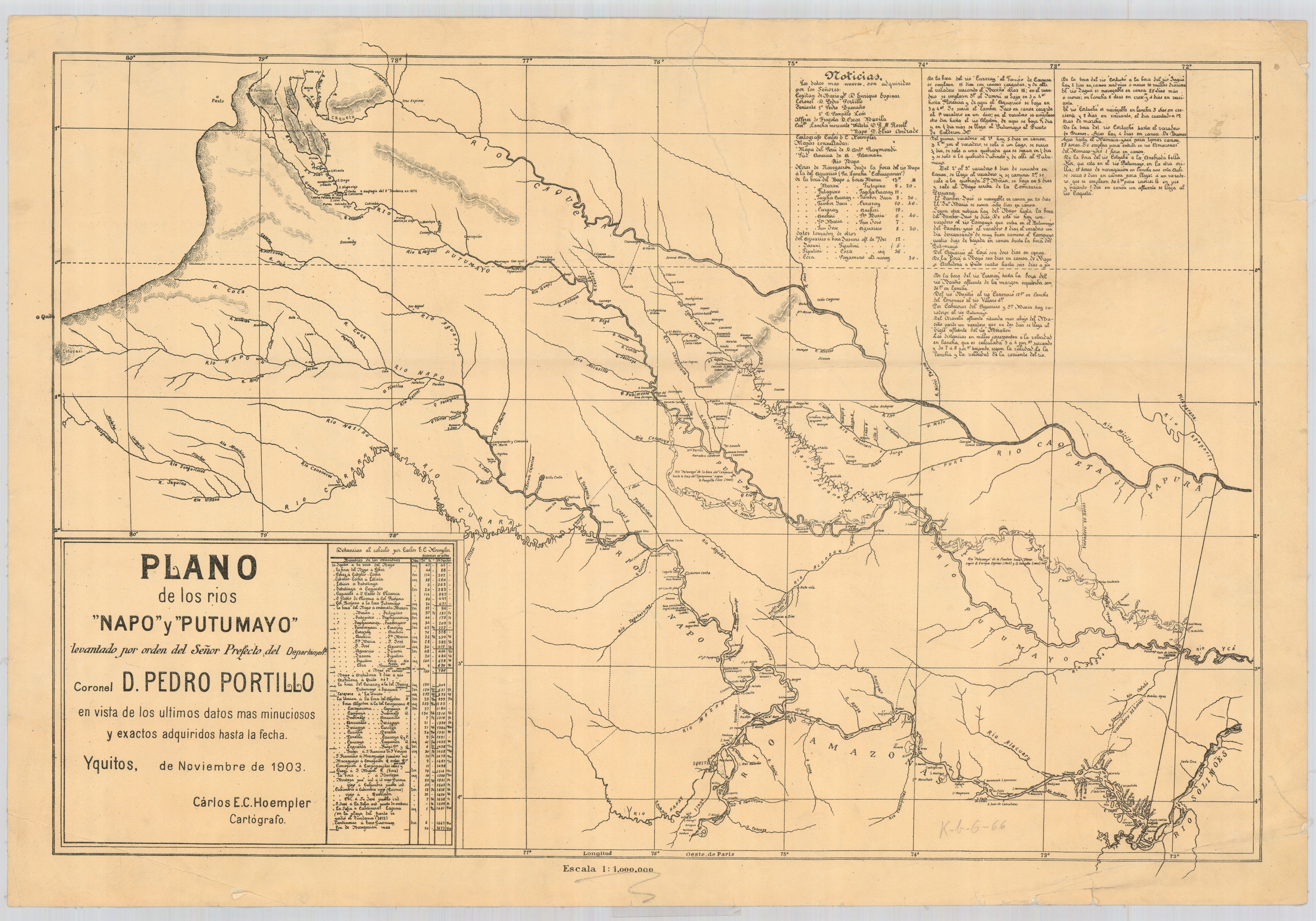
Plano de los rios Napo y Putumayo / levantado por orden del señor prefecto del departemento coronel d. Pedro Portillo en vista de los últimos datos mas minuciosos y exactos adquiridos hasta la fecha
Map 1903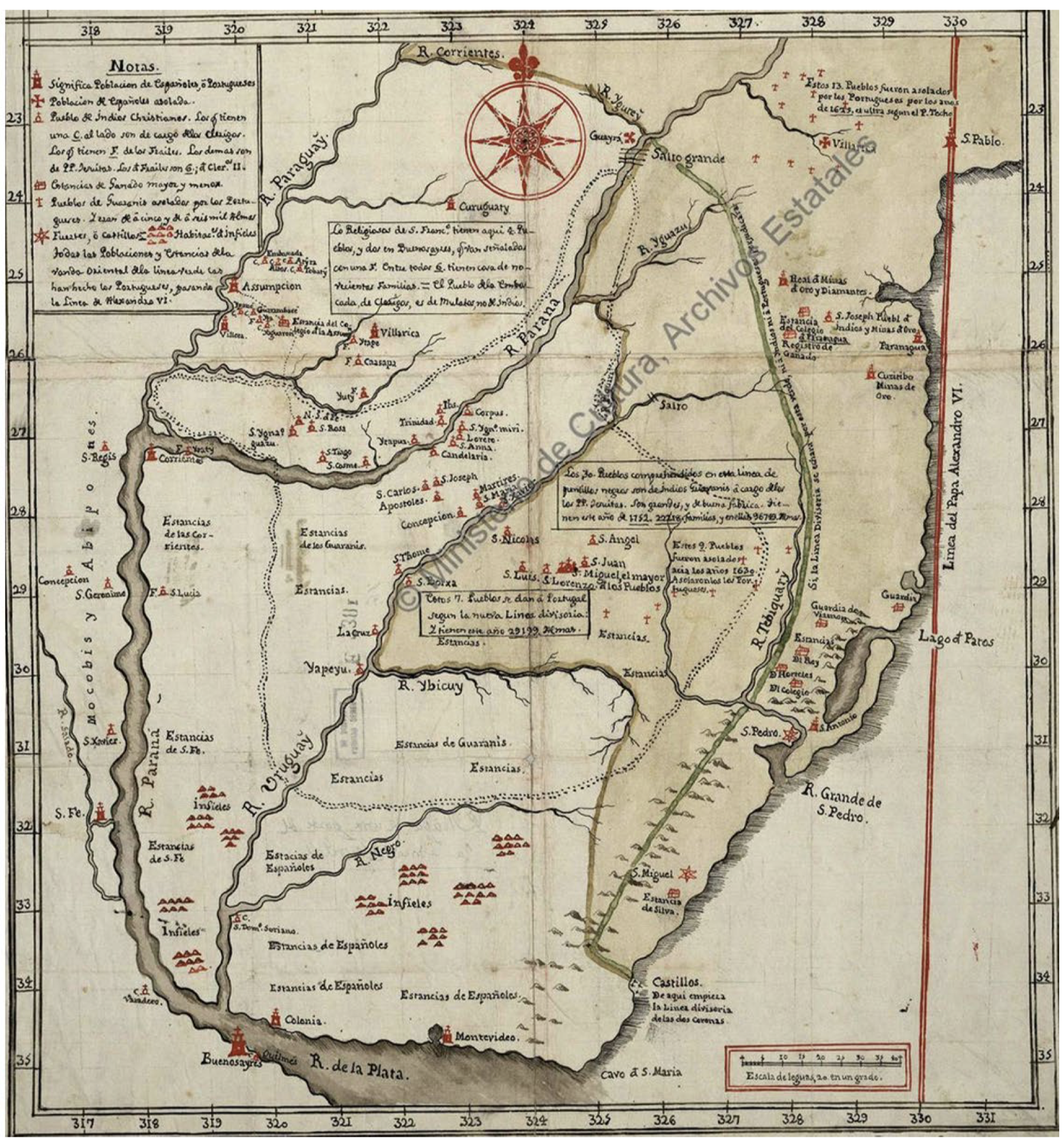
Mapa De La Gobernación Del Paraguay Y Buenos Aires, Con La Línea Divisoria De Las Tierras De España Y Portugal_1752.
Map 1752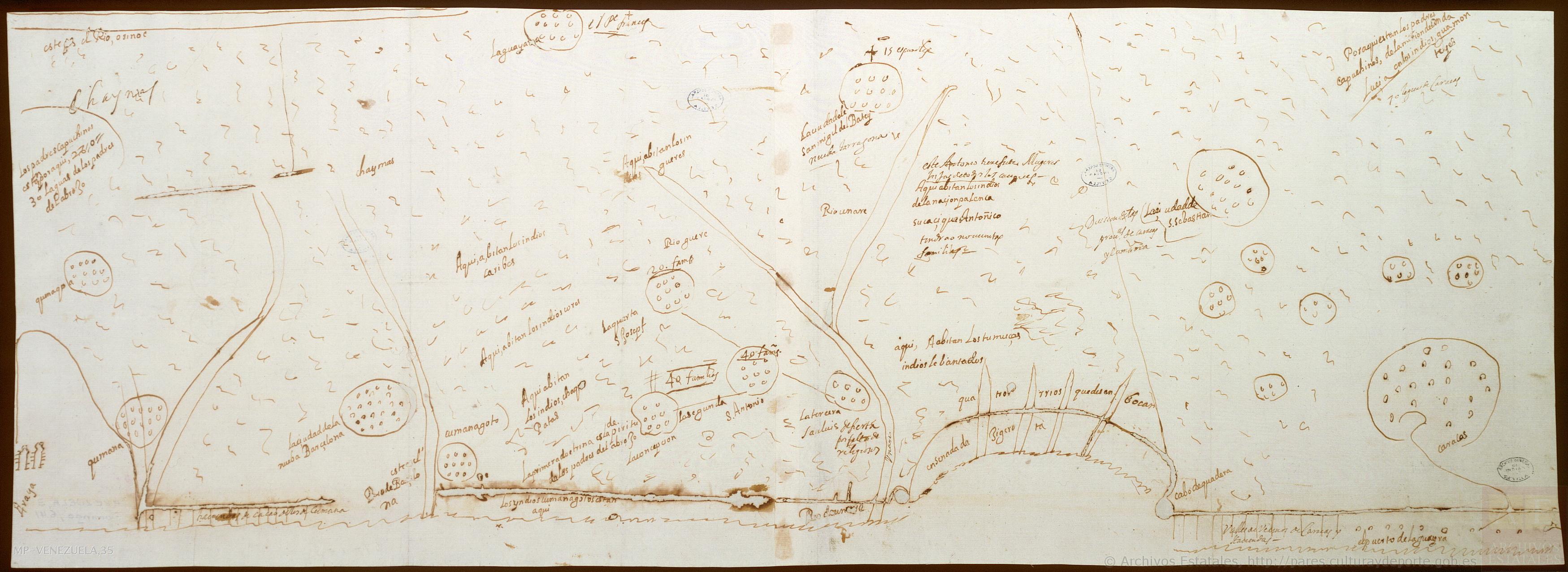
No Title
Map 1660